Siletz
1) Elk Creek to Moonshine Park
| Difficulty | III-IV |
| Length | 10.5 mi |
| Avg Gradient | 30 fpm |
| Gauge | Siletz River at Siletz, or |
| Flow Rate as of 57 minutes | 109 cfsbelow recommended |
| Reach Info Last Updated | June 4, 2019 |
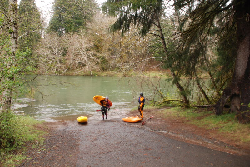
The Siletz is an Oregon Coast Range classic with easy roadside access providing a few different options from one long run to shorter runs that can be matched to the skill level of the group. The run is only available on weekends as the private timber road that provides access is closed to the public during the week.
Elk Creek to Buck Creek (4.5 miles)
A good intermediate run with the two most challenging rapids in the first mile.
Buck Creek to Moonshine Park (6.5 miles)
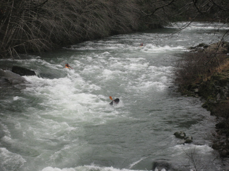
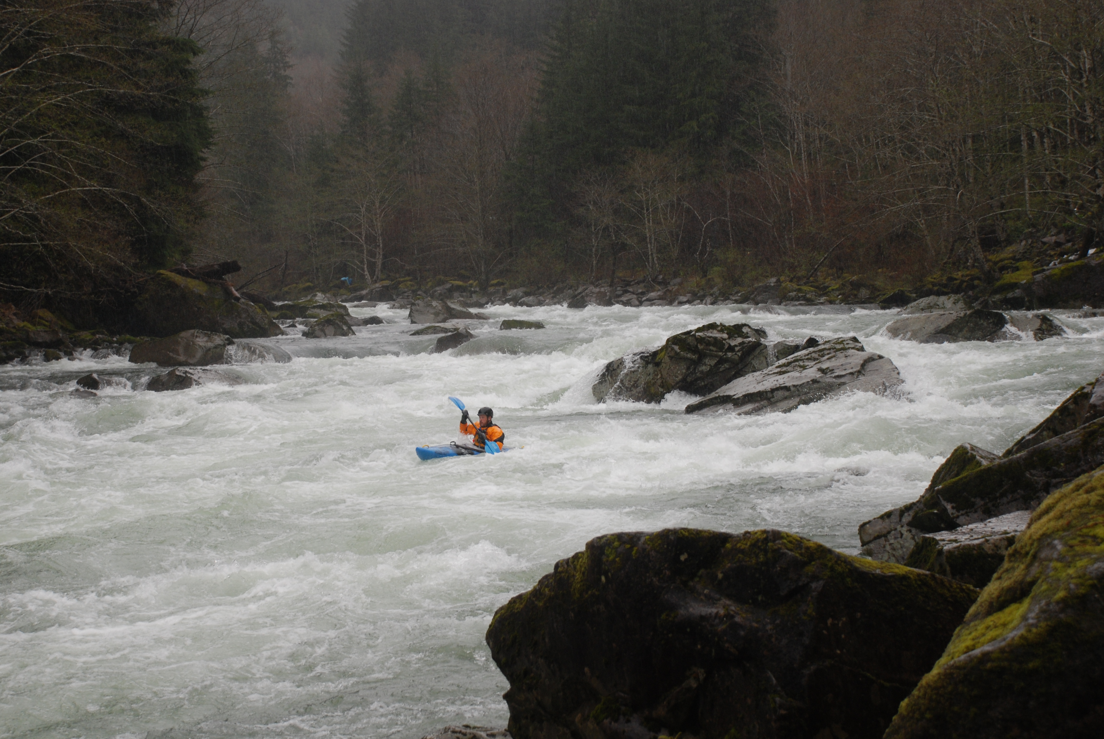
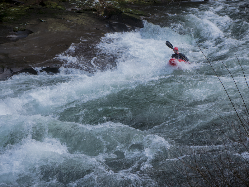
This run serves up some great whitewater with Silache a long rapid which can range from class III to solid class IV depending on flows. It can be easily seen from the road as you run your shuttle. There are more fun rapids, notably Quarry Drop where the river squeezes through a short and narrow rock gorge.
Logistics: At Highway 411 mile post 7.8 in Logsden (15 miles from Nashville or 8 miles from Siletz) turn on to Moonshine Park Road which heads up along river left. At mile 3.5 on Moonshine Park Road the county maintained road ends but you can turn down to the left which is 0.2 mile paved entrance road to Moonshine County Park with a boat ramp just before entering the park. To reach the put-in continue up the private gravel road (only open on weekends) and for the first few miles you have several options for roadside access. At mile mile 3.4 you will see Silache Rapid, the major rapid on the run which is easy to scout from the road. You will cross the bridge at mile 3.7 which marks the start of Silache Rapid and can serve as an alternate access point. After you cross this bridge the river climbs away from the river. At mile 5.2 you will cross Buck Creek staying to the right as you cross the bridge. You immediately come to Y in the road: take the right fork for the 0.4 mile descent down to the bridge that serves as the lower put-in at Buck Creek, or continue up the left fork to mile 11.6 and the put-in at Elk Creek. Well-worn boater trails can be found at both of thes
...
Unrunnable falls upstream of the put-in. Located at USGS river mile 64.8.
Access on river right just upstream of the Elk Creek confluence.

The Buck Creek access at the bridge across the Siletz near the Buck Creek confluence provides convenient access for those looking for a shorter run. It can serve as a take-out for those just doing a short intermediate run or a put-in for those who want a warm-up before running the stretch with Silache. It is located at USGS river mile 58.8.
A take-out for those who want to exit the river before Silache or a put-in for those who want a short run that takes in the biggest whitewater. A well-worn trail downstream of the bridge on river left provides access. Located at USGS river mile 57.0.

A long rapid which can range from class III to solid class IV depending on flows. As you are traveling down river, the rapid is just past a bridge and can be scouted from the road on river left. It is located at USGS river mile 56.9.
A rapid where the river squeezes through a short and narrow rock gorge. Located at USGS river mile 55.0.
At Highway 411 mile post 7.8 in Logsden (15 miles from Nashville or 8 miles from Siletz) turn on to Moonshine Park Road which heads up along river left. At mile 3.5 on Moonshine Park Road the county maintained road ends but you can turn down to the left which is 0.2 mile paved entrance road to Moonshine County Park with a boat ramp just before entering the park.
Jan 10, 2010
A winter trip down the Siletz River.