| Difficulty | III+(IV) |
| Length | 7.1 mi |
| Avg Gradient | 75 fpm |
| Gauge | Wilson River Near Tillamook, or |
| Flow Rate as of 50 minutes | 140 cfsbelow recommended |
| Reach Info Last Updated | February 28, 2026 |
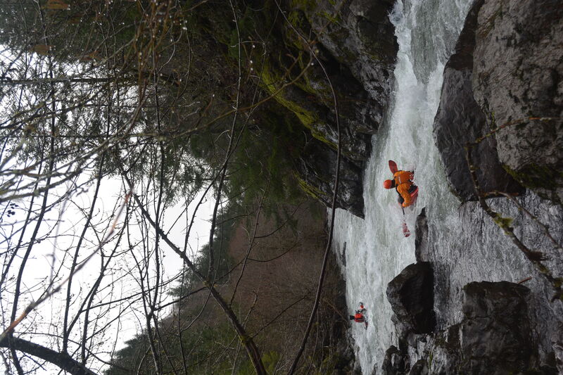
This is a local favorite for up-and-coming creekers because it requires strong boat handling, but has no large drops. The 'DLF' is the Wilson tributary that highway 6 follows down from the pass. A mere quarter mile downstream from the launch the South Fork enters and the Wilson River begins. Highway 6 alongside the run has frequent pullouts and fishing trails allowing river access. Still, the highway rarely intrudes on your consciousness because the river keeps you quite busy.
From the launch point the river immediately launches into a long, technical class III section. First time visitors are well advised to scout, especially at lower flows. If you feel good in this section, you are going to enjoy the run. If you don't, you can easily walk back up and get a car to drive to the takeout or on out to the coast for some Tillamook icecream.
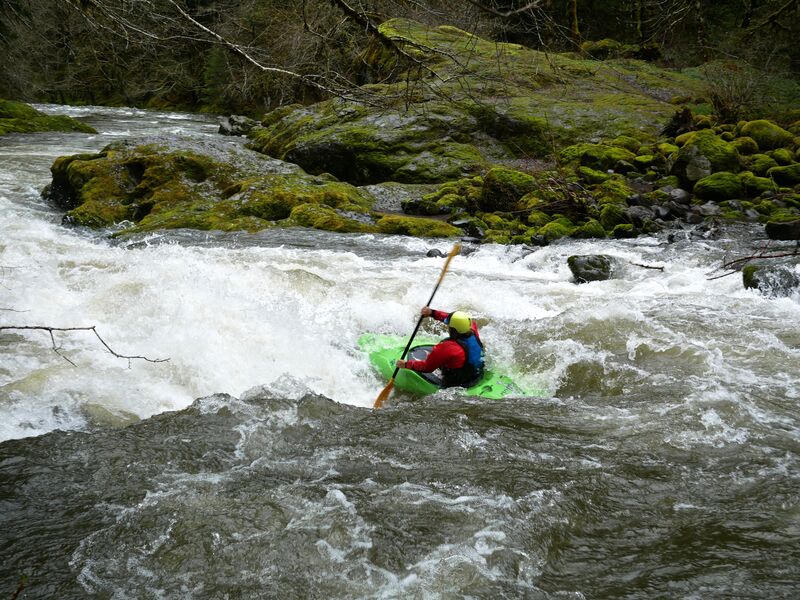
The whitewater remains fast and furious with many small horizon lines, eddy hopping galore and some fun surfing spots. Four rapids of note include Elk Creek Rapid, the Mini-Gorge/Pinch, S-turn Ledge and Golf Course from upstream to downstream.
Elk Creek Rapid is 10-15 minutes downstream from the launch and is a swift approach to a small ledge then a swift outflow. The main ledge can be glimpsed on the shuttle, while looking upstream from a bridge. Locals sometimes stop while shuttling to scout, as this drop does catch wood. There are several line options being more conservative toward the cobble bar on river right, and more spicey over the ledge on the left. Soon after this rapid look for one of the better playholes on the run--eddy right.
The Mini-Gorge aka Pinch is likewise visible from the road, in the distance as you are headed upstream. It doesn't look like much from the highway or from the scout but it has some gradient, and the water squeezes down to a narrow channel with lateral waves and holes above, and boily swirls below.
The S-turn Ledge occurs downstream from a long class I-II section wit
...The launch is on creek-left just upstream from a bridge that crosses the river.
An alternate takeout is on river left just after the bridge near Lee's Camp Store.
Dec 19, 2020
There's new troublesome wood in the first rapid before the launch point as of Thursday, 12/17/2020. Passable with class IV creek skills but not OK for anyone who finds this rapid challenging without additional obstacles. It's a long, busy, rocky section that steepens as it goes around a right bend. There are two logs extending from the left that force paddlers out of the main channel and to the right. The riverwide log just above the South Fork confluence is still there.
Jan 7, 2019
No troublesome wood as of Dec 2018.