Anderson Creek
Rockton to Curwensville
| Difficulty | II-III+ |
| Length | 12.6 mi |
| Avg Gradient | 39 fpm |
| Gauge | Sinnemahoning Creek at Sinnemahoning, Pa |
| Flow Rate as of 1 hour | 1540 cfsbelow recommended |
| Reach Info Last Updated | November 1, 2025 |
River Description
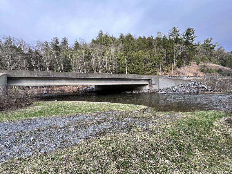
There is a painted gauge located at the take-out bridge where route 879 crosses Anderson just outside of Curwensville. The first line being the minimum and the third being the maximum. If traveling check the USGS gauge for Clearfield Creek at Dimeling and Sinnemahoning at Sinnemahoning. If they are at 1200 CFS/3500 CFS and rising Anderson is probably runnable.
There are two places to put-in on this run. The first is where route 322 crosses the creek just before the town of Rockton. There is parking available on the left hand side just after the bridge. As of 9/04, there were numerous strainers in the first (2) miles. Several of these were on braided sections and were unavoidable. The more common put-in, is to take route 879 west to Curwensville. About a mile past Curwenville you cross Anderson Creek. Just after the bridge make a right. Follow this approx. (6) miles and make a right on township road 484 (Maclin Rd.) Do not attempt to drive down this road, unless you have a four wheel drive vehicle. You will go down a very steep rocky road, you will reach a clearing. Park here, and carry the rest of the way down the road. You will reach an old railroad bed, at the railroad bed carry you boat down the bank to the creek.
There will be about a 1/2 mile of fast water to warm up on. There is a downed tree on this section, it is runnable at the minimum level. At higher water you will have to carry it. After the warm-up, the creek starts to tilt downward. There are several class 2(+) rapids, usually where the creek makes one of its many sharp bends. After about 2.5 to 3 miles, there is a runnable 4ft. dam on the creek, scout this if you are not familar with the creek. You can paddle right up to the dam without being pulled over. There is a rock on the left-hand side and one near the center. You can line up with the center boulder and boof off the side of it, to prevent being pulled into the backflow. You can portage the dam on the right
...River Features
Put In
Take Out
Trip Reports
Log in to add a reportRan it today 19 March 2015
Levels:
Sinnemahoning 3650cfs
Clearfield Cr 2600 cfs
After the splash dam creek very intense. Too many Class III's to count.
I find it hard to believe that there are only three posts about this creek and the last one was 3 years ago. This is an absolute gem of a white water stream. The first half had several downed trees that needed portaged. Yes, it was a pain in the ass but the beauty of the area made up for it. Still no Class III's but you still need to pay attention. Once you hit the splash dam it's balls to the wall. This is NOT a beginners creek. You need the right experience and equipment. It's 4 miles of Class III+. You will be exhausted and exhilarated when you reach the end. After the Dam there are two places on left turns with a log on the right. The first one wrecked my partner (I portaged around when I saw his wreckage), the second one we made it through but you need to paddle hard left like your life depends on it. We hit 15mph through that chute (GPS Calculations) and that tree could have been deadly. There's a small rock garden just beyond that would pulverize you. Do not be complacent after the dam. Do not take beginners. However, this is a fun frickin' creek!! We hit it at just the right level.
We just checked out this run from Maclin Rd to Curwenseville. Two guys in a camp told us that they gated the road and posted the property leading up to the stream. The owner has a history of arresting people for tresspassing. It appears that you will need to put in at Rockton to run this...unless someone knows of an alternate put-in. The same guys did tell us that a kayaker walked from the gate to the put-in but it appears to be a long walk.
Mike is right. There is still numerous stainers on this run but most are runnable below the damn with exception of a new one that fell recently that is 40 feet below the damn on the right. If you drop the damn you will have to get far left or portage on the island and set in left. Also if you are running the whole way to the susquehanna there are more strainers below 879. One is just after the split if you take right just beyone 879. There are also 3 man made damns, all easily runnable beyond here. River must be up to minumum level to run these. The two beyond the damn seem to have changed postion and they are runnable with a little caution. This is a great fast run when the water is up to level and if you dont mind a little hike for the set in. If you CHoose the Rockton set in there are two strainers. First one is completely across a ledge on a narrowing(portage right), second is completely across on a left bend(portage left). Both should be portaged though the first could be done on absolute minumum levels if you duck and come up quick.There is a log submerged immediately following the drop.