Cache Creek
1) Hwy 20 to the Bear Creek Confluence(Wilderness Run)
| Difficulty | II(III) |
| Length | 18.9 mi |
| Avg Gradient | 20 fpm |
| Gauge | Nf Cache C Nr Clearlake Oaks Ca |
| Flow Rate as of 47 minutes | 266 cfslow runnable |
| Reach Info Last Updated | February 17, 2025 |
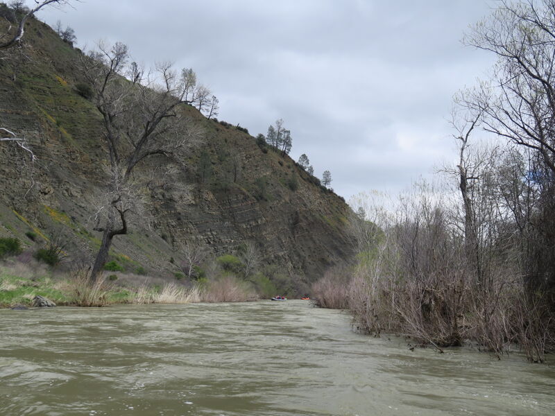
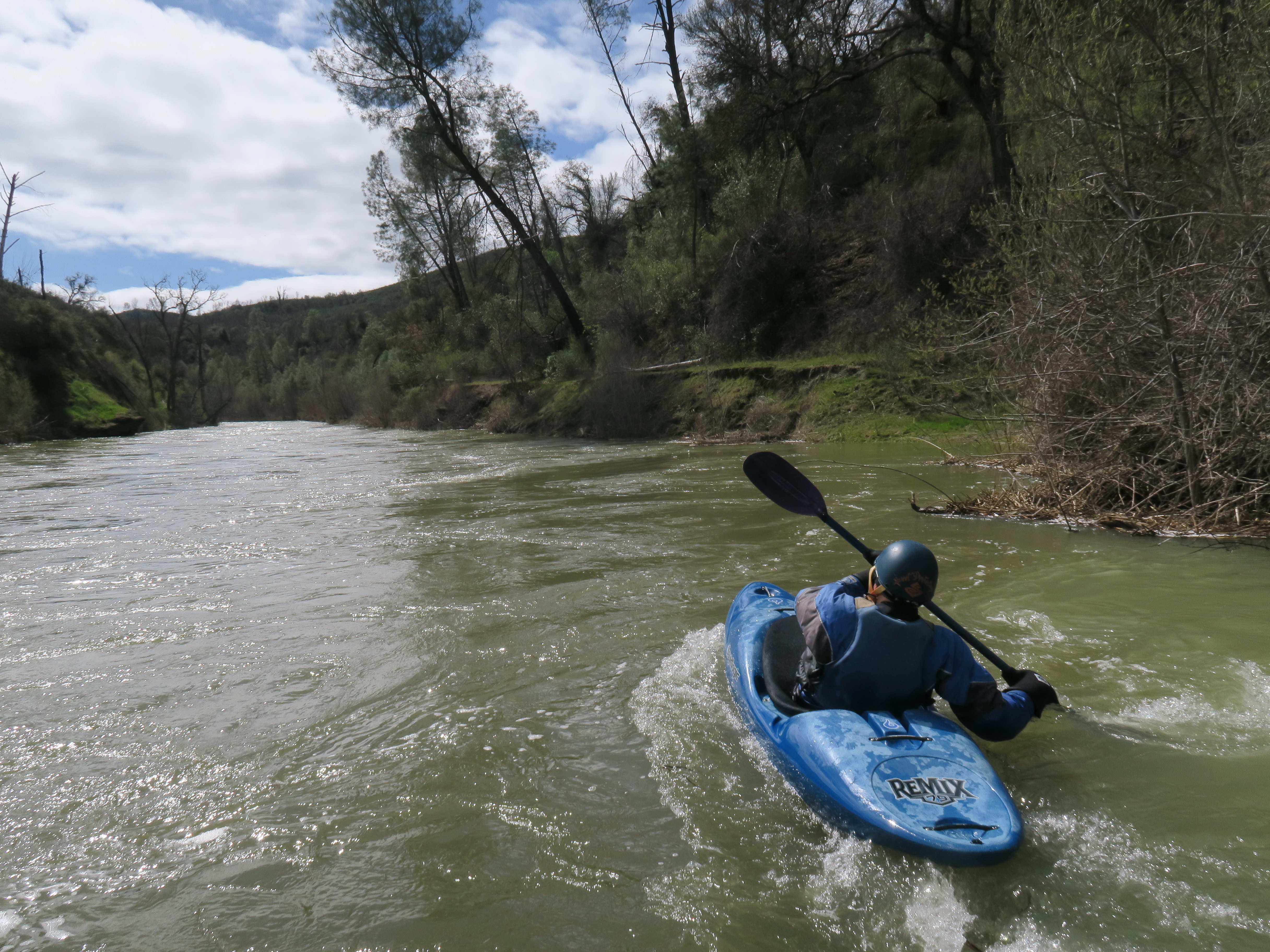
The Cache Creek Wilderness Run offers paddlers a true wilderness experience through 18.9 miles of pristine California chaparral landscape. Located in Lake County, this Class II(III) run flows through the 27,294-acre Cache Creek Wilderness area, managed by the Bureau of Land Management. The run combines scenic beauty with moderate whitewater, making it an excellent choice for intermediate paddlers seeking solitude and wildlife viewing opportunities.
The ecosystem supports a diverse array of wildlife, with paddlers commonly spotting bald eagles, otters, deer, osprey, elk, herons, and wild turkey. The semi-arid landscape features mixed chaparral and interesting geological formations, creating a unique paddling environment distinct from many other California runs.
There has been confusion online about flow requirements, caused by incorrect gauge references on some websites. This page updated Feb 2025 with definitibe flow details.
The Cache Creek run is a combination of the cold, clear flow from the North Fork, out of Indian Valley Reservoir, and the warm, turbid flow from the Main (South) Fork, out of Clearlake.
The put in for the run is above the confluence, at the Redbud Trailhead, where Highway 20 crosses the North Fork.
To put on on the North Fork, 85 cfs is the absolute minimum to avoid dragging your boat, and once you get to 1000cfs on the North Fork, things get very sketchy with sweepers and wood hazards, and a bridge you have to portage. IK's and Packrafts have been known to put on even lower.
If the North Fork is too high or two low, packrafters can hike 1.5 miles downstream and over the ridge to Baton Flat, on the Main (South) Fork. [There are class V rapids just above Baton Flat on the South Fork, but nothing else has been written about this section below Cache Creek Dam that this author could find. Please add that here if you have info]
Put in at the BLM parking lot where state Highway 20 crosses the North Fork of Cache Creek. Easy access - Note that the North Fork will be very small compared to Cache Creek.
There are also significant issues with sweepers and debris in the streambed on this two mile section down to the confluence. We punctured a raft tube here one time on an old trailer axel.

The north fork merges with the main branch of Cache Creek that comes out of Clear Lake after 2 miles. Be sure to note the contrast between the cold clear water of the North Fork (from Snow Mountain via Indian Valley Reservoir) and the warm, smelly, brown water from 'Clear' Lake.
At about Mile 4 - distance is approximate. It is in a sharp Right Hand turn. (Sweeper no longer there as of 7/10)
Distance approximate - Fun rapid - Left hand turn and drop around large rock. At end of long boulder garden.

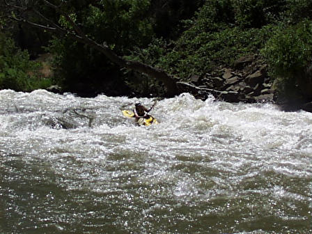
This is usually the toughest rapid on the run. It is almost within sight of the take out in a sharp 'S' turn that starts to the left and then goes back to the right. There is a significant turning drop that flows into a rock/hole (depending on the flow). Scout or portage right.
This is a possible take out. It is at the confluence with Bear Creek and it is where you will see Highway 16 and Civilization for the first time in a while. There was an old dump truck abandoned here for many years. It was removed in 2002.
This is a good Reason to continue beyond the Rusty Truck take out. There is a II called 'Up Against the Wall' directly below the Bear Creek Put-in/Take-Out. The next rapid is right on the county line and has a large drop that inevetibly takes you through a hole and shoves you into rocks on river right as there is a 90 degree turn to the left at the bottom of the drop. Fun stuff.
This is often a better take out. It will cost $3 if you leave a car here but you can get very close to the water.
This is another take out. This is the public campground. It has a nice II+ rapid right below the camp and a great play spot. You can drive to within 100 feet of the river.
Apr 1, 2023
Good day on teh Cache Creek WIlderness Run. We had about a dozen paddlers in a group organized by Jerry Meral. A bit of bush/tree whacking on the North Fork before the confluence with main. The North Fork Cache Creek near Chalk Mountain guage was at 2.94 ft, I would estimate it was 300- 500 cfs. The flows on the Main was robust and very fun. Big wave trains and serval holes big enough to surf a raft. Most of the bigger rapids are towards the bottom of the run. This is very much a wilderness run and a beautiful place to be in the springtime.
May 4, 2018
The low water bridge was condemned and the road to buck island has been closed for 4 or 5 years. There are no commercial trips on the wilderness run anymore which makes the privacy even better!