Conewago Creek (East)
Aberdeen Mills to Hillsdale Rd
| Difficulty | I-III |
| Length | 5.5 mi |
| Avg Gradient | 15 fpm |
| Gauge | Conewago Creek Near Falmouth, Pa |
| Flow Rate as of 17 minutes | 3.50 ftbelow recommended |
| Reach Info Last Updated | August 7, 2012 |
Put-ins To catch the whole 6.2 miles begin your run at Aberdeen Mills (just above Aberdeen Rd.) From the west (Harrisburg) take route 283 to the route 230 & route 341 exit. At the end of the ramp turn right in a block turn left at the 'T' onto route 230 heading east. In a couple miles turn right (south) on South Deodate for the shorter run described below; S. Deodate will take you to the put-in. Continue to the next left (northeast) onto Hertzler Rd if you want the full run. Hertzler Rd gradually approaches and follows the creek upstream. Turn right at the 'T' when you reach Mill Rd. You will soon cross the creek. Walk a couple hundred yards up the rail trail to where you can put-in.
Take-out From the upper put-in retrace your path to route 230 and cross it staying on Hertzler Rd. Hertzler Rd will merge with S. Deodate Rd just above the bridge at the lower put-in. Just before you cross the bridge take a right on Locust Grove Road. Follow Locust Grove Rd until a 'T' on Hillsdale Rd. Turn left at this 'T' passing under the rairoad and follow Hillsdale until it crosses the creek at the takeout. From the lower put-in follow the directions starting at Locust Grove Rd.
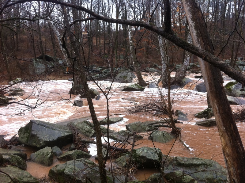
River Description (upper put-in) After the short hike up the rail-trail you can launch upstream of the class 3 drop just above (and visible from) the bridge. This drop is quite technical, somewhat sievelike but usually not very pushy. Scout before running this drop as the two lines are narrow and easily obsructed by downed trees and if you are running it there has likely been a very recent and very hard rain. A lot of the water passes through the rocks at the drop but if the creek is runnable there will be enough going over the top for your boat. The hazards associated with sieves remain.
From the rapid at Aberdeen Mills to South Deodate Rd you will travel a distance of almost 4 miles of flatwater and easy riffles. Watch ou
...To catch the whole 6.2 miles begin your run at Aberdeen Mills (just above Aberdeen Rd.) From the west (Harrisburg) take route 283 to the route 230 & route 341 exit. At the end of the ramp turn right in a block turn left at the 'T' onto route 230 heading east. Follow PA 230 east for a few miles until you come to Hertzler Rd. Turn left (northeast) onto Hertzler Rd. Hertzler Rd gradually approaches and follows the creek upstream. Turn right at the 'T' when you reach Mill Rd. You will soon cross the creek. Walk a couple hundred yards up the rail trail to where you can put-in.
From the west (Harrisburg) take route 283 to the route 230 & route 341 exit. At the end of the ramp turn right in a block turn left at the 'T' onto route 230 heading east. In a couple miles turn right (south) on South Deodate for the shorter run described below; S. Deodate will take you to the put-in.
Take-out From the upper put-in retrace your path to route 230 and cross it staying on Hertzler Rd. Hertzler Rd will merge with S. Deodate Rd just above the bridge at the lower put-in. Just before you cross the bridge take a right on Locust Grove Road. Follow Locust Grove Rd until a 'T' on Hillsdale Rd. Turn left at this 'T' passing under the rairoad and follow Hillsdale until it crosses the creek at the takeout. From the lower put-in follow the directions starting at Locust Grove Rd.
Apr 23, 2011
unknown level
Jun 20, 2009
There is a gauge painted on the bridge at S. Deodate Rd. with tally marks up to six or seven. I ran it today with the level reading at three tally marks and ledge upstream of the bridge was one big river wide hole. It was difficult to see the bottom of two or three rapids because the waves blocked downstream vision. I recommend scouting at this level or above to make sure you do not get pushed into trees that partially block the creek in spots.
Mar 2, 2003
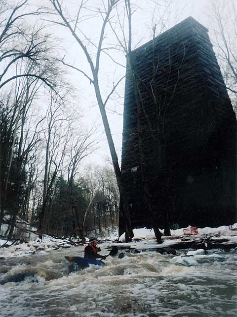
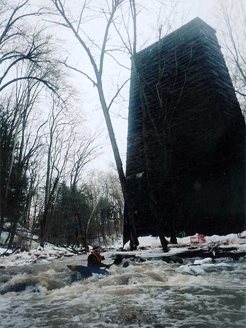
At this point, the ice that had broken free throughout the gorge created a jam in this calmer stretch before the last set of plunges. We determined the stream to be unrunable and dangerous. We carried the boats out of the gorge, and back to the start point.