| Difficulty | II-IV |
| Length | 5.6 mi |
| Avg Gradient | 82 fpm |
| Reach Info Last Updated | December 27, 2001 |
River Description
Lat / Longitude data are very approximate.
Takeout Latitude: 41° 13' 03'' N
Takeout Longitude: 76° 00' 55'' W
River Features
Put In
Access PointDistance: 0 mi
Take Out
Access PointDistance: 6.5 mi
Trip Reports
Log in to add a reportMZ
Mark Zakutansky
Nov 23, 2011
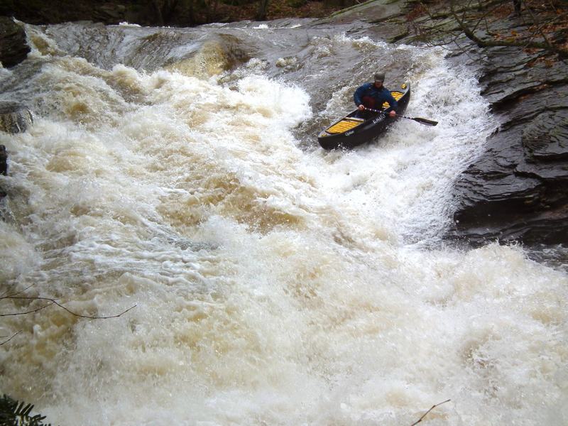
Tommy H. in a Blackfly Option on the Slide at a higher level.
MZ
Mark Zakutansky
Nov 23, 2011
As of 11-23-11, the normal take-out area at the confluence has rocks preventing you from getting back there. We parked off to the side of the dirt road that is just downstream of the confluence by the basketball court. It meant carrying the boat 200 yards from the normal take-out parking lot, but worked fine.
And yes watch out for the trees. Nothing you can't see coming, but there are quite a few to look out for and always new trees.
?
Untitled
May 8, 2011
Harvey's is a nice intermediate run that runs for a day or two after good rain. It's mostly class 2 with four juicy class 4's including a nice 10' falls at the put-in above Rt 29. The PA-creeker guys http://groups.yahoo.com/group/PAcreekers/ run it often. Easy shuttle and lots of fun. Some strainers from time to time so be a bit careful. Guys usually meet where Rt. 29 meets Rt. 11 in West Nanticoke-behind the mini-mart at the intersection
MZ
Mark Zakutansky
Apr 8, 2010
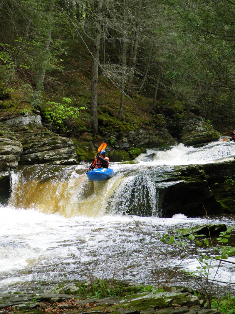
Eric Sorenson boofing double drop... photo by Mark Z.
MZ
Mark Zakutansky
Apr 8, 2010
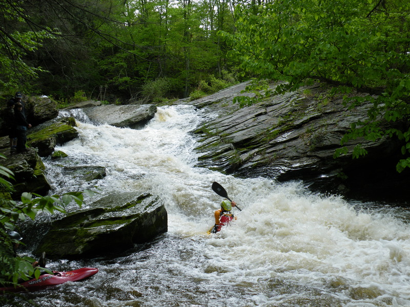
Lowish water, but still good...the large slab at the top of the slide forms a pretty bad sieve...enter the slide on FAR river left.
GC
greg cielosczyk
Jul 1, 2006
Recent flooding has altered this creek and has created new hazards. Please use extreme caution when attemping this reach. Route 29 is closed for road work, to reach the put in, follow rt. 11 North into Plymouth and make left on Washington Street to left on Weavrtown Road, to right on Mountain Road follow to Chase road until you reach route 29.