Red Moshannon Creek
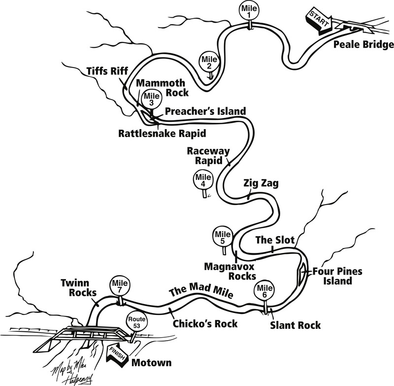
1 - Peale Bridge to Route 53 Bridge(Red Moshannon, "Red Mo", Race Course)
| Difficulty | II |
| Length | 7.1 mi |
| Avg Gradient | 28 fpm |
| Gauge | Moshannon Creek (red Mo) at Rt53 Bridge |
| Flow Rate as of 1 hour | 1429 cfsmedium runnable |
| Reach Info Last Updated | February 13, 2018 |
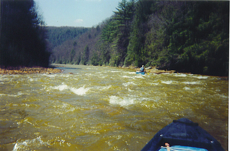
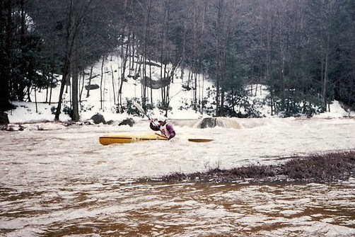
The classic Central PA introduction to class II whitewater! The tainted Moshannon Creek is affectionally known as 'Red Mo'. If you love the whitewater features of Spring Creek in Bellefonte, PA, Red Mo is the next logical step in the progression.
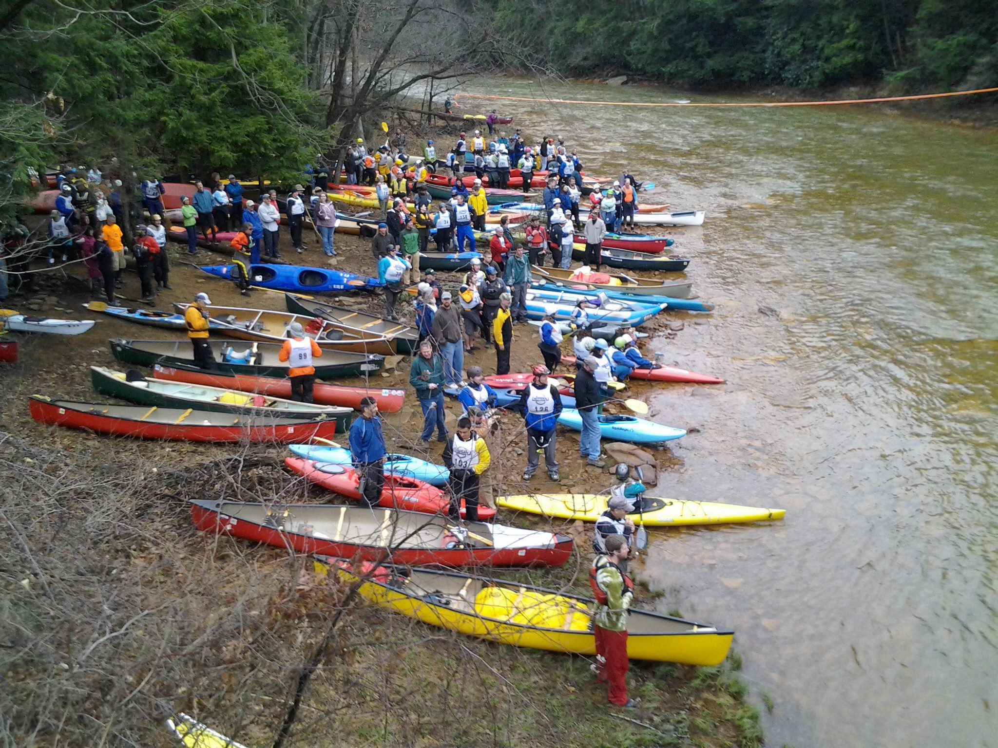
The last weekend of every March, Tussey Mountain Outfitters organizes Pennsylvania's longest running downriver race...
Red Moshannon Downriver Race
This race is held in the Spring on a remote 7.5 mile section of Moshannon Creek. It starts at Peale Bridge near the town of Grassflat PA, and ends at the Route 53 Bridge near the town of Moshannon PA. At moderate levels and typical temperatures for this time of year, this section is rated Class II.
There are classes for solo and tandem open canoes, kayaks, and decked canoes. Racers can also participate in the 'poker race' by picking up cards along the race course - the best hand wins.
The Red Mo Race was begun in 1967. The Penn State Outing Club Canoe Division ran the race from 1967 to 1980. There was no race in 1976. The 1981 race was jointly sponsored by PSOC and Tussey Mountain Outfitters. TMO has run the race since 1982. Boat classes have varied over the years and the race history reflects the awards made in each year.

The first 'action' after 2+ miles of warm up. Wavetrains on river-right where most of the flow pushes.

The clear path is river-right of this island. This is the popular destination for 'on-river' spectating carnage at Rattlesnake Rapid on race day!
Rocks the size of a Magnavox TV river-right on the outside of a slight turn to the left.
Looks to only be 3 pines remaining. Keep river-left.
The biggest hole on the Red Mo. The Slant Rock is river-left and the hole is left of center. Playable if you can attain. Some brave folks have been seen jumping off this rock, but it would appear to be a fairly shallow landing.
Stay river-left to miss the 'action'. Beware of Chicko's that lurks submerged in the middle of the river halfway through the rapid.
Stay river-right and 'split' the Twinn's because this is the finale!
Take-out river-left under or just past the bridge.
Brad Nelson setting the Red Mo race record: 39:29 in 1993.