Clavey
2) Lower Bridge to Ward's Ferry, Tuolumne River(Lower Clavey)
| Difficulty | V+ |
| Length | 21.2 mi |
| Avg Gradient | n/a |
| Gauge | Clavey R Nr Buck Meadows |
| Reach Info Last Updated | May 14, 2020 |
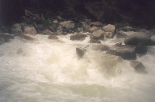
This lower section of the Clavey River is beautiful and pristine, and much steeper + more congested than the upper section. Although no individual rapids are singularly huge or overly notable, this section contains a sh*tload of good class 5 (and some 5+) drops stacked one after another. Although most of the river is pool -drop character, many of the pools are short, and long boulder-hopping type sections are also prevalent.
Below the (now closed) bridge which marks the end of the upper section, the pace continues gradually. The first rapid is directly next to a huge slab of rock, which makes a good campsite. The rapid is a bit of a pinch drop into a flushing chute, which goes much better than it looks. If you feel like walking it -know that the next 8 miles contain numerous class 5 drops which will be more continuous, taller, stouter, and often more technical or junky.
After the campsite rapid, gradient eases for a mile or two, offering numerous fun class 4+ stuff. The next bigger section is in a short gorge, featuring a series of maybe 5 ledges which are mostly boat scoutable. The gorge exits into a long, fun, and occasionally junky boulder garden (class 5). Somewhere in this section was an 8 foot boof on the right, which will smash your ass on a bad rock if you don't boof in the proper place.
After some more boat scouting and boulder junk (class 4ish), you'll come to a horizon line that is one of the taller on the run. This ~15 foot boulder pourover is best run in the center of the river, eddying out at the top behind some bushes, and taking a delayed boof with nose pointing back left. The runout is good down the middle (class 5).
Easier boulder hopping once again continues for about a mile, until the Hunter's Bend gorge -which is probably the most fun section of the run. Big white granite boulders clog the riverbed, and the bottom of the canyon is quite gorged up in several parts -making scouts/portaging difficult. This section is quit
...
This is the approximate location of the USGS streamgauge that was operational from 1959 to 1995.
USGS11283500CLAVEY R NR BUCK MEADOWS CA
May 14, 2020
The road to the lower bridge is now closed for good, and the only real option for this run is to put on at the Cottonwood Road bridge (upper section put in) for a 2-day. Although similar in mileage, the upper section will take significantly less time than the lower: about 2-4 hrs for the upper and a full day for the lower + paddle out on the T.
Flows for the upper section should feel somewhat low when you put on. If it feels high or padded out, then the lower will likely be too stout. There is a notable overhung rock on river left, in the eddy at the bottom of the rapid under the bridge at the upper put-in. We had water levels 1-2 feet below the overhang, and I would consider it medium-low flow. I would probably not put on if the overhang is underwater or very close to it.
There is a brilliant campsite at the end of the upper run, on a huge slab of rock on river left, about 1/8 of a mile below the now closed bridge. In addition to being a very comfortable slab, the rock contains numerous indigenous grind holes, clustered in one location. There is another campsite about 4 miles into the lower run, on river right, marked by a tire hanging on a tree. Getting there will require passing about 20 of the best class 5 rapids, and I would not consider it to be a quick 4 miles.
May 22, 2017
I ran this section last weekend 5/20-21/2017. It is much more challenging than the upper. Also, there is a three-mile hike to the put in due to a road closer. And the road to the lower takeout/ Putin is closed. Winter storms were hard on the road infrastructure in this area.
Check out this google earth screencast for more information on this advanced run. https://www.youtube.com/watch?v=kJdisSBnX5w&feature=youtu.be