Slippery Rock Creek
1. Kennedy Mill (Frew Mill Rd., SR 1012) to Eckert's Bridge(Slippery Rock Gorge)

| Difficulty | II-III |
| Length | 4.1 mi |
| Avg Gradient | 23 fpm |
| Gauge | Slippery Rock Cr at Mcconnell's Mill |
| Flow Rate as of 1 hour | -0.50 ftbelow recommended |
| Reach Info Last Updated | October 9, 2024 |
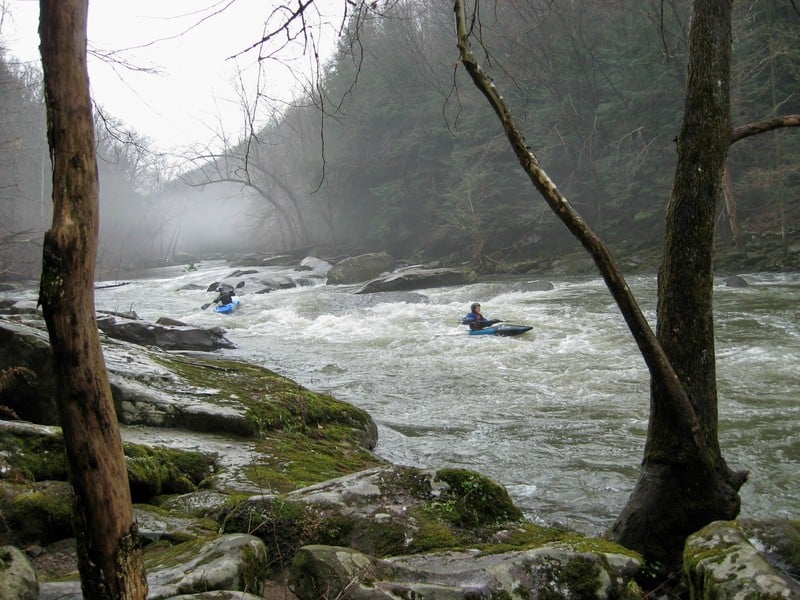
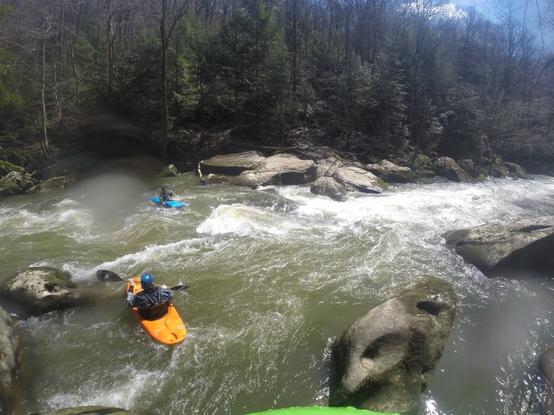
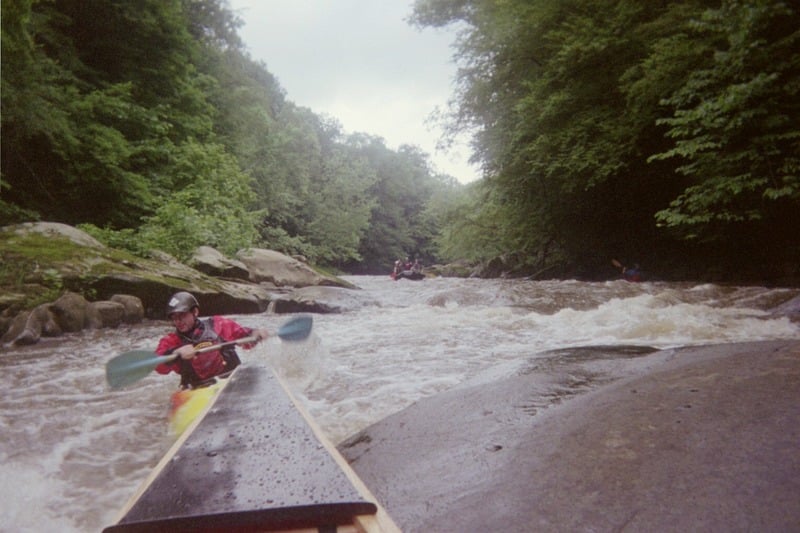
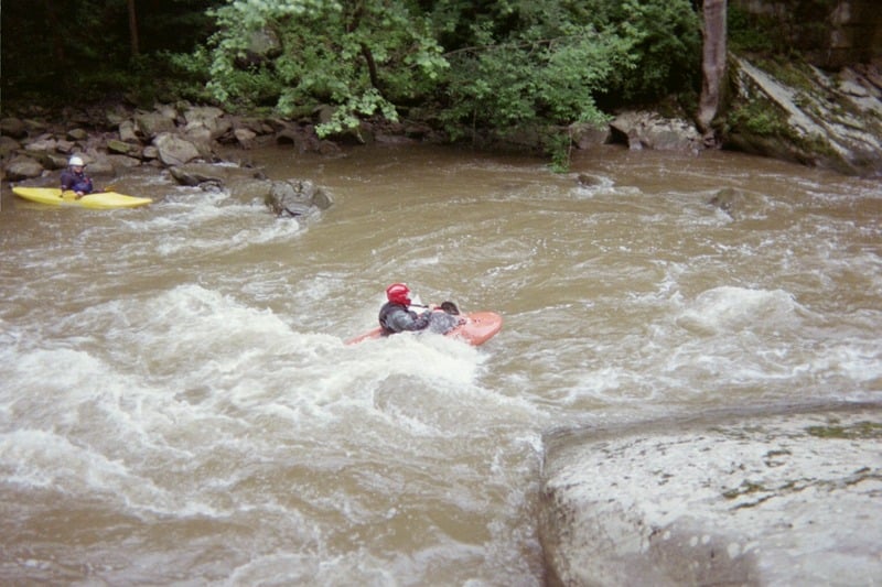
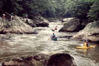
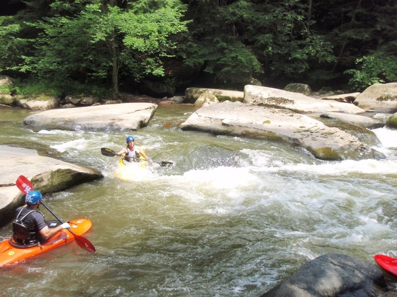
A local favorite: beginners like it for its relatively easy (mostly Class II, but there are a couple of III-) rapids; experienced paddlers head there for the play. Everyone likes its beauty.
Check out Three Rivers Paddling Club or Larry Wentzel's exhaustive description.
Directions: head for McConnell's Mill State Park. From the West and North, take I-80 to Rt. 19 South. Check out the Keel-haulers Map (linked to in the 'Maps' section at the right) for details to the putin and takeout. There are several alternate putins: the Ranger Station, probably half a mile downstream from Rt. 422; Frew's Mill, a mile or so upstream of 422 (this adds a lot of flatwater, but it also adds a couple of neat rapids and some nice scenery); and Rose Point, not far upstream of 422. Rose Point is an easier putin, but it adds some flatwater and parking is limited.
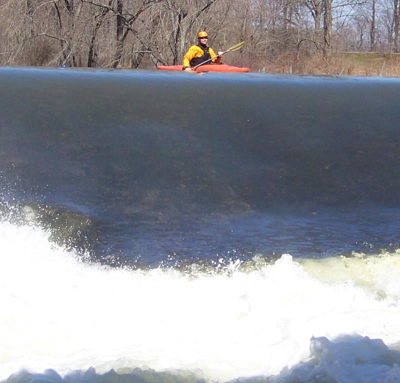
It can be a fun run in the mid-winter, but be warned: you might find the wrong kind of white water. Click here to see what I mean.
For those who might have trouble with the Slippery Rock Gorge, especially at high water, check out the Lower Slippery Rock.
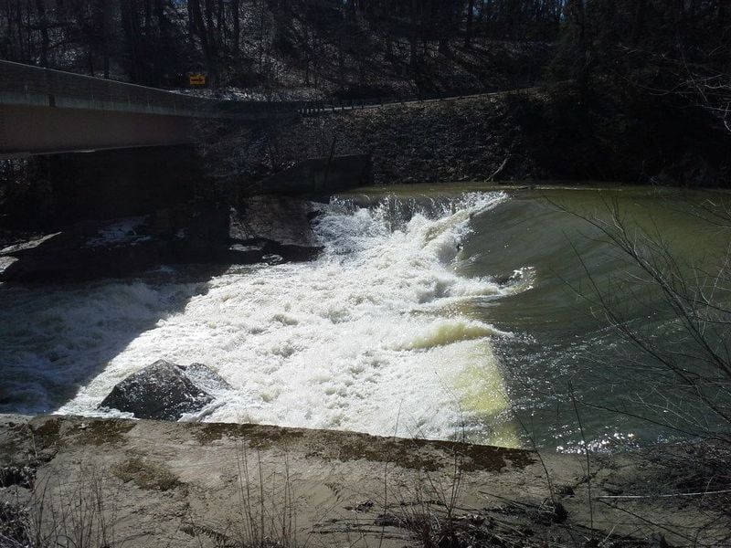
For the extra flatwater, if you put in here, you get a spanky slopy drop to begin your river trip. The drop under the bridge is pretty scrapy at levels below about a foot on the stick gauge. It's a cool drop at higher levels, but watch out for the eddy on river left--you can get shoved into a rock and woody debris and stuff.
Lat/longitude coords for putins, takeout, and rapids are verified by GPS.
Easy putin, but parking is limited, and there's more flatwater (though pretty) than if you use the putins downstream.

This used to be popular. If you use this one, park well off the road (on the river-left side of the eastbound lane of the highway) and be respectful of private property. It's a steep hike down to the river.
The fourth putin. Park at the Ranger Station and hike downstream.
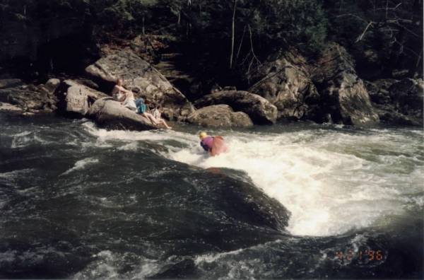
This deep hole in a narrow space between two large boulders is a great playspot. Old-schoolers get enders here; modern playboaters use the hole for their own devices. Try to roll up quickly, as there's a sloping rock on river left that you can easily get swept up against.
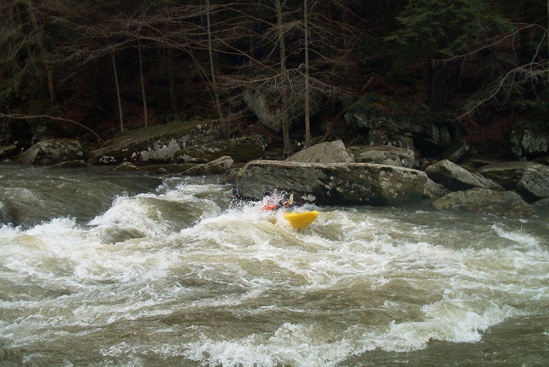
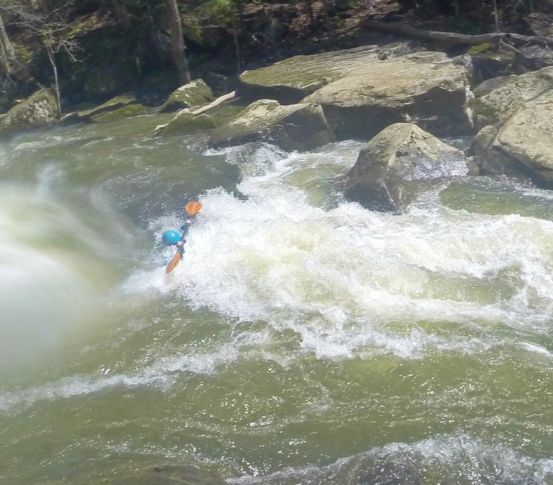
This is another hole formed by a boulder constriction. At higher levels (1.5' or more), the hole is quite munchy. Punching it is risky; you can usually boof into a small eddy to the extreme right. There's a large pool after this rapid before the portage at McConnell's Mill.
This beautiful mill, a major attraction of the park, with tours and a covered bridge just downstream, is a mandatory portage. Take out at the beach on River Left and put in on the rocks below the Mill.
The stick gauge is just downstream of the dam, on river left.
Three drops (duh), with lots of eddies to catch on the way. This is one of the tougher drops in the Mile between McConnell's Mill and the takeout.
Also known as Susan's G Spot, this has a great popup spot on river left and a grabby pourover hole to the right of the sweet spot. Pick your poison!
At the right level (Maybe 0.7-1.8 feet on the stick gauge), this rapid has one of the sweetest flat-spinning holes imaginable. It'll give you a dozen donuts without any effort. This is the last rapid before Eckert's Bridge.
Renamed in June 2006, in honor of Martin Wick, a stalwart supporter of Slippery Rock Creek.
Jun 28, 2026
212 cfs. Two river wide trees were passable with cataraft. First on the left, second on the right going under the main trunk. They weren't an issue at this low flow but will be when it gets higher.
Apr 22, 2015
As of 8-6-14 the strainer at Gilligans is gone. Big props to who
ever removed it. Watch for new strainer at airport.
Apr 20, 2015
Getting swallowed
Feb 14, 2012
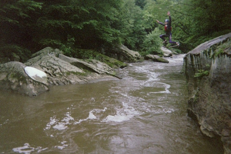
Jumping off an awesome rock just below the last rapids of Kennedy Mill. It's probably about 20 ft. http://evidence2faithministries.yolasite.com/
Feb 14, 2012
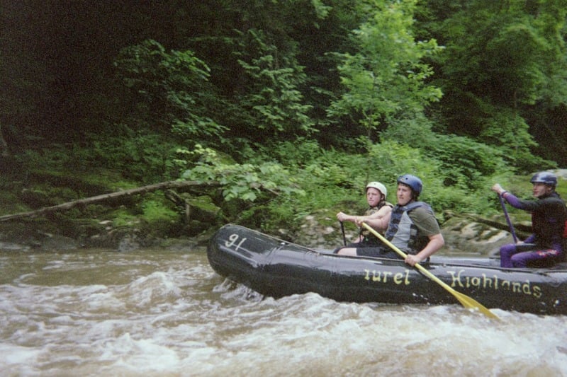
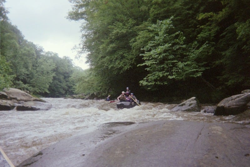
There's nothing like a nice June day on the Slipp! The level was 616 CFS, and 1 ft at the Mill. Evidence to Faith Ministries of Erie rafting trip 6/25/11. Guide Jonathan Janicki with Justin Benny and Justin Kowalski. http://evidence2faithministries.yolasite.com/
Feb 14, 2012
There's nothing like a nice June day on the Slipp! The level was 616 CFS, and 1 ft at the Mill. Evidence to Faith Ministries of Erie rafting trip 6/25/11. Guide Jonathan Janicki with Justin Benny and Justin Kowalski. http://evidence2faithministries.yolasite.com/