Trip Reports
Log in to add a reportMZ
Mark Zakutansky
Apr 30, 2014
After some friends scouted the BIG drops at very low water, they are only marginally runnable at best. Do not waste your time on the huge mank, its just not worth it. One wrong move or a swim would equate to certain death. By the BIG drops I mean the one obvious, enormous boulder drop with the house in river river about a 1/4 mile above the bridge. The other drops are good to go.
?
Untitled
Aug 25, 2009
formerly concidered class VI, It got ran in Jan of 09 by yours truly (Eli), Im callin it 'Gnar'cassim because if you get down it in one piece you gonna feel like the man
?
Untitled
Aug 25, 2009
formerly concidered class VI, It got ran in Jan of 09 by yours truly (Eli), Im callin it 'Gnar'cassim because if you get down it in one piece you gonna feel like the man
?
Untitled
May 4, 2009
Wow very impressive that some of you guys have given this a go!!! I trout fish this section all the time, but for now my friends and I only dream about kayaking this one. We do a lot of the local small creeks when it floods, like the perkiomen, swamp, and unami downstream of Pa route 63. There is a nice park that we use as a put in just upstream from sumneytown hill and the Inn right there on 63. We shoot that down to the perky all the time as it lacks the major boulders and sieves of the section you guys are discussing. For an easy day maybe try that, watch out for a six foot or so low head damn about half way down.
As a fisherman who crawls around and under all those boulders in low water, be careful on that upper section it is very nasty. We're gonna be looking real hard at a few spots that might be fun to run up there with a little less danger for this summer.
FW
Fred Westrom
Jan 8, 2009
I live about 5 miles from Unami Creek, so yesterday (January 1, 2009) I went to check it out. It looked like a fairly nice water level. I have a nasty cold, so I didn't spend too much time there, but it looks very good. There appear to be the couple of dangerous spots - and there is some wood in there as well, but otherwise it looks very doable.
I was there at about 4 PM, and the level looked ideal. USGS 01473000 (Perkiomen@Graterford) shows that there was about 1.7 inches of rain within abou 24 hours, and the level was about 4200 cfs.
Next time it rains enough, I will be running it. Would love to hear from anyone who is up for the run.
?
Untitled
Jan 7, 2009
Jan 7th, First D on the una-mi, class VI has been run
?
Untitled
Feb 4, 2008
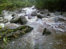
This run is the creekers alternative to the Toh. The Unami rises with the Toh but falls faster. If the small volume area creeks arent running but the Toh is, the Unami probably is as well. The Unami is super boulder chocked and has one long rapid that is probably tougher than the upper B. The nice thing is its mostly road side and theres three sections seperated by some flat water so you can choose your run depending on your skill level (the Upper having the class V most will portage). Low water (under 2 feet) is technical slot and boulder drops and youll have to walk at least two drops. Over two feet it starts stompin and most will probably want to walk at least two drops, although everything is runnable at this level. give this run a try youll probably kick yourself for not doing it sooner.
MZ
Mark Zakutansky
Apr 27, 2007
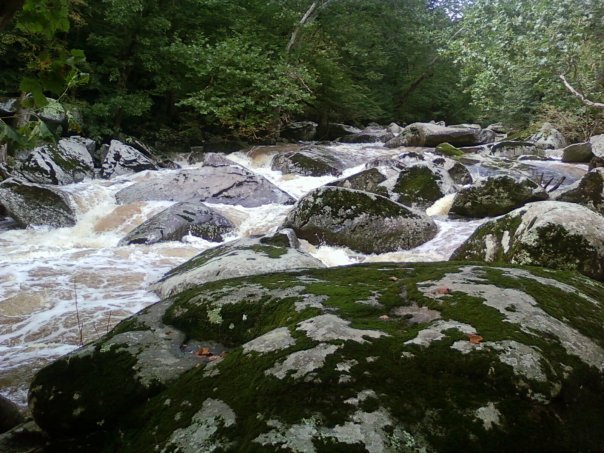
So, I finally had a chance to run this reach on 4/27/07 and its hard to even find words to describe it. Noah S. described it as epic and that may truely capture the essence of this gem. Noah, Joe, and myself ran down from nursey rd. in Trumbauersville to an unnamed fisherman pull-off on Swamp Creek Rd. near Gerysville. Some flatwater mixed with class II-III rapids led into the meat of the run. There are two, maybe you could say three very long rapids, one after another where the river drops ALOT. Both rapids are extremely sieved with enormous undercuts, manky lines, huge moves, and off the wall rewards. We all walked the first rapid because we had not seen it in low water to understand the bad ass hydrology. Honestly the creek felt almost bony throughout, even though it was clearly flooded. Most of the water flows under rocks and throuh the caves and sieves. I ran the top of the second major rapid and took out half way down the rapid in a microeddy with help from Joe and Noah. It consisted of a few boulder drops with a huge pillow rock boof left with half the current dissappearing right into a sieve. The bottom half looked just too manky. The rest of the reach is class IV technical boulder drop, slot based moves with huge rewards and big consequences for missing the line. I think the class IV-V+ is suitable, although the huge rapids are runnable if you can stick your lines perfectly! This reach reminds me of the Upper Yough with bigger boulders, more gradient, and huge consequences. I'd love to run it again with some really experienced creekers if anyone is ever interested. Check the Perkiomen guage (USGS 01473000 PERKIOMEN CREEK AT GRATERFORD, PA), it read 8,000 cfs when we put on and dropped to 6,000 cfs by take-out, a good level I'd guess, maybe a bit more would be good. Precipitation at the guage read .22 in. I would not suggest running it lower. If you think youll just scrape down, you'll end up scraping right into a cave/sieve.
Has anyone scouted the upper unami? From Umbreit Road to Kumry Road or all the way to Trumbauersville Rd. with the flatwater. There looks to be some whitewater from the google earth images.
MZ
Mark Zakutansky
Apr 16, 2007
I have been checking out this reach for some time now, but have not had a chance to scout it or clean it out. If anyone wants to scout it, clean it up, or give it a run email me at mrz2@lehigh.edu. I live up in Bethlehem and would love to check out this local creek. For some more information check out the Upper Perkiomen Creek Watershed Conservation Plan, www.upwcwatershed.org/PDFs/Topography.pdf. This report says that the unami and deep creek drop over 400 feet in 1.5 miles before the confluence with the upper perk. Unexpected gradient for eastern PA, well south of the Poconos.