| Difficulty | III |
| Length | 7.2 mi |
| Avg Gradient | 25 fpm |
| Gauge | Youghiogheny River at Ohiopyle, Pa |
| Flow Rate as of 35 minutes | 1.89 ftmedium runnable |
| Reach Info Last Updated | October 21, 2025 |
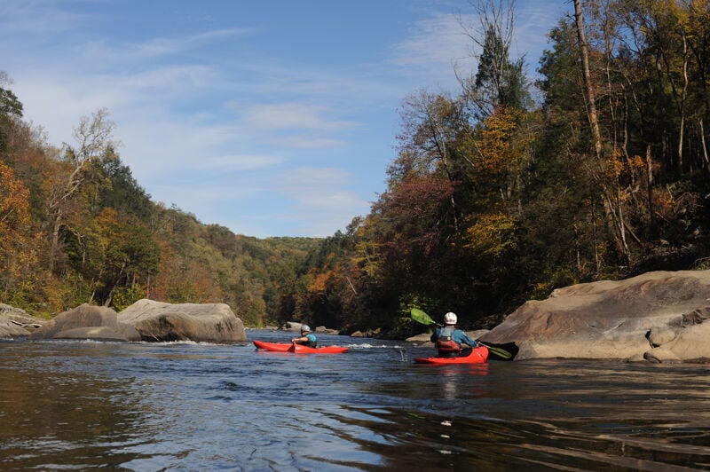
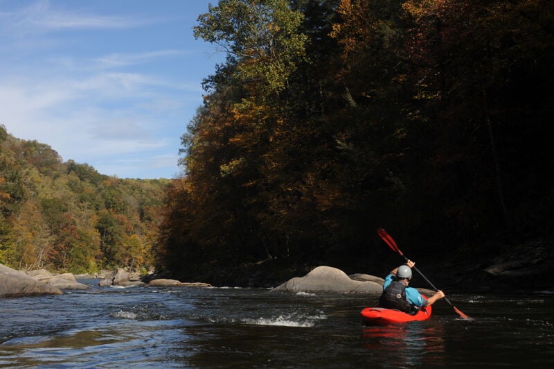
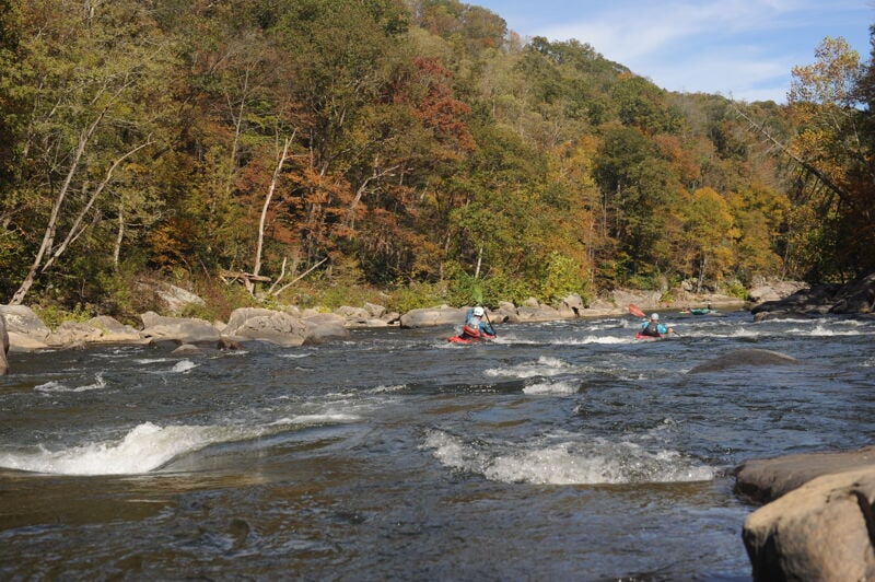
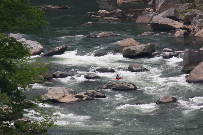
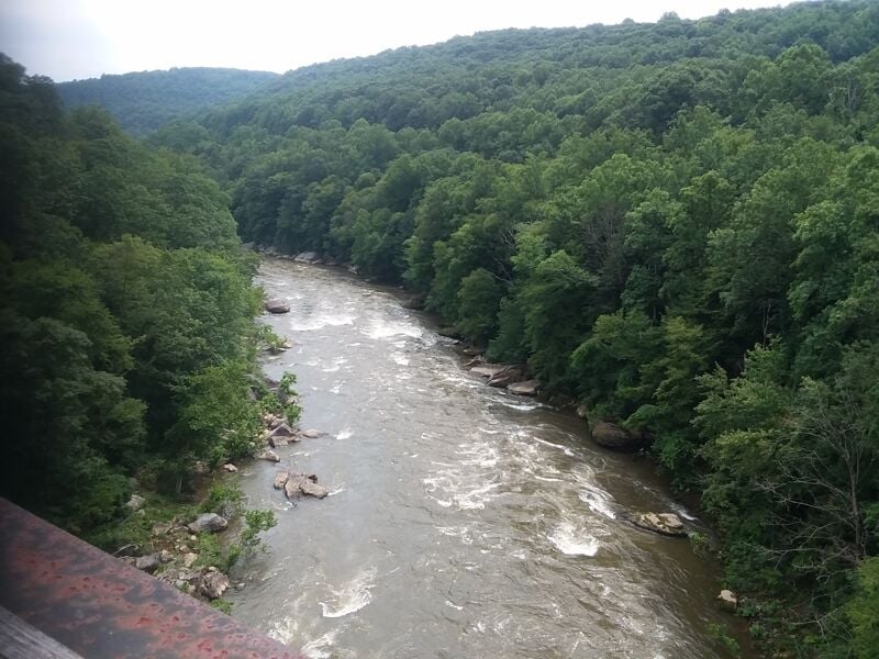
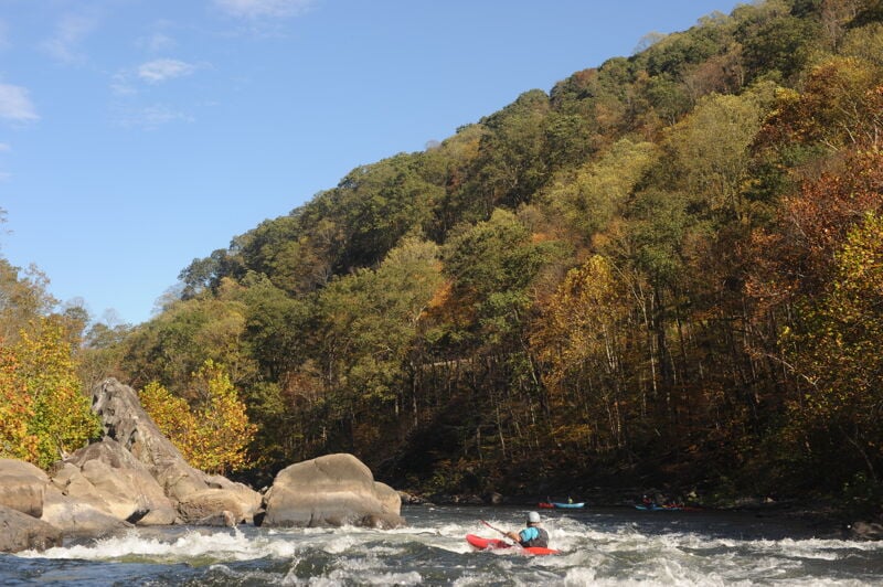
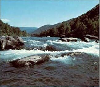
The Lower Youghiogheny River, or simply the Lower Yough, is one of the most popular and dependable whitewater runs in the eastern United States. Flowing through the steep sandstone gorge of Ohiopyle State Park in southwestern Pennsylvania, this seven-and-a-half-mile reach begins just below Ohiopyle Falls and winds downstream to the take-out at Bruner Run. The river’s consistent dam-regulated flows, moderate gradient, and beautiful scenery make it a year-round favorite. With several class III rapids punctuated by deep pools and technical boulder gardens, the Lower Yough offers an ideal blend of excitement, accessibility, and natural beauty.
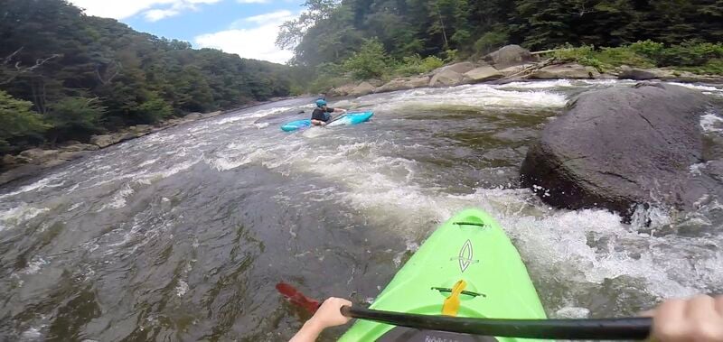
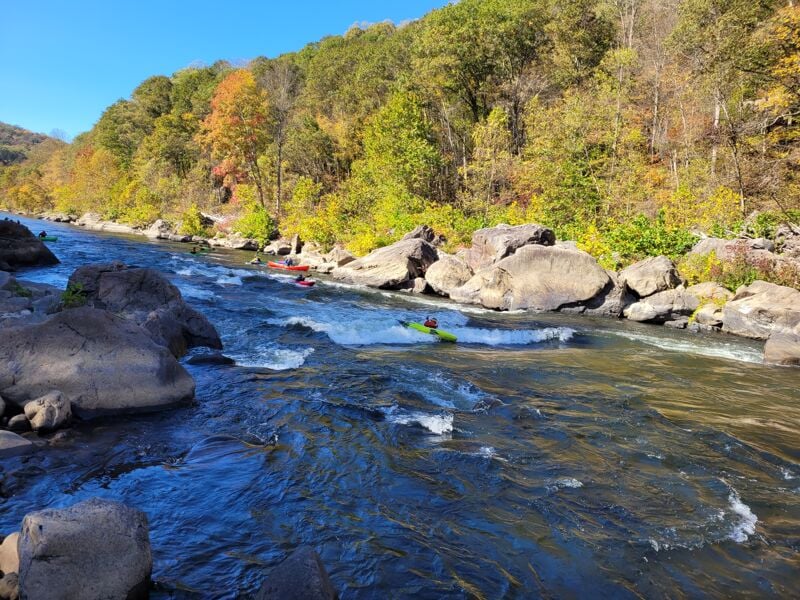
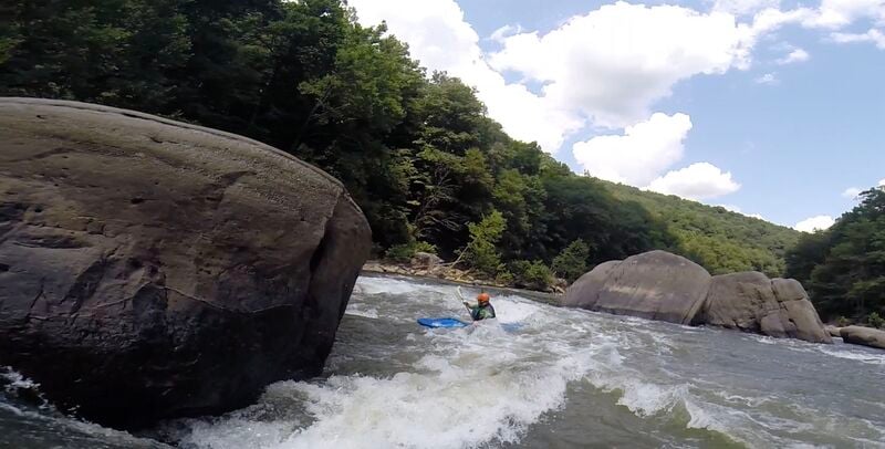
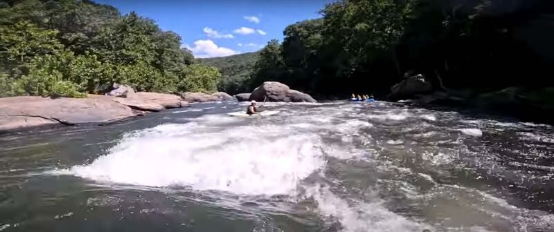
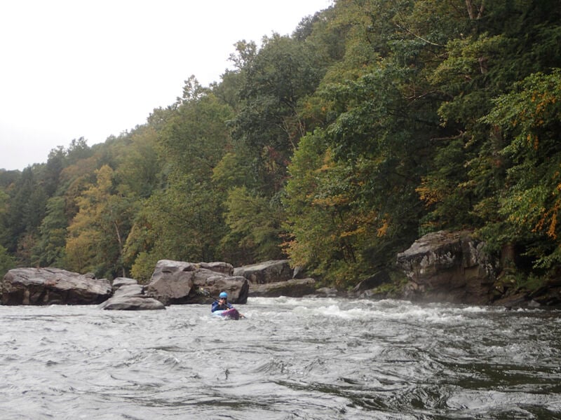
From the moment paddlers launch below the thundering drop of Ohiopyle Falls, the river sets a lively tone. The water is clear and cold, coursing between forested cliffs and massive sandstone boulders that give this gorge its rugged character. Just below the put-in Entrance Rapid offers excellent warm-up opportunities, with friendly waves and plenty of eddies to practice ferrying and maneuvering. As the river sweeps around the famous horseshoe bend known locally as the Loop, the whitewater becomes more continuous with Cucumber and a sequence of half a dozen fun rapids down to the High Bridge. This upper mile of the run provides a compact and thrilling experience where paddlers can put in and take out almost at the same point—a perfect option for first-timers wanting to sample the Lower Yough without committing to the full run or anyone looking for a short whitewater fix with easy logistics.
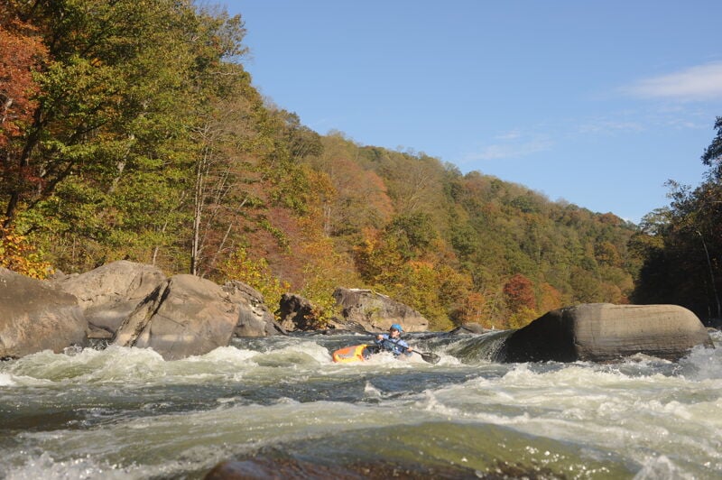
Below the Loop, the river continues through a scenic stretch and the sense of wilderness deepens as the river leaves the bustle of Ohiopyle behind. The corridor is steep and wooded, with rocky cliffs rising from both banks and the sound of whitewater echoing through the gorge. The pace is relatively mild until you reach Dimple Rock where the pace quickens and paddlers need to exercise precise boat control to avoi
...
The put-in is on a large pool on river left a short distance below Ohiopyle Falls and on the downstream side of the State Park office. Parking is across the road at the 10 Sugarloaf Boater Parking.
'Entrance' begins at the bottom of the put-in pool. It has some of the best surfing on the run -- Surf 'Hogs' can spend an hour on just this rapid. The rapid starts with a series of two or three surfing waves and eddies in which warm up. Then (at Summer low to moderate levels) at the first part of the rapid, there are three choices:
In all cases, catch the big eddy on river left and collect your group. The second part of the rapid starts with another set of surfing waves with lots of eddies and peel outs to do to avoid rocks generally moving center to left on a read and run basis, particularly at the bottom where there is a rock that splits the current. Eddy left at the bottom. At higher water [above 6'] there is no large left eddy to split the rapid -- it's just one long huge wave train down the center left of the rapid. If you find this daunting: stay right at these higher levels.
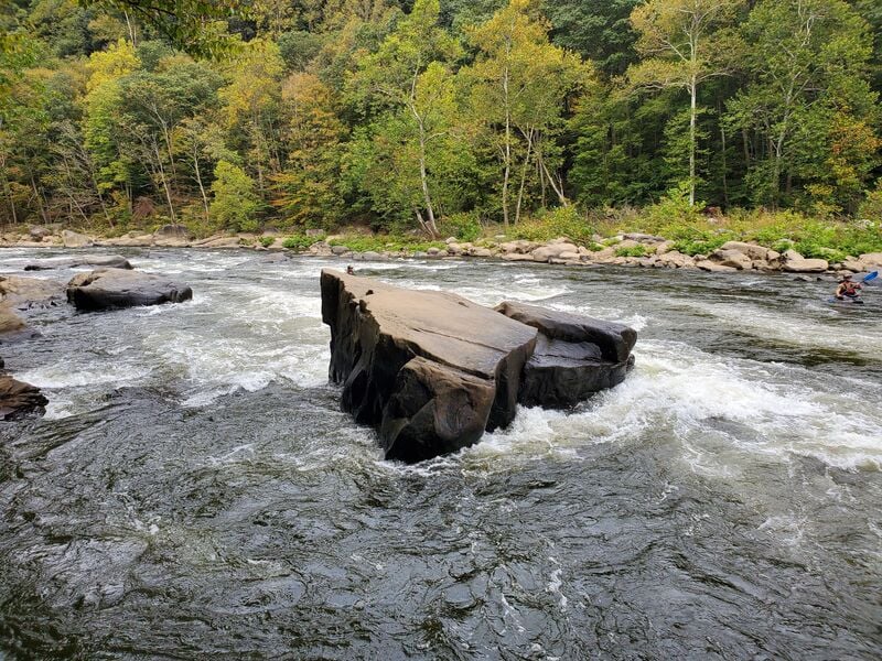
The biggest drop on the Lower Yough. From the big eddy at the top on river left where Cucumber Run comes in, work your way staying mostly left through a rocky boulder garden. The current in the boulder garden will begin to move you to the right as you approach 'Guide Rock' and the main drop. To the immediate right of 'Guide Rock' is a tongue - try to stay as far left on this this tongue as possible (a last minute current off 'Guide Rock' will try to push you to the right - don't let this happen). Take the drop on the tongue and keep paddling through some splashy waves. Eddy left. River racers take a line to the left of guide rock (it's faster) and there is a line that requires some aggressive paddling to the right as you approach 'Guide Rock' to catch an right side eddy from which there's a rocky drop into the main current. At most levels, the tailwaves have some play potential. (At summertime levels this is not a good place to flip as there's a barely submerged rock that will clock ya upside the head if you invert without seriously tucking, and, at really low water, whether you tuck or not.) Between the high 3's and the high 4's the preferred line starts to shift to the right side of the main drop. At higher levels [above 6'] 'Guide Rock' and the ledge form a huge hole from the left shore to the center of the river; the line is to stay right on the main current and punch the standing waves. Also [above 6'] the loop rapids run into each other, resulting in a wild ride from 'Cucumber' down, with only a little break before 'Railroad.'
Easy. The pourover 'play hole' on the right is a bit spanky though, at usual Summer levels.
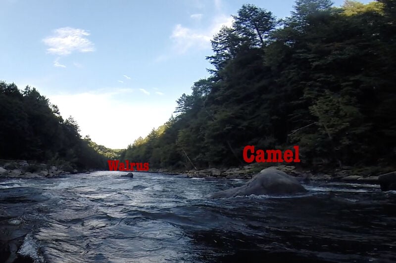
As the rapid is approached from upstream, at low and moderate levels, there is a rock on far river right that looks like a camel's head (not visible in picture). Just to the left of the camel's head rock is a rock that looks like the hump of a camel's back - this is 'Camel' rock. Further downstream and river left relative to 'Camel' is a dark rock in the center of the river that looks like a 'Walrus'. Usual line is to head to the left of 'Camel' rock and to the right of 'Walrus,' punching hard or boofing the ledge that runs diagonally upstream from 'Walrus.' Alternative line is to run between 'Camel Head' and 'Camel' rocks and catch the eddy behind 'Camel' rock. From there do a hard peel-out into the main current and build up speed to punch the ledge to the right of 'Walrus.' After the ledge there is a rock lying just below the surface to be avoided to your right. Either cut back left hard or run wide right. If the submerged rock can't be avoided, hit it hard and/or lean into it. Also, 'Walrus,' has an excellent boof opportunity. Boof it from the right side over the ledge. Increasingly, some paddlers chose to punch the hole to the left of 'Walrus.' There is a sneak line far right after passing the 'Camel' rock, but below 2.5, or so, it has a rocky runout.
Most of the commercial rafts take an easy line down the left side. Most hard boaters prefer the right or middle. The right side has a nice ledge to punch after catching a couple (or more) eddies. All rocks and eddies. Pick your way down. Enjoy!
This rapid is a read-and-run, but there is big playhole at the bottom that needs to be played or punched. The name comes from the Ledyard paddlers from Dartmouth who would travel down from New Hampshire during spring break and set up a slalom course for training.
One of the more technical rapids in the Loop. The usual line is to run in the middle of a ledge at the entrance to the rapid. The current wants to push you either left into a rock or right into a crosscut hole called 'Charlie's Washing Machine.' Being pushed either right or left is to be avoided, stay in the center. (The hydraulic formed by this ledge may be the best cartwheelin' playhole on the river.) An alternate line is to ride the 'Frog's Back' slot between two boulders just to the right of the main line. Below this first ledge, at usual summertime levels, a rocky shoal forms in the center of the rapid. In all cases, once you take this first drop IMMEDIATELY either catch an eddy or aggressively catch the main current to the left or a slot to the right. The left main current goes back and forth like a slalom; the right into a pool with several slots below. Eddy to river-right at the bottom. The Loop take-out is on river-right.
Between the high 3's and the high 4's the middle of the rapid opens up with large standing waves and holes. At higher levels [above 6'], the right side can be considered.
Takeout river right after Railroad. It's a steep walk up the trail to the parking lot.
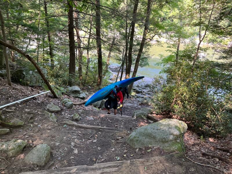
For those paddling the Loop section of the Lower Yough, parking is available at the Loop Access Area, directly across from Wilderness Voyageurs in downtown Ohiopyle. Most paddlers begin by dropping boats and gear at the Lower Yough put-in just below Ohiopyle Falls, then drive back to the Loop Access Area to park. From there, it’s a short walk—about five minutes—back through town to the put-in. The Loop makes a one-mile circuit of whitewater that bends around a large horseshoe in the gorge, ending at the Loop Take-out just below Railroad Rapid. A well-marked trail climbs from the river back up to the parking area, completing the circuit. This setup allows paddlers to run the Loop multiple times without a shuttle—simply hike back up, reload, and drop in again.
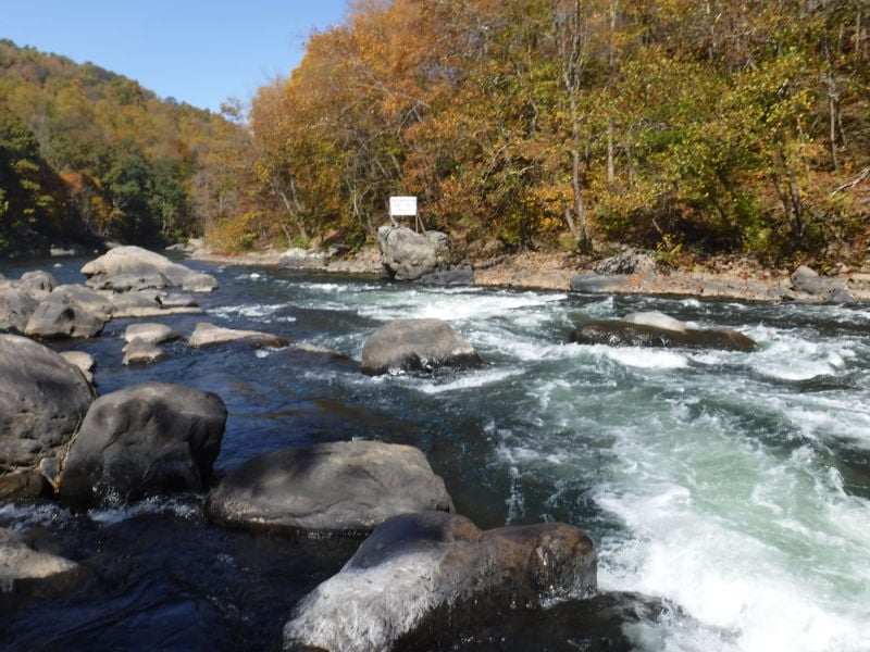
Below the Loop take-out, the rapids continue with a sweeping wash under the railroad (now bike trail) bridge and then a series of small ledge rapids and open slots. Towards the bottom, there is a small rock cave in the rocks on the right and a fossil on a rock at the left at the very bottom. After 'Lower Railroad' come two miles of 'Doldrums', punctuated by 'The Sisters' and ending at 'Dimple' rapid.
(AKA 'The Sisters;' AKA 'No Name' -- sometimes seen on older rafting guidemaps.) A usually easy rapid which can be run down a main channel that runs between a series of rocks which are easily avoided. Three of those rocks and the eddies behind them became named the 'Three Sisters' for a series of three moves for paddlers looking for a challenge after the 'Doldrums' and before 'Dimple.' But some paddlers now find more than three moves (first four and now up to seven) and the rapid name seems to be simplifying to just 'The Sisters.'
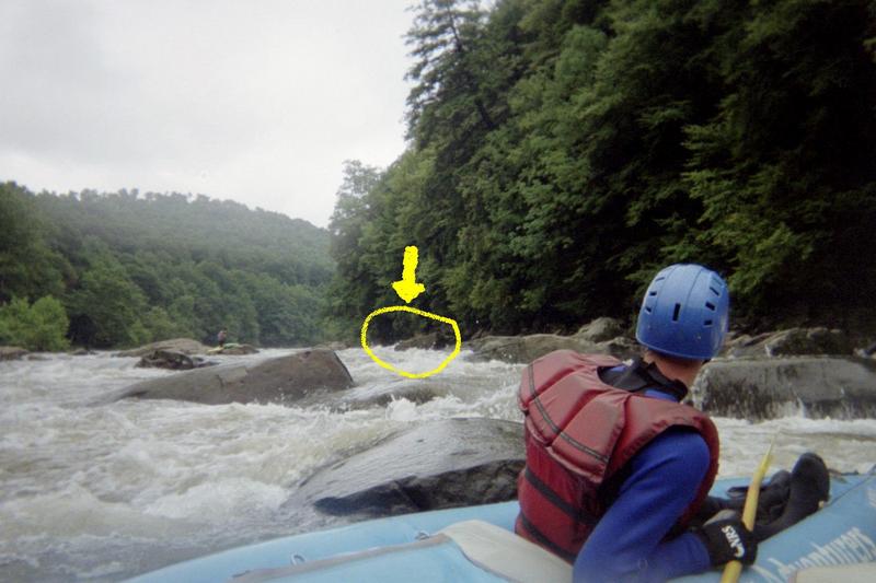
'Dimple' Rock is notorious because of its propensity for flipping boats. Thousands of rafting customers (and a fair number of hard boaters) swim here every year. The standard line at 'Dimple' is to follow the current at far river left, drifting toward 'Dimple' Rock while pointed somewhat to the right, then driving into the eddy behind 'Pinball' Rock (upstream and right of 'Dimple') as soon as you pass the guard rocks. It's a fairly straightforward move for experienced kayakers, and for raft crews that work well with each other and pay attention to their guides. The issues are: 1) that a paddler has to focus on the eddy behind 'Pinball' and not on 'Dimple' Rock and 2) it is a little tricky to time the move from the current through the eddy - too early and the upstream eddy current pushes you into 'Pinball' - too late and you hit the pillow on 'Dimple' (Either of which is manageable if you keep a cool head and keep paddling).
There is an undercut on 'Dimple' Rock, just to the left of the pillow. ' Between 1983 and 2003, there were eight drownings in those ['Dimple' Rock] rapids. Since 2003... [a drowning in 2022]... was the only one.' ( statement by Ken Bisbee - Park Manager at DCNR/Ohiopyle State Park in 2023). Most of these drownings have been rafting customers are washed into and become fatally trapped by the undercut . There's a sneak to the right of 'Pinball' Rock and left of the larger 'Vulture' Rock for those who want to take no chances and at higher levels there's a line to the right of 'Vulture' Rock, as well. There is the option to portage: The park has created a portage that starts at the rock beach on river right and follows a trail to put in below 'Dimple.'
The 'Dimple' approach can change at different water levels. At very low water there is a ledge and hydraulic on the left side of the approach that makes it more difficult to achieve the correct right angle on the approach to the 'Pinball' eddy; also the undercut is more exposed at low water, which can make it more dangerous if one is out of the boat and shoved to the left and into the rock (This concern is greater for the occupants of rafts and duckies than for hard boaters who rarely swim on the approach). At moderately high levels, a boil forms at the foot of the 'Pinball' eddy that can flip boaters making the eddy turn. At still higher levels there are more route choices and exactly where you are relative to 'Dimple' rock may not be the main focus of your attention.
Below 'Dimple' Rock there are a series of rocks to dodge and a riverwide ledge to find slots to pass through.
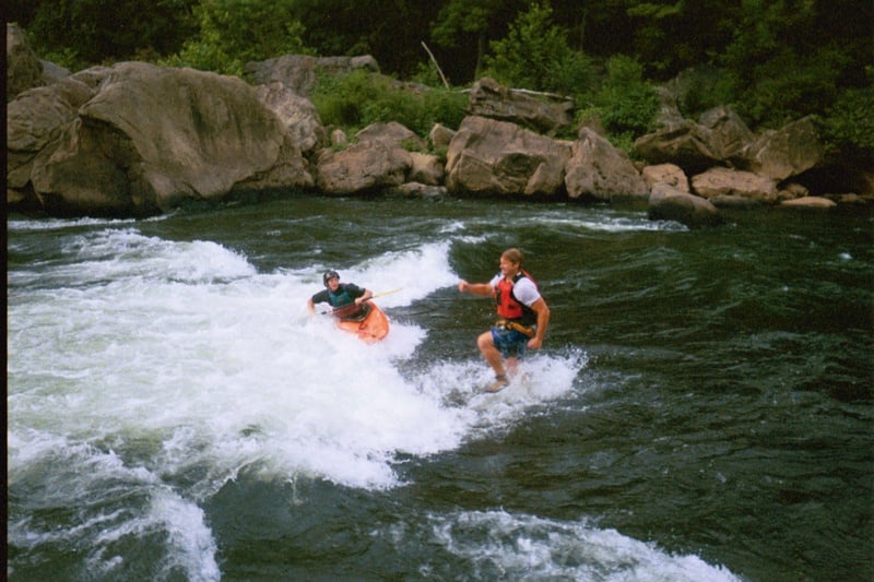
The lead-in to 'Swimmers' rapid starts almost immediately below the ledge below 'Dimple'. Stay in the center - there is a nasty hole on the right side followed by nice eddies both right and left above 'Swimmers.' 'Swimmers' hole (or wave) is one of the most famous playholes in the Eastern US. Try to avoid bouncing surfers out of 'Swimmers' by clipping it either right or left. Downriver traveling boats that eddy out upstream and wait for the current surfer to finish are traditionally granted one quick 'surf on the fly' by the line that forms on river left. Downstream of the hole are some nice tailwaves, too. Rafters get a big kick out of jumping into the water from a rock not far above 'Swimmers' Hole and swimming through it.
Usually approached from the right. There is a rock in the center just above the main drop that can be passed either right or left. If the center rock is passed on the right, punch a small hole and move right to left - take the main drop (or boof the right side of the big rock on the left). If the center rock is passed on the left, the move is a fast left to right or even a ferry move to pass between the center rock and the left rock at the drop - take the drop and eddy right. The rapid can also be run well to the left of the boof rock. The name 'Bottle of Wine' comes from the early days of rafting when guides found a bottle of wine in the eddy below the boof rock.
As the name implies... The first hole is a pourover ledge. The second hole is playable, but trashy at lower levels. The standard line is to catch a first eddy in the center of the river and a second a little further down and to the right. From there, peel out and stay center right to the bottom. There is an alternative creek line down the left side of the first hydraulic and a 'Hairy Ferry' line, crossing just above the first hydraulic. Around 3.5', the second hole is a smooth wave; above 6' the entire rapid is a glassy tongue.
Perhaps the toughest rapid on the Lower Yough, this one has a couple of rocks with pinning potential. The normal line is to start in the center with increasing left angle, and work strongly to eddy out behind the big rock on the left called 'Whale Rock'. The objective is to stay away from the wall like rock on the right called 'The Wall' AKA 'Flat Iron' unless you intend to eddy out to the right and power ferry across. There are a line of rocks running into the current in a line from 'The Wall'/'Flat Iron' rock called (in order) 'Snaggletooth,' several 'pinning' rocks, and 'Wash Up' rock which you are trying to avoid by staying tight to the left behind 'Whale Rock'. Finally, some boaters like to run a hard tight line between 'Snaggletooth' and 'The Wall'/'Flat Iron' into the eddy below. There is a nice big eddy immediately below the rocks on the line from 'The Wall'/'Flat Iron'. The rapid continues with the main current going from left to center with additional eddies to catch and another big rock to dodge with a pool below.
High water comments: 1) This is a rapid that does not 'wash out,' - the main line remains the same - but requires more and more skill and power. 2) At higher water, there is a rarely done Class IV creek line to the right of 'The Wall'/'Flat Iron' rock, but watch out for strainers...
Low water comment: Low water exposes additional rocks and a mid channel ledge. Many paddlers find, at low water, that it is easier to eddy right in the beginning of the rapid and power ferry across to one of the eddies behind 'Whale Rock'. This allows you to see the additional rocks and ledge and plan a better line -- but don't get blown on the ferry...
The rapid starts with some fairly easy waves, then a sharp turn to the right. After the turn the river continues (with several nice eddies both left and right) towards a large rock called 'Schoolhouse Rock'. Most paddlers will pass to the right of 'Schoolhouse Rock', but a run to the left can be done as well. From the left side, here's a neat move through a slot between the huge Schoolhouse Rock and a small rock just downstream of it for those that like to be challenged. A fairly easy rapid with a playable wave train. Below 'Schoolhouse Rock' there is a nice big eddy and below that an area of weird cross-currents called 'The Land of Schwerley Waters'.
The normal line is to take the wave train down the river-left side which curves around a rock in the center. A harder line is to go to the right of the rock where there are a series of ledge holes to punch. Finally, there is a 'Boof Moof', which is a boof off the right side of the rock in the center into the eddy below it - but this move must be tight, as there are rocks just below to catch a paddler doing a sloppy boof.
This one is bad. Nasty. Dangerous. This rapid is so scary, that it's too scary to look at. Therefore, it's traditional to run it backwards.
At most water levels there are a series of easy chutes along the right shore, but at really low water, stay with the main current at center left. Most notable for being the original takeout (river right at a layered rock that looks, from just upstream, like a stack of Pancakes) for the Lower Yough before the railroad closed the at-grade crossing after the 1976 boating season following a train derailment in the mid 1970's.
(AKA 'Rocky Road' - which some older rafting guidemaps call this rapid, assuming a line straight down the center.) Most hard boaters call this rapid 'Maze' as they prefer to find their own route through the boulders on river left. The 'Maze' line is more fun than difficult.
On the approach, the main current moves to the left because of a shoal to the right, but if you stay left, watch out for the 'Gates of Hell'; they're just close enough to two-point broach older, longer boats. As you pass the last rock of the right side shoal, begin moving right of the big rock in the center of the river where there are a bunch of waves. There are some cool ferry moves here, if you still have energy, and some of the waves are good play, especially at higher levels. Also, some run the left side through the 'Gates of Hell' (sometimes also called 'Pharoah's Tomb'). The take out is at the bottom of the rapid, river left.
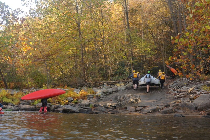
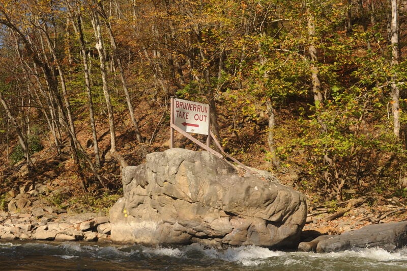
Take out on river left just below Bruner Run Rapid. A short trail leads uphill to a staging area where, during the weekend permit season, a shuttle bus transports boaters to the parking lot at the Old Mitchell Place. Outside of the weekend permit season—or on weekdays—you can drive down and park here near the river. Designated outfitter parking is located on the lower terrace closer to the water, while public parking is just above. The Bruner Run access opened to both outfitters and the public at the start of the 1979 boating season.
The next takeout downstream is at the Indian Creek Aqueduct on river right, approximately three miles below. Access there is via a steep, rough jeep trail descending the right bank to the Aqueduct—reportedly even rougher than the Jenkinsburg Bridge road to the Cheat Canyon takeout.
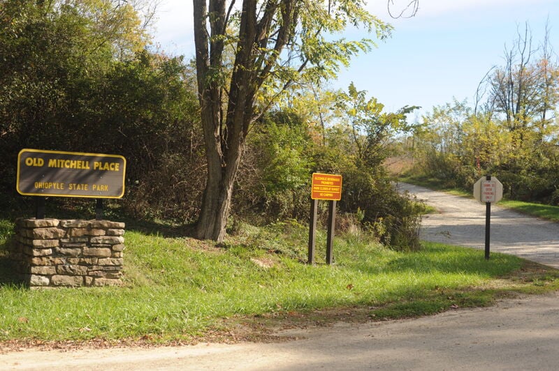
The Old Mitchell Place Take-Out, located within Ohiopyle State Park, serves as the main access point and parking area for boaters running the Lower Yough River. Situated high above the river on river left, this site functions primarily as a staging and parking area rather than a direct river access. Paddlers finishing the Lower Yough typically take out at Bruner Run and then use the park’s boater bus shuttle—operated during permit season on weekends—to reach the Old Mitchell Place parking area. The shuttle climbs steeply out of the gorge on a narrow road and covers about one mile uphill to the parking area. Outside the permit season or on weekdays when the shuttle is not running, boaters may drive down to the lower terrace closer to the river for loading or unloading, with some limited space available for parking. The Old Mitchell Place itself is a flat, grassy area above the canyon rim with restrooms and informational kiosks.
Sep 14, 2022
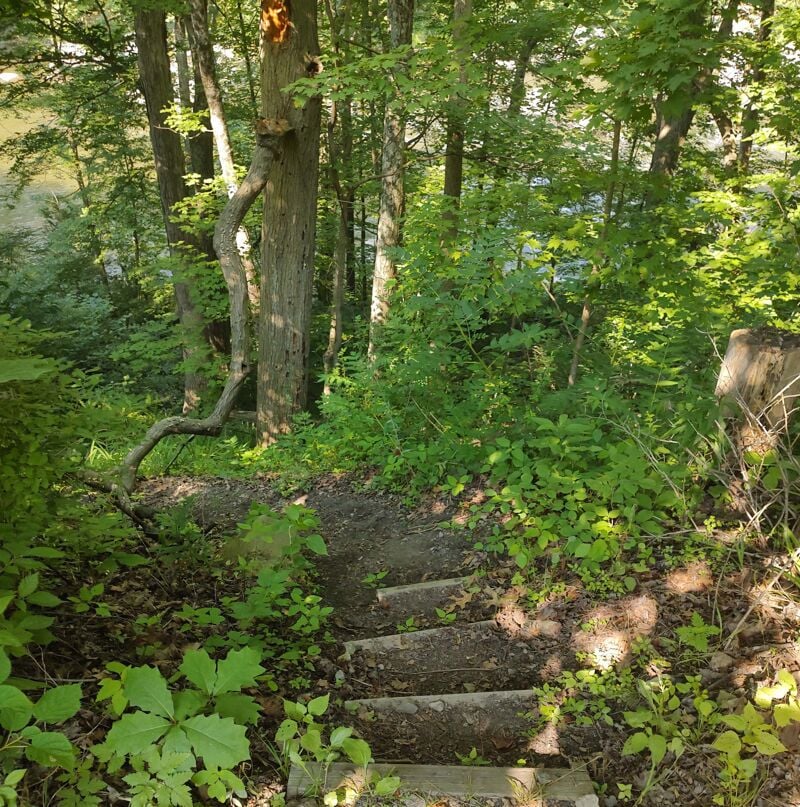
I joined Park and DNR representatives for a site visit to discuss helping with some low-key improvements to the eroding steps at the Loop Trail, and checked out all the access signs and new infrastructure. It was a good visit, and I paddled the Loop for the first time in many years.