Cosumnes
Highway 49 to Highway 16
| Difficulty | II-IV(V) |
| Length | 20 mi |
| Avg Gradient | 34 fpm |
| Gauge | Cosumnes R a Michigan Bar Ca |
| Flow Rate as of 40 minutes | 45 cfsbelow recommended |
| Reach Info Last Updated | December 18, 2023 |
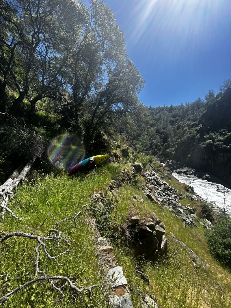
The Cosumnes has a mixture of continuous class 4 rapids, low gradient flat water, and two big portages, surrounded by great scenery.
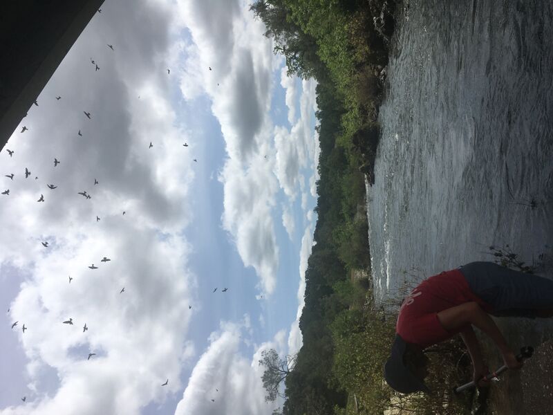
At low flows, this is a Class II run with one Class V portage (on the right) and lots of great birding opportunities.
Season: The Cosumnes River is low elevation and needs rainfall for good flows. Watch flows during the winter after large rain storms or a series of moderate rain storms. There can be a short spring snowmelt season as well.
Access Problems: Local residents and governments have done their best to eliminate any public access areas for this river. There is minimal public parking anywhere near the river. Vehicles must be parked some distance away. Loading and unloading near the river must be done efficiently and as quickly as possible, to minimize potential complaints or conflicts. Long bike shuttle is possible and pretty, and eliminates the need for leaving a car at the top.
Put in: Highway 49 bridge. There is a large turnout on the south side of the bridge that appears to be legal for parking. This may or may not be legal access in the view of the county.
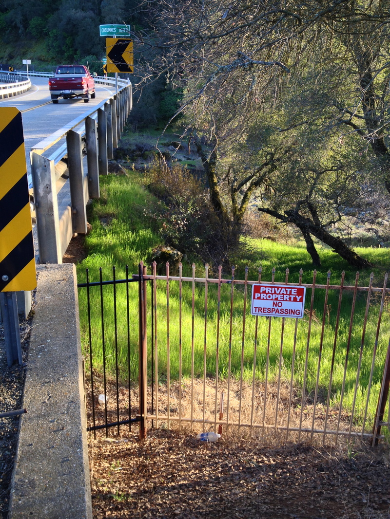
Latrobe Road. There is no legal parking near the river. You may be able to access the river, but you will have to park some distance away.
UPDATE AS OF 03-15-16: Recognizing American Whitewater's mutual work on other bridge projects and the value of river recreation in the area, El Dorado County Counsel had the illegal fence that was blocking access to the river at Latrobe Road Bridge removed. They also assured us if a new fence were erected that they would help the public keep the fence down permanently. This action supports the California constitutional right of the public to the use of and access to a navigable waterway (See People ex rel. Younger v. County of El Dorado (1979)).
Thanks to AW Regional Coordinator, John Simpkin for the initial ground work an
...
There appears to be legal parking on the south side of the bridge.
Class 4 rapids begin immediately below the Hwy 49 Bridge and continue back to back or with short pools for one mile. These rapids lead directly into a rapid that should be portaged.
A series of 3 big waterfalls is generally portaged, though modern creekers may or may not run them. Only a short section of swiftwater separates the last class 4 rapid from this class 6 rapid.
The river runs south, then curves west (right) at the last class 4. High cliffs on the left mark the big drop. Scout and portage on the right.
Smaller but fairly continuous rapids continue below this point.
A ranch road fords the river here. It creates a small drop, but might be a hazard at some flows.
The gradient is low in this area, so long flat water sections separate occasional rapids.
Three nice rapids, one after the other, break up the flat water.
The river splits around a long island. Looks like the left channel is the cleanest.
Boaters do access the river in this area, but load or unload quickly and park vehicles at a turn out 1/4 mile to the south.
Take out on river right when you see a big house up on the hill.
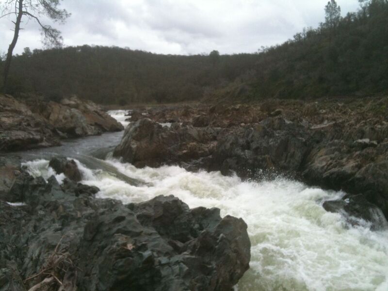
This class 4 rapid at the start of a gorge leads to a class 6 rapid at the end. Only a short distance seperates the two drops. Either portage this rapid and the falls below on river right or scout very carefully to make sure you can get out when you need to.
This ugly two tiered waterfall may be run by some at some flows, but is normally a portage. Portage the drop above as well, or carefully scout the whole section.
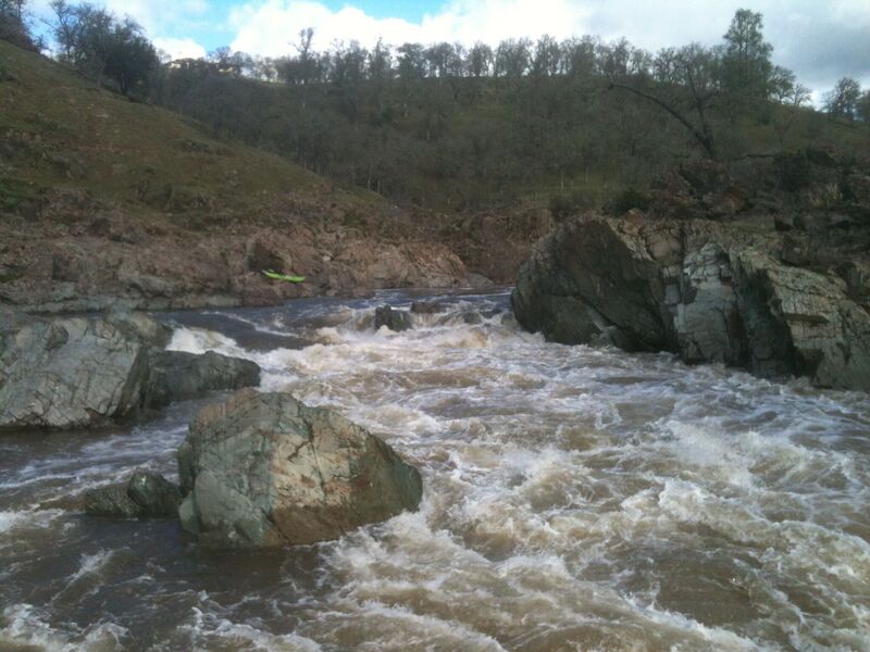
The river turns south and drops through this significant rapid. Stumpy is hazardous and tends to collect trees.
Many people walk past this rapid as part of the portage around Cosumnes Falls.
This rapid consistently pushes boaters into a trapped recirculating eddy on the right at the bottom.
Many people walk past this rapid as part of the portage around Cosumnes Falls.
This is the easiest access back down to the river after portaging Cosumnes Falls. This also avoids the two class 4 rapids; Stumpy and Corner Pocket.
The river curves to the right then drops over bedrock shoals. This rapid breaks up a long section of relative flat water.
A series of nice rapids come at regular intervals to keep the next mile interesting. The rapids probably range from class 2 - class 3.
The land owner does not allow any public access to the river at this bridge. The river is flat water with some riffles below this bridge.
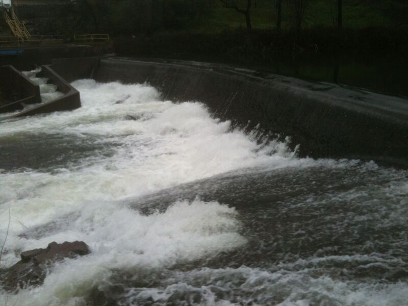
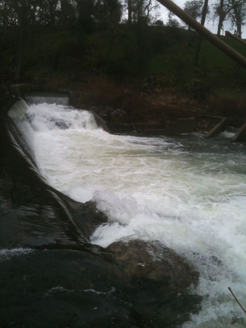
A large island divides the river. Both sides are blocked by dams. The dams create the usual death trap recirculations. Portage across the island down the middle for the easiest walking and access. The flat water from the dams extends upstream about one mile.
Rancho Murieta Community Services district has large pumps and inlets on the north side of the river here. The district diverts water from the Cosumnes River between November and May of each year to Calero, Chesbro and Clementia Reservoirs. All of the District's drinking water is treated before it is supplied to the customer.
Between the diversion dam and Hwy 16 are three or four small but interesting rapids.
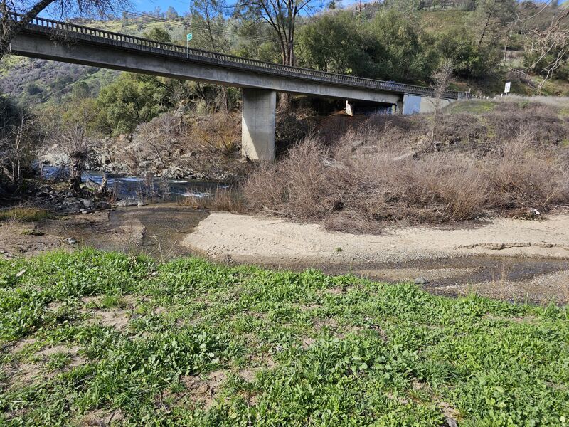
Take out is easiest on river left on the downstream side of the highway bridge. There is easy access to the river at this bridge but all the turnouts have prominent No Parking signs. Do not leave cars here, but park further away in legal areas. Load boats as quickly as possible.
Apr 22, 2024
Ran 49 to Latrobe, and what a wonderful section of river. Fun and continuous solid class IV (at 1300 CFS) followed by a really pretty portage. Yes, there's a bit of a flatwater paddle out and the rapid intensity does taper as the run goes on, but the class IV at the beginning certainly makes it worth it.
As far as logistics go, we put in on the north fork of the Cosumnes, about 1/2 mile north of the confluence of the north and middle fork Cosumnes, just north of the trailer park. There's a pullout with a sign for 'Nashville' on the northbound side of 49 that was not signed. From here it's a short walk to the north fork, which is brushy class I-II. We then floated down to the confluence where the IV starts. For takeout, we parked a car past the no parking signs on the northbound side of Latrobe, south of the bridge. One person retrieved the vehicle then drove it to the north side of the Latrobe bridge, where there was a wide shoulder to load and stage. Slight pain of logistics, but what a beautiful and fun run.
Jan 31, 2024
Hello, we are the new owners of the property on the South side of the Hwy 49 bridge. It has always been privately owned, but public access and parking was tolerated by the previous owners.
Note: the turnout up at the bridge level is a no parking tow-away zone and will be strictly enforced going forward. The land on both sides is private property; please be respectful.
We are planning a small private day use parking area for the near future, so that families can access the water and enjoy sanitation facilities and other amenities to come later. We do ask visitors to stay on established trails, as we are creating gardens and orchards. Thanks for your patience and look for signs later this spring when we open. There will be a small parking fee.