Saluda
4 - Lake Murray Dam to Broad/Congaree confluence(Saluda Shoals County Park to Senate Street Boat ramp off US #1)
May 20, 2003
| Reporter | Brad Roberts |
Saluda stuff
-------------------------------
Some corrections to the names:
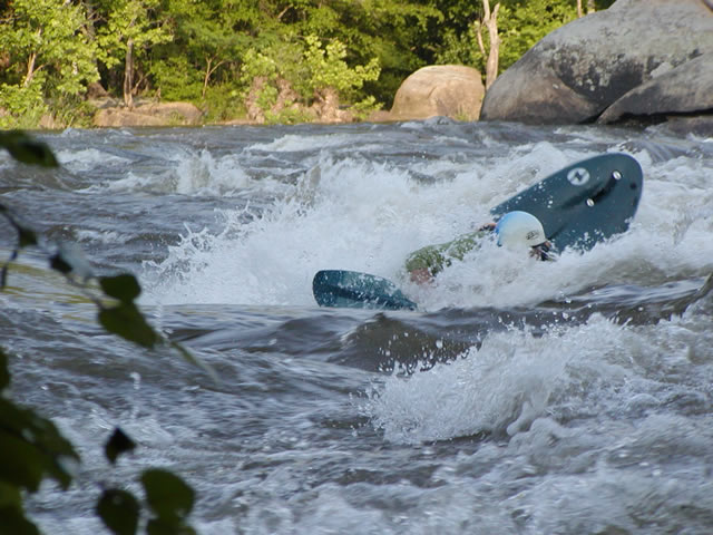
Radio Towers is at put-in. At high flows (15,000+) Maytag and Lap of luxury come into play (not rock of luxury :) )
Moshpit=Pop-up, just different names.
The creek currently has some ugly strainers, use caution.
Please note the importance of having a local show you down Millrace the first time, there are places you just DON'T want to be depending on water levels. plus, some more play stuff happens in the top of Millrace on the dreaded right side at up to maybe 3,000 that you
would not want to attempt if you didn't know just where you could and could not be.
There is no mention of the rest of the section. To run the river from the zoo to Gervais:
(class II-II+ (III) if you start below Millrace)
First rapid is Shandon Rapid (III-), .25 mi below Pop-up: as the river splits, take the right fork. Run the rapid on river right. A straight shot, with a
decent hole and a side surfing wave at some levels.
There has been a foot entrapment death here.
River then widens and the Broad joins the Saluda. There is a riverwide shoal type rapid with lots of playable waves and holes. Run just left of the rocks
in the middle of the river.
From here down, read and run easy class II+. There are some more holes etc as you approach the first bridge, nothing scary unless the water is really high. Takeout just past the second bridge (not
counting the zoo bridge) on river left, there is a small beach. Access here may be iffy right now, tread lightly.
This is a good short beginner run. At higher flows most things begin to wash out and some holes form near the bridges. 3 mi. Can be run in an hour or less.
Directions to Gervais takeout from the zoo: get back on I-126 towards Columbia (east). Take the first exit (Huger St.) A mile or so down Huger, turn right on
Gervais St. Just before crossing the bridge, there is a parking lot on the left hand side with a bus stop in
front of it. Park here. Walk to the back corner of the lot, down that street just a bit, and you will see the short take-out trail down to the river.