Saluda, South
1- Table Rock Reservoir to Highway 11
| Difficulty | II-III |
| Length | 15 mi |
| Avg Gradient | n/a |
| Gauge | South Saluda River Near Cleveland, Sc |
| Flow Rate as of 40 minutes | 4 cfsbelow recommended |
| Reach Info Last Updated | February 25, 2023 |
This run is primarily an easy float. A few small rapids break up the class I stuff. Below Hwy 11 is the Blyth Shoals section with big whitewater.
Sep 16, 2022
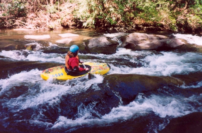
Caught this run a couple days after a big rain (9' in 24 hours!) in early September, running about 350 cfs. We paddled from the highest legal access point, where it runs out of the Greenville Watershed, to Highway 11. It was delightful. It is a narrow stream, about 30-35 feet wide. The water that day was warm, very clear, quite deep, with a steady current punctuated by occasional ledges and short easy rapids providing some surfing opportunities. The scenery is pretty, heavily forested with many vacation cabins, and again, the beautiful water quality was a big part of the joy of paddling this section. There were a few trees in the creek, but there was only one place we had to portage, very near the takeout. I'd rate it as slightly more challenging than the Lower Green, mainly because of the somewhat greater amount of wood, but anyone with basic boat control could paddle it safely. We saw no other paddlers, partly because it was a weekday, but mostly because this section isn't on many people's radar. Overall, no adrenaline, but really a pleasant run.
(By the way, at 350 cfs Blythe Shoals was roaring, and we opted not to try it.)
Jan 1, 1900
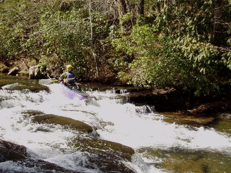
South Saluda has some easy roadside rapids.