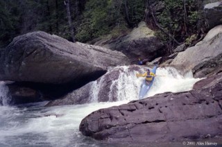
North Chickamauga Creek
2. Walden Ridge to Soddy-Daisy(North Chick)
March 17, 2005
| Reporter | Robert Maxwell |
The USGS North Chick gage is in an unstable stream bed that changes and shifts after floods. Lucky for us, the Bowater Paddler's gage is placed in a very stable area and hasn't changed with each flood. As of December 2004 here's how the USGS gage relates to the Paddler's Bowater Gage.
USGS = Paddlers Gage
10.93 = 5.50
7.68 = 3.25
7.23 = 2.90
6.92 = 2.80
6.84 = 2.50
6.57 = 2.20
6.30 = 1.80
6.27 = 1.75
6.16 = 1.50
6.14 = 1.10
I have an Excel 2000 spreadsheet that predicts the levels for North Chick and several other rivers in the southeast. If you