Barton Creek
2. Lost Creek to Loop 360 (Austin) (4.5 miles)
| Difficulty | II-III+(IV) |
| Length | 4.6 mi |
| Avg Gradient | 19 fpm |
| Gauge | Barton Ck at Loop 360, Austin, Tx |
| Flow Rate as of 37 minutes | 0 cfsbelow recommended |
| Reach Info Last Updated | June 25, 2019 |
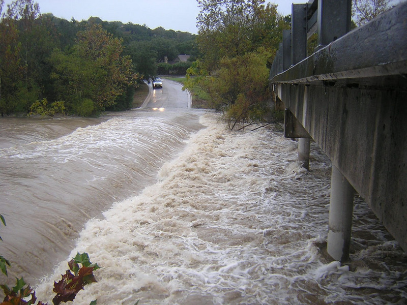
Barton Creek doesn't usually have enough water to be runnable, but when it does, it creates one of the best Class III runs in the state of Texas, right through the heart of Austin. Barton does not generally rise as quickly as other area creeks, but it can definitely go from low to raging in a matter of hours after a heavy rainfall. Because the creek does not always flow, there are often trees and strainers throughout the run, particularly if the creek has been recently dry.
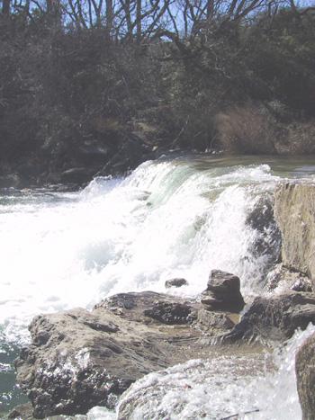
Most of the run involves Class II wave trains, rock gardens, and small drops, such as Sculpture Falls. Some of these drops are surfable at moderate flows (500-1200-ish.) The only three consequential rapids are a seven-foot dam, about a mile from the put-in; another dam about 1/4 mile below that (only consequential at low levels); and Twin Falls, which is near the Mopac bridge (see descriptions below.)
Put-in parking is typically available on Bend of the River Dr., the abandoned low-water crossing adjacent to the Lost Creek Blvd bridge. If full, additional parking is available on one of the nearby cross streets. Do not park on the low-water crossing itself. At somewhere between 3000-4000 cfs, the creek will start flowing over the low-water crossing. Police will shut off access to the parking area whenever this happens. Area residents seem to be very supportive of local boaters, and vehicles tend to be safe.
Takeout vehicles can be parked at the Barton Creek Greenbelt trailhead next to the Loop 360 Bridge where Mopac and Highway 360 intersect. If the trailhead parking area is closed (which it sometimes is after a heavy rain), then parking is also available in the adjacent dirt lot. From the water, watch for the wooden fence on river right just after you go under the 360 bridge to avoid missing the takeout. Follow the trail about 300 yards up to the parking area.
Many continue on for the remaining 4 miles and take out at Zilker Park to
...
(More of a IV- below 1000 cfs and a IV+ above 2000 cfs.) A seven-foot dam near the Hill of Life is the most consequential feature on the run, creating a very retentive and potentially deadly hydraulic at higher flows (multiple thousands of cfs) and a piton hazard at lower flows. There used to be a straightforward stair-step line over a chute at center left, but it eroded somewhat during the Halloween flood of 2013, so the dam is now more hazardous than it used to be. Scouting or portaging is highly recommended. The former stair-step line will still ender a playboat at higher flows, and missing the line (particularly to the right) can have dire consequences. This dam, along with other Central Texas low-head dams, could be described at high water as a 'Class III line with Class V consequences.' If you hit the line, it's straightforward, but you absolutely don't want to miss it. The drop is not easily boat scoutable, and the chute is not apparent from the top. Bank scout/portage on river left.
Austin firefighter Rob Horne is assumed to have drowned in the river right hydraulic at 3000-4000 cfs during the July 4, 2002 floods.
The Halloween 2013 flood also opened up a Class III-ish creek line at river left that has become wider with subsequent floods and is now runnable at most (reasonable) levels above about 400-500 cfs. It requires a couple of tight turns around trees and a boof at the end to avoid a small recirculating ledge.

This drop used to be straightforward at all levels, but the Halloween 2013 flood apparently re-arranged it a bit, and at lower flows (500-1000 cfs, for instance), it now forms a couple of nasty-looking offset holes, left and right of center. There is a one-boat-wide diagonal that threads the needle left to right between the holes, but that line also sets you up for another recirculation downstream. The left hole in particular is in a tight notch created by broken pieces of the dam. Don't go there. The other holes might not hold a long boat, particularly if it has sufficient speed, but they definitely appear as if they might cause problems for a playboat.
At higher levels (2000 cfs, for instance), these features wash out, and the rapid is straightforward again, more of a II or II+.
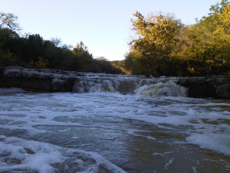
Above 400-500 cfs, Twin Falls can be run either left or right of the island. When running the left line at low to moderate flows (below 1000 cfs, especially), a tricky eddy line often pushes boaters into the trashy, retentive hole at the bottom of the drop. This hole has caused more than one expert boater to swim. At higher flows (2000 cfs, for instance), it becomes easier to sneak left around the hole.
Running to the right of the island is possible at moderate to high flows (generally around 400-500 cfs or above.) At moderate flows (below 1000 cfs), it involves paddling as close as you can to the island, then doing a sort of right-to-left diagonal boof (similar to a rail slide) off of a boulder and into the pool below. At high flows, right of the island becomes a straightforward line.
Bank scout/portage Twin Falls on river left.
Some boaters use this as an alternate takeout for this reach, or an alternate put-in for the reach below it.
Public parking and access is available along the turnout under the bridge at river left. Note, however, that this area has a high incidence of vehicle break-ins. It also requires a bit of a hike to get to/from the river.
May 16, 2016
Did this run in my inflatable raft (intex seahawk 4) and had a blast. We portaged the two lowhead dams but ran sculpture and twin at about 200 cf/s with no problem. Went over the left side of twin and got real wet but the raft handled it like a champ!
Jan 1, 1900
High waters await