Barton Creek
3. Loop 360 to Zilker Park (Austin) (3.75 miles)
| Difficulty | III |
| Length | 3.9 mi |
| Avg Gradient | 17 fpm |
| Gauge | Barton Ck at Loop 360, Austin, Tx |
| Flow Rate as of 54 minutes | 0 cfsbelow recommended |
| Reach Info Last Updated | June 15, 2026 |
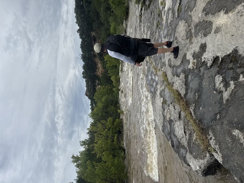
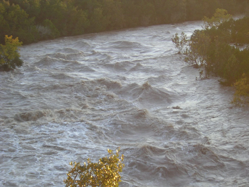
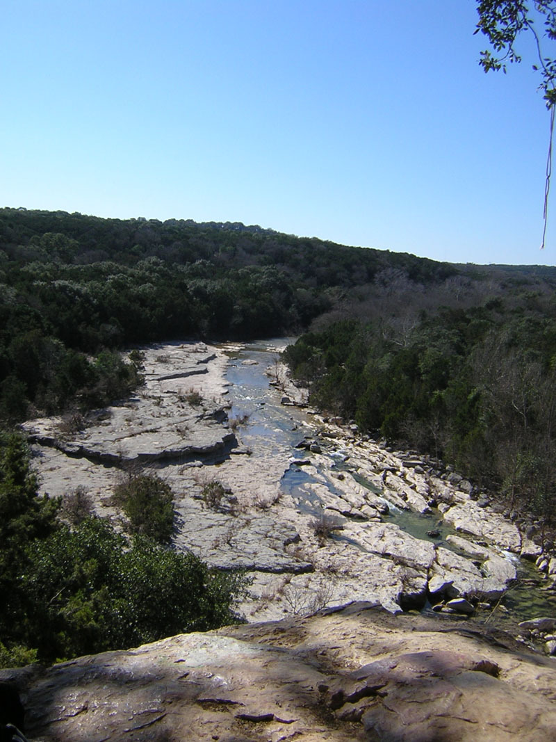
Barton Creek doesn't usually have enough water to be runnable, but when it does, it creates one of the best Class III runs in the state of Texas, right through the heart of Austin. Barton does not generally rise as quickly as other area creeks, but it can definitely go from low to raging in a matter of hours after a heavy rainfall. Because the creek does not always flow, there are often trees and strainers throughout the run, particularly if the creek has been recently dry. This stretch in particular contains several Class III rapids that are formed by trees growing close together in the creek bed. The lines through these rapids are not always visible from the top, and fallen trees do occasionally create hazards to navigation.
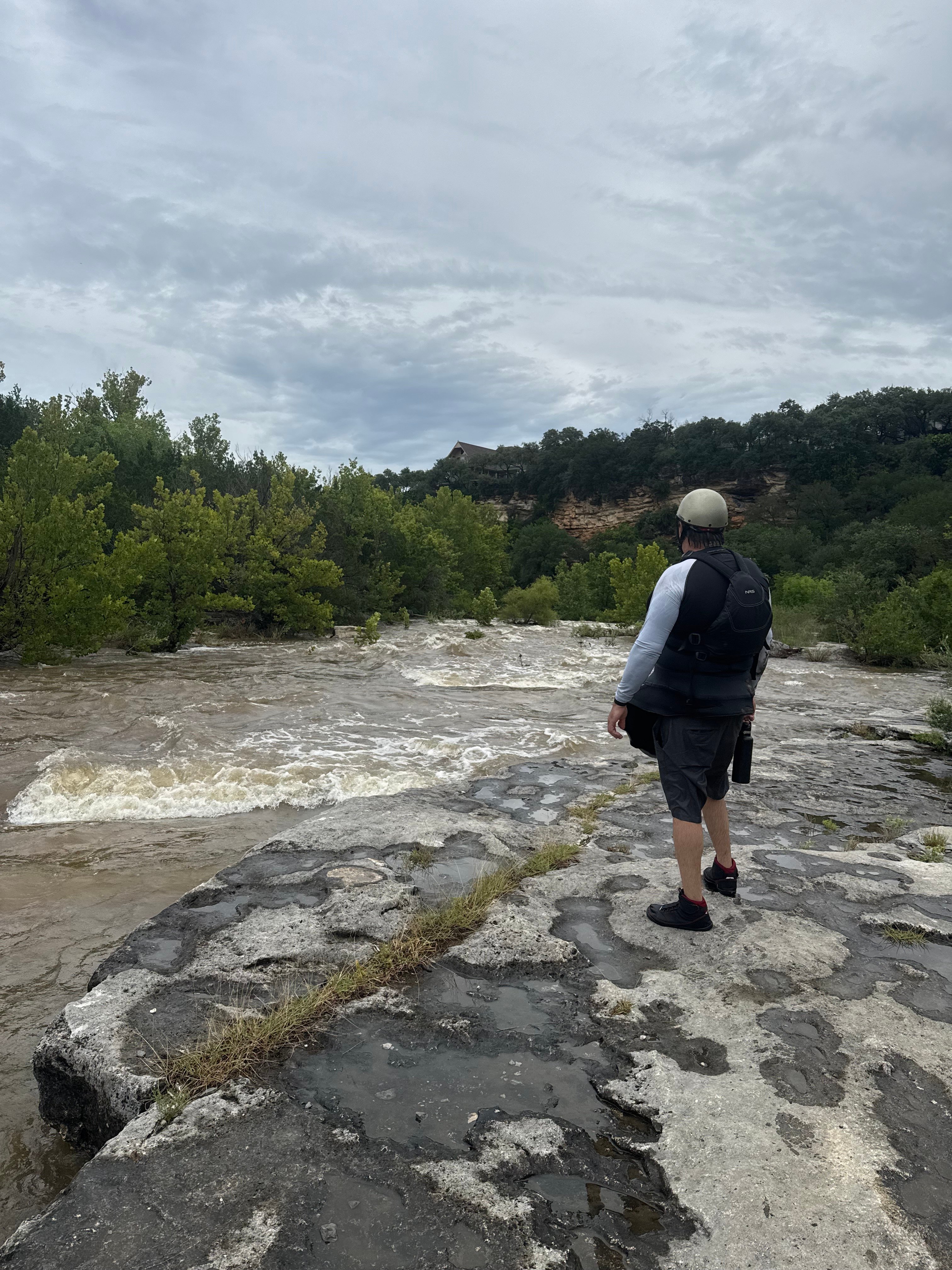
Put-in parking is available at the Barton Creek Greenbelt trailhead next to the Loop 360 Bridge where Mopac and Highway 360 intersect. If the trailhead parking area is closed (which it sometimes is after a heavy rain), then parking is also available in the adjacent dirt lot. There is a trail to the left of the fence that leads directly down to the water.
The takeout for this run is at Zilker Park, in the parking lot for Barton Springs Pool. Paddlers usually take out at river left just above the dam at the upper end of Barton Springs Pool. It is technically illegal to paddle over this dam and into the pool, and if you do that, you will usually get yelled at by a lifeguard and may be hassled by police or fire officials in some cases. The dam creates a nasty hydraulic at some levels, and the bypass grate that is supposed to divert the normal flow of the creek around Barton Springs Pool becomes a potentially deadly strainer at high water.
On at least one occasion, boaters have been skunked on this stretch, because a flood bubble had reached the put-in but had not yet reached the takeout (which was still bone dry.) This created a bizarre situation whereby the paddlers literally reached the end of the river and had to
...
(III+ above 2000 cfs.) Triple Falls is the first major rapid after the 360 Bridge. It is composed of three drops spaced about 40 yards apart. Upstream from the first drop, the main flow of the creek jogs left through the trees. After you make that jog, go right of the tree in the middle of the creek to get set up for the first drop.
The first drop is typically run center left, but at high flows (above 2000 cfs), a retentive hole forms in the center of the channel, and a right-to-left maneuver is required to avoid it.
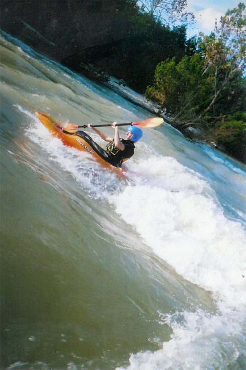
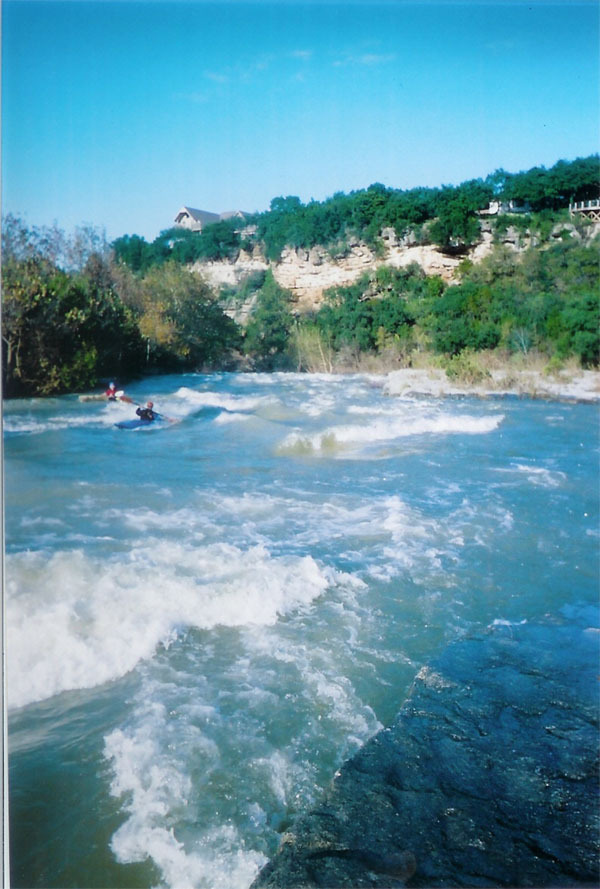
A great play wave emerges at the bottom of the second drop at moderate flows, and kayakers tend to stop here and surf for long periods of time. Eddy service is best on river left but can be a bit tricky due to low-hanging branches. If you miss the eddy, pull out at river right below the third drop and hike the trail back up. At higher flows (> 2000 cfs), the second drop becomes more of a wave-hole, and a wave train forms to the left of it.
The third drop is a shallow but surfable ledge at moderate flows, but it washes out at higher flows.
Here is a video of kayakers surfing Triple Falls:

(Really more of a III- at most levels.) Swirl is typically run river left. Pinball gets its name because of rocks just below the surface that can bounce boaters around, particularly at lower flows. Pinball is basically a 'follow the water' rapid. There are some turns required, but the lines are generally straightforward. At high flows (> 2000 cfs), water starts flowing over the boulder at the bottom, creating a deep hole right in the middle of the channel, but the wave train to the left sets you up for some strainers along the left bank.
The standard line for Campbell’s Hole is to start center and work left, bypassing right of some 'FU' rocks and then left of the large hole and boulder at the bottom (this line sometimes requires ducking under a tree branch.) Large rocks just below the surface have been known to flip kayakers and send them into the hole (particularly at lower flows.) At flows around 1250 cfs, the hole can be easily boofed by experienced boaters. At above 2000 cfs, a straightforward line opens up at center right, skirting the right edge of the hole.
Jan 1, 1900
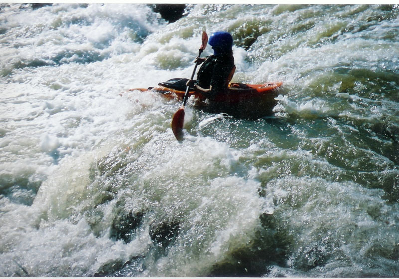
Kayakers playing around at campbell's hole.