Guadalupe
4. Canyon Dam to First Crossing (16 miles)
| Difficulty | II+ |
| Length | 15.8 mi |
| Avg Gradient | 7 fpm |
| Gauge | Guadalupe Rv at Sattler, Tx |
| Flow Rate as of 20 minutes | 95 cfsbelow recommended |
| Reach Info Last Updated | May 25, 2016 |
The Lower Guadalupe is fed from a bottom-release dam ( Canyon Dam), and thus it almost always runs relatively clear and cold (60 degrees at the dam.) During the summer months, if the dam release is at 'recreational' levels (< 750 cfs), the river will be clogged with tubers. Referring to this article, The Guadalupe-Blanco River Authority controls the releases from Canyon Dam whenever the lake level is 909' or below, and when this is the case, typically the releases will be geared toward tubing (no more than 750 cfs, and usually much lower) during the summer months. During periods of drought, the GBRA will release only the minimum necessary to maintain the health of the Matagorda Bay estuary and fulfill downstream water contracts (about 50-75 cfs.) When floods occur on the Upper Guadalupe and the lake gets above 909', the Army Corps of Engineers takes control. If the lake level gets too high, then they will attempt to lower it to 909' as quickly as they can, which usually results in days or weeks of 3000-5500 cfs releases downstream (5500 cfs is the maximum dam release.) However, the Army Corps must also ensure that the release, when combined with natural flows, does not exceed 12,000 cfs at Cuero, Gonzales, and Victoria. During big dam releases, the Lower Guadalupe becomes a playground for rafters and whitewater kayakers, but unfortunately this only tends to happen every few years, and extended multi-week big releases only tend to happen once or twice every decade.
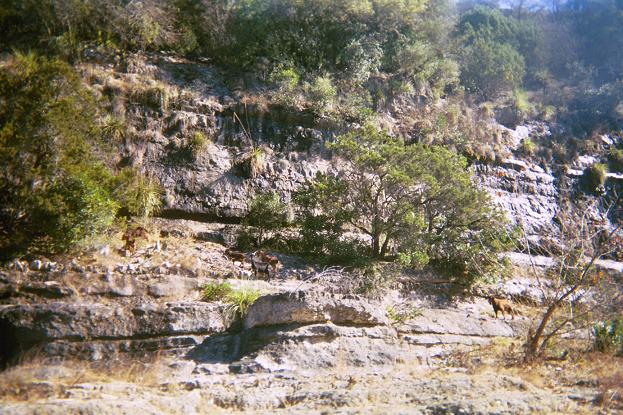
Although there are a few decent natural wave trains on this stretch of river when the dam is releasing 3000+ cfs, most of the significant rapids are formed by low-head dams, and the majority of rapids are above 4th Crossing. The stretch from 4th Crossing to 1st Crossing has a lot of flat water. The main allure of this stretch is its scenic beauty, as the river winds through some
...
Park in the public lots on either side of the outlet (located on S. Access Road.) Hike 500' or so down the trail to the river (both sides of the outlet have a trail.)
Prior to 2002, this 6' dam was deadly, because its crescent shape caused most of the water to recirculate back into the dam. Multiple people apparently lost their lives here. In the July 2002 flood, 70,000 cfs went over the Canyon Lake spillway (the first time that the spillway had ever been activated), and that water entered the Lower Guadalupe just upstream of Horseshoe Falls, burying it in sediment. The dam has since been excavated, but the character of it was forever altered by the flood, and it is now runnable. At high levels (thousands of cfs), it forms a wave train at river right with a shallow ledge hole at river left. The ledge hole looks grabby, but it is unknown whether anyone has actually been in it. Use caution. At low levels, most of the water goes to river right, and the shape of the natural shelf (exposed during the 2002 flood) creates a small diagonal hole that can hold and flip a tube. That hole may present difficulties for recreational canoeists as well, but it is not known to be dangerous for whitewater boaters.
Potential access point (no public parking, but you can pay one of the river outfitters)
Potential access point (no public parking, but you can pay one of the river outfitters)
A tube chute right of center creates a friendly green tongue that is runnable at all levels. Above 500 cfs or so, water starts flowing over the rest of the dam, creating a ledge hole whose grabbiness varies with the flow. Use caution. Multiple tuber deaths have occurred here, mostly at 800-1200 cfs (flows that are rated 'strenuous' for tubers), and beta suggests that the ledge hole can grab boats just as easily at these levels. The grabbiness of the ledge hole at higher levels than this is unknown.
Rated II+ primarily because of consequences. The ledge hole is easy to avoid, but you do not want to go there.
A tube chute at the center of the river creates a friendly green tongue that is runnable at all levels. Beta from canoeists suggests that the rest of the dam, like its upstream neighbor (Kanz Dam), can become grabby at low flows. At high flows, it washes out.
Potential access point (no public parking, but you can pay one of the river outfitters)
This dam is generally run left of center, and at low flows, the line is easy and unconsequential. At high flows (thousands of cfs), the river right side of the dam forms a large ledge hole (grabby at some levels), but following the green water at river left lines you up for a trashy wave-hole (Trashcan Hole) located 60' downstream of the dam. Trashcan Hole becomes a world-class rodeo hole at around 3000-4000 cfs but earns its name at higher flows than that. At higher releases (generally 4500-5500 cfs), the dam itself forms a beautiful surf wave ('The Niño') left of center, and above 5000 cfs, The Niño has eddy service and is river-wide. This wave is fast and forgiving. You can zone out in a front surf for days on it or easily do spins, and it gives up airscrews and such to more experienced playboaters. Below about 4500 cfs, The Niño becomes less retentive and more difficult to catch, and the wave compresses at river right into more of a wave-hole. There is no public access here for park 'n' play.
The following videos are, respectively, from 2015 of some local kayakers playing in The Niño at 5500 cfs and from 2007 of some local kayakers playing in Trashcan Hole (note that the level shown in the 2007 video was actually about 4000 cfs, not 5000.)
The river splits around a large boulder in the center of the channel, with an easy line to either side of it. At high flows, watch out for the large boulder at river right near the exit of the rapid, as it is undercut.
This is a straightforward rapid created by the alluvial fan at the mouth of Bear Creek, which forces the river to jog left. There is a small but easily avoided hole left of center near the top, and this hole becomes more of a wave-hole at high flows. At 5000 cfs, this rapid contains some large reactionary waves and a medium-sized wave train, but it is otherwise unconsequential.
Bear Creek is the most significant feeder stream between Canyon Dam and Common St., and it can contribute hundreds or even thousands of additional cfs when there has been a recent heavy rainfall in the area.
When the dam is releasing thousands of cfs, this is a must-portage. This low-water crossing was responsible for a deadly accident in 2001, during which a recreational kayaker was pinned under her boat at 5100 cfs. It is unknown whether it is passable at lower water.
A low-head dam forms a very grabby hydraulic at river right. At low water, there is a natural limestone chute at river left, allowing boaters to bypass the dam. At high water, the chute is inundated and becomes nothing but an easy set of waves spanning half the river. However, be vigilant, because at high flows, there is a wave train at river right upstream of the dam that, if followed, will line you up for the dam hole, and it isn't obvious where the hole is from upstream.
How do you rate a Class IV/IV+ hole with a 50-foot-wide Class I-II path around it? II+ seems to be appropriate, primarily because of consequences rather than difficulty. The pourover at river right is very easy to avoid, but you absolutely do not want to go there.
Potential access point (no public parking, but you can pay one of the river outfitters)
A couple of river-wide ledges. The normal line at low flows is river right. At full dam release, the ledges are completely inundated, and there is nothing but a wave train here. At 3000 cfs, the lower ledge forms a river-wide shallow surf wave.
No public access. Taking out at First Crossing will require paying a fee to one of the outfitters located on either side of the river.
If you take out below the 1st Crossing bridge, be cautious of the pilings from the old bridge, which are located just downstream of the current bridge. These form about 20 slots across the river. At high dam releases (thousands of cfs), some of these slots can form grabby hydraulics and/or collect large debris (tree limbs, etc.) Generally the second slot from the left is the best one to take, assuming it isn't clogged with debris. The river left side of the bridge also has the most vertical clearance.
May 23, 2016
NOTE: As of this writing, there is a non-linear error in the Sattler gauge that causes it to read too high when the release is above about 4700 or 4800 cfs (which generally only occurs when the Corps are doing a full release from both the dam and the power plant.) The gauge will read 7000 cfs when in fact only 5500 cfs is being released. The Sattler gauge is located at Horseshoe Falls, just below the point at which the Canyon Lake spillway channel joins the river channel. There are no significant contributing streams between the gauge and the dam, so if the spillway is inactive, then the Sattler gauge should match the dam release. Refer to the Army Corps page (http://www.swf-wc.usace.army.mil/canyon/) for the actual release information. If the Sattler gauge disagrees with that, then the gauge is most likely incorrect.