| Difficulty | II-IV(V) |
| Length | 20.3 mi |
| Avg Gradient | 16 fpm |
| Gauge | Pedernales Rv Nr Johnson City, Tx |
| Flow Rate as of 40 minutes | 331 cfsbelow recommended |
| Reach Info Last Updated | August 27, 2021 |
River Description
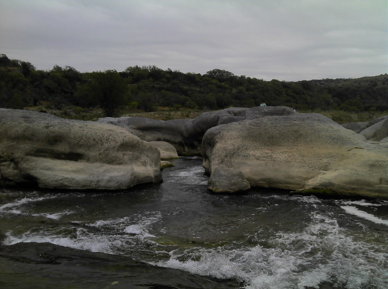
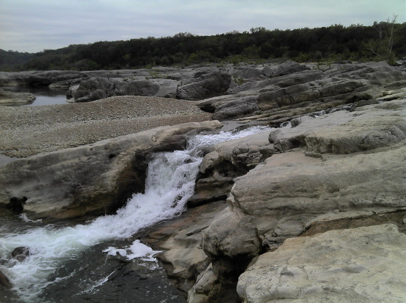
The Perd doesn't go very often, but when it goes, it goes big. The river bed is extraordinarily wide (often well over 100 yards), but unlike the Upper Perd, this stretch tends to channelize the flow much more, and thus it is runnable at much lower levels. At very high water (10,000+ cfs), the features become Grand Canyon-sized. For more specific beta, see Texas Whitewater.
The crux of the run is near the end. Pedernales Falls is a series of three features spaced about 200 yards apart. At levels where the downriver run is worth doing, the falls are likely to be deadly, so most boaters choose to take out at river right in the large pool above the top drop and portage the rest of the falls, or to run just the top drop and portage The Slide and S-Turn. The best time to huck the falls is when the river is low and the rest of the run is scrapey. See separate description for the falls for level-specific beta.
NOTE: As of this writing, the official park policy is to disallow boaters from putting in or taking out at the falls (although you may, of course, legally portage them.) If you don't want to run the falls, you can take out at the park boundary and hike a mile to the Pedernales Falls parking area. You can also portage/run the falls and take out 3 miles below them at the swimming area. Please respect park regulations and be respectful to rangers. You are legally allowed to run the river, but the park is legally allowed to control access to it.
Distances and gradient measured using GIS tools in 2015. Average gradient from Johnson City to the top of Pedernales Falls = 14 fpm. Maximum gradient is 132 fpm, measured from the top of 60/40 Falls to the base of S-Turn (0.34 miles.)
River Features
LCRA Pedernales River Nature Park
Access PointDistance: 0 mi

Parking/access at river right
Johnson City Dam
HazardDistance: 0.11 mi
Runnability unknown. You can easily put in below the dam without leaving the LCRA park.
Private Low-Water Crossing/Dam
HazardDistance: 1.22 mi
May create a hazard at some levels (beta needed)
State Park Boundary
Access PointDistance: 16.5 mi
Alternate takeout for those who would prefer to carry their boat a mile rather than portage/run the falls and do the 3-mile paddle-out. A trail system leads back to the Pedernales Falls parking area/trailhead.
Pedernales Falls
PortageHazardWaterfall / Large DropClass: VDistance: 17.18 mi
See separate description for the falls. Note that, if the river is within the recommended range for the downriver run, Pedernales Falls will be either a Class V or a V+.
NOTE: As of this writing, the official park policy is to disallow boaters from putting in or taking out at the falls (although you may, of course, legally portage them.) If you don't want to run the falls, you can take out at the park boundary and hike a mile to the Pedernales Falls parking area. You can also portage/run the falls and take out 3 miles below them at the swimming area. Please respect park regulations and be respectful to rangers. You are legally allowed to run the river, but the park is legally allowed to control access to it.
Pedernales Falls SP Swimming Area
Access PointDistance: 20.03 mi
Official takeout, accessible on river right via a 300-yard foot trail that leads from the swimming area parking lot.