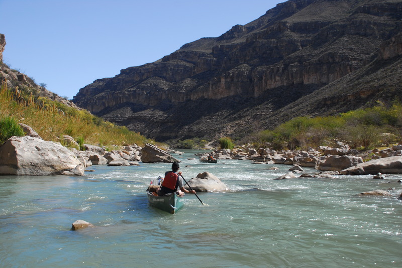
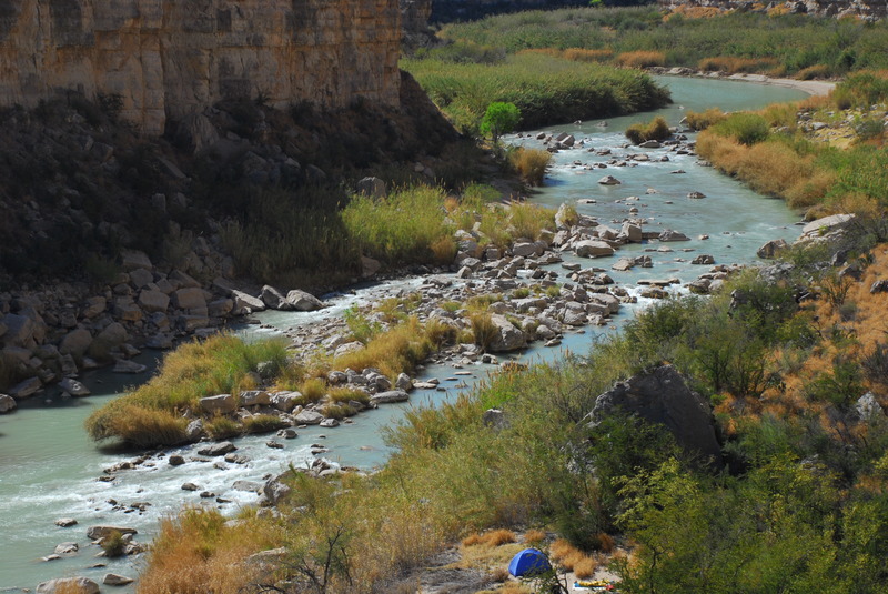
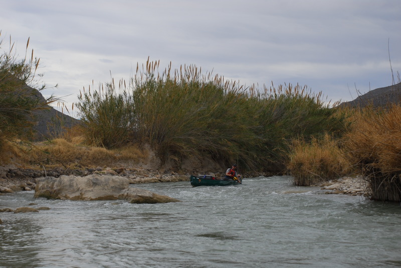
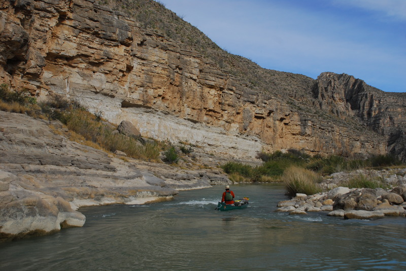
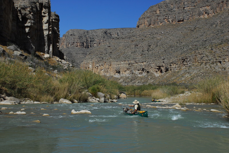
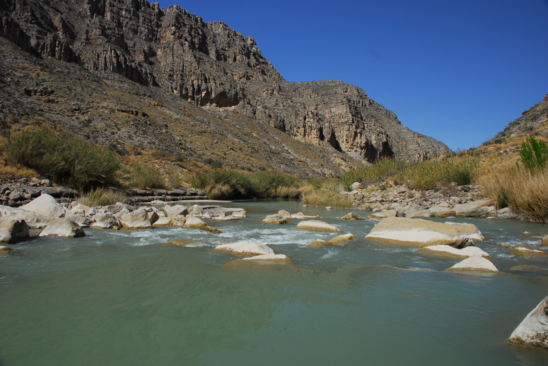
Big picture: a mostly flatwater trip on a Wild & Scenic river in one of the most remote corners of the lower 48. Fantastic scenery and slot canyons to explore. Almost all the whitewater is class 2. The dominant factor with the whitewater, hiking and camping is hostile vegetation, the invasive river cane, Arundo dorax.
- Water levels severely limit when you can run the river. Winter is most reliable. Spring run-off from the upper river does not reach the Big Bend area. Flash flood risk is high in the rainy season.
- At low water, small camps (one or two tents) are available. Almost all the larger camps described in the guidebooks are overgrown with river cane. At imaginary higher water, the small camps will be underwater and areas higher on the bank are overgrown.
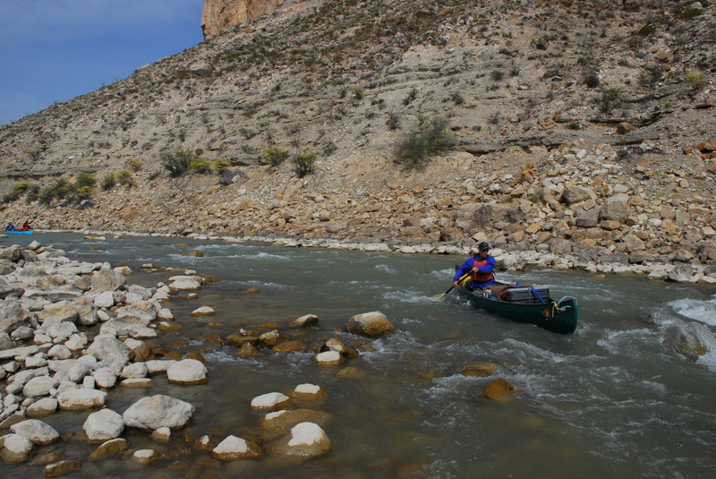
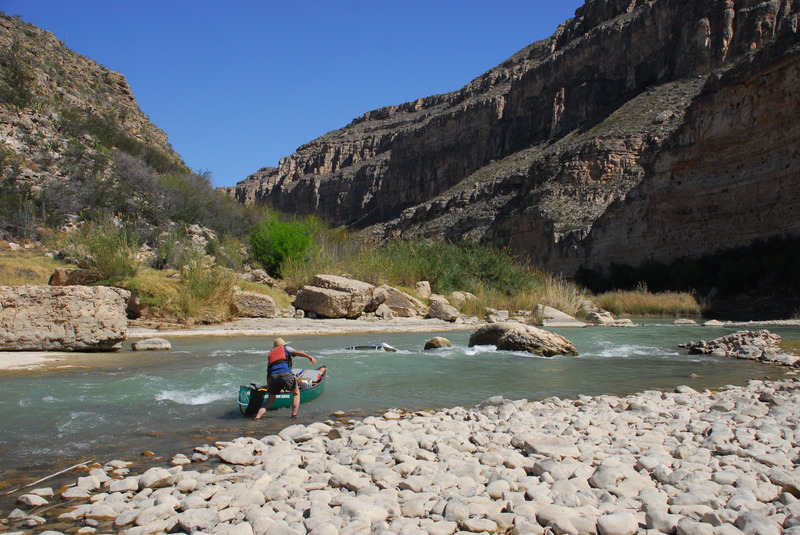
- The cane presents challenges on the river as well as on shore. There are mile-long stretches with cane on both sides of the river. It is especially prevalent on the outside of bends, where most of the water flows through and under it. Pick your line to avoid cane, not shallows.
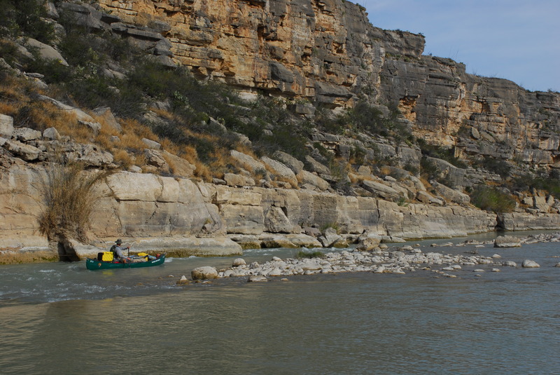
River beta: it is all read and run for intermediate canoeists. Probably too shallow for other craft, including self-support kayaks. (I have no experience with pack rafts.) Notable exceptions:
- Upper Madison rapid: Intermediate run in a WW kayak. All others will likely have challenges. We portaged gear and ran the canoe empty, taking the left line on the Texas side. You probably want two 70’ throw bags per canoe to line it
- The portage trail is tough. Cane has caused bank erosion making upper access very steep. Alternative is a boulder scramble a bit lower down, then a cane-filled bushwack to the lower end of the trail. Running river left (Texas side) you can easily attain back to the end of the portage trail in Mexico.
- Lower Madison rapid: we scouted and ran the canoe loaded.
- Unnamed, unmarked rapid: at mile 59 (717.3 in the BBNHA map) there is a new rapid from a recent flash flood from a canyon in Mexico. It is a straightforward, one move rapid, missing a boulder and running a hole. The most fun little rapid of the trip at our flows.
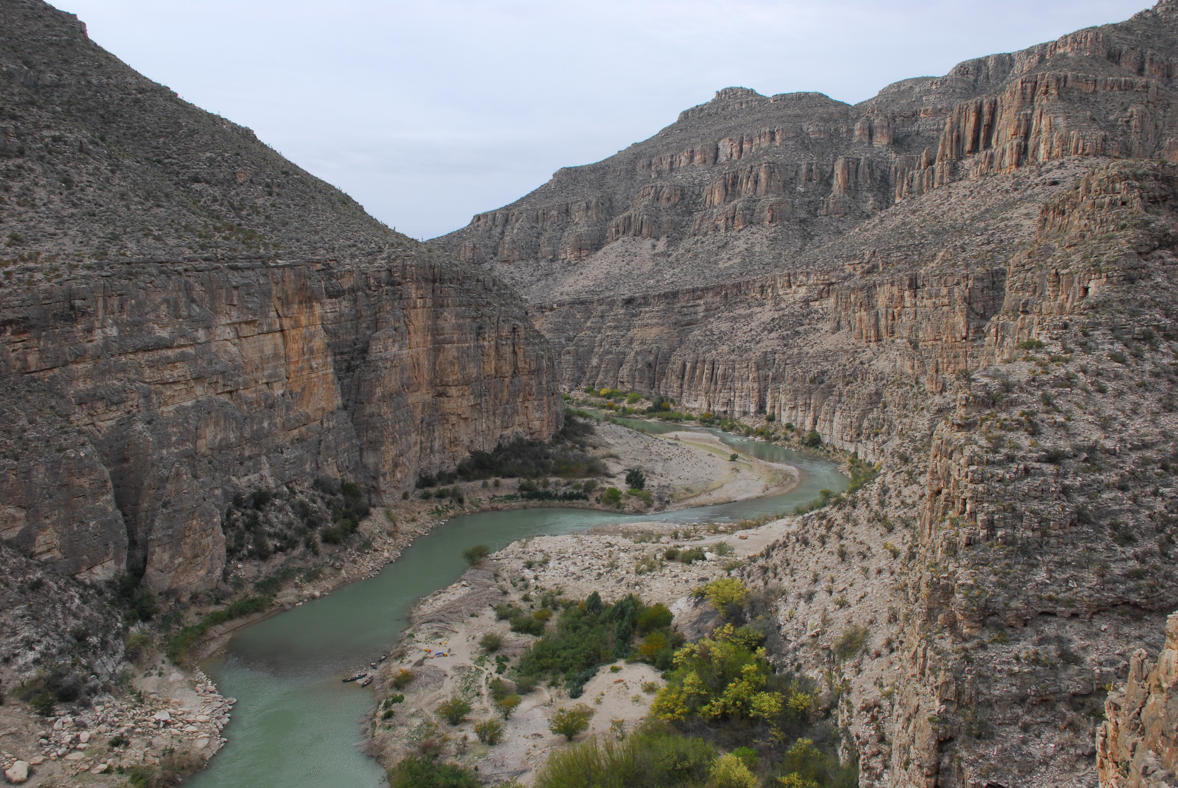
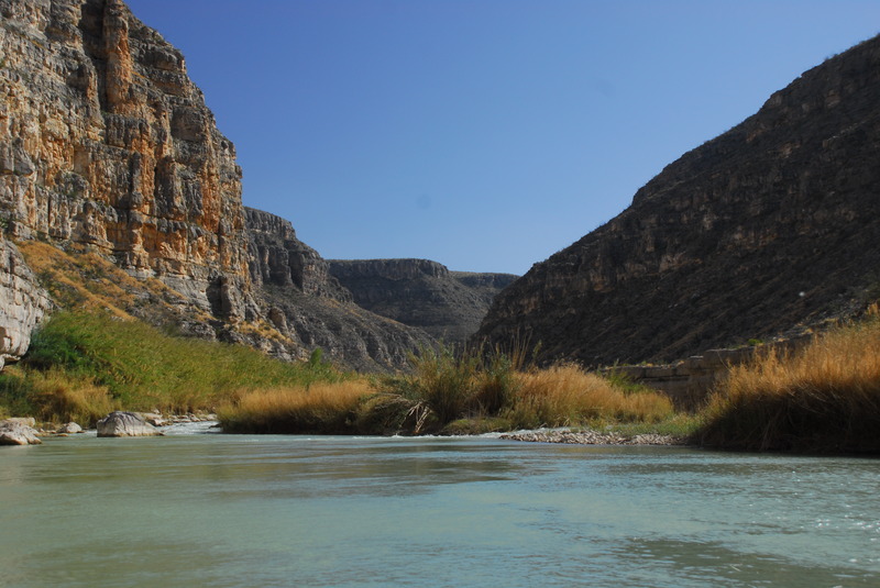
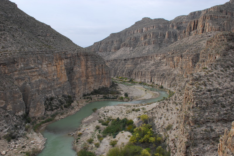
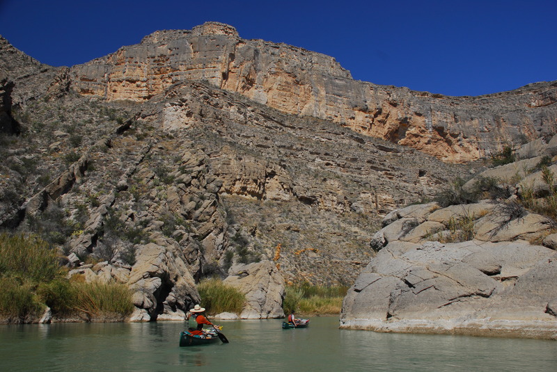
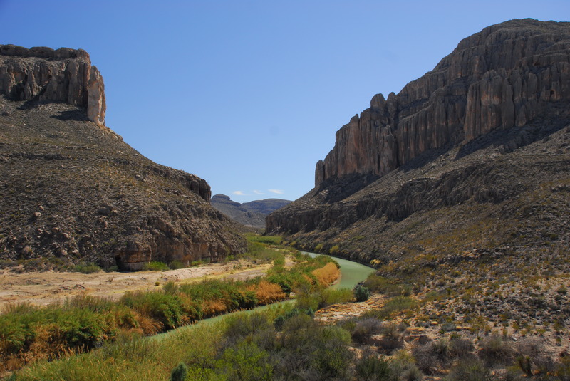
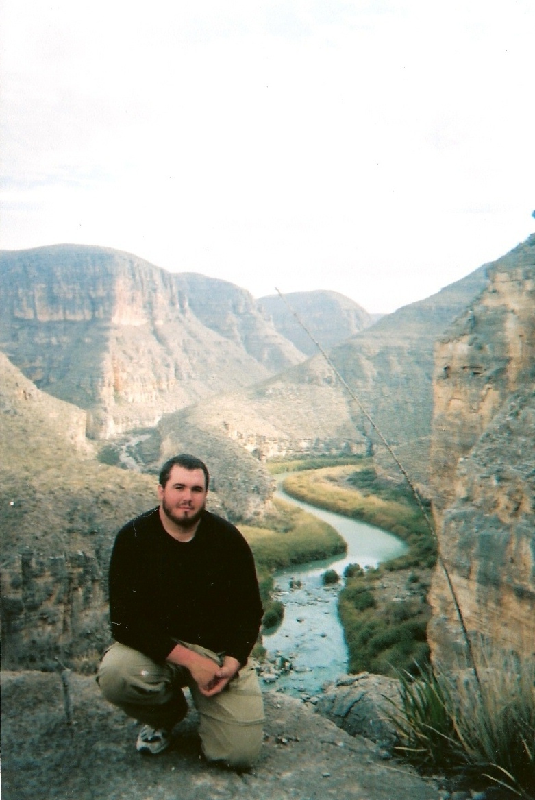
About the Lower Canyons: Fantastic limestone canyons. Most of the corridor is in the canyons, although some parts are in “vegas” (flats). The major side canyons (recommended hikes in the guidebooks) are generally wide and less interesting. There are many smaller slot canyons. Pick the ones you want to explore and have fun.
The Hotsprings area deserves special note. We stopped there before lunch with a plan to hike, hang, and spend the night. It is the grossest, most unpleasant riverside camp I have even seen. Human feces abounds. Tons of trash. (Not a figure of speech, we have hauled tons of trash out of river corridors during clean-ups.) We explored up the canyon a bit to see if things got nicer, then hit the river and moved on.
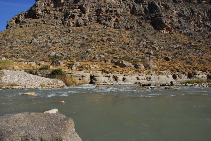
The 1st part of the river we shared with many near-feral cows and a few burros. After we entered the deeper canyons, there was no livestock until almost the takeout. Tons of wildlife sign - this place is nirvana for tracking nerds (like me). Tracks and sign of mountain lion, black bear, ringtail, deer, sheep, exotic aoudad, beaver, nutria and more. Surprisingly little live wildlife, however.
Guide books & maps: there are no current or accurate books or maps that describe the Lower Canyons of the Rio Grande. The detailed references available include The Lower Canyons of the Rio Grande, by Aulbach and Butler, and The ULTIMATE Guidebook to: Paddling the Lower Canyons of the Rio Grande!, by Todd & Copeland. There is also a laminated, spiral bound map by the Big Bend Natural History Association (BBNHA).
Each of the guides contributes some useful info, but both are wildly out-of-date due to river corridor changes caused by the cane. The Todd book has lots of handholding advice for folks stepping up to a longer trip, but has no maps, just aerial photos of the river corridor.
Aulbach and Butler is more useful on the river, and offers natural and human history as well. It is targeted at larger groups, suggesting camps that do not exist anymore, and singing the praises of boring hikes in wide washes with human history.
The BBNHA map is good, but has some notable mapping errors, failing to show 1000’ high cliffs, which could be confusing when navigating. It is also missing a number of rapids that novices would like to know about.
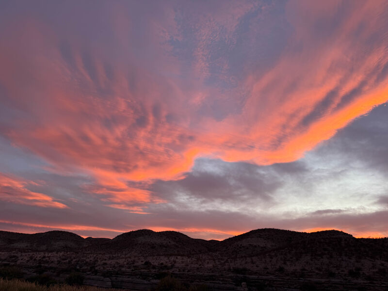
Stars: The dark sky and nightly star show is one of the highlights. If you care about this, time your trip around a new moon. We timed our trip around my daughter’s college winter break. We overlapped with the full moon and did not get the typical Big Bend area night sky.
Logistics: We brought everything as checked baggage on a commercial flight except white gas, food, a canoe and paddles. (Alternatively, almost everything is available for rent locally.) We hit a local supermarket on our way to the river from Austin.
Most of the outfitters and liveries are in Terlingua, TX. One is in Marathon. For folks flying in, a good option is flying to Austin and using the livery in Marathon; it saves you several hours of driving. It is less expensive to have them use their vehicle to shuttle you, rather than have them shuttle your rig, since only one driver is needed.
Although the Lower Canyons are downstream of Big Bend NP, the park manages access. You must drive to the main visitor’s center to get a permit, there is no online option. The ranger asked about firepan, spare PFD, etc., but did not ask to see anything. YMMV. My Lifetime old-man Pass saved me the park entrance fee and ½ the cost of the river permit.
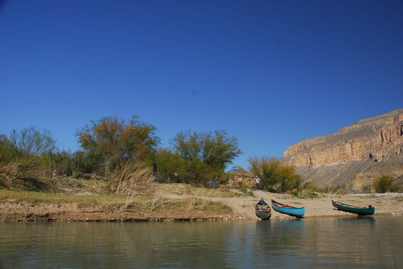
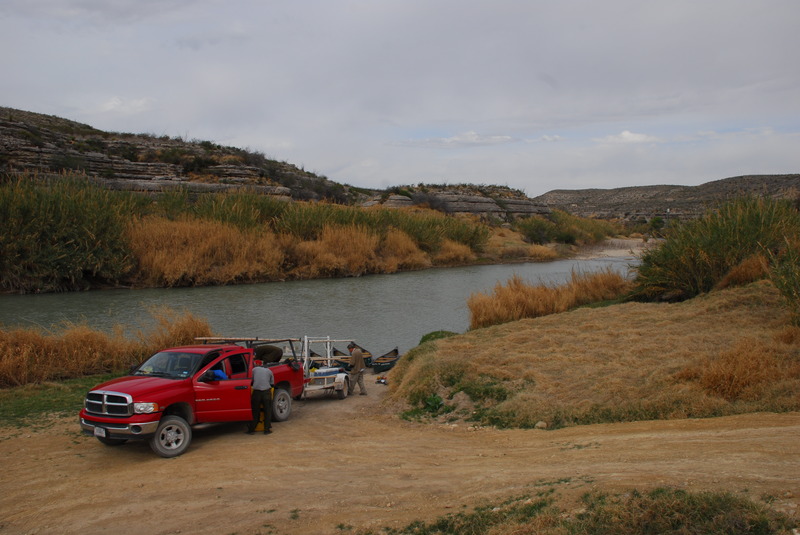
You also need to pay a per person and per vehicle fee to access the take-out on private land (see photo).
In addition to silt and ag run-off, the dead cows in the river make drinking (even treated) river water unappealing. The springs run clear, but many smell of sulfur and are hard to reach due to river cane. We brought five 10-liter water bags and did not use it all. We also had a filter+Steripen combination if we needed to use river water.
Flow: Like most of the SW, the Rio Grande is in the midst of a multi-year drought. We ran it at around 2.75 ft on the Rio Grande Village gauge. Late December/early January is the most reliable time of year to run the river; even spring snowmelt rarely makes it this far down the river. The river treaty specifies required releases from impoundments in Mexico. Due to the drought, they are not fulfilling treaty obligations; the treaty has no meaningful enforcement mechanisms.
Us: 28 December 2025 launch. Nine days, eight of them paddling. One OC-2, a father-daughter team. Both are kayakers; daughter paddles some OC-2 in New England, dad paddled OC-1 in the 1990s.
Please: Support AW. Join, renew or donate.