Eel
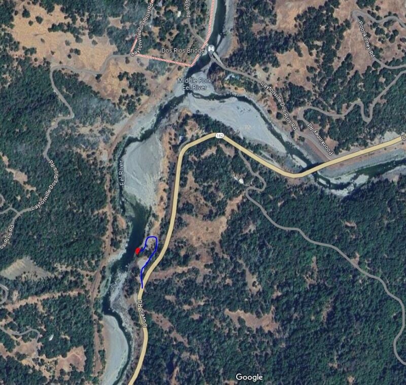
4) Dos Rios to Alderpoint
| Difficulty | III-IV |
| Length | 48.6 mi |
| Avg Gradient | 13 fpm |
| Gauge | Eel R a Fort Seward Ca |
| Flow Rate as of 1 hour | 74 cfsbelow recommended |
| Reach Info Last Updated | July 4, 2024 |
This is a great multi-day river trip that is often overlooked but can be worth checking out in the spring. In some years flows last through Memorial Day weekend. Look for something above 1,500 cfs for rafts, but it’s still a good kayak self-support trip at lower flows.
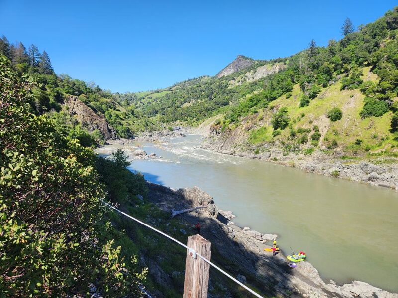
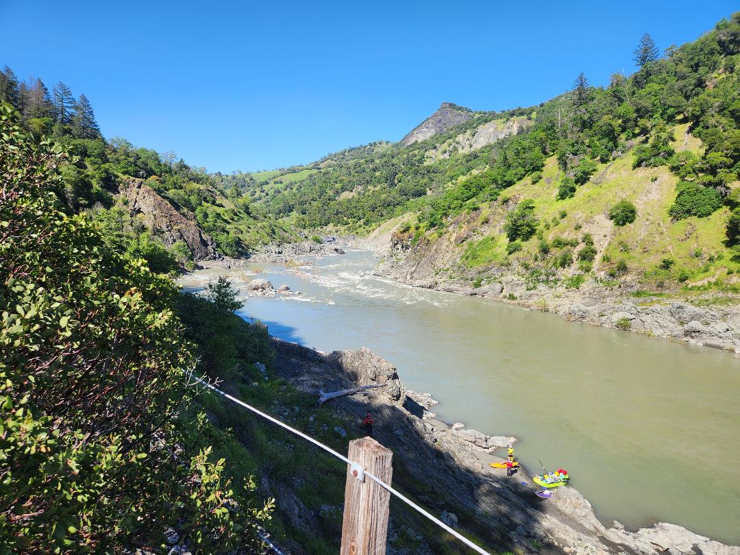
There is some disagreement about what difficulty level the river is, and at what flows. A previous description of this river stated that 'at moderate flows (1500-10000 cfs) the run is class II with half a dozen class III rapids.' That may be true for expert kayakers. However, as of April 2024, the river is a solid Class IV run at a flow of ~5,400 CFS, and I would consider that flow to be High, with as many as four Class IV rapids and numerous additional Class III+ rapids. The river's remoteness, low visitation, and lack of available mile-by-mile river guides adds to the sense of difficulty. In addition, many of the Class IV rapids appear around blind corners. In general, the difficulty level above 5,000 CFS is somewhere between the Rogue and the Tuolumne.
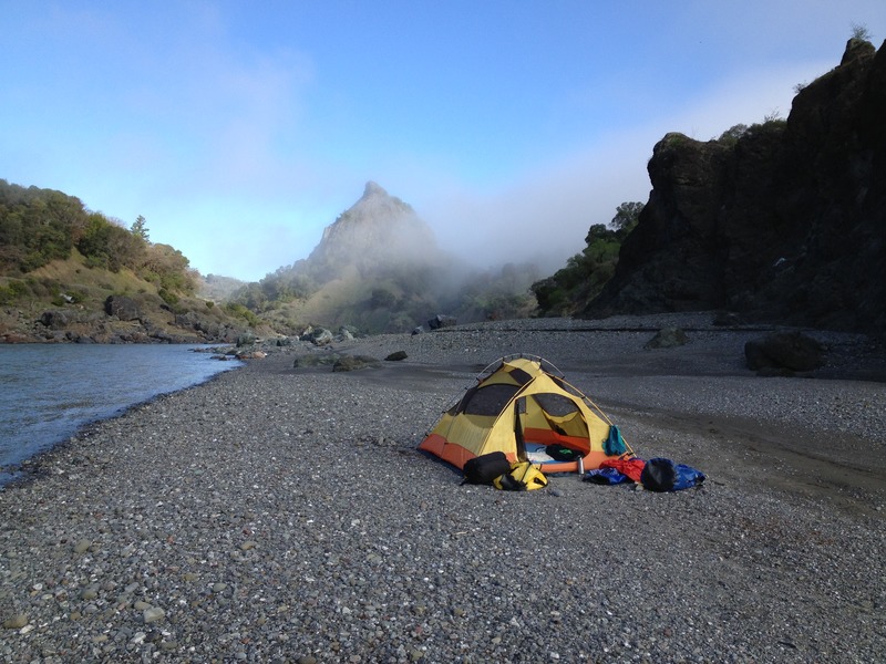
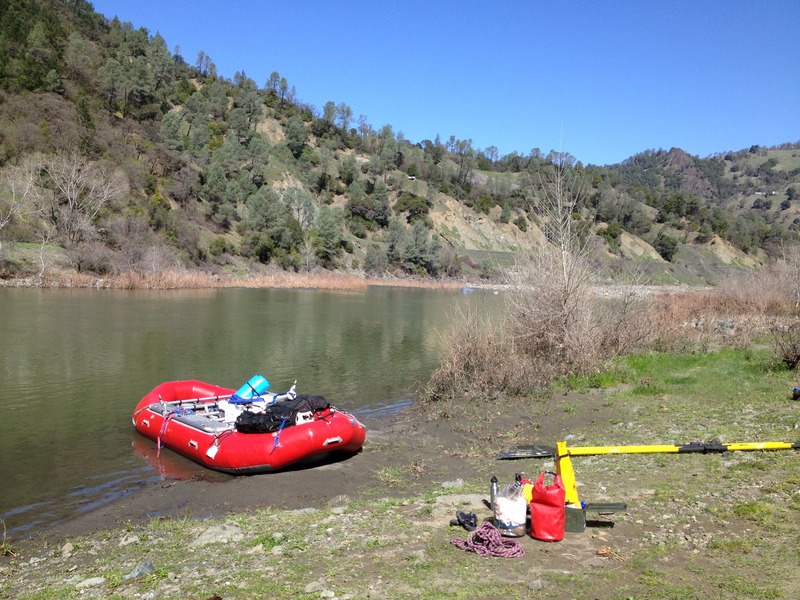
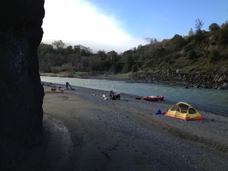
This 50-mile trip is typically run over 3 to 5 days with some nice sandy beaches that make for good camping and plenty of opportunities for hiking and exploration up side canyons.
From Alderpoint, you can also continue down to Fort Seward (8mi) for more Class II floating, or all the way down to the SF confluence for another day of easy paddling.
Other Information Sources:
Cassady & Calhoun, Holbek & Stanley, Schwind, Penny
Island Mountain is typically the largest and most technical rapid on the run. While it is straight forward at lower flows, higher flows bring on big waves and hydrolics that can flip boats.
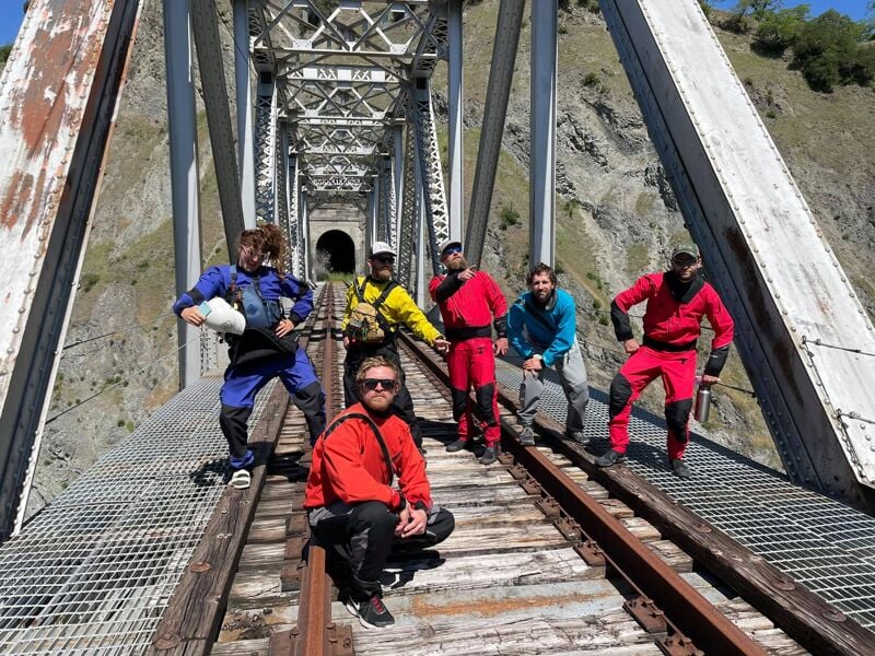
The rapid can be scouted from the railroad tracks on the left bank above a large cobble bar. At ~5,400 CFS, there are multiple routes through the rapid, most of which have much stronger eddy lines and currents than appears to be the case from high on the bank where people scout the rapid.
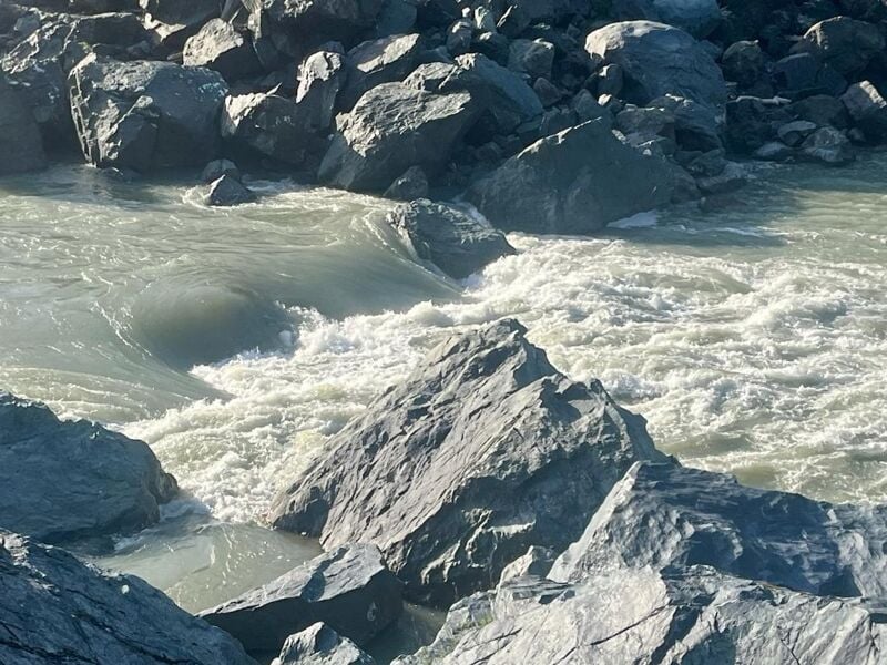
This rapid is no big deal at lower flows but at 10k it becomes a masive hole and is hard to see from above. The line is on the right and pretty thin.
Donna can advise which takeout is best accessible depending on the river flow.
May 9, 2026
We put on at Dos Rios and took out at Alderpoint. The gage was at around 1100-1200 while we were on the river. We found this flow low and friendly but not too shallow for hard shell kayaks. We took 3 days to do the 50 miles, our daily mileage was approx 20/20/10. First day is mostly flat water and we found it to be beautiful, but mildly annoying with a constant headwind. Night 1 we camped on river left where Blue Rock creek enters the river, after this the rivers character changes for a while and there are more consistent rapids and less water perfect camp sites (still good ones to be found). Day 2 was much more interesting with 90% of the rapids being read and run class I-II and the occasional III- rapid. Day 3 was mostly class I with a couple class II rapids but the flat water was less painful than day 1. Overall the river is stunningly beautiful but the headwinds and flat water can get tiresome.
Apr 16, 2025
We put on with the Ft. Seward guage reading 9,000cfs and took off at the end of the fourth day with the gauge reading 6,000cfs. Our group was a mix of rafts, kayaks, and packrafts. Several group members had done the run prior, with some on their fourth trip down. Plenty of surf waves to be caught on the fly and many class II rapids with a handful of class III rapids. The biggest two rapids on the run fell into the class III+ range. Island Mountain Falls we scouted - enter right, shoot two small horn rocks, and keep right to avoid large holes & waves on the left side. On running Kekawaka Falls more veteran Eel group members said the top was washed out, but the bottom hydraulics were a factor - enter far right and catch the flow pillowing left of the right wall. One other kayaker and I ran center left with left angle and managed to punch through but momentum was key. Veteran trip members felt that the rapids were more frequent and punchier than their trips at lower flows and too much higher would likely wash out. We took out at Fort Seward and one car in our group had the gas tank drilled and siphoned out - wisest to plan shuttles to arrive after you hit your takeout. Ours happened after only two hours on the river bar from drop-off.