Lake Fork
01. Moon Lake to Bridge to Yellowstone River
| Difficulty | III-IV |
| Length | 10.8 mi |
| Avg Gradient | n/a |
| Gauge | Lake Fork River Bl Moon Lake Nr Mountain Home, Ut |
| Flow Rate as of 54 minutes | 82 cfsbelow recommended |
| Reach Info Last Updated | February 19, 2024 |
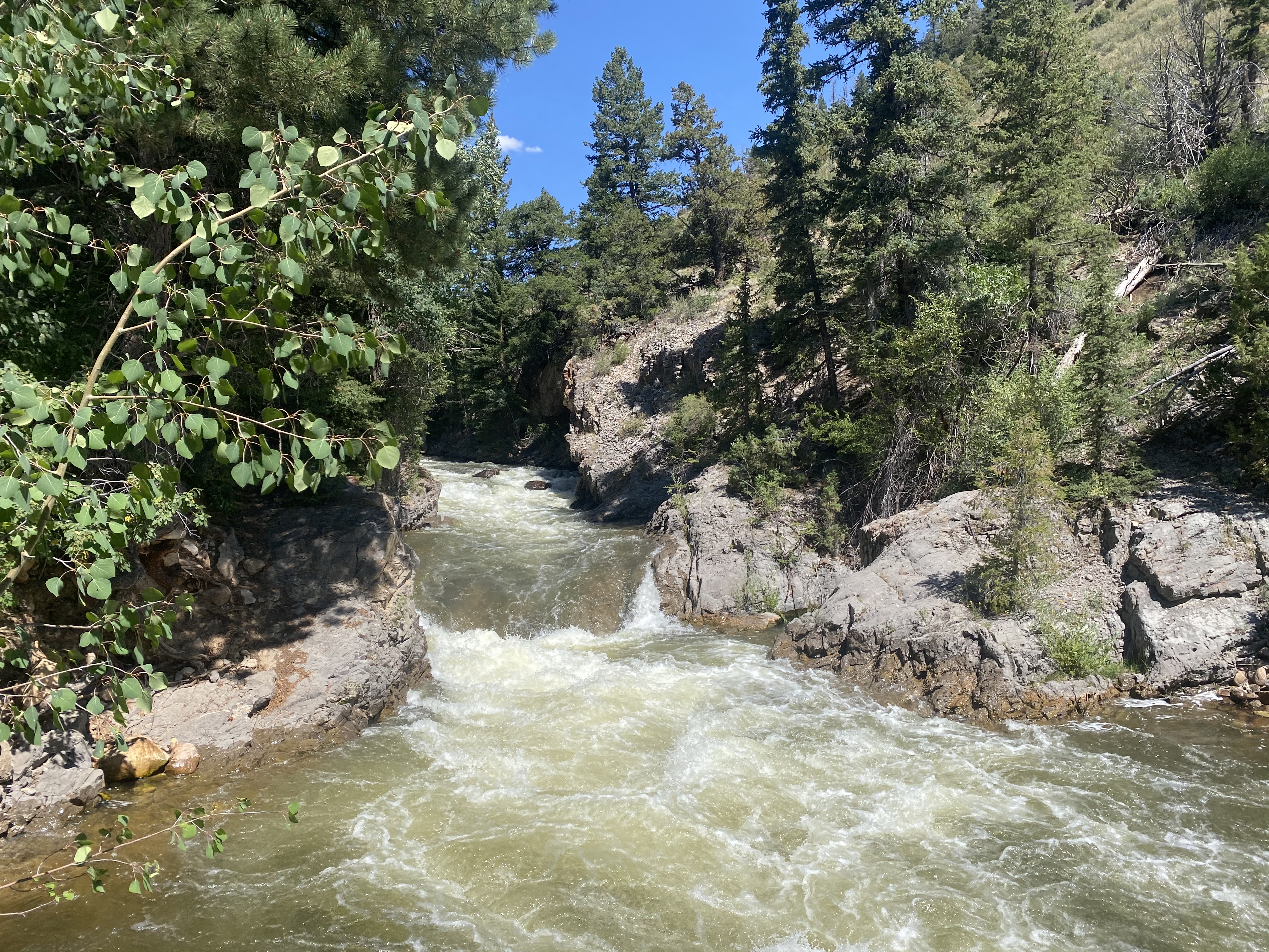
This run can receive dam release flows in the 300 cfs range in the summer, which makes for continuous and scenic whitewater, as an intrepid local packraft explorer, Scott England reported on July 18, 2015.
There is a dirt road right below the dam that could be a possible putin, although access is unclear, please be respectful.
Devin Peterson paddled this run with a group in 2018, around 350 cfs (and 275 cfs, also a good level) and reported:
The best drops are just below the lake. You can scout them using a dirt turnoff. https://goo.gl/maps/TBkSNTqsec82
10/2/2018, the log situation is improved, still worth a scout as always.
Here is a video of the run: https://youtu.be/QkXNu7bxu1c
Summer 2018 report:
There was a scary riverwide log just below the put in. First time the river braids you can take the right channel with less water, to avoid it. There was another mandatory portage a few miles down with easy takeout on the right. Once you get to the diversion you can hop on the canal going off the right to get back to the road. If you don't you'll end up in endless log jams and braiding. https://goo.gl/maps/bQAvXncpLDp
The run is just over 2 hours drive from Salt Lake.
This section seems to be about 2.3 miles.
Jul 3, 2024
06/30/24 BEWARE. Too many log jams. hidden log jams under waterfalls. Almost died in the first mile. Portaged more than rafted. Exercise extreme caution. Bring a chainsaw first and be a hero.
Feb 19, 2024
From the damn to the first drop had a Bridal Veil (Provo River) feel to it. The run is fairly steep with some rocks to dodge. The rocks here are not rounded and very sharp. I ended up missing a bunch of plasitc. Would be better with a bit more water in there. The wood hazards are real in here as it doesn't get ran that often.
May 30, 2020
True class IV run. We tried in a small inflatable cataraft (culebra by jacks plastic) at 270 on 5/29/20. While this level would work for kayaks and packraft and duckies ( for the brave), small inflatables like 10 foot rafts etc would not work, just too many rocks. I would guess i would wait till its over 350 for those type of craft. Also there is a put in right at the Dam. However, the best and easiest put in is the road right before the Dam road. Also the road right before this one goes right down to the three main drops on the run and you can scout them or set up spotters with throw bags in case you get worked. The first drop is right down the middle, you don't get to choose. The second has many lines depending on the level. The third drop is down the left side. I would love to tell you more but on the third drop i ripped a hole in the boat. Needless to say the run was over. This river has lots of sharp rocks and my small boat did not survive. It would be easy to run laps on this run. Everyone that i saw was ignoring the signs about no trespassing.
Nov 17, 2019
There is a great wilderness stretch above the reservoire for packrafting. In 2017, I hiked up to the confluence of Oweep Creek to paddle a few miles through a box canyon. At 600 cfs, this was class III to IV whitewater features, but had several wood portages. At the base of the box and right above the reservoir, the river braids with lots of wood. I recommend taking out above here. Above the Oweep tributary, both main branches are in long box canyons and are steep with frequent wood across the streams.
