| Difficulty | II-III(IV) |
| Length | 7.5 mi |
| Avg Gradient | n/a |
| Gauge | South Fork Ogden River Near Huntsville, Ut |
| Flow Rate as of 1 hour | 64 cfsbelow recommended |
| Reach Info Last Updated | March 27, 2025 |
River Description
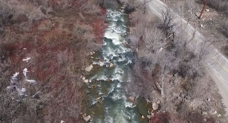
In the lower part of the run there is 150 yards of roadside III+/IV-, which splits the run into an upper section that is more beginner friendly, then the lower section, which can pack a punch at higher water. This stretch can be portaged, or you can just set your shuttle above it if you want. Below there is hard to scout without going into some private campgrounds; please be courteous.
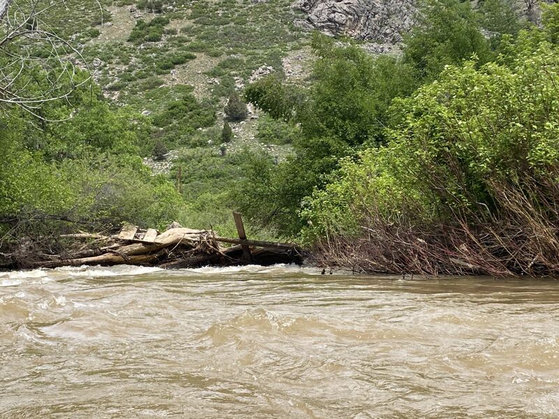
Lower section: Botts Campground (or a dirt turnout just downstream) is a good putin if you are mainly interested in the harder stretch. There is a rock spire on the left that lets you know the action is about to pick up. The takeout is on 10450 East, immediately above a diversion dam. Its 1.5 miles from Botts to the crux, and 2.7 from Botts to the 10450 East takeout. Private land is an issue all along this run. In 2011 there was a riverwide log in the private campgrounds below the crux, but on April 25, 2015, this log was gone. There is a heavy wood load on this run, and wood is likely to move with each new seasonal high on the gauge. 5/11/2019, The crux down to the 10450 East takeout was good to go, although a couple half-river logs keep you on your toes in the class 2. The takeout eddy above the bridge on the right is better than below the bridge, where there is not much of an eddy (not much of an eddy at 550 cfs either, bank scout this takeout above 400 cfs).
Upper section: In 2019 there are no fences; however there is a very low footbridge just below a riverwide weir (which looks worse than it is, just hit it straight on), and a riverwide log jam in the upper Memorial park. Portaging right worked fine. In 2014 a new riverwide fence was reported below the Memorial Park.
If Causey is spilling well, you can put in below the Causey spillway. From the last a dirt road that leaves the paved road before it ascends toward the top of the dam, take a right fork, park and hike down the hill to the river. Below the Memorial Park is all private land and can't be bank scout
...River Features
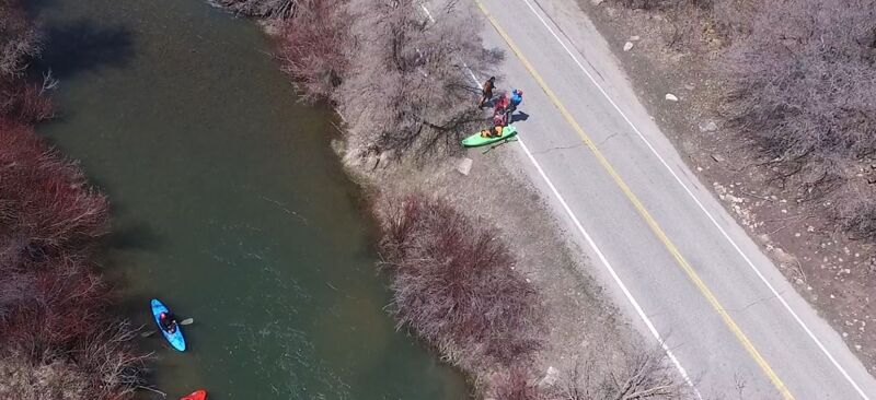
Put In
Access PointDistance: 0 mi
Alternate Put in
Access PointClass: IIDistance: 4.16 mi
This is an alternate put in. In the early spring this is a good spot to park and walk down to the bridge. The bridge is only 50 yards past the gate.
Seal launch for Crux Laps
Access PointClass: II+Distance: 6.33 mi
This is the Seal launch area for laps on the crux.
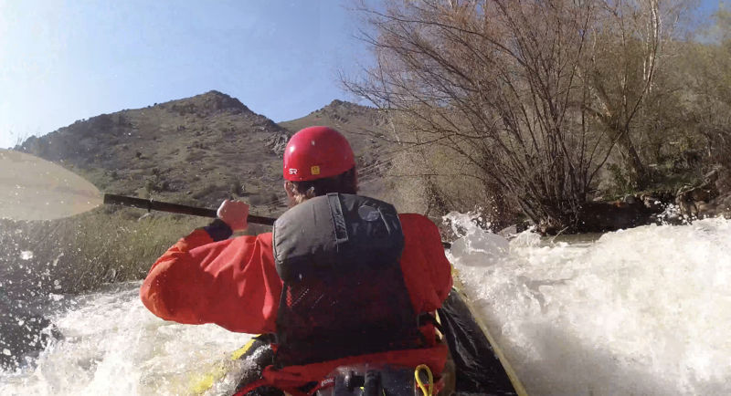
The Crux
RapidClass: III+Distance: 6.4 mi
This is the Crux of the run, The line on this upper half of the crux starts right, moves center then off Bill's Boof Rock on the left. The if you are doing laps you can eddy out on the right and hike back up the road to the Seal Launch area.
Bill's Boof Rock
RapidClass: III+Distance: 6.42 mi
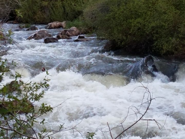
Bill's Boof Rock, The boof is just right of the pyramid rock on the left of this picture. This is really the main line of the upper crux. Boof back to the center of the river (right boat angle) then its read and run rock dodge after that.
Take Out
Access PointClass: IIDistance: 7.48 mi
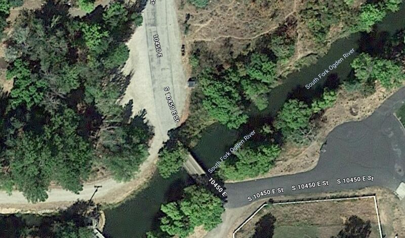
When on the river the take out is past this bridge on the right. The upstream side and left side is Private property. The property owners are not very happy with river runners and have had several incidents (verbal exchanges) Please respect thier property. Also The parking for the take out is not in the dirt area, please park down the road, the dirt area is for emergency vehicle turn around and is also private property.
Trip Reports
Log in to add a reportJK
Jaidan kuester
Apr 23, 2026
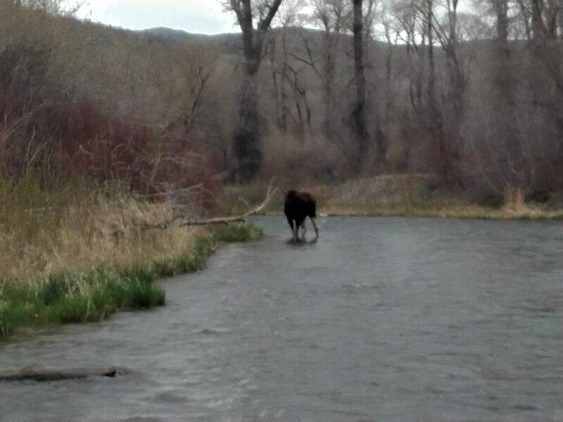
Fallen foot bridge has been removed and some brush cleared. Only one portage that was easy to spot from a fallen tree...then one portage around a moose.
JB
Jackson Boyd
May 11, 2025
315 cfs / 2.88 ft.
Ran a couple laps from Meadows campground to Magpie campground on 5/11/25. Packraft and a duckie. We actually were surprised at how much fun we had. Fast-moving water, a bit splashy in sections. We did this short segment because we heard some thunder rumbling and didn't want to get caught out. It took us about 30-40 min each lap.
The crux looked like it could have been a fun rapid, but wasn't really our goal for the day so we skipped it.
There was one downed tree across most of the river shortly above Magpie, but you could easily get under it river left. The 'almost good' surf wave is pretty much as advertised. It looks so good but just doesn't quite break enough.
We didn't do the whole run, but we didn't encounter any major hazards. A couple bridges near our take-out at Magpie were somewhat low but could easily duck under them at this stage.
If you're looking for an off-the-beaten-path, fast-moving creek with mostly small little splashes, this could be a fun option! There is quite a bit of private land, so be careful about put-in and take-out. It's pretty obvious when you're there what's private and what isn't, at least on the section we ran.
We took out river right just below the private bridge past Magpie parking.