Provo
02. Soapstone to Pine Valley Campground
| Difficulty | III-IV |
| Length | 4.5 mi |
| Avg Gradient | 85 fpm |
| Gauge | Provo River Near Woodland, Ut |
| Flow Rate as of 32 minutes | 68 cfsbelow recommended |
| Reach Info Last Updated | May 24, 2021 |
If you like adventure boating in the highland forest and want to start at Soapstone, going to Pine Valley campground is the easiest to set shuttle for (4.5 miles). 500 cfs on the Provo at Woodland gauge is a suggested minimum. In May 2021, evidently a high water year has cleared out some beaver dams and moved one riverwide log, and the first mile is somewhat better channelized. The wood avoidance is still class IV; or you could say there are a lot of must-make class 3 moves, and there are a handful of portages. Pine Valley to Woodland (5 miles) is rarely done, the wood is at least as bad, there is some private land, and the shuttle would be much longer.
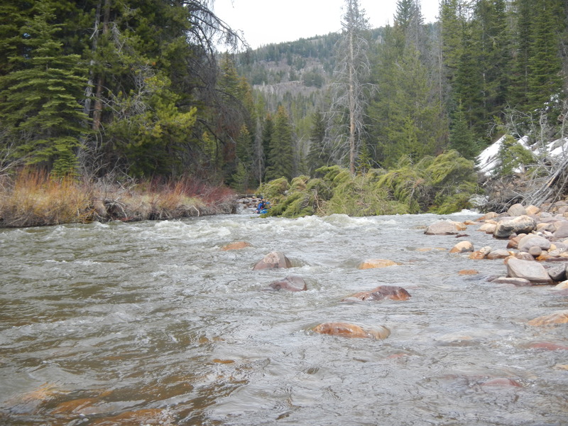
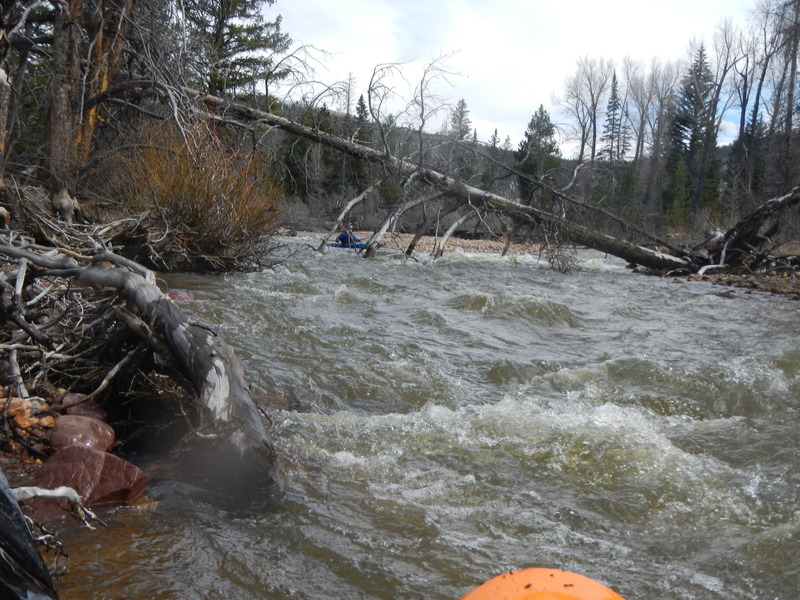
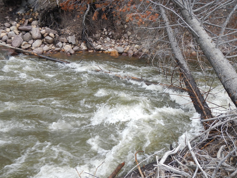
The gradient is continuous so the rapids are steady class 2 and 3. Besides massive amounts of downed trees along the run, the river frequently splits into multiple channels. The river is especially braided near the beginning and below the FS Rd 922 take out. There are two-track trails north of the river, reserved for hiking, horseback riding or mountain biking; posted for no ATVs.
Scenery in the area is very nice.
Getting There: This section of the Provo runs along Highway 150. It is a bit over an hour away from either the Salt Lake City area or the Orem area.
Put In: There is a large turnout with convenient river access at the junction of Soapstone Basin Road and Highway 150. There appear to be other put in options upstream and downstream. Elevation at put in is about 7753 feet above sea level.
Take Out: There is river access at Lower Provo River Campground, which was open in May 2021. This is the location marked on our map. The elevation here is about 7380 feet.
FS Rd 922 is just upstream of the junction of the NF Provo River and leads to a large parking area close to the river. However there is a steep hillside with no trail that I saw, so it may not be the best takeout. The brick bathroom little building is visibl
...
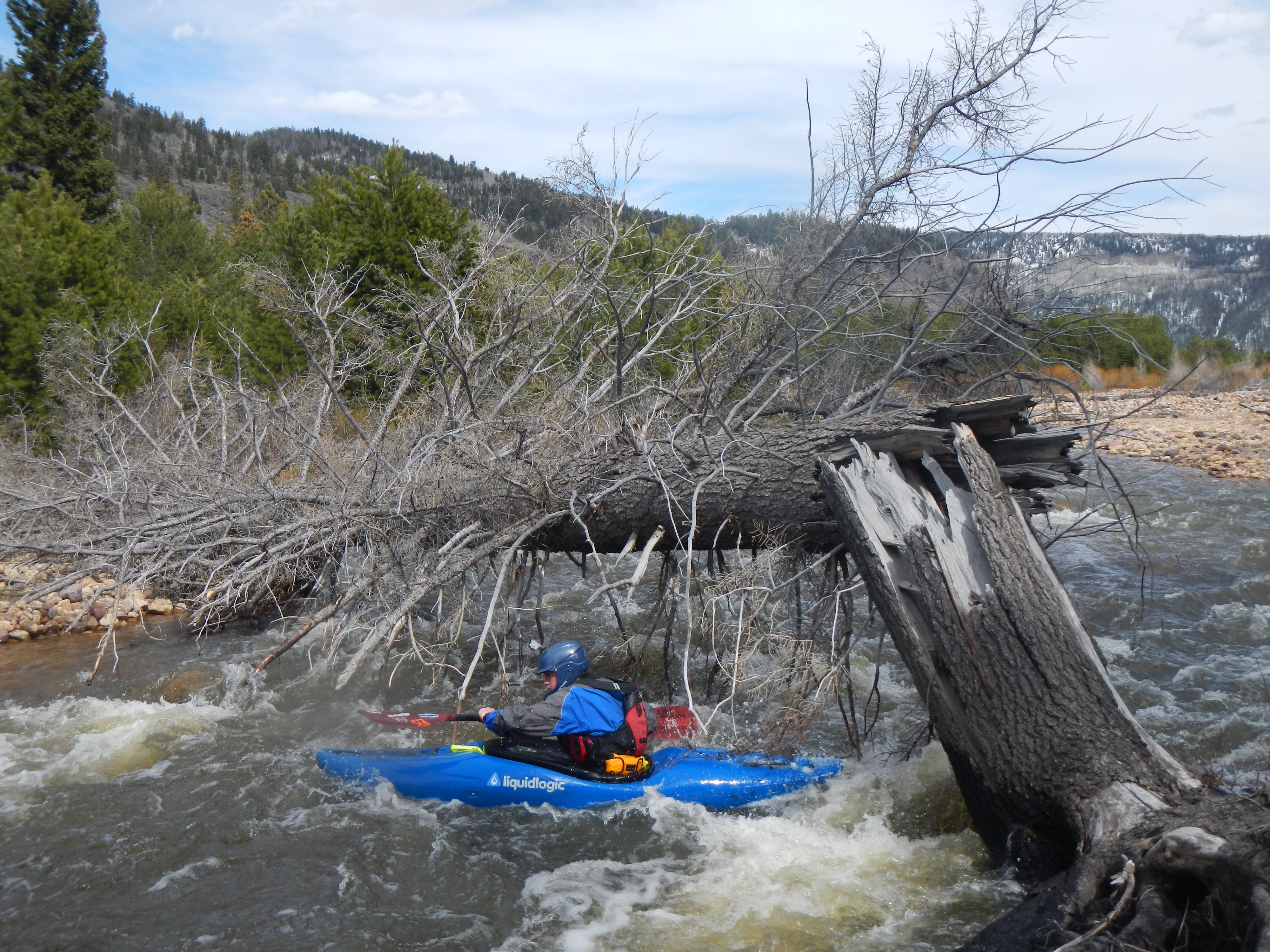
A typical downed tree that blocks most of the channel. Expect many of these. Also expect many such trees that completely block the channel and must be portaged
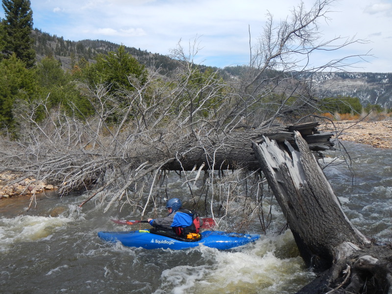
Another downed tree that boaters were able to go under. This tree will inevitably drop lower and block the channel, forcing a desperate eddy out and a portage. There are many other trees like this one and many that completely block the channel.
This was a particularly hazardous spot in May 2014. It may not be there now, but another tree may be in a worse location. Be careful! This strainer is not visible from water level. It looks like you can go under the large tree, but the submerged tree drives you right into a wedge/pin spot. Flows about 600cfs.

FS Road 922 leads to this large parking area close to the river. It is just upstream of the NF Provo. This location is usable even when the campgrounds are still closed or blocked by snow. Also the river gets very braided again with numerous channels between here and the campground.
This campground is about 3/4 mile off Highway 150. It may be closed in early season or when there is still snow. The river is braided in this area and the take out is on a right hand channel. Scout it beforehand carefully.
This is the last take out accessible from highway 150. Boating further requires a long shuttle out to Kamas and then south to Woodland and Highway 35.
May 7, 2014
My son and I ran it on 5/3/2014 at about 600cfs. We portaged downed trees at least 5-7 times, and snuck several others. Would be a fun calss II-III run except for all the wood. At higher flows you might get pushed into areas you don't want to be due to lack of eddies and blind corners. There was at least one drop with wood in it that was impossible to see from river level and could be a bad pin spot. This pin spot was upstream ~ 1.5 mile of takeout at Lower Provo River Campground. High flows will rearrange the wood in this river every year.
May 6, 2014
Flows about 600 cfs
May 6, 2014
Flows about 600 cfs