Weber
01. Aspen Acres to North New Lane
June 15, 2024
| Reporter | Kyle Mays |
| Gauge Reading | 920 cfs at WEBER RIVER NEAR OAKLEY, UT |
| Flow | Medium Runnable |
Ran this at 920 cfs on June 15th. In the past I have run this same stretch at 1000 cfs and 750 cfs. I have only run this in a packraft. I typically put in at smith and morehouse creek 40°47'05.6'N 111°09'20.2'W and take out at the 'alternate take out' 40°44'07.7'N 111°15'08.2'W. You can also put in where East Weber Canyon Road crosses over the river 40°46'21.8'N 111°11'47.7'W to run the bottom 2/3 of the river, which is more difficult than the top 1/3. In my opinion, more water is much better here. A lot of the features that create fun drops/waves/holes are boney below 850cfs. At lower flows, a lot of the rock bars become exposed and the river can constrict to a smaller channel giving you less room to navigate.
Personally, this is my favorite stretch of whitewater close to SLC, and it's unfortunate that it has such a short window of good flows each year. In the 850-1000cfs range, the run is fairly consistent class 2 whitewater with a few class 3 wave trains and holes towards the end of the run. There is no real flat water. The good eddies are few and far between, but you can find micro-eddies that could fit a single boat along the banks. The river slowly increases in difficulty from top to bottom, so you can opt to just lap the bottom 2/3 of the river if you want more meat. Most of the action in this river consists of waves and holes that can be avoided at higher flows but are more fun to punch through. The bottom half of the river has a lot of shallow rock dams on river right, all of which are super fun drops at flows over 850cfs. In my experience850-1000 cfs is the ideal level to float this river.
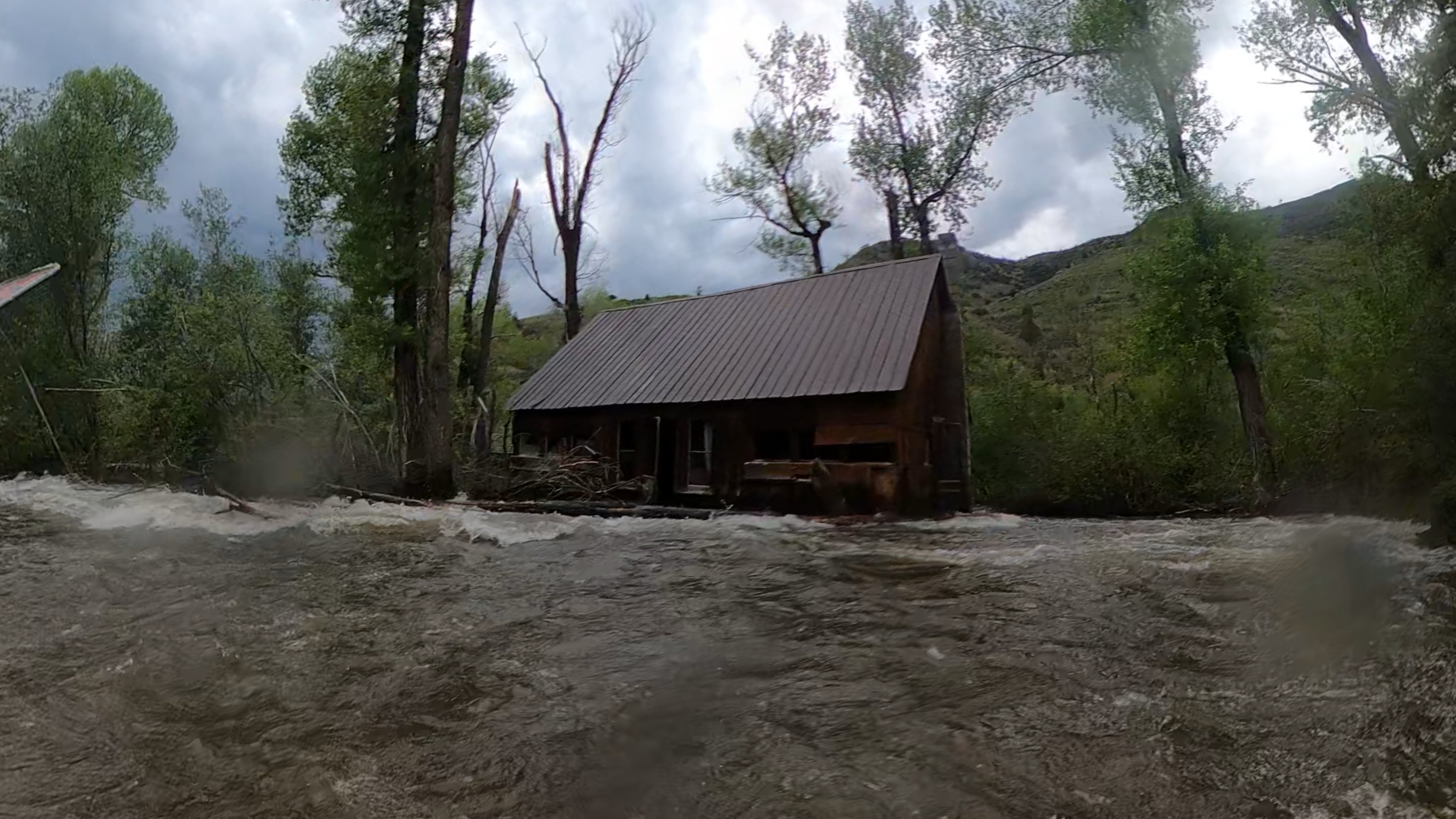
Towards the last mile of the river, there are some quick turns in the river with a fair amount of wood piled up on the outside banks. You'll obviously want to hug the inside corners of the river here, but you will have plenty of time to react and plenty of room between you and the wood at these flows, just keep your eyes downstream. In the last mile there is also an abandoned cabin on river right that is slowly being eaten by the river. As of this year, the outer wall of the cabin has been ripped off and deposited along the outside of the next few banks. This cabin will continue to deposit more wood as time goes by, so just be cautious towards the bottom.
Lastly and most importantly, there is a mandatory low bridge portage. The low bridge is right here 40°46'28.6'N 111°11'40.6'W. There is another bridge right before it, with a good eddie on river right, right here 40°46'32.4'N 111°11'36.2'W. You can take out, walk the paved road on the south side of the river, and put back in just after the low bridge in a little tributary creek on river right, here 40°46'28.8'N 111°11'41.2'W. This is all on private property so please be respectful and don't dilly dally, though I've never been given a hard time here. This can all be avoided if you put in where East Weber Canyon Road crosses over the river and just float the bottom 2/3 of the river, which is immediately after the low bridge (coordinates given above).
In summary, if you're confident in class 2/3 and want to paddle whitewater then I would highly recomend this stretch, but only over 750 cfs. I can't speak for what it would be like at lower flows, but I'm guessing it's more shallow and less fun.