Fresno
1) Goldside Drive, off Highway 49, to Road 600(Goldside)
| Difficulty | III-V |
| Length | 3.6 mi |
| Avg Gradient | 76 fpm |
| Gauge | Fresno R Abv Henley Lake |
| Flow Rate as of 29 days | 14 cfsstale data |
| Reach Info Last Updated | May 18, 2009 |
Put-in: From the junction of highways 41 and 49 in Oakhurst take highway 49 3 miles to Griffin Drive at the Goldside subdivision. Turn left and go .8 of a mile till you find the river. Griffin Drive becomes River View Drive for the last .2 of a mile. There are now more houses at this put-in so parking and access could be a problem. Might be best to be dropped off or put-in upstream in Oakhurst and portage the big cascades in between. Elevation about 2080 feet.
Take-out: Backtrack to Highway 49 and continue 1.1 miles north to the Raymond Rd (Grub Gulch Rd on the some maps). Drive 2.5 miles till you see the river. There is a big turnout with a historical marker and a trail down to the creek at this point. This is BLM property. The road also parallels the river for about a half mile allowing you to boat several more excellent rapids. It does force a steep hike back up to the road. There is a house right where the creek turns away from the road, so take out far enough upstream that you don't walk through their yard. Elevation about 1830 feet.
Season - Winter. Fresno River generally needs a pretty good sized storm system or series of storms to bring it to good, boatable flows.
Description: The first half of this run starts out relatively flat, flowing past houses and back yards. A few bedrock slabs form gentle play spots, and a few short, steep, congested drops keep you alert. Watch out for a floating bridge to portage. Logs, brush hazards, or barbed wire fences could be a problem in any year.
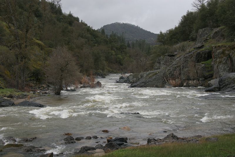
The start of a gorge section is marked by a long, wide, shallow, bushy and rocky rapid. You can usually scrape through, but you may want to portage parts or most. Below this are several very interesting rapids through a pretty gorge. A last shallow, rocky rapid signals the exit of the gorge and the appearance of the Raymond Rd. Excellent rapids continue downstream for the short distance
...Apr 10, 2006
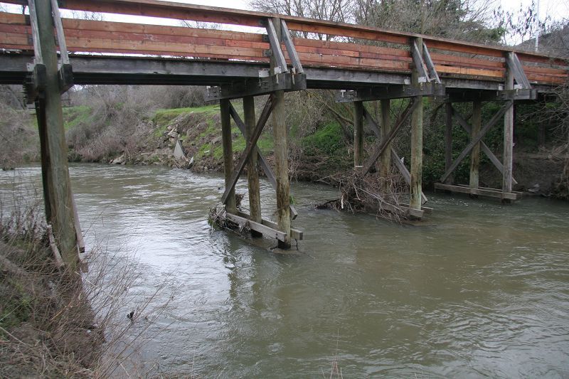
Looking downstream where the river parallels the Raymond Rd. One can take out here or continue downstream another half mile before climbing up a steep hill. This spot is a good put-in, if boating the Fresno Gorge section.
Apr 10, 2006
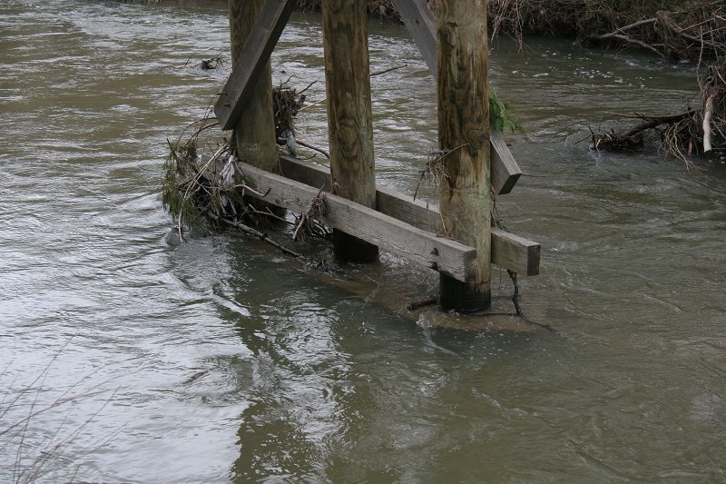
close up of footbridge in Oakurst that can be used to judge flow.
Looking upstream where the Fresno River meets the Raymond Rd. There is a big turnout up on the road, with a historical marker and a trail down to the river.
Mar 31, 2006
This footbridge in Oakurst may be a useful gauge as it is easily accessible next to highway 41. In the middle of Oakhurst, on the east side of highway 41 there is a small park and hiking trail system. This briged is behind the chamber of commerce and fire station. This level probably corresponds to about 600 to 800 cfs inflow to Hensley, though it is probably only 200 or 300 cfs at this point.