West River
3. Salmon Hole to Route l00
| Difficulty | II |
| Length | 3.5 mi |
| Avg Gradient | 37 fpm |
| Gauge | West River at Jamaica, Vt |
| Flow Rate as of 47 minutes | 36 cfsbelow recommended |
| Reach Info Last Updated | April 30, 2018 |
Put in elevation........668'Take out elevation......551'Total drop..............117'Average drop/mile.......37'Mile 1 drop....53'Mile 2 drop....40'Mile 3 drop....21'Distance................3.2 milesRiver width average.....170'River geology........... small to medium granite boulders, ledge at ducky dumpRiver water quality.....good, some homes along the way.Scenery.................nice forested sceneryWildlife................Deer, Mergansers, Hawks, Blue herons.Jamaica, Vermont is a popular destination for its annual spring and fall release weekends. The main attraction is the release from Ball Mountain flood control dam operated by the Army Corps of Engineers. The spring release is usually scheduled for the last full weekend of April; the Fall release falls on the third full weekend of September. This release allows boating on two sections of the West: The Upper West(class III) and the Lower West (class II). The termination for the Upper and the start for the Lower are located at Jamaica State Park which lies just to the north of Vt. route 30. Camping is available at Jamaica State Park but you will need to make your reservation by the afternoon of January 2nd to be assured of a site for the weekend. No reservations are accepted until the new year. Call 1-800-299-3071 to make your reservation early or 1-802-874-4600 during the camping season to try and get on the waiting list for a cancellation.
Another alternative to Jamaica State Park is Winhall Campground, located about 10 miles further north of Jamaica on Route 100. Winhall Campground is operated by the Army Corps of Engineers and used to be free to spring and fall campers up until 1998. More and more people have been coming here over the last few years but as of last year the campground was still only about half full. To guarantee a spot or particular campsite call 1-877-4
...
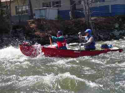
Just downstream of the bridge and after the ball field put in the river splits. The right channel is smaller and more technical, the left is where the main flow of the river runs. This section is a about a half mile long with waves and a few small holes. It eases up as the right channel comes back into the river.
Shortly after the bridge and ball field put in the river splits. The left channel is where most of the flow goes but the right channel is smaller and a bit more technical. This section meanders back towards a farmers field then turns left back into the forest. It is on this left turn that Mimi Lebeau of the Ledyard Canoe Club became pinned in a strainer and drowned in the spring of 1989. Please be aware of this potential hazard. Downstream from here the river runs under a small covered bridge, just downstream and on river right there is a good play hole at release levels.
Shortly after the channels come back together the river calms down for a short distance. Trailer Park rapid starts at the first mobile home on river right and continues up to the Vermont route 30/100 bridge. There is nothing of any note here except for some large waves and a few small holes.
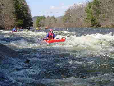
The shortest of the Lower West rapids but most difficult. The half mile past the VT rt 100/30 bridge is fairly calm water with a few small rips. When you see the rt 100 bridge in the distance and a rock out cropping on the right you may want to pull over to river left to scout. The further left of the rapid you go the easier it is, the right side forces you to maneuver or punch a couple rather large holes. There is a nice recovery pool after this rapid.
Another 1/4 mile will lead you up to the recently used take out on river right just under the VT rt 100 bridge. Note the old takeout a half mile downstream is now on private land and you need permission to access it. Paddlers have since generally taken out across the street from the Gulf station on route 30. Landowners have contacted AW to let us know that this too is PRIVATE LAND and they do not wish paddlers to use this takeout any longer. You can (and presumably should) paddle further downstream and take out at the Townsend flood control dam. This section is long and flat. AW has not confirmed the land ownership situation at the takeout.
No trip reports yet.