Calawah
Hyas Creek to Bogachiel River
| Difficulty | II-III |
| Length | 18.8 mi |
| Avg Gradient | 18 fpm |
| Gauge | Calawah River Near Forks, Wa |
| Flow Rate as of 1 hour | 98 cfsbelow recommended |
| Reach Info Last Updated | December 1, 2025 |
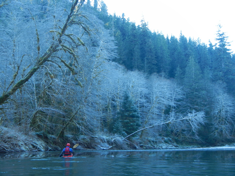
The Calawah is a low elevation drainage and flows for whitewater boating depend on winter rains. Storms coming in off the Pacific can send the river to floodstage overnight while an advancing cold front can make flows drop out of the range just as quickly.
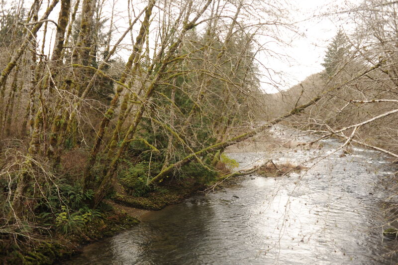
The river has faced a history of intense logging, but a new generation of forestry regulations has resulted in greater protection of riverside forests and water quality is now generally exceptional on this river. Sightings of salmon, steelhead, and eagles are common on this run.
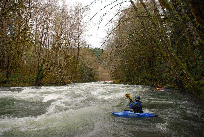
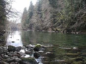
While the entire 17 miles is likely too long for a day trip, this river can be broken up into several sections. The first 2.5 miles from Hyas Creek to Klahine Campground is the most scenic flowing through Olympic National Forest with emerald pools separated by class II to II+ whitewater.
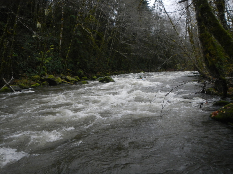
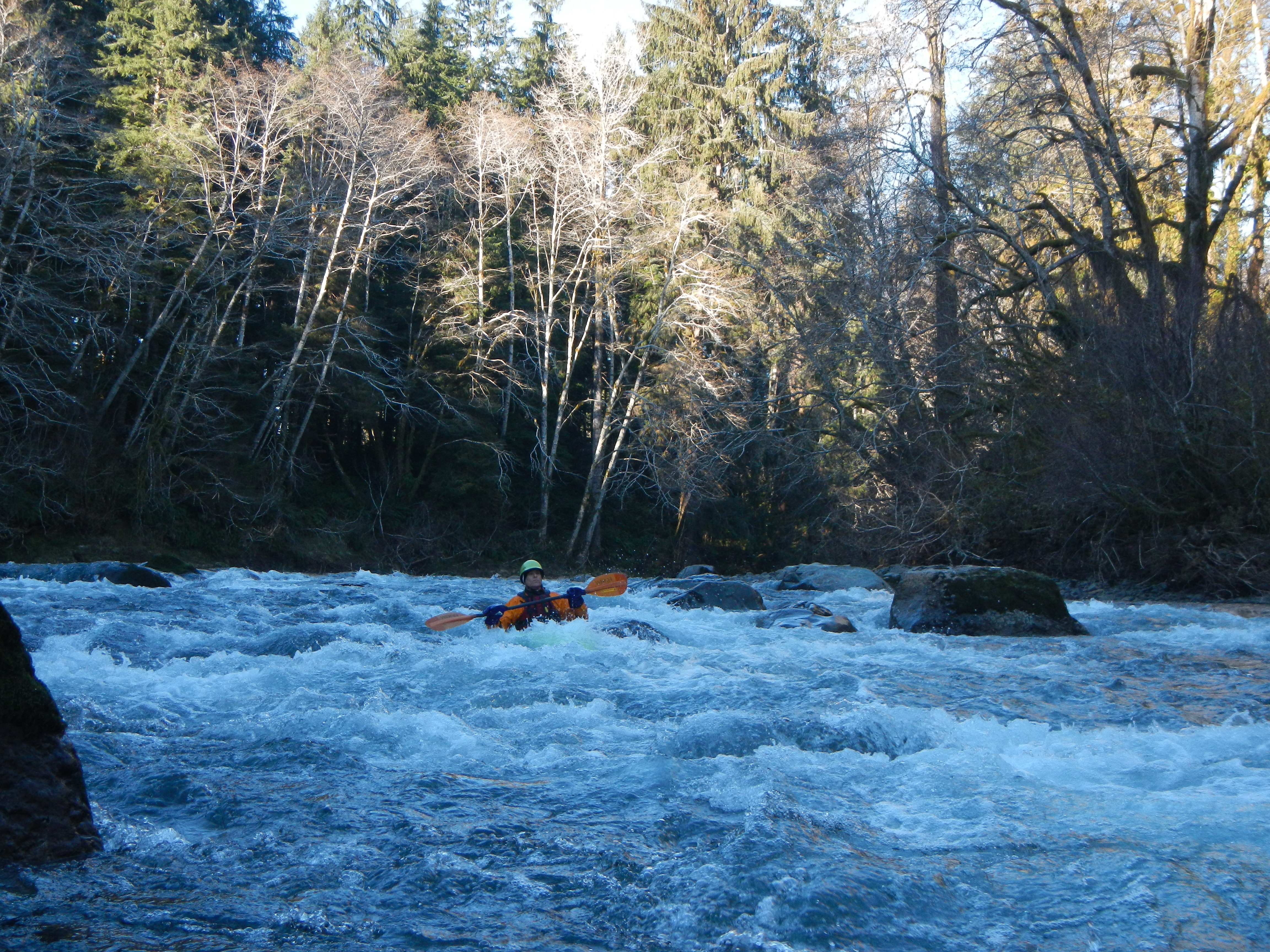
About a mile downstream of Klahine Campground, as you enter state-managed forest land, the Calawah drops through the best section of whitewater with approximately a mile of high quality class III boulder garden rapids ending with 'Island Rapid' which is run down the right.
As you reach the confluence with the North Fork Calawah, the action tapers off again but offers more class II whitewater. As a few riverside homes come into view on river left you know you are reaching the Highway 101 bridge access.
Below the Highway 101 bridge the river flows through commercial timberlands. While the class II rapids are enough to make drift boat fishermen nervous, whitewater kayakers should not have too much trouble. Some fun play awaits as the river joins the Bogachiel. Floating on the Bogachiel just over 3 miles brings you to the Wilson Boat ramp and the lowermost take-out.
Access Logistics:
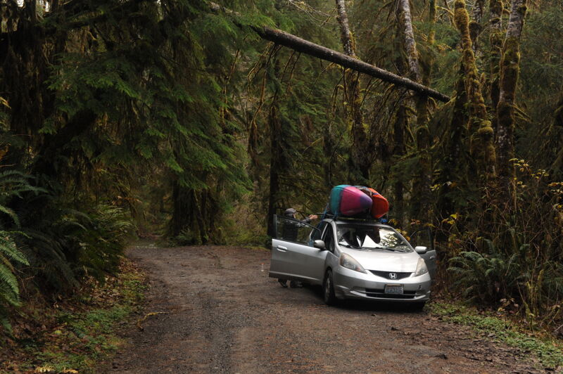
For a put-in, a number of access points are available along Forest Road 29 which parallels the upper part of this run on river right. To find this road head about a mile north of Forks and at Highway 101 mile 193.3 turn east on to Fores
...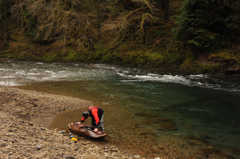
Access at a dispersed recreation site just downstream of Hyas Creek on land administered by the US Forest Service. To reach this site head about a mile north of Forks and at Highway 101 mile 193.3 turn east on to Forest Road 29. Follow this road to mile 8.0 where you will reach the Hyas Creek confluence. The access is at a dispersed site at a gravel bar with great river access just downstream of where Hyas Creek joins the Calawah. A short drive provides parking off the road.
To reach this site head about a mile north of Forks and at Highway 101 mile 193.3 turn east on to Forest Road 29. Follow this road to mile 6.0 and turn onto Forest Road 2932 (Elk Ridge Road) which crosses the river at a bridge that provides a potential access point on Forest Service land suitable for hand-carry craft on the downstream river right side of the bridge. This access is at Calwah USGS river mile 13.1.
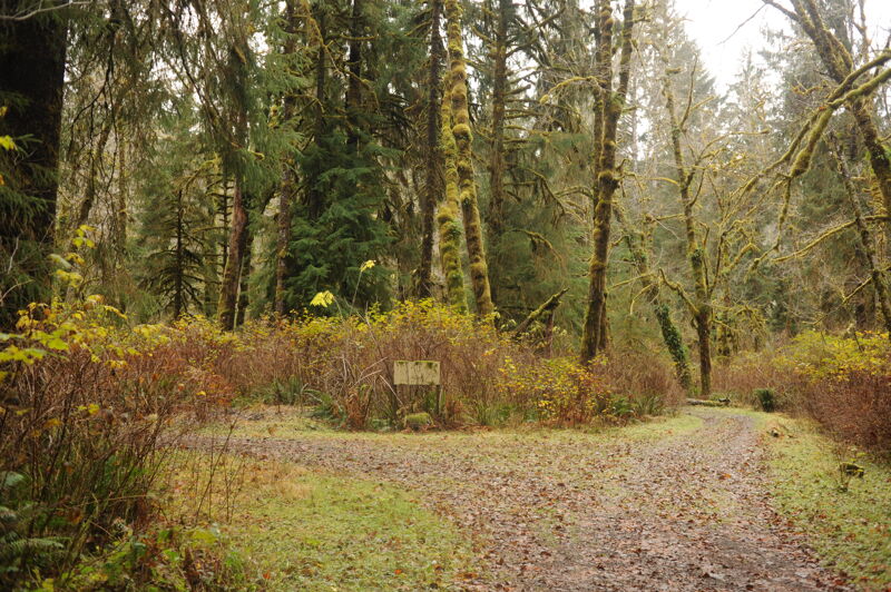
The Klahanie Campground, administerd by the US Forest Service, is located at mile 5.4 on Forest Road 29. The campground was closed to overnight use in 2022 due to hazard trees and root rot but is located within a beautiful patch of old-growth along the river and available for walk-in day use. The campground sign has been taken down making the site a bit difficult to recognize. This site is at USGS river mile 12.7.
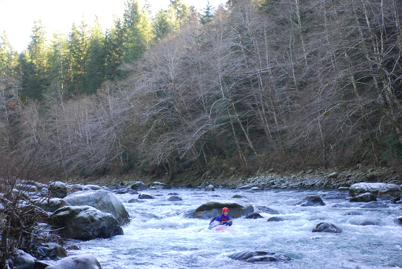
The begining of a great section of class III boulder garden rapids starts at river mile 11.5.
The North Fork Calwah enters from river right. Access for hand carry craft is available on the North Fork just upstream of the actual confluence and on the downstream river left side of the bridge. This is at Forest Road 29 mile 3.6.
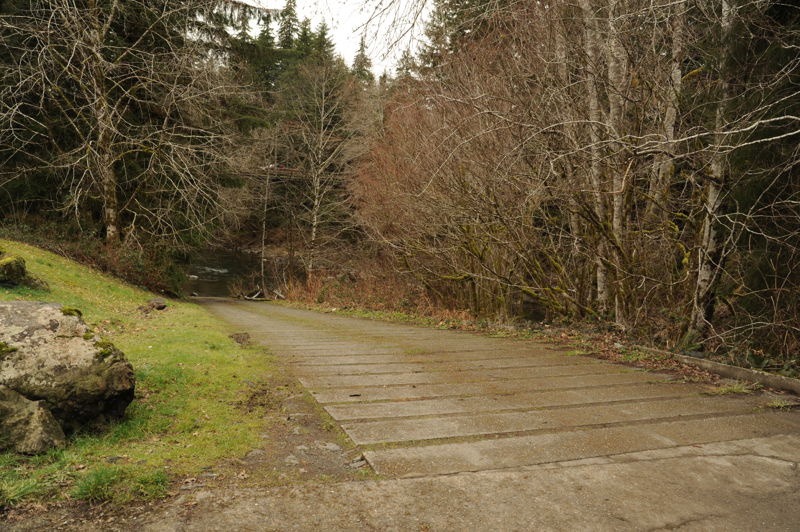
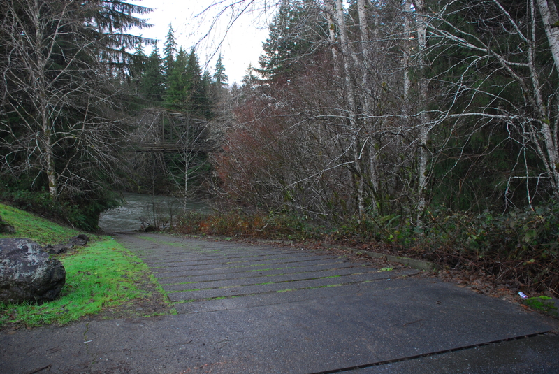
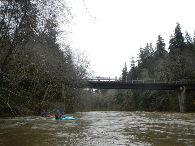
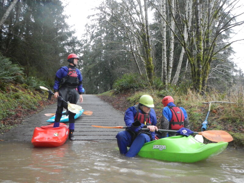
This site is at the Highway 101 bridge at mile 192.3 where the highway crosses the Calawah, turn into the Washington State Department of Fish and Wildlife access on the upstream river left side of the bridge. A Discover Pass is required to use this site which has a parking area and concrete boat ramp. The access is at Calwah USGS river mile 6.5.
This access is on the Bogachiel River a short distance downstream from the confluence with the Calwah. The access is on river right and administered by Washington Department of Fish and Wildlife and requires a Discover Pass. The site has a concrete ramp suitable for trailered boats, a large parking area, and a toilet. This site is just north of Forks where you turn onto La Push Road at Highway 101 mile 193.2. Head 5.5 miles down this road and turn left on Wilson Road. Follow this road 0.6 miles until it ends at the this access site.
Nov 25, 2017
Good high water option. Thomas O'Keefe, Emma Johnson, and Boris Startsev did this run over the Thanksgiving 2017 holiday and found the run clean with no hazards. The class III section is all too short but it is fun around 4000 cfs. We started our trip with a short entry on Hyas Creek.
Nov 24, 2016
Good times at high flow with Thomas O'Keefe, Jan Tackett, Omar Jepperson, James Girton, and Cyn Taylor. With many of the traditional creek runs on the high side we opted for a high water run on the Calwah. We put on around 11am and were off by 1:15pm completing the approximately 16 mile run in just over 2 hours. The current was very swift and rescue would have been a challenge in spots but it was a fun option for experienced boaters.