Cle Elum
3 - Cle Elum Dam to confluence with Yakima River

Aug 15, 2025
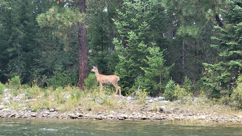
This is a nice and peaceful little run! Very excited to paddle something in August that has plenty of water in it. This run reminds me of a mini Tieton with how continuous it is and the amount of wood it has. This section is no harder than class 2, but you have to weave through some sections that look like they're clogged with wood. We boat scouted the whole thing. It only took about 1.5 hours to complete 5.7 miles. There's some catch on the fly surf along the way. Level was 1500cfs ish
*not a great run for super beginners due to the continuous nature and amount of wood hazards. Boat control and scouting abilities are necessary to navigate safely.
Aug 7, 2025
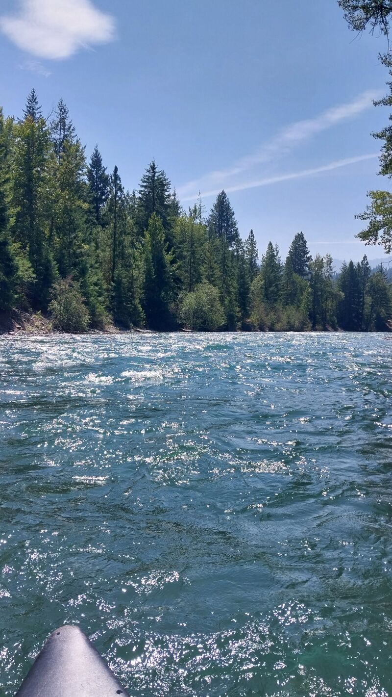
Ran a tandem canoe with airbags on Aug 5. You can drive a vehicle down to the put in to unload with a short carry down a steep bank with a path. A bike shuttle is possible with the connecting bike paths in Suncadia. You can drive down to the take out, then park the vehicle on the side of the highway. Only room for a few vehicles along highway. The run was gorgeous- stunning clear-blue water, super fun wave trains. Water is fast moving - Garmin watch read 8 mph without paddling at times. Good navigation skills are needed to pick channels to avoid all the large woody debris. Over $1.5M in engineered log jams were added for fish habitat, so attention is needed. I agree with others, not a beginner run and the main channels always had a clear path. Took us just under 1 hour ro run this, even with some eddy turn practice.
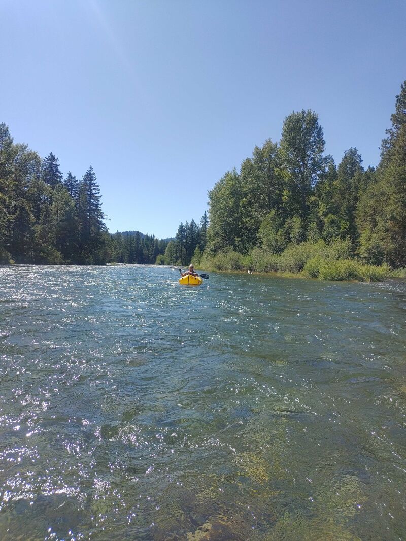
Aug 2, 2025
Wonderful, quick run in an open canoe. Very consistently moving flow with most channels runnable and practically no exposure of the gravel bars. A few small, avoidable wave trains and obvious strainers. I only saw one of the side channels being fully strained, but the main channel was always a go. Great way to spend a half day.
Jul 15, 2025
A scenic, Class II run with an incredible amount of high-consequence strainers – more than I've seen to date on any river. Would not recommend for beginner paddlers.
Braided river with scenic stretches and lots of areas to pull over and eat a snack / lunch.
Jul 2, 2023
Took a couple of packrafts out on the Cle Elum river. Easy put in and take out. We left a car at the take out and bike shuttled through Suncadia to the put in below the dam after initially one of us with the boats at there. The river moves consistently which makes the flatter stretches pass quickly. There's a few wave trains to find and the occassional rapid, but most features are easily passable or avoidable. There is a lot of wood in the river, but it's apparent and easy to navigate. It's a good river to bring someone new to build paddling confidence and getting used to the flow of a river and common obstacles. But it's not a stretch to seek out for action or thrills.
Sep 10, 2014
I didn't go back to look for my Mohawk Probe because the river stayed high so long. Haven't heard that anyone found it. My mishap was about a mile below the put in - not at the dam, but the first one after that. I flipped where there was a line of obstacles across the river, got back in the canoe when it stopped at a log jam past the next corner and then dumped again when I hit a log jam on river left at the corner after that.
Aug 3, 2014
We did this Saturday the 2nd of August 2014 - Ms. Spencer must have got her boat out as we did not see it. The flow at 3700 is above recommended, but there is no reason not to run it as it is a cake walk other than avoiding the logs and strainers in a few areas. Of those areas, only one is a concern - perhaps a mile or so after the put in you will get stacked and pinned if you dont make the corner (I imagine this is where the boat was lost). We will take the other side of the river next time that essentially cuts the corner (will still require you are on your toes), but this go round we just walked around the jam. The only decent rapids are in the area just before you start to see the Suncadia lodge and the take out, but dont have high expectations as it is fairly basic stuff. One note: There were crazy swarms of mosquitos at the take out - It was not a fun wait for my buddy to go and get the truck - so be aware of that.
Aug 13, 2010
I have to disagree about running this section when the dam is letting out a lot of water. I was there a few weeks back and diverted to another river because if any of the kids or senior citizens in my party had fallen in that fast current we would have had a hard time getting them out. For experienced and you strong beginners not a problem but for a family outing don’t try it when it is over level.
If the log jams are cleared out of the Yakama river you can run it from below the John Wane trail near the golf cores to the confluence but 3 weeks ago it was full of log jams that blocked the whole river. At the confluence was also dangerous because of the high volume of water coming in from the left and a log jam on the right.
Mar 19, 2004
The comments above about the maximum river level could be higher need to take into account the river rating of Class II. It may be possible to paddle this stretch at the higher levels mentioned, but the river flows to fast into that log jam for beginning paddlers.
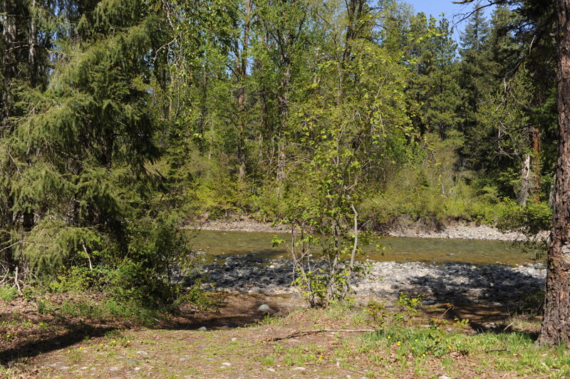
An alternate Put-In: Take Salmon La Sac road, thru Roslyn and Ronald. About 1.2 miles beyond the town of Ronald, (or town or 6.l mi from Roslyn, or 6.5 miles from turnoff on SR 903) look for a gravel road going only to the left. Turn there, it is Winston Road. Have faith and continue driving, bearing left where there is a choice. You end up at a small gravel-taking area, with a steep former drive (rocks only) down to the river. This area won't be built on. It's National Forest Recreation area.
Sep 1, 2003
The maximum recommended flow of 3000 seems a little arbitrary. A couple of us ran this section at 3800 and the only difference was that it was a little faster.
In the summer of 2003, the only real problem on this run is a log jam about a mile below the put-in. The river makes a sharp left turn, and the entire right half of the channel is filled with trees, while the left half is too shallow to run. The easiest run is to make a sharp left, beach on the gravel bar, and drag/crawl 10 feet back to the small channel in the left.
At above 3000cfs, this run takes around an hour. It can be extended by running down into the Yakima and down to the confluence with the Teanaway. This stretch parallels I-5 for a few miles, and the scenery includes a few RV parks, but the last 3-4 miles of this stretch are much nicer. The run from the Cle Elum dam to the Teanaway confluence makes a nice day in July or August.
Jul 28, 2003
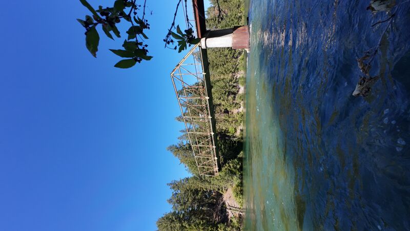
A better takeout is just downstream from the bridge on river right. There's a nice eddy and plenty of room to gather equipment.
One minor thing about the put-in: When you turn left on Lake Cabins Rd, the immediate left is really going straight, because Lake Cabins Rd turns right immediately - if you really took an immediate left, you'd be in someone's driveway.