Dosewallips
3. Six Mile Bridge to Dosewallips State Park
| Difficulty | II-III |
| Length | 6.4 mi |
| Avg Gradient | 38 fpm |
| Gauge | Duckabush River Near Brinnon, Wa |
| Flow Rate as of 52 minutes | 0.21 ftbelow recommended |
| Reach Info Last Updated | November 16, 2024 |
This run is characterized by an impressive gorge that can be enjoyed by intermediate paddlers. It can be paddled by itself or as a continuation of the Middle Dosewallips run. Just keep in mind that the land at Six-Mile Bridge including the shoreline adjacent to the Pinch is private property. The river flows on rain events through the winter, typically beginning in November, and can continue on snowmelt through the first part of summer on a good snow pack year.
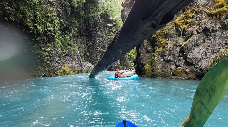
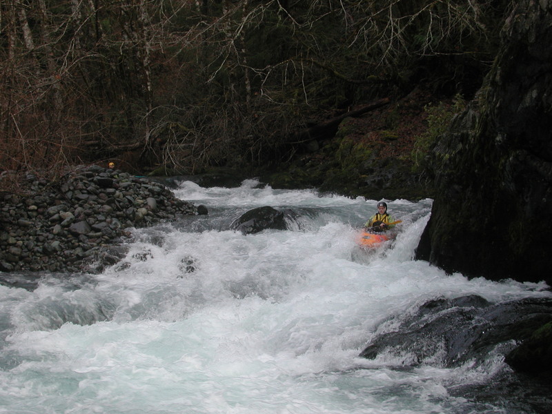
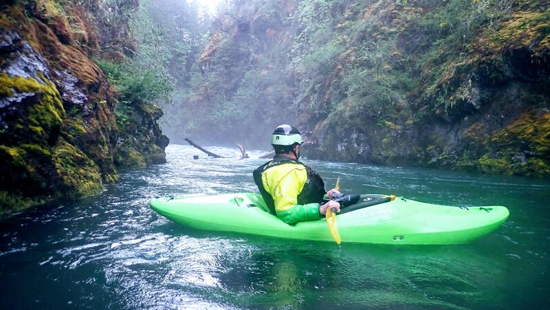
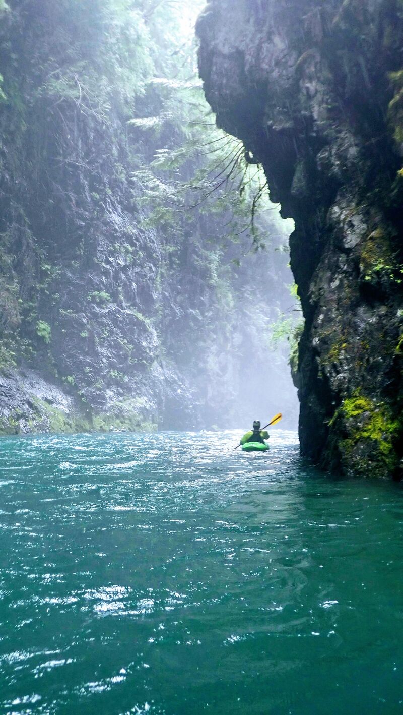
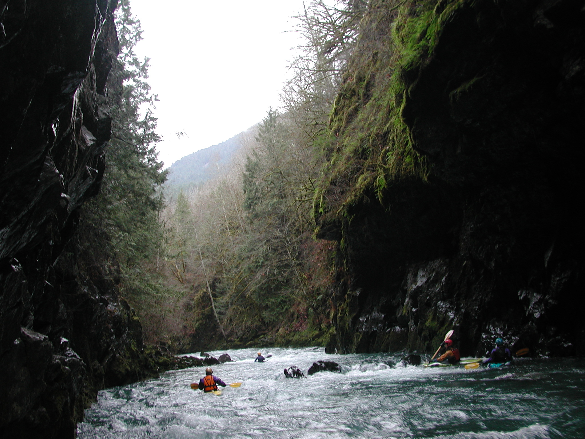
Below the Pinch, the river consists of a few miles of nearly continuous class II/III whitewater with a few fun but short class III rapids. There are waves, small ledges, short boulder gardens, and little holes. Be cautious of wood hazards--it's not uncommon to have a portage or two. About halfway through the run at Wilson Creek you will encounter one of the better playspots on the run at a fun little hole, and then you will enter an impressive gorge section characteristic of the Olympic Peninsula rivers. There is a rapid at the entrance and then the walls close in around you. When the ground is saturated an impressive waterfall flows off the gorge rim that you can paddle through. As you look downstream the river flows straigh into a bedrock wall, but makes a hard turn to the left before opening up. It's a short section of just a few hundred yards but it's a very beautiful place and one of the most accessible gorge sections on the Olympic Peninsula for intermediate paddlers.
There are a few more rapids after the gorge but the pace begins to slow as the water calms down to class I/II and river-side homes begin to appear. If there were a take-out option here most would probably exit the river at the end of the gorge, but it's all private property. As you approach Hood Canal, the channel becomes braided and although there are a few strong eddy lines the rapids are basically over. Once you exit the gorge, expect to
...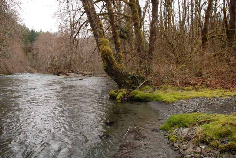
The put-in is located on river right just downstream of the Six Mile Bridge on the short Forest Road 2610-010 spur along river right. Please don't access the river at the bridge which is private property. It's a short walk on the old 2610-010 road alignment to the river down this abandoned spur that takes you to the river shoreline and good lowbank access on public Forest Service land.
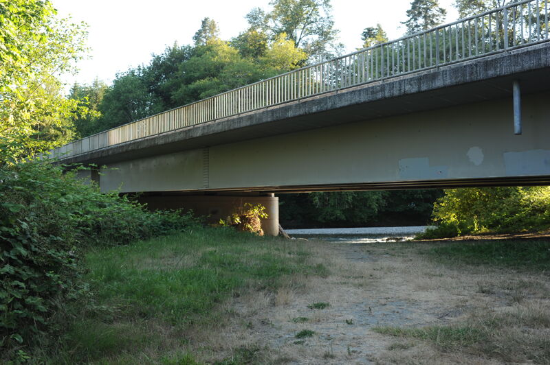
Take out on river right upstream of the Highway 101 Bridge in Dosewallips State Park Campground or downstream of the bridge on river left in Dosewallips State Park day use area.
Feb 18, 2024
We ran a pair of packrafts down the run on back to back days. We had a blast despite how low the river was (we ran at the aboslute bare minimum for water level). Would love to see it with a foot more water in the river because it'd be even more fun.
Put In: Follow the bridge that stretches over the pinch and use the turn off immediately to the left at the end of the bridge to stage/store a car, don't park north of the bridge. Please be aware that much of the surrounding area is private property. We did have one property owner stride over to chat us up. They were very kind but politely reminded us to respect property lines. Another local shared tales of prior owners who were much less hospitable. This run's guide is helpful and should be followed to ensure good access and friendly relations with neighboring property owners. There's a footpath that leads from the staging area down the river to put in. We used a bike to shuttle from the campground to the put in and stashed it at the put in without issue.
Water level: ~1.3ft. The Duckabush gauge sat between 1.25 and 1.3 ft most of the weekend. The Big Quilcene river was sitting at 1.6ft all weekend. We optimistically guessed that the Dosewallips was sitting somewhere in between. The AW description list the lower run range at 1.5 feet. We definitely had a fair number of scrapes/buzzes on shallow portions of the river. There were only 2 occassions we're we had to jump out of our boats to quickly pass over too-shallow a section to runnable water. That being said, this was the absolute bare minimum for water in the river, it'd be a miserable experience with less water present. Ideally you'd want the gauge at 2ft or higher as it would ensure an enjoyable run and open different lines and features.
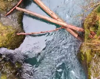
Hazards: No log jams or hazards of note. There was one downed tree that spans much of the river about 2/3 of the way into the run. It's plainly obvious in a slack section of water. With more water in the river you could easily pass to the left (we had to pop out and drag our boats the 5 feet needed to pass through the shallows). Otherwise we could read and run everything and encountered no surpirses or unexpected hazards.
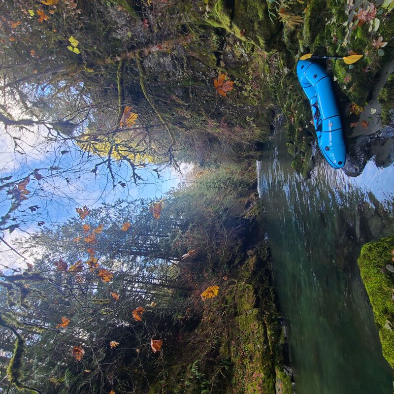
Run: We enjoyed the pristine blue waters and abundant bird life along the river. We did see Elk on neighboring property heading up Dosewallips river road but no Elk passed through the river itself. With the water level so low, it's hard to comment too much on the rapids as many would be more enjoyable with more water, the wave trains we did find were fun enough but probably lacked amplitude. The canyon was spectacular and was a welcome oasis (albeit rather short). Steep, damp, and abundantly green walls jutted from the spectacularly blue waters with a couple of waterfalls trickling down. The couple of small bolder gardens were fun and probably more easily navigable in higher water, we were starved of choices given the water height so took what was available to us. We had fun but were also aware of how much more enjoyable the run would be with more water.
Pull out: We had a campsite at the Dosewallips campground for the two nights we were there. This made for a convenient pull out at the gravel bar just upstream from the 101 bridge that passes over the river as it heads to the sound. There are pink tag markers to help guide you toward the campground which is a relatively short walk from the river. It's a really nice campground with new, heated bathrooms and showers. But it's worth booking a site in advance as it's a popular camping spot throughout much of the year (limited to no options for dispersed camping in surrounding area). Tent sites are closed for much of the winter so we made do with an RV site. We paddled to the sound at the end of one of our runs, but note tide times as low tides may mean you have to navigate around private property. A run all the way to the sound adds a 1/4-1/2 mile walk back to campground to rendezvous with a car/campsite. The lower portion of the state park is closed to vehicle traffic much of the winter.
Jun 18, 2023
A group of 8, all in packrafts did this reach on 6/17/2023. At 420cfs/1.5' gauge height flow was very low and there were a handful of short sections too shallow to navigate without scraping. There were also a couple short stretches requiring dragging boats (maybe 50 yards total?). Near the end of the run, at 47.703646, -122.920636 there is a full-width tree, but it is obvious, the current is calm, and the portage is easy. The tree is free of limbs on the topside and with 1+' of higher flow you would cruise right over it. Very worthwhile doing even at these flows (at least for packrafts).
Nov 28, 2022
Pretty low water, a few downed tree obstacles but no portage necessary (except too-shallow areas towards river mouth). Easy run for a new paddler. Rapids in the canyon were friendly. Elk herd, eagles building a nest, spawing salmon.