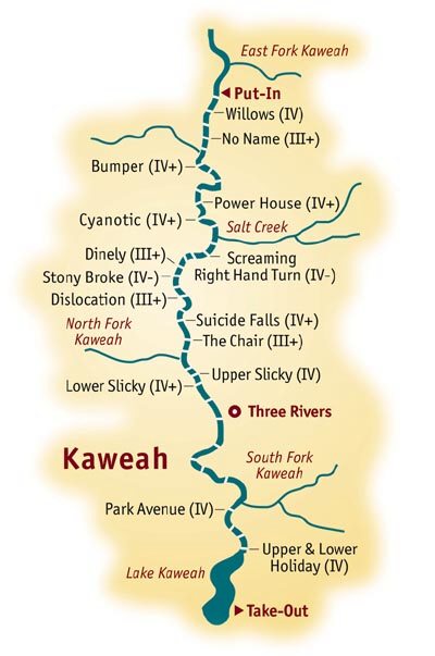
Kaweah
Dineley Bridge to N. Fork Bridge(Dineley Run)
| Difficulty | III-V |
| Length | 2.9 mi |
| Avg Gradient | 57 fpm |
| Gauge | Kaweah River at Three Rivers |
| Flow Rate as of 29 days | 215 cfsstale data |
| Reach Info Last Updated | May 24, 2007 |
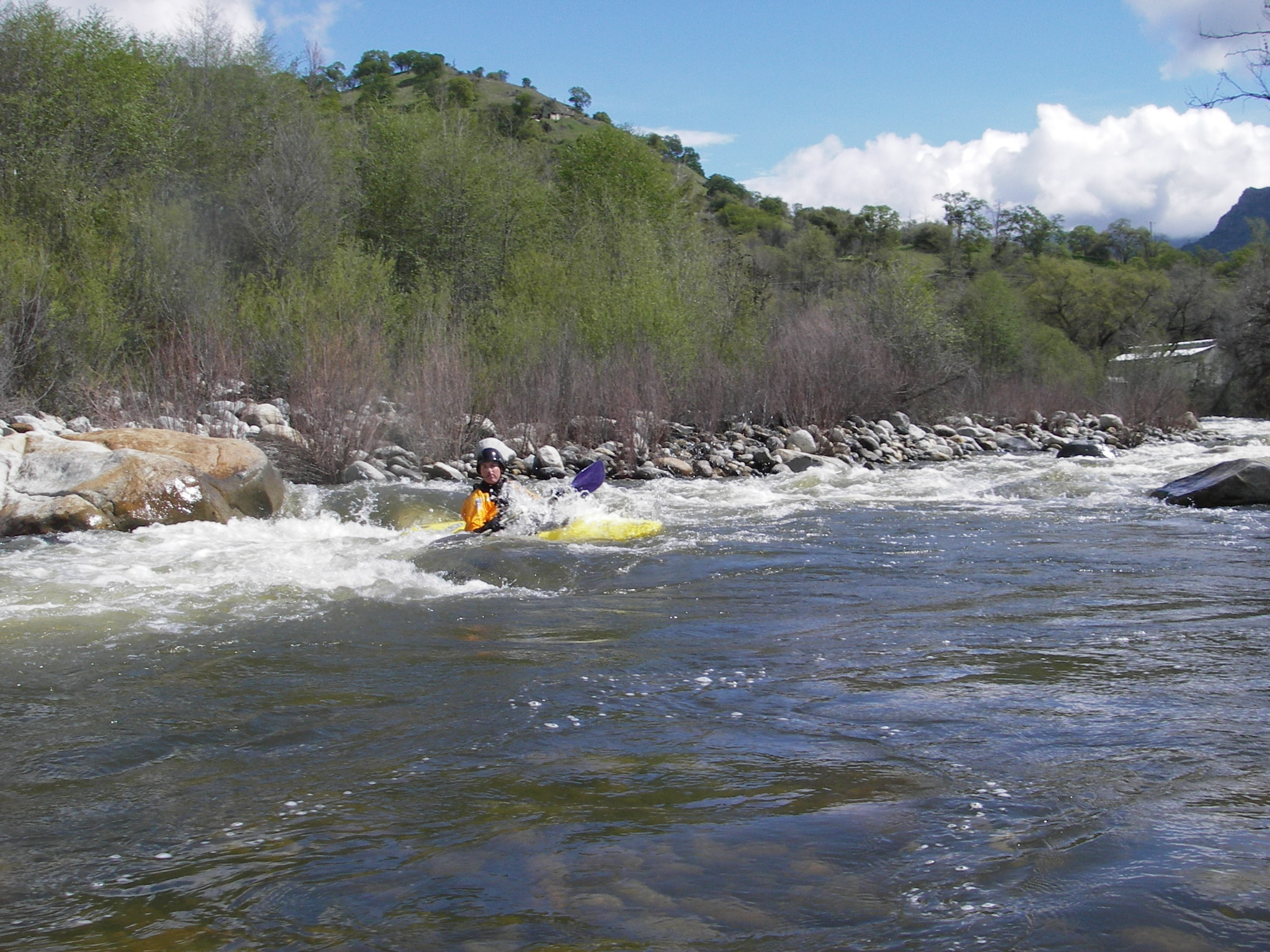
The Dineley section is significantly easier than the upstream Gateway section, but it still has many busy and respectable class 4 rapids including the intimidating Suicide Falls.
Put in:
Dineley Bridge is one of the few legal river access points in Three Rivers. Even so, a few locals may hassle you for launching there. On the upstream river right side of the bridge is a county owned parcel of land. A gated dirt road leads down towards the river. There is only a small amount of space on the roadside to unload boats. Once gear and boats are unloaded please drive cars back up towards the main highway and find parking areas up there.
Alternatively a narrow road leads downstream on river right from the bridge to an SCE powerhouse. There is very limited parking near the powerhouse and SCE allows launching in that area.
Take out:
Problematic. You can hike up from the river at the NF Bridge but all of the roadside in that area is posted no parking. River access seems to be tolerated at just below Lower Slicky, but it may or may not be legal. A few businesses in this area will allow river access to boaters if you ask permission. Parking is tolerated in the elementary school parking lot after school hours and on weekends.
Other Information Sources:
1. The Kaweah River Page maintained by Kaweah fanatic, Bill Pooley, has the best and most up-to-date information about the river.
3. Kaweah-River.com where you can find this handy little river map.
Local Clubs:
For more information on this and other local paddling areas, please feel free to contact these local clubs:
...
This drop is named for the final exciting drop where boaters attempt to paddle off the center of a fan rock. There is just enough drop and several small rocks and holes above that it is not easy to line up for a clean run. Boaters can not come straight at it and must make last second adjustments as they come up to a horizon line and drop towards the lip. Dropping off to either side of the rock is usually forgiven by the river, but can lead to rock impacts and recirculation danger.
Scouting is usually done on river right, so portaging tends also to be on that side. However, at higher flows there tend to be sneak routes down the far left side and portaging may also be easier on that side.
A short but steep drop funnels into a deep wave hole in the river center. The hole is big violent enough to flip rafts and cartwheel kayaks. At some flows it is a wild play spot. Upside down boaters usually flush very quickly and it does not hold swimmers. However, it can be very shallow and kayakers have hit their heads or paddles on the bottom when they get flipped. Swimmers coming into the rapid from above could fare worse.
Conservative boaters sneak the hole on either side. Those seeking to provide carnage entertainment charge the middle.
Early in the year the NF can contribute a lot of extra water, but later flows drop way off. It is easy to float past here without noticing that another river is entering rather than just a channel rejoining.
A bedrock rapid with several chutes and ledges.
The bottom drop is a river wide sliding ledge that forms an extremely sticky reversal. The higher the flows the more dangerous. The usual line of weakness is on the left edge. Scout and portage on river left as well.
