Hyas Creek
FR 29 030 spur to SF Calawah confluence
| Difficulty | II-III(IV) |
| Length | 0.95 mi |
| Avg Gradient | 75 fpm |
| Reach Info Last Updated | December 3, 2024 |
This is a short alternative to a longer run on the Calawah and an option when flows are a little high for the Sitkum. It flows during heavy winter rains.
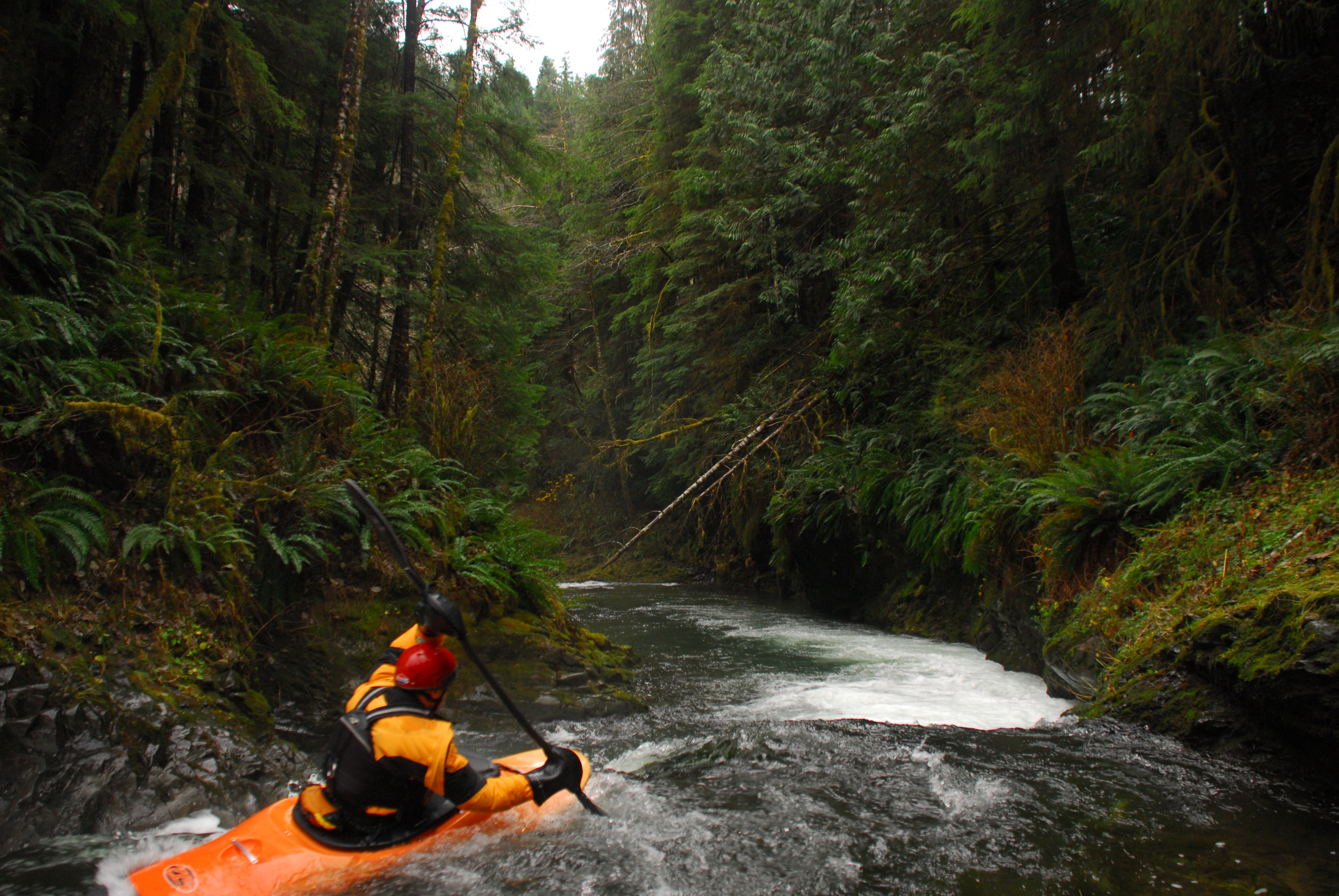
The highlight is a fun ledge drop that should be scouted. A boulder blocks the left line and a the wall is undercut on river right. It can be portaged on the left.
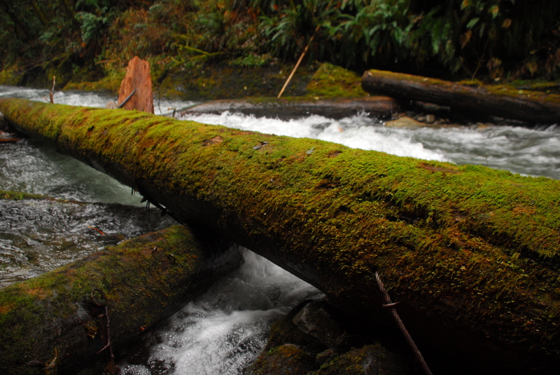
Below the ledge drop engineered log jams have been cabled in the gorge and create a hazard that has been in place for at least the last couple decades. Use caution and prepare for a portage.
Logistics: About a mile north of Forks, Forest Road 29 leaves highway 101 at mile 193.3 and heads east. Follow FR 29 along the Calawah 8.0 miles to the Hyas Creek bridge to check the level. Return to FR 29 mile 7.8 and take spur road 030 which parallels Hyas Creek on river right and follow it up as far as you want to go. The road is really just a narrow jeep track so you will likely want to hike up. Once you get to the top of the hill continue down the long straightaway. Shortly after you come to the end you should see the creek through the trees and the ledge drop below you. Put in here or continue hiking up further.
The takeout is at the Hyas Creek confluence with the the South Fork Calawah or continue downstream to the bridge at the North Fork/South Fork Calawah (mile 3.7 on FR 29). You can obtain current road information from the USFS Pacific Ranger District in Forks (360)374-6522.
for additional information see:
Korb, G. 1997. A paddlers guide to the Olympic Peninsula. third edition.
Pacific Ranger District, North - USFS Olympic National Forest website
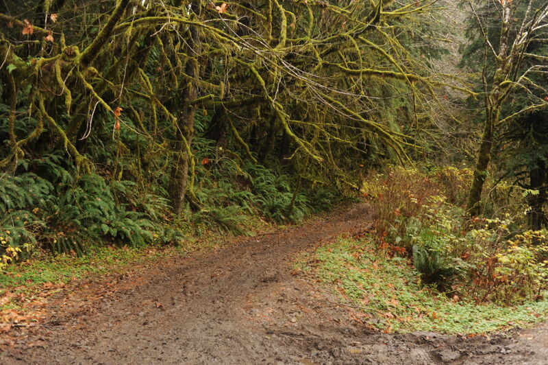
You may be able to drive a short distance up the 2900-030 spur at Forest Road 29 mile 7.8 but you will likely need to hike up the road bed to access your preferred put-in.
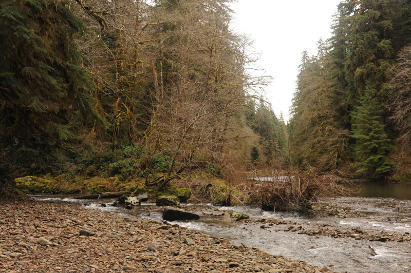
Hyas Creek ends at the confluence with the South Fork Calawah at Forest Road 29 mile 8.0. You can take out on river right here at a dispersed recreation site but many will want to continue down the South Fork Calawah.
Nov 29, 2025
Nov 30, 2024
Photos of Hyas Creek confluence.
Nov 25, 2017
A short exploration of Hyas Creek before running the mainstem Calawah with Thomas O'Keefe, Emma Johnson, and Boris Startsev. It was at a good level when the Calawah was at 4000 cfs. We encountered a channel-spanning engineered log jam a short distance upstream of the bridge at the Calawah confluence requiring a portage.