Big Timber Creek
near Half Moon Campground
| Difficulty | V |
| Length | 2.9 mi |
| Avg Gradient | 720 fpm |
| Reach Info Last Updated | March 2, 2023 |
This thing is in the Montana Surf guidebook, and in Twitch. It's at least a class V.
Lat/longitude coords are a good guess, bracketing the gnarliest section. More exact coords will be posted as we get them.
Info from StreamKeeper Cody Howard:
Drive up to Half Moon Campground, and then hike the trail up along the creek. You will see a sign and a side trail to go look at the Falls, worth checking out so you know what's coming up at the end of the run. Continue to hike up and you'll cross a bridge; hike up the hill almost to the top, and then head down to the creek.
-You should come to an 80-ft slide that constricts at the bottom; this is the Pinch. Put in and run it, or below it, but be careful because there is no warm up, and it's a tricky slide.
- There will be a bunch of clean slides, including Gambler, a right banking slide into a gnarly hole.
- From there you will go underneath the bridge and it will turn into a boulder drop. GET out as soon as the canyon constricts because you've got to portage the upper half of the falls.
- Run the lower half of the falls (shown in Twitch) and then you'll come to Shakedown (last slide) and then get out at Half Moon.
---> Definitely pick up a copy of Montana Surf, the guidebook, for a more detailed description of the creek and surrounding runs. Beautiful guidebook, which you shouldn't be without.
-CODY HOWARD
Check out Mike Albrecht's photos of Big Timber Creek
Jun 4, 2010
Raining lots! The flows are high. the island on lower big T falls is almost all the way under. rock gone!
Jun 4, 2010
For all of you lower big T falls lovers, the rock that was in the way last season is GONE! water is high get out there.
Jul 8, 2009
How can the average gradient be greater than the max gradient?
Answer: if the run is less than a mile long, since the average is per mile.
Jul 9, 2006
I hiked this thing...It is just insanely huge. Biggest boatable whitewater I have EVER seen. It is all hikeable...Great hike if you are around bozeman.
Jun 25, 2006
Example of what can go down if you get off line.
Jun 29, 2003
Smooth.
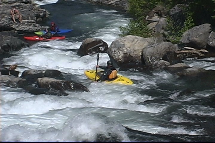
Below the walking bridge on Big timber Creek.
A double drop on Big Timber Creek.
I don't know the name of it.
Getting shook.
Shaken not stirred.
Jun 29, 2003
Sticky.
Haulin ass!
Dang.
Woah.
Jun 15, 2002
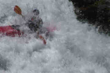
This picture was taken about 2/3 of the way through the Pinch.
Jan 1, 1900
This is the first part of Gambler, the slide continues for about another 30ft, into a MEAN hole. I actually was lucky and had a saftey dude at the bottom and grabed onto the throw-bag to get out of the hole. If the hole stops you, 99% of the time your going to swim.
-CODY HOWARD
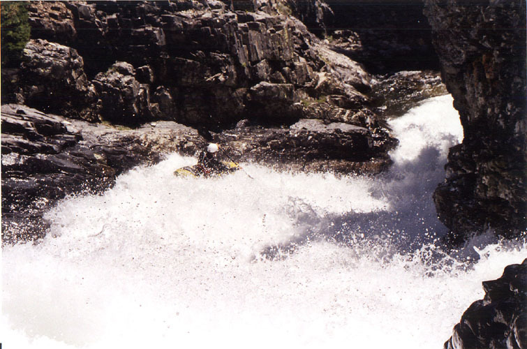
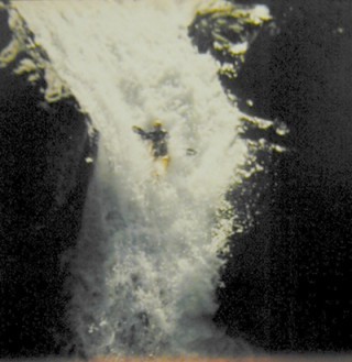
This is Cody Howard running the second part of the Big Timber Falls (60fter total drop). The photo got screwed up, but where the pic ends is not the pool, it still drops another 10ft, into the pool. This is by far the coolest drop on the creek, next to the Pinch. You can see footage of this drop in Twitch, and Nurpu.
-CODY HOWARD
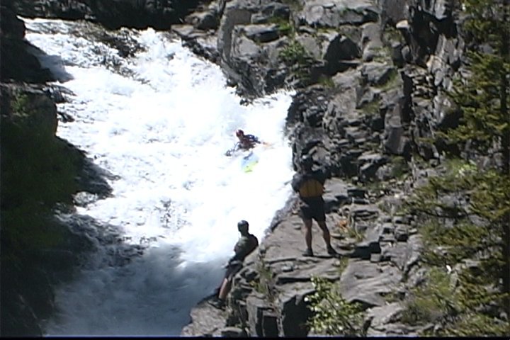
This is the upper part of big timber falls, the part with me running them is directly below this 50fter. Dave Norell i heard ran it, but i think it was really low water. Other than that i believe they remain unrun, because they go into the wall/rocks.
-CODY HOWARD
This is Cody Howard running the second part of the Big Timber Falls (60fter total drop). The photo got screwed up, but where the pic ends is not the pool, it still drops another 10ft, into the pool. This is by far the coolest drop on the creek, next to the Pinch. You can see footage of this drop in Twitch, and Nurpu. -CODY HOWARD
Jan 1, 1900
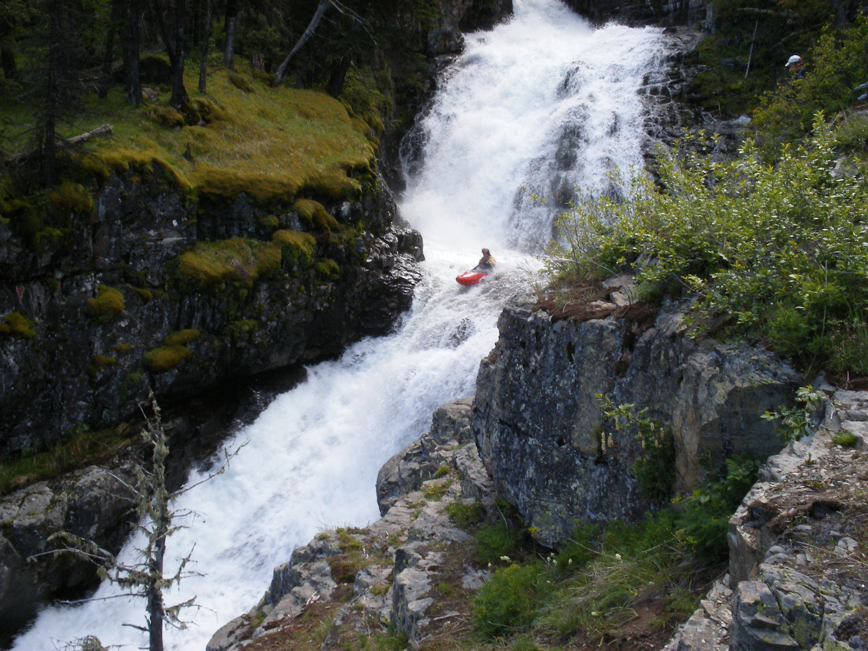
Gordon Dalton runs Big Timber Falls on a nice day in June.
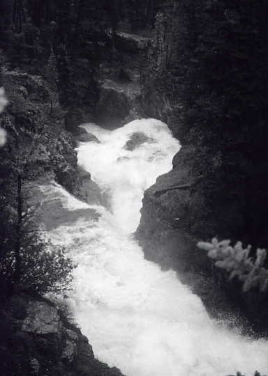
Looking down on Big T Falls from above the drop. That pool at the bottom doesn't look so big anymore - but you'll get there nevertheless.
Gordon at the top of The Pinch.
The bottom half of The Gambler. The infamous hole is at the bottom of this slide. Believe me, it is stout.
Boofing the last drop of Tripple Dipple. In the foreground is 'The Pinch' slide which immediately follows Dipple.