Methow
2. Carlton to Averill (McFarland Creek) access

| Difficulty | II |
| Length | 10.7 mi |
| Avg Gradient | 20 fpm |
| Gauge | Methow River Near Pateros, Wa |
| Flow Rate as of 1 hour | 637 cfsbelow recommended |
| Reach Info Last Updated | July 16, 2022 |
The Methow Valley is one of the most important landscapes in the state of Washington and of national significance for outdoor recreation with a diversity of opportunities for the recreational pursuits our members enjoy. Every spring, whitewater boaters enjoy the experiences on the Methow River, Chewuch River, and Twisp [...]Read More
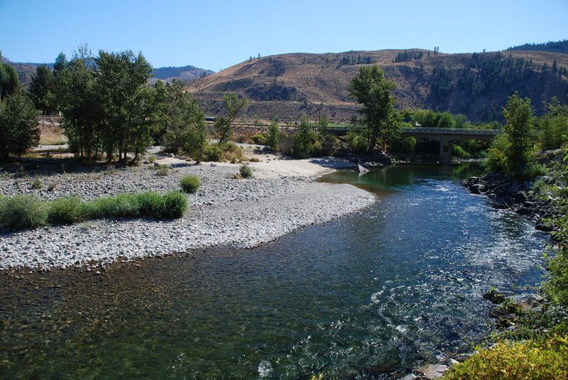
A good class II section on the Methow.
Logistics: Put-in access can be found at the WDFW site (requires a parking permit) in Carlton on the upstream river left side of the Highway 153 bridge at mile 22.4. The WDFW site on the upstream river left side of the bridge at Highway 153 mile 14.1 serves as the take-out.
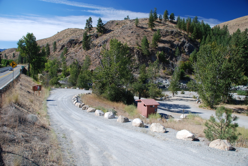
River access site administerd by Washington Department of Fish and Wildlife. The site includes parking and a toilet with an unimproved access to the river. A Discover Pass or a WDFW Vehicle Access Pass is required to park a vehicle at the site.
River access site administerd by Washington Department of Fish and Wildlife. The site includes parking and a toilet with an unimproved access to the river. A Discover Pass or a WDFW Vehicle Access Pass is required to park a vehicle at the site.
Jul 9, 2014
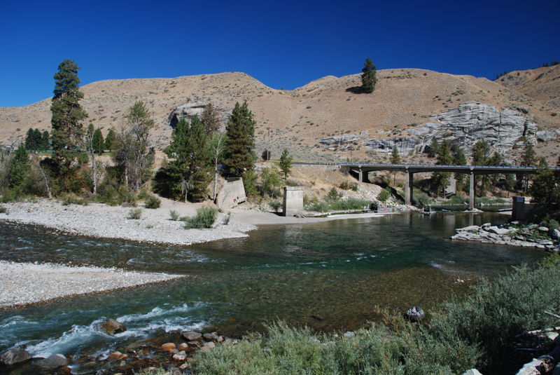
The D.O.T. rapid is at the 3rd bridge, counting the bridge at the Carlton put-in as the first bridge. This is right at the Gold Creek Road and it can be scouted from the road as you do the car shuttle. Class II boaters may want to portage this rapid as it has gotten larger over the years, and it can be tricky to rescue in fast flow after the rapid. The rapid is really just two huge waves,with the second one coming in as a lateral from the left.
Locals have dubbed this the D.O.T. rapid because they reckon that concrete chunks of the old bridge, left in the water by the Department of Transportation, are what has caused this rapid to grow.
Sep 9, 2007
Public river access on the Methow River.
Jul 9, 2004
This section can be done at much lower level than 2,000 CFS for canoes and kayaks.