Nooksack, S. Fork
River Mile 25 to Saxon Road
Lummi Nation installed 18 engineered logjams (ELJs) in 2020 at Elk Flats, between river mile 22.5 and 23.1. The GPS are as follows:
48.59823950960 -122.05076615800
48.59965558060 -122.05098200300
48.59923642250 -122.05105954400
48.59893279000 -122.05104175200
48.60053873740 -122.05477255600
48.59772116770 -122.04919567700
48.59735480780 -122.04759493900
48.59931873460 -122.05057035900
48.59903906680 -122.05068926000
48.59862215770 -122.05050710600
48.59804398960 -122.05004485800
48.60021130860 -122.05231382100
48.59999635580 -122.05202596700
48.60022214940 -122.05209737400
48.60009791690 -122.05178154900
48.60031345130 -122.05174220600
48.60027591860 -122.05132799100
48.59996364690 -122.05017444700
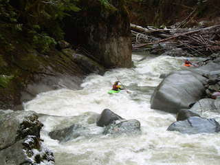
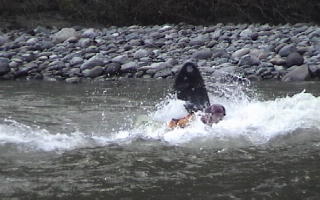
All of the structures are equipped with yellow warning signs. Four of the structures protrude into the recreational flow river channel around river mile 22.8. These four structures are partial channel spanning to deflect flows toward the left bank and Elk Flats point bar. They can be avoided with several hundred feet of sight distance, just paddle to the opposite side of the channel. Lummi Nation periodically assesses all of these structures for safety hazards, and will update this site as needed.
The Lummi Nation installed 15 engineered logjams (ELJs) in the South Fork Nooksack in 2018, posted to AW in 2019. One ELJ in the Edfro Island side channel has become a channel spanning ELJs, and still has a yellow sign. This structure is at river mile 15.3 about 300 feet upstream from the Edfro Creek confluence with the side channel; the GPS coordinate is 48.6598, -122.1241. The channel-spanning ELJ is excellent for salmon habitat and geomorphic processes.
The Lummi Nation installed 22 engineered logjams (ELJs) in the summer of 2022 between river mile 18.4 and 18.7. This area is currently off-limits to public use. The majority of the ELJs are on the left smaller channel. The GPS coordinates are as follows:
48.62301355130 -122.10872284100
48.62237300500 -122.10888455100
48.62251353920 -122.10906314300
48.62236444090 -122.10929957700
48.62229488780 -122.10976869200
48.62178674910 -122.10986803600
48.62228499250 -122.11162436700
48.62252188160 -122.11203694300
48.62302816940 -122.11235459600
48.62326630800 -122.11236751400
48.62385040560 -122.11231856000
48.62413119610 -122.11228706000
48.62441044030 -122.11226900200
48.62476034060 -122.11206336300
48.62487358770 -122.11200855600
48.62494808420 -122.11196754100
48.62376926870 -122.11080686000
48.62504534380 -122.11158713800
48.62499760490 -122.11121708400
48.62495010580 -122.11090271700
48.62201072600 -122.10996269300
48.62297454390 -122.10924881100
Please note that there is a total channel spanning logjam around river mile 18.6, the GPS coordinate is 48.6220, -122.1091. There is a long sight distance of over 500 feet. There is another ELJ near the mouth of Fobes Creek blocking the majority of the channel at , the GPS coordinates are 48.6232, -122.1123.
The Lummi Nation installed 15 engineered logjams (ELJs) in the South Fork Nooksack in 2018, posted to AW in 2019. One ELJ in the Edfro Island side channel has become a channel spanning ELJs, and still has a yellow sign. This structure is at river mile 15.3 about 300 feet upstream from the Edfro Creek confluence with the side channel; the GPS coordinate is 48.6598, -122.1241. The channel-spanning ELJ is excellent for salmon habitat and geomorphic processes.
PUBLIC SAFETY NOTICE: Please note that three new engineered log jams were installed on the South Fork Nooksack River in summer 2019 upstream of the Larson’s Bridge between river miles 21.1 and 21.4, including two CHANNEL SPANNING LOG JAMS. See maps of new and previously installed engineered log jams in the photos tab. The upstream structure is marked with 18'x18' yellow warning signs to alert recreational users. For more information, contact Kelley Turner, Restoration Manager, Lummi Natural Resources at (360) 312-2315. Here are GPS points of the new log jams in decimal degrees: 48.605142 -122.071818; 48.606364 -122.077073
PUBLIC SAFETY NOTICE: Please note that 15 new engineered log jams were installed on the South Fork Nooksack River in summer 2018 upstream of the Skookum Hatchery near Edfro Creek. See maps of new and previously installed engineered log jams in the photos tab. Most structures are marked with 18'x18' yellow warning signs to alert recreational users. For more information, contact Kelley Turner, Restoration Manager, Lummi Natural Resources at (360) 312-2315.
Here are GPS points of the log jams in decimal degrees:
48.624743 -122.110539,
48.624357 -122.110996,
48.623605 -122.112306,
48.623292 -122.112621,
48.623163 -122.111361,
48.62279 -122.111667,
48.622283 -122.110598,
48.619291 -122.101789,
48.618211 -122.101653,
48.617404 -122.101891,
48.615952 -122.101547,
48.615291 -122.102263,
48.614634 -122.101484,
48.613337 -122.100849,
48.612164 -122.095098,
48.609579 -122.091428,
48.60976 -122.090103,
48.609322 -122.088385,
48.610163 -122.083631,
48.610501 -122.085125,
48.64479 -122.119901,
48.644435 -122.119928,
48.643305 -122.11736,
48.640229 -122.118598,
48.639975 -122.118745,
48.63981 -122.119437,
48.67018 -122.143626,
48.669918 -122.145437,
48.669813 -122.146751,
48.642315 -122.118822,
48.641669 -122.119124,
48.641149 -122.119236,
48.640881 -122.119389,
48.640369 -122.119725,
48.642933 -122.119044,
48.642062 -122.118974,
48.643462 -122.118979,
48.612505 -122.0982,
48.612143 -122.09649,
48.611445 -122.097011,
48.611665 -122.096478,
48.611435 -122.095775,
48.611746 -122.095133,
48.609326 -122.087054,
48.643637 -122.119089,
48.669733 -122.147025,
48.669617 -122.147272,
48.669676 -122.147663,
48.669581 -122.148149,
48.670268 -122.14223,
48.609944 -122.08316,
48.611412 -122.093478,
48.609664 -122.089851,
48.606563 -122.079245,
48.606502 -122.080478,
48.607327 -122.080243,
48.607711 -122.080256,
48.608063 -122.081997,
48.60847 -122.08113,
48.60967 -122.083009,
48.609733 -122.085383,
48.609539 -122.08752,
48.609688 -122.089271,
48.610751 -122.093707,
48.610987 -122.09396,
48.611792 -122.094147,
48.612354 -122.09595,
48.669677 -122.143623,
48.669217 -122.14532,
48.668881 -122.146486,
48.669813 -122.146751,
48.67018 -122.143626,
48.669918 -122.145437,
48.670177 -122.144159,
48.658031 -122.122365,
48.658466 -122.122915,
48.658591 -122.123928,
48.658827 -122.124466,
48.659336 -122.125244,
48.660005 -122.12576,
48.660404 -122.126413,
48.660762 -122.127384,
48.661775 -122.129053,
48.662806 -122.130672,
48.660364 -122.125297,
48.660131 -122.124418,
48.65989 -122.124168,
48.659773 -122.123632,
48.659319 -122.12297
Additional Engineered Logjams have been installed by both Lummi and Nooksack Tribes at several sites from the Saxon Road Bridge downstream to the confluence with the North Fork. While this section of the website is specific to RM 25 downstream to Saxon Road Bridge, there is no section on the website for the reach below the bridge. This is to inform the whitewater community that these structures are in the South Fork Nooksack. Most structures are marked with 18'X18' warning signs to alert recreational users.
As a courtesy to the paddling community, the Lummi Nation has provided the following information on the installation of engineered log jams on the South Fork Nooksack River. SITE 1) South Fork Nooksack, near the Fobes Creek tributary: We have recently installed 14 engineered logjams on the South Fork Nooksack River between river miles 18.2 and 18.5. This is in a section that is not easily accessible, but we have several plain yellow warning signs on the logjams in areas where it might be difficult to see the logjams. Here are the lat/long for the furthest upstream and downstream logjams: Furthest downstream extent: 48 37’ 29.698”N 122 6’38.117”W Furthest upstream: 48 36’48.09”N 122 6’ 3.18”W.
SITE 2) South Fork Nooksack, near Skookum Creek tributary: We have recently installed 3 engineered logjams on the South Fork Nooksack River between river miles 13.6 and 14.2. Information we have obtained is that this is where a take-out point is. We have installed yellow warning signs on these logjams. These logjams have been placed into the left bank.
Locations: 48 40’ 10.716”N, 122 8’ 53.195”W; 48 40’ 12.585”N, 122 8’ 30.819”W
Jan 7, 2016
The Washington Department of Natural Resources is embarking on a new planning project that will guide recreation on DNR-managed lands in the Nooksack River and Whatcom Lake watersheds for the […]
Aug 23, 2013
American Whitewater is working with several partners through the National Park Service Rivers and Trails Conservation Assistance Program to develop an updated recreation plan for the upper Nooksack River basin. Paddlers […]
Aug 5, 2005
In June 1986 Lewis County Public Utilities District received a license to build and operate the Cowlitz Falls Dam and hydroelectric facility at the confluence of the Cispus and Cowlitz […]
Aug 5, 2005
Membership VolunteerMike ColemanMike may not even know it yet, but he is this month’s membership volunteer of the month. For nine years, Mike has been AW’s lead on organizing the annual Deerfield Festival in Charlemont, MA. This year’s event […]
Oct 19, 2000
For Immediate Release, October 13, 2000 Settlement Reached for Rock Creek-Cresta Hydropower ProjectNorth Fork Feather River, California (Silver Spring, MD) American Whitewater, in concert with other recreational and environmental groups […]