Sauk
1 - Bedal Campground to Whitechuck River (Upper)
| Difficulty | II-III |
| Length | 8.6 mi |
| Avg Gradient | 37 fpm |
| Gauge | Sauk River Ab White Chuck River Nr Darrington, Wa |
| Flow Rate as of 25 minutes | 325 cfsbelow recommended |
| Reach Info Last Updated | January 9, 2026 |
Beginning high in the North Cascades, the Skagit Wild and Scenic River winds down steep slopes, through forested hillsides and wide open valleys, eventually reaching Puget Sound. The rivers of this system – the Skagit, Sauk, Suiattle, and Cascade – flow through rugged wilderness, forestlands, rural communities, farmlands, and [...]Read More
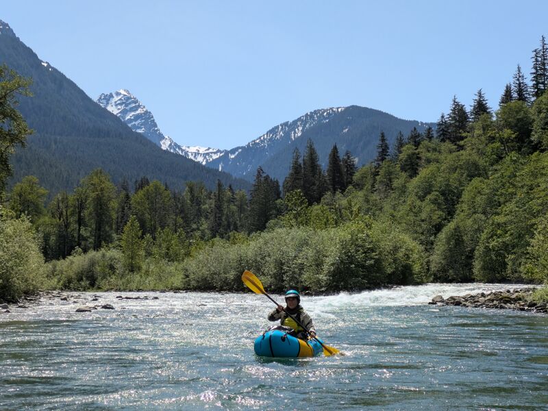
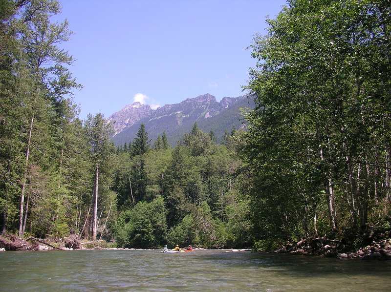
This is a good beginner run but be sure to go with experienced paddlers and make sure you have good boat control skills. Wood hazards can be significant and may require some precise manuvering. This run is also one of the most scenic trips through the Mt. Baker - Snoqualmie National Forest, flowing through majestic riparian forests in a beautiful river valley–it stands out as a true gem of the Wild and Scenic River system.
The run starts out on the lower section of the North Fork Sauk before soon joining the confluence with the South Fork a couple minutes downstream of the Bedal Campground. The river starts of with lively class II rapids. The best rapids on the run are in the first four miles where the river cuts a course through class II/III gravel bar rapids interrupted by occassional boulders. Although you will encounter a couple sections of bedrock, most of the river freely migrates across the floodplain contributing a constant supply of wood as the river carves new channels through sections of forest.
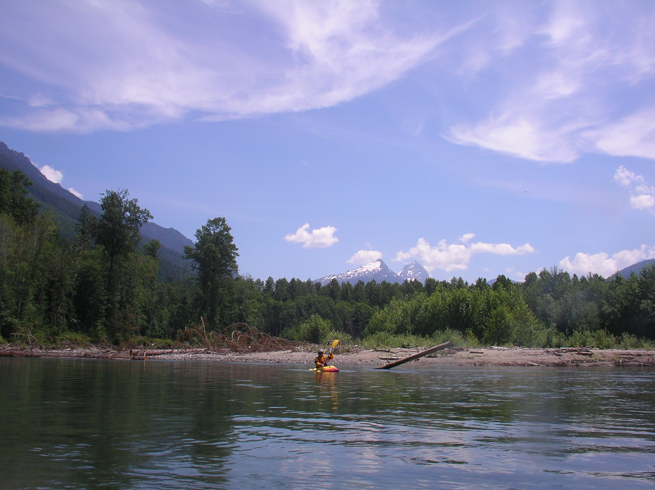
Once the rapids taper off, the river meanders back and forth across the floodplain but still continues along at a good pace. On a clear day, you will have great views back up the valley and into the Glacier Peak Wilderness. High above the valley on river right you will pass by Pugh Mountain and if the river is at a medium flow you will find several gravel bar beaches that make great lunch stops or a campsite for an overnight trip. Bring your firepan and practice Leave No Trace Camping. Overnight use seems to be increasing and boaters have reported increased evidence of impacts.
This section of river finishes off with the best rapid of the trip at Rocky Road, a fun class III drop just upstream of the Mountain Loop Highway bridge. You will recognize the approach by a gaging station on river right. Within a short distance of passing the gage, the river enters a short section of bedrock-constrained channel with several boulders that create a fun t
...Access is available in the Bedal Campground where an access site has been established with a load/unload area and path to the river. Parking is available outside the campground on the upstream river right side of the bridge across the river.

Final rapid just before the take-out as the river bends to the right and passes under the bridge. Located at USGS river mile 31.9.
Access on river right immediately downstream of the Whitechuck River confluence. This day use site is administered by the Forest Service.
May 24, 2025
Had a lovely time on the Upper Sauk from Bedal to Whitechuck. We had two portages, one tricky sweeper, and a handful of log jams that the current pushed towards. The mountain views were gorgeous!
Flow was 1400, Sauk above Whitechuck, on Saturday May 24th.
Our two portages were easy to spot, with plenty of time to find slow moving water over a shallow cobble bar to get out. Easy, quick, portages for kayaks, packrafts, or light rafts. Would be more challenging in a heavy raft due to some big trees you have to work your way over or around. 48.1390511, -121.4293259.
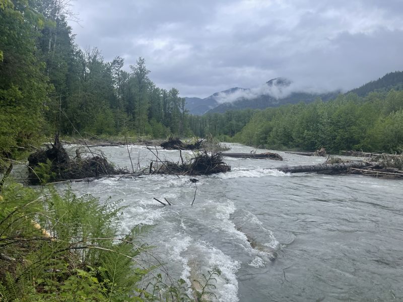
There was one nearly riverwide sweeper that posed a challenge. 48.1652211, -121.4580400. There was about 6 feet of passage on river right, but a few guard rocks made that line a bit tricky. Unlike the other wood hazards near cobble bars, this one had a cut bank on one side and a long jam on the other. Portaging would be more challenging.
Otherwise, the majority of the other wood was along banks that the current pushed towards. Would be dangerous for a swimmer, but someone in control of their boat would be fine.
Jun 17, 2024
We paddled from Bedal to Whitechuck in mid-June 2024 and found several significant wood hazards approximately 4-6 miles below Bedal. This is a dynamic river and the channel is continuing to adjust to the slope and sediment changes from a major channel avulsion over a year ago. Rafters should anticipate three portages along cobble bars and over large logs. Stopping will require hasty parking on a cobble bar with moving water and no eddy. Kayakers could successfully run this section without portaging, but it requires numerous log ducks, cautious boat scouting, and at least one dicey ferry above an unassuming but dangerous strainer.