Skykomish
1 - Index (Sunset Falls) to Split Rock
| Difficulty | III+(IV) |
| Length | 4.4 mi |
| Avg Gradient | 45 fpm |
| Gauge | Skykomish River Near Gold Bar, Wa |
| Flow Rate as of 1 hour | 738 cfslow runnable |
| Reach Info Last Updated | March 19, 2021 |
The Skykomish River is one of the nation’s premier whitewater destinations. Rising in the high country of the North Cascades, the river and its tributaries attract paddlers from across the country and around the world. The Washington State legislature recognized the river’s outstanding qualities by designating the Skykomish as [...]Read More
On September 28, 2011, Public Utility District No. 1 of Snohomish County filed an application for a preliminary permit proposing to study the feasibility of the Sunset Falls Hydroelectric Project to be located on the South Fork Skykomish River near Index in Snohomish County, Washington. On March 21, 2013 [...]Read More
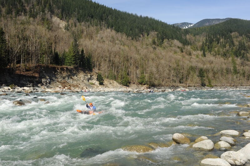
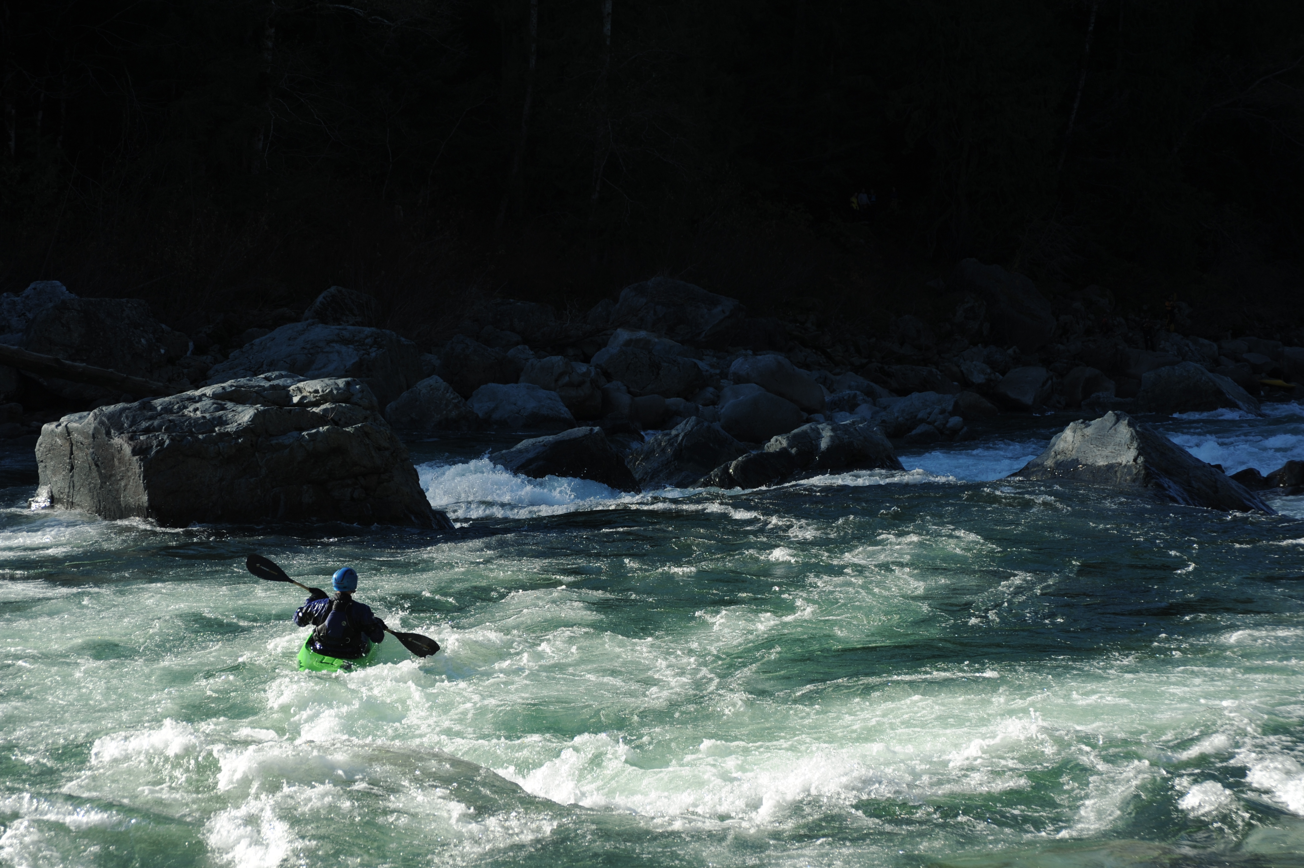
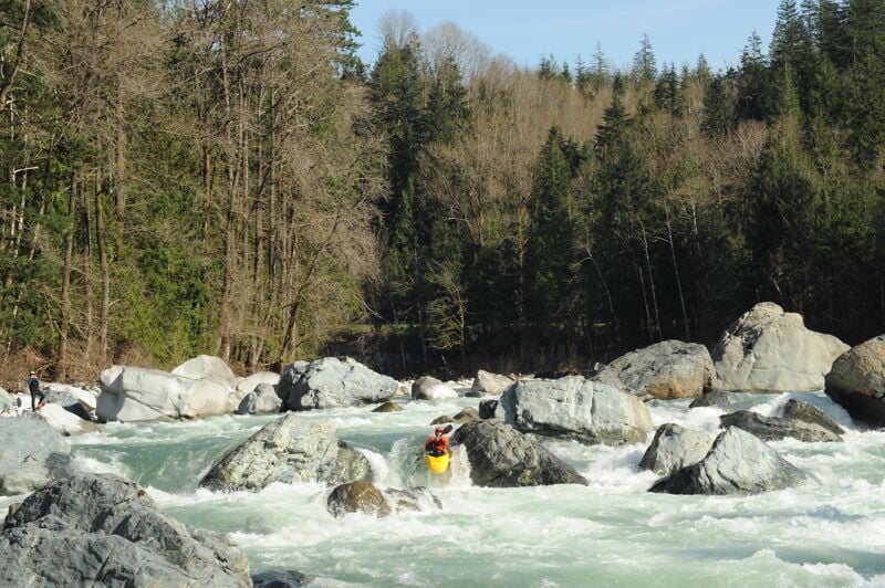
Known simply as 'The Sky', the Sunset run on the Skykomish is where experienced boaters can go for their weekly whitewater fix and still be home by dinner. Only an hour from Seattle, or closer for those who live in Highway 2 corridor, the run offers excellent whitewater throughout the year and plenty of fun play spots. In a good water year it can be paddled all twelve months of the year. You may be grinding your way down on the coldest winter days or after several days with no rain in the summer, but you are just about always guaranteed to have a good time.
Historically, kayakers began their trips from the base of the dramatic Sunset Falls with a seal launch from the rocks (before access was closed by WDFW in 2000). Currently, boaters will put in at Cable Drop located on the South Fork and administered by the Forest Service, at the Highway 2 Bridge at the confluence of the North Fork and South Fork Skykomish, or in the town of Index when there is sufficient flow on the North Fork. From Sunset Falls access, which is currently not generally used, the first rapid on the river is a short series of ledges ending with one of the favorite surfing waves on the run. Pull out on river right to line up for First Wave.
The next rapid is a straightforward boulder garden ending with a sometimes meaty hole just to the left of center. You can hop in for a wild ride, but at most levels it's not for the timid. The river passes through another boulder garden before reaching Cable Drop.
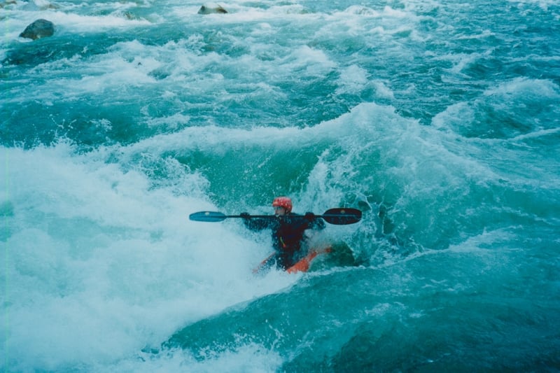
Powerlines overhead and a horizon line mark the entrance to Cable Drop Rapid (otherwise known as Powerline). It's a great intermediate rapid at moderate flows. Good lines can be found down river left or river right. At most levels you can find some good surfing in this rapid and this has been the site of the SkyFest freestyle through a rapid competition in the past. Continuing down on river left you pass through a boulder garden with a nice ender spot at some levels, and then on und
...![Sunset Falls - Put-in [closed to public]](https://images.americanwhitewater.org/photo/medium/888670.jpg)
The traditional put-in for the Skykomish was the base of Sunset Falls on river right at the state-owned fish trap and haul facility. Despite the fact that this facility belongs to the public and is one of the most dramatic and scenic river access points in the nation, Washington Department of Fish and Wildlife closed the site to access in the year 2000.
![Cable Drop Access [Forest Service]](https://images.americanwhitewater.org/photo/medium/885209.jpg)
Cable Drop Access serves as the primary public access point on river left. Following a request initiated by American Whitewater to develop a formal access at Cable Drop, the Forest Service successfully secured resources that American Whitewater was able to leverage through contributions that had been made to the Skykomish River Access Fund. In 2012, American Whitewater entered a formal partnership with the Forest Service to define a parking area and design a new trail and a set of stairs down to the river that accommodates rafts. Washington Recreational River Runners, stepped forward with volunteer labor to work on the project.
A few different lines are possible through this great drop which also serves up some fun play spots. In the past it was the site of the SkyFest rodeo competition.
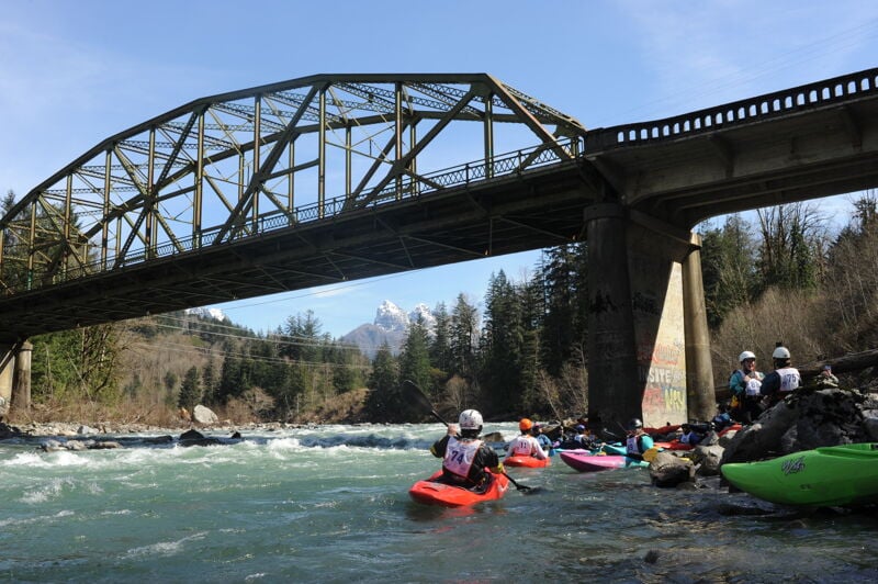
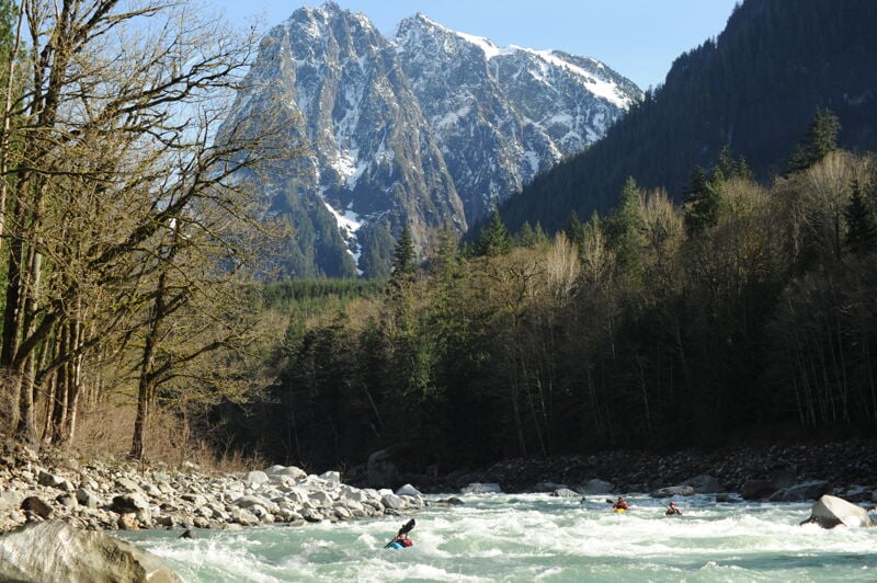
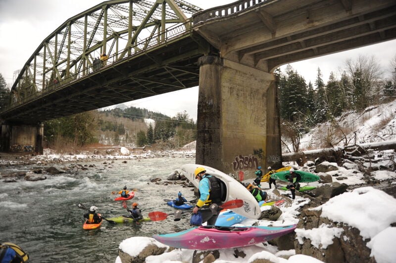
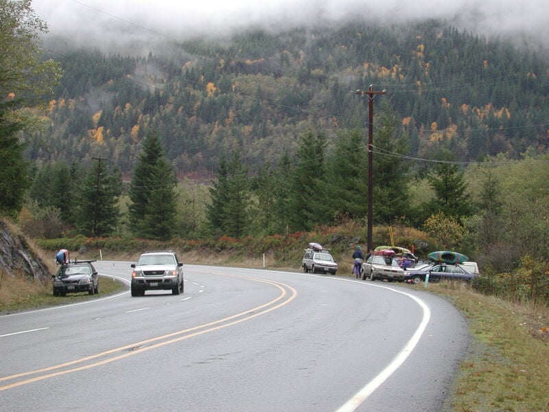
The confluence where the North Fork joins the South Fork to form the Main Skykomish River. Trips can begin on either the North Fork or South Fork although the South Fork has traditionally begin on the South Fork. This site can also be used as an access point with an informal pull out and social trail down to the river on the downstream river left side of the Highway 2 Bridge across the South Fork and immediately upstream of the confluence.
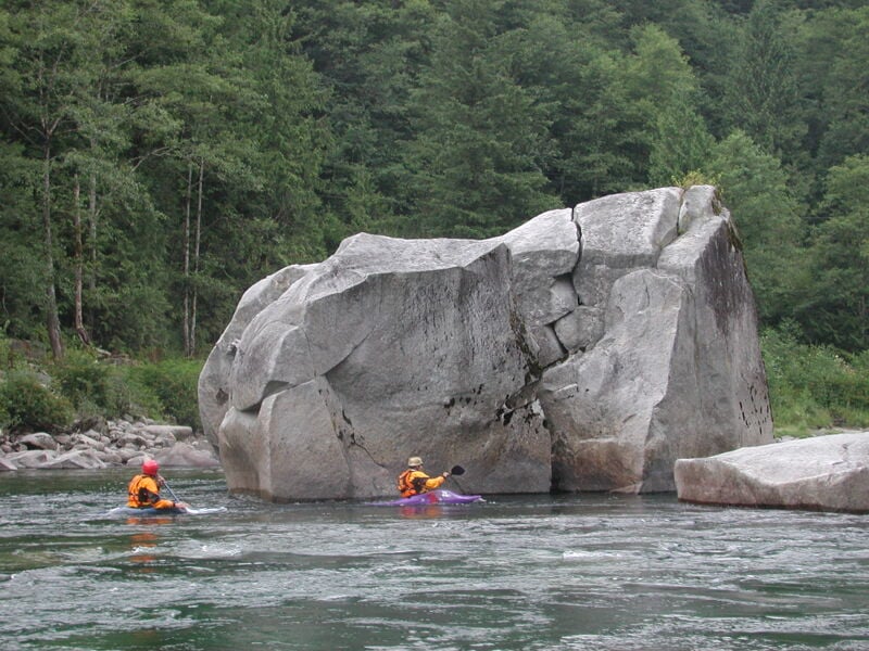
The confluence of Anderson Creek that joins the Skykomish on river left marks the approach to Boulder Drop. If you are planning to portage Boulder Drop this is the most common place to take-out (on the downstream side of the creek) where you can hike up to the highway and then back down below Boulder Drop. In the past there was a surf feature that formed at certain flows but rocks have shifted and the whole feature changed considerably in the December 2025 floods.
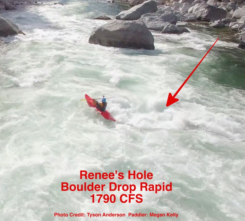
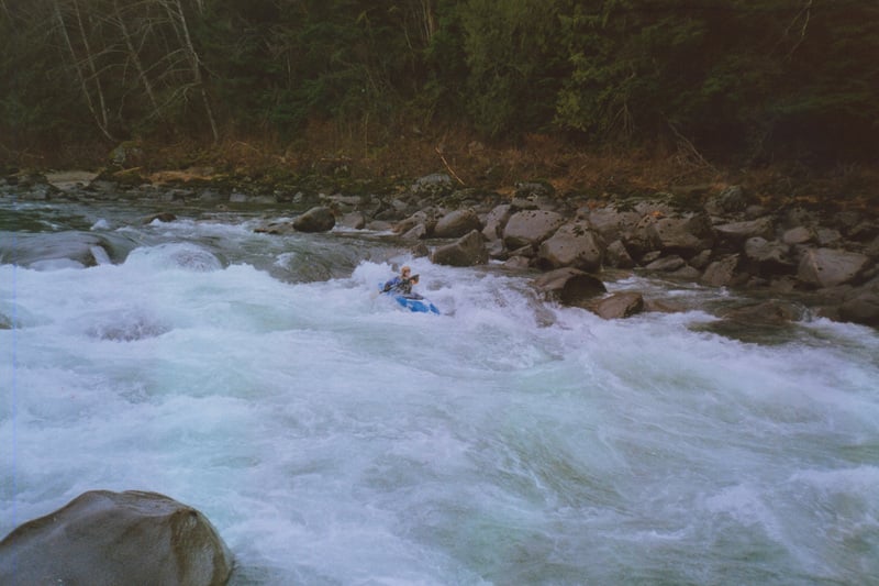
Boulder Drop is the main rapid on the Skykomish. For many boaters in the region, it is the first class IV rapid they run. There are several different lines depending on flow and skill. Standard lines include Ned's Needle or Airplane turn. The best scouting location is from river right. It can also be portaged on the left (hike up to the road and walk along the shoulder).
The hole is near the left bank. Take the narrow line on the left or go wide to the right. Some just drop straight into the hole.
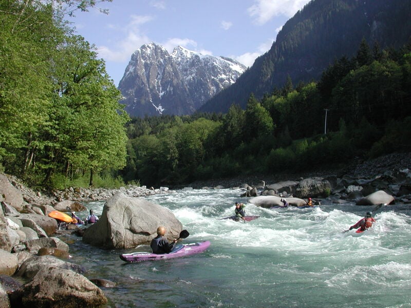
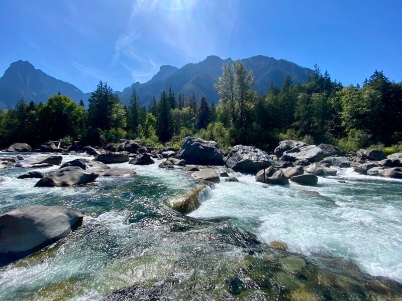
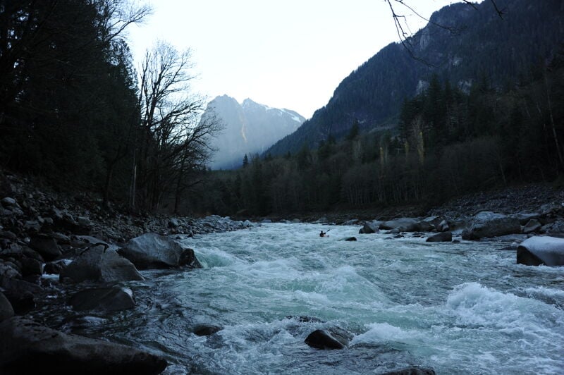
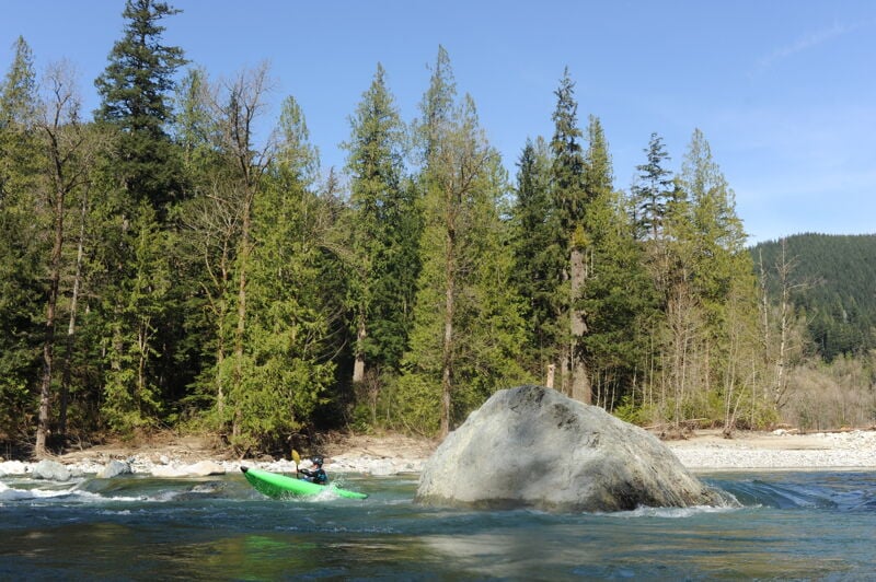
Fun rapid with a wave train that builds as flows increase. Good surf can be found at the bottom at the right flows. On a clear day the upstream view is one of the most iconic and beautiful on the Skykomish River.
A fun park and play spot on river left. The shoreline here is privately owned. The property owners are friendly to boaters but have requested that boaters walk along the shoreline to access the feature or exit their boats to spend time on the shoreline or use the area as a toilet. Please only access this feature from the water.
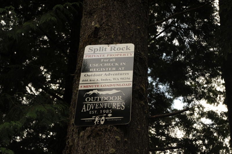
![Split Rock - Access [Private]](https://images.americanwhitewater.org/photo/medium/EPa28IjcEx96EGdg9Jcns.jpg)
This access point on river left has been used by the paddling community for the past several years but is privately owned. Park within the highway right-of-way on the south side of Highway 2. The small pull-out with the trail to the river should only be used for loading and unloading. If Outdoor Adventure Center is using the site for a commercial trip, please be courteous and stay out of the way. Outdoor Adventure Center has managed the access on behalf of the private landowner who has a few expectations that include the following:
\* take the shortest path to the water and avoid walking upstream to access the Split Rock feature by land (access to river features should be by water and paddlers must avoid creating new social trails along the bank and avoid approaching the private residence),
\* refrain from using Split Rock as a bathroom,
\* consider using Big Eddy as a meeting point for trips where a bathroom and parking is available to consolidate vehicles,
\* avoid bringing dogs onto the property,
\* avoid lingering (exit the river, run shuttle, load boats, and depart the area as quickly as reasonably possible) to avoid the appearance of this being a public river access or picnic site,
\* respect commercial outfitter operations during the summer rafting season when Outdoor Adventure Center is actively using the site,
\* do not use the access site for commercial activity (e.g. paid kayak instruction),
\* fill out a liability waiver with Outdoor Adventure Center on an annual basis.
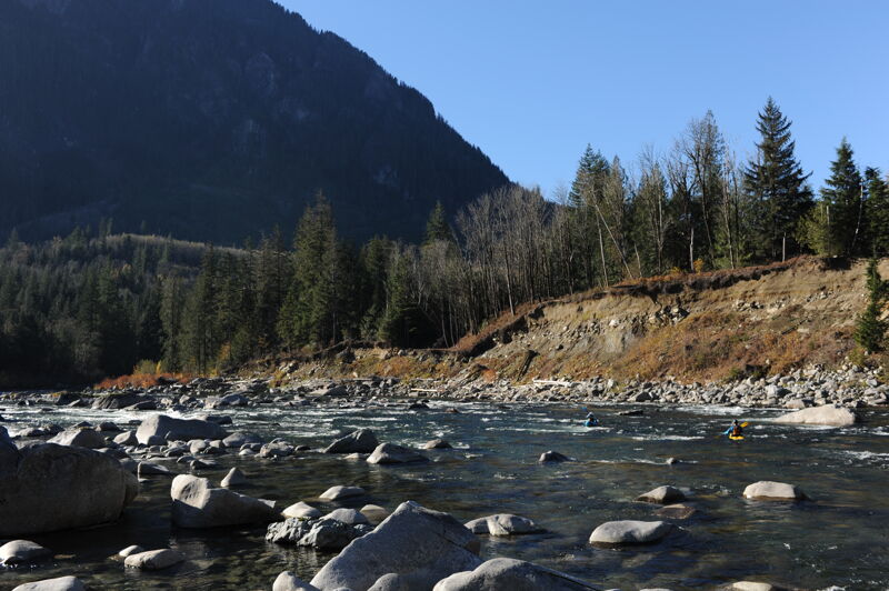
The access at the railroad bridge is privately owned by BNSF but has been used as an access on river left. It's a short steep climb up under the left bridge abutment to a pull out along the highway. The access is at Highway 2 mile 32.5.
Apr 4, 2026
It was a great weekend for the Collegiate Whitewater Festival, with beautiful weather and optimal flows on the Skykomish River. The event brought together 77 racers and 45 volunteers for a fantastic day on the water.
The intermediate race ran from Confluence to Boulder Drop, while the advanced race covered the stretch from Boulder Drop to Split Rock. The day concluded with awards and prizes at the River House in Index.
Aug 21, 2025
Put in at the South Fork Skykomish Bridge and made it down to Big Eddy. River was low and occasionally bottomed out, but didn't ever have to walk more than a few feet. Much lower and I think you'd end up having to walk some shallow sections. Great Day!