Snoqualmie
Snoqualmie Falls to Fall City(Powerhouse)

| Difficulty | II+ |
| Length | 7.2 mi |
| Avg Gradient | 15 fpm |
| Gauge | Snoqualmie River Near Snoqualmie, Wa |
| Flow Rate as of 1 hour | 688 cfslow runnable |
| Reach Info Last Updated | September 24, 2024 |
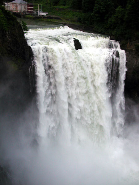
The Snoqualmie River takes a spectacular plunge at Snoqualmie Falls where over 1 million tourists come each year to check out the view; paddlers come to enjoy some of the most convenient river segements for training and instruction. This is a great river for beginning paddlers learning the sport and a convenient spot for a quick boat demo. The river starts with a short 1 mile class II+ section of whitewater and then tapers off to class I downstream of Fall City. The river has dependable flow throughout most of the year.
The Snoqualmie River can be divided into different segments allowing paddlers to focus on a single segment or combination of segments best suited for the time available and skill of the group.
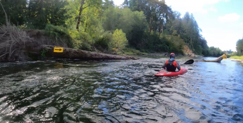
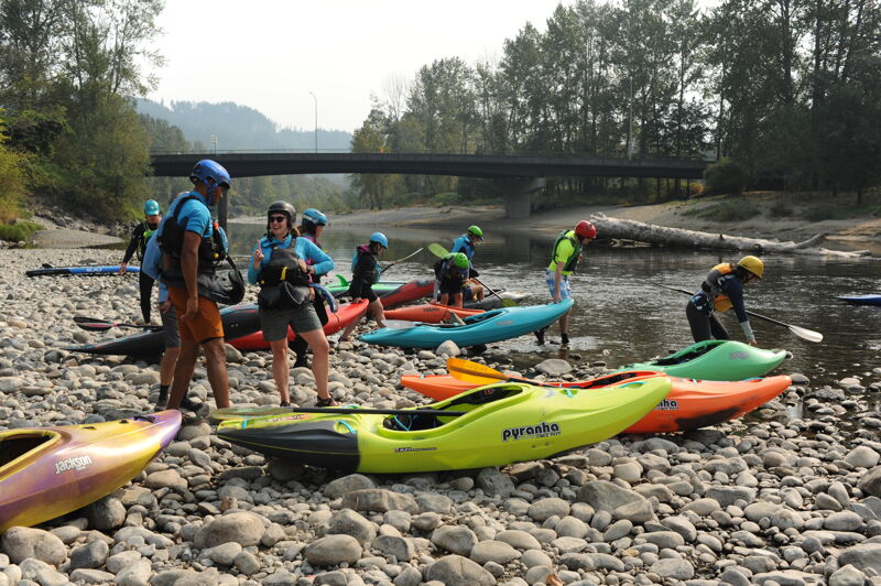
Snoqualmie Falls Powerhouse to Plum's Landing, 1 mile, class II+
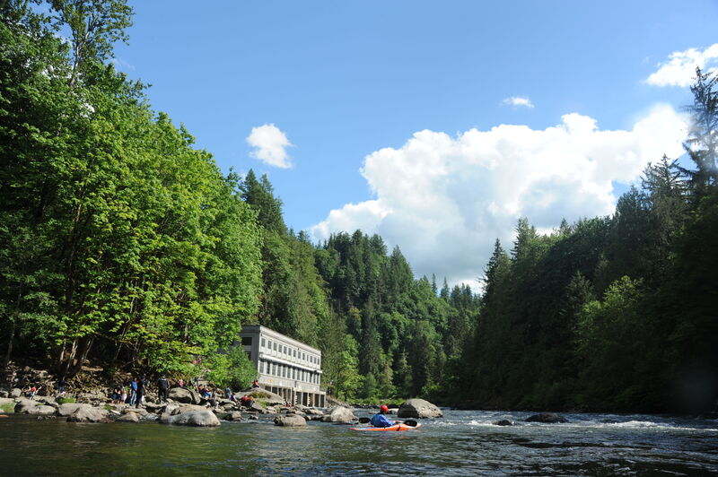
The best rapid is on the river is on the upstream side of the powerhouse. A generous eddy here is well suited to group instruction, and otherwise known as the Training Pool. Once paddlers have had a few sessions on flatwater (availabe on the segments downstream of this one), this is a great place to begin learning in moving current. Paddlers start out on the eddy on river right and can then start practicing peel outs and ferry moves in one of a couple good jets. Over towards river left a fun surfing wave develops, the best on the river, that provides quick learners with a fun challenge. The nice thing about this section is that as long as the river is at medium flows or below it's fairly easy to collect up swimmers who miss their roll. Over the years Puget Sound Energy has made it more difficult to access the river upstream of the powerhouse in response to safety concerns from the Federal Energy Regulatory Commission that hikers were accessing the shoreline immediately below the emergency spillway at the base of Snoqualmie Falls.
Continuing on downstream past the powerhouse the run enters a short section of more consistent gradient and sustained current. Pass by
...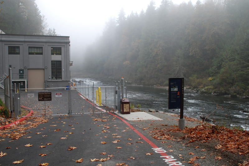
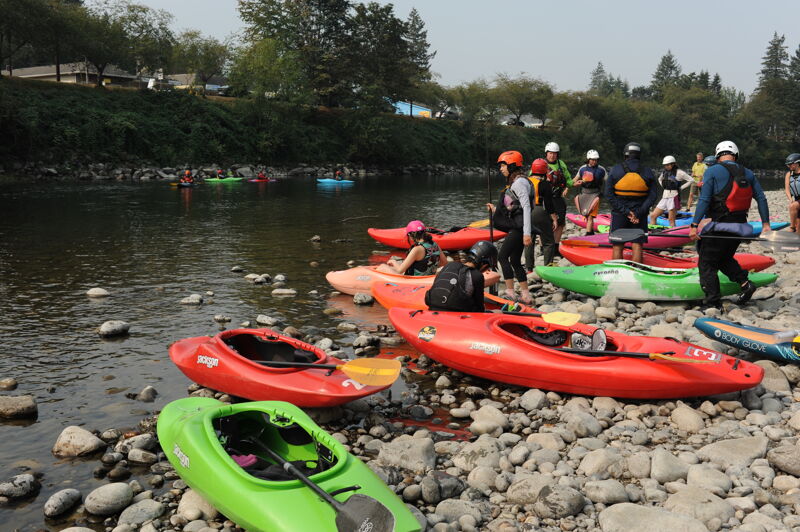
Access for the Powerhouse Run is available at the Puget Sound Energy Powerhouse on river right below Snoqualmie Falls as a condition of the hydropower license. It is located at USGS river mile 40.0. It is freely available to the public during the day. At mile 24.1 on Highway 202 (just east of Fall City) turn onto 372nd St. Follow this 0.2 miles to the junction with SE Fish Hatchery Rd. Follow SE Fish Hatchery Rd. east 0.5 miles along the river and park in the lot outside the powerhouse gate. Hike your boat down to the powerhouse.
A trail behind the powerhouse leads to a boardwalk and a trail to access the Training Pool and the best play wave on the run; in 2002 FERC's safety office ordered the utility to close this access, and the boardwalk has since been reconstructed making it more difficult to get to the river. FERC instead has ordered the utility to redirect paddlers to the downstream side of the Powerhouse for 'safety' reasons which unfortunately cuts off some of the best instructional features on the run. In the past you could also easily access the pool at the base of the falls and paddle the most challenging rapid from this pool to the Powerhouse.
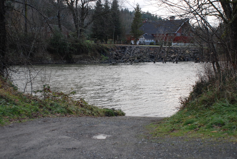
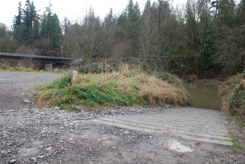
This is the standard take-out for the Powerhouse Run and also a put-in for the reach that continues down to Fall City and is very popular with tubers and can get extremely crowded on hot summer days. It is located on river right. To reach the access head east from Fall City to mile 24.1 on Highway 202 and turn onto 372nd St. Follow this 0.2 miles to the junction with SE Fish Hatchery Rd. The parking area at the Tokul Creek confluence is often referred to as Plum #1. Continuing downstream 0.2 mile on SE Fish Hatchery Rd. takes you to a second parking area and the primary Plum Access that has a concrete ramp. These access points are WDFW facilities that requires a Washington State Discover Pass. Located at USGS river mile 39.4.
Zurfleuh access on river left just upstream of the Raging River Confluence. This is a WDFW facility that requires a Washington State Discover Pass. Located at USGS river mile 36.3.
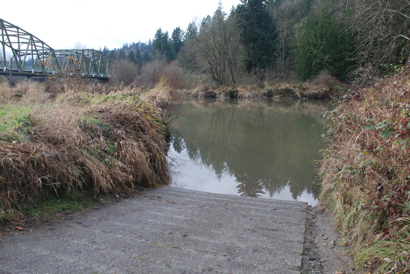
This is a popular access point serving as a take-out for the extended Powerhouse Run. The standard access is now on river right just past the Highway 202 Bridge. Previously the river left access was the standard take-out but more parking is available on river right. USGS river mile 36.1.
Access on river right in Duvall from Taylor's Landing Park. It is accessible off the highway at the south end of town. Located at USGS river mile 9.6.
This access is along Neal Road on river right. This road is blocked near the north end. You can drive to the ramp from the south end. It is a short walk of 100 yards on the north end. This is a WDFW facility that requires a state access permit. Located at USGS river mile 33.0.
Access on river right just upstream of the Tolt River confluence and on the downstream side of the NE Tolt Hill Road Bridge. Located at USGS river mile 25.0.
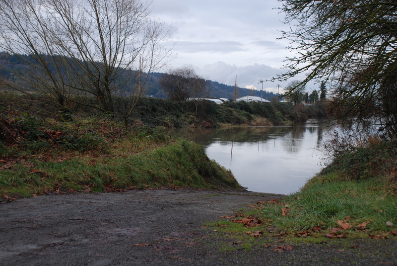
Access on the downstream river right side of the Crescent Lake Road bridge. This is a WDFW facility that requires a state access permit. Lcoated at USGS river mile 2.7.
Sep 17, 2024
Preparing for a beginner float, we paddled the section between the Plum Landing #1 (Tokul Creek) and Fall City Community Park, because I saw warning signs in the Plum Landing #1 parking lot. When you get close to the southwest corner of the golf course where the river bends almost 90 degrees to right, you would see warning signs on the left shore and one on the right gravel bar. You will see the big tree in the water at the bottom of a slight drop. At 541cfs, the drop is shallow, and we had to go towards left, but we could paddle over it in the middle. The right side of the log is open.
Sep 8, 2024
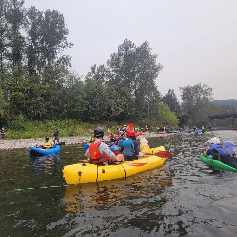
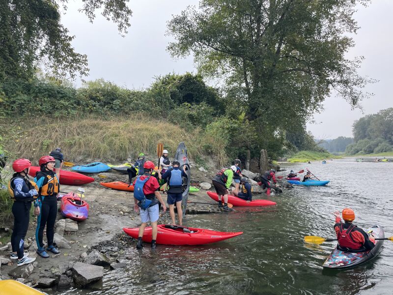
The Diversify Whitewater event was a success again this year! Day 2 we took participants down the Snoqualmie River from Fall City to Neal Road. We had kayaks, inflatable kayaks, a bellyak, packrafts, and SUPs in our crew. There were about 50 participants and 50 volunteers to make this a memorable day. We had beautiful weather and a fantastic time! The flow was about 455 cfs making it low, but still runnable.
Nov 10, 2022
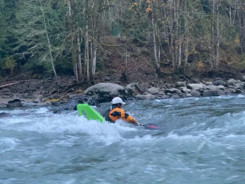
Yesterday evening (11/3/2022) three of us spent a couple of hours popping and blunting unexpectedly. Friends told me there was a great play hole with eddy service; now I concur! Textbook smooth and smiley. Dead center of the river, 50-75 meters down from the generating station. Eddies all over but great service from the river-L side. It was smooth, deep, good shoulders on both sides, easy surfing and looping, and surely washed out today as the rains are bringing things up. Play your brains out then walk back up to the parking lot. Thanks for the beta, Rich! Def on the lookout for this level again! No pix because we were too busy playing to think of it. Next time ;)
11/10/2022 we went back at 1600cfs and the playhole is still awesome (see video clip). There are also two great training surf waves above it. All is park-n-play, walkiing back up to the parking lot when it's really dark. Will keep probing and posting other playhole levels. Supposed to be good even to 1100cfs.
Sep 11, 2022
The annual Diversify Whitewater event was held on the Snoqualmie River at the park in Fall City that provides river access on river right. Jim Good organized the event that included many volunteers from the local community. We paddled from Fall City down to Neal Road, a distance of approximately 3 miles. This is a good trip for those experiencing a river for the first time and is just class I moving water. Although the flow was low, it was enough water to get down.
May 19, 2022
Last night after a lap on the South Fork I decided I still had some whitewater in me and wanted to check out the Powerhouse at 'higher than recommended' flows. Normally, I love to ferry across the river at the powerhouse and walk up the other side of the river and put in at the base of the falls. This is a convenient little loophole that allows boaters to continue to run the rapid above the powerhouse, which is the best rapid on the run by far. It's kind of wack that the PSE doesn't allow boaters to still access the pool at the falls via the trail, but this will do for the time being. Only problem, this is not really an option above 3500cfs. The currents pushing through the center of the river combined with the surging outflow of the powerhouse make the ferry practically impossible and the scramble up the river left bank would be pretty ghetto.
The gauge was running at 5300cfs, and I don't think this should be considered 'above recommended' at all. At this flow the river gives a big water feel, with choppy waves and massive eddylines (the one at Tokul Creek was rip roaring!). The rapids are basically just big wave trains, the largest being the one about halfway down with the big boulder in the middle. There were a couple fun little holes in this rapid but as a general rule the rapids tend to wash out a lot at this flow. Less technical skill building than standard flows but a lot of bracing practice for beginners. It's nice that the road to the boat launch a few hundred yards downstream of the standard takeout is open again so the last rapid around the corner is more in play. With a couple solid boaters to tag along with, I'd say this is still a great class II/II+ run at this flow!
Oct 11, 2012
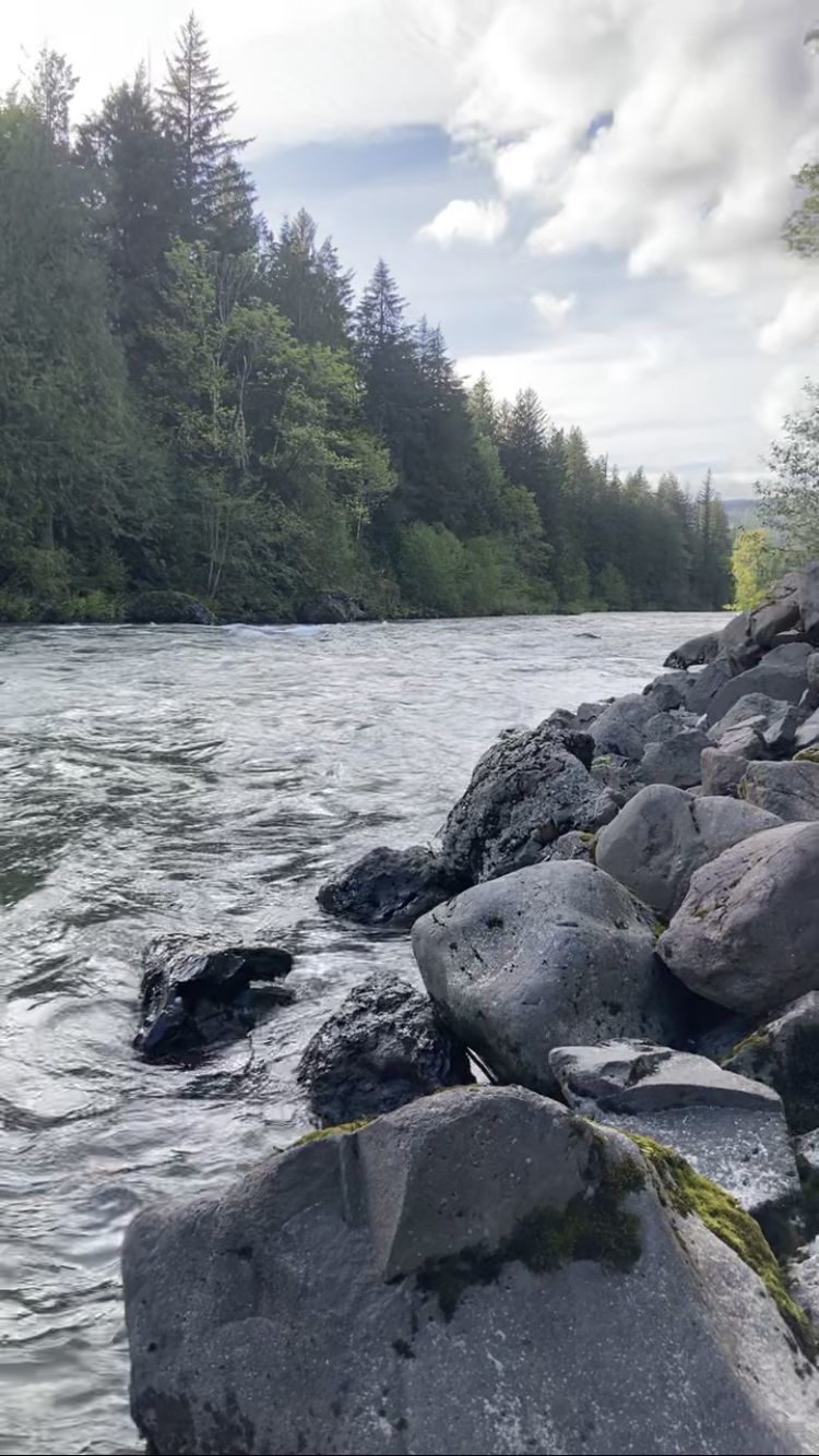
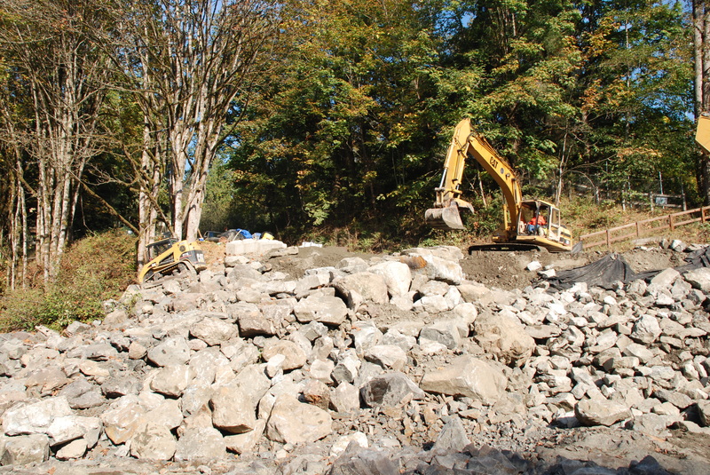
Construction of the new access point at the Powerhouse under construction. The rip rap downstream of the powerhouse is being configured to better facilitate access down to the river. American Whitewater provided input on the design for this project to address the challenges of getting down to the river over the irregular rip-rap that was challenging to navigate while carrying a boat.
May 6, 2007
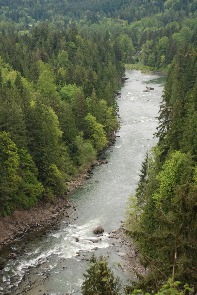
View of the Powerhouse Run from above on river left from the train. The run starts with the first rapid visible, passes by the powerhouse (located on river right) and continues through 3 more rapids before turning the corner to the left and hitting a final rapid just before the take-out.