Sol Duc
4. Bear Creek to Hatchery
| Difficulty | III |
| Length | 6.2 mi |
| Avg Gradient | 27 fpm |
| Gauge | Sol Duc R. Nr Quillayute |
| Flow Rate as of 1 hour | 15.39 ftbelow recommended |
| Reach Info Last Updated | December 3, 2024 |
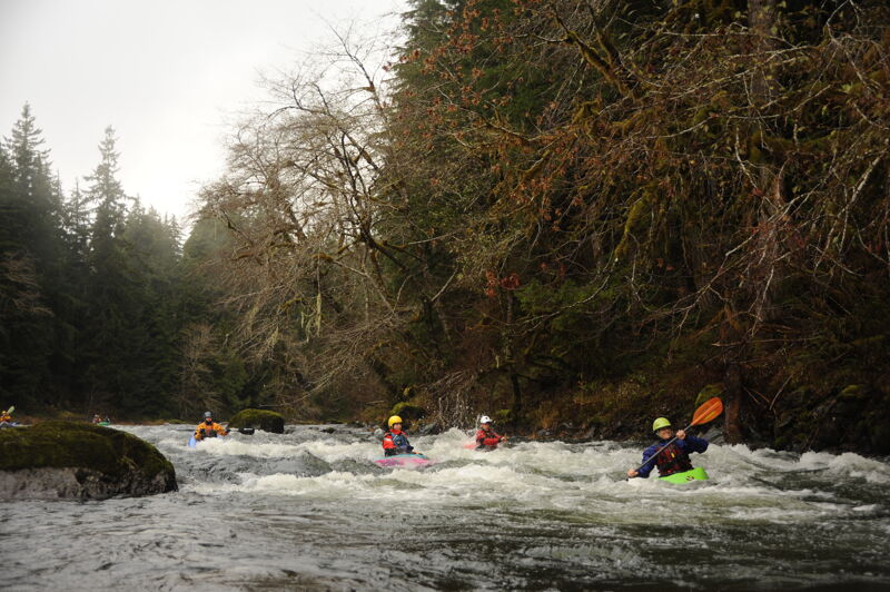
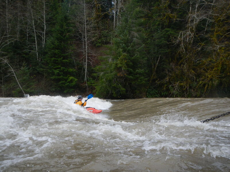
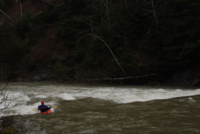
The Bear Creek run on the Sol Duc River offers Class III boating through boulder gardens, with multiple routes at lower flows and exciting waves at higher flows. Fed by winter rains, the river is typically best from October to April. High flows create abundant catch-on-the-fly surf waves, making it a great option when other creek runs are too high—provided you have the necessary skills for safe navigation.
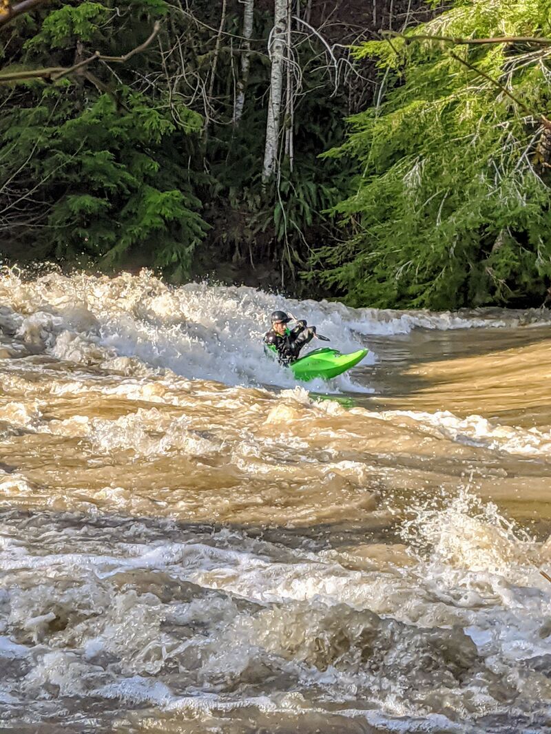
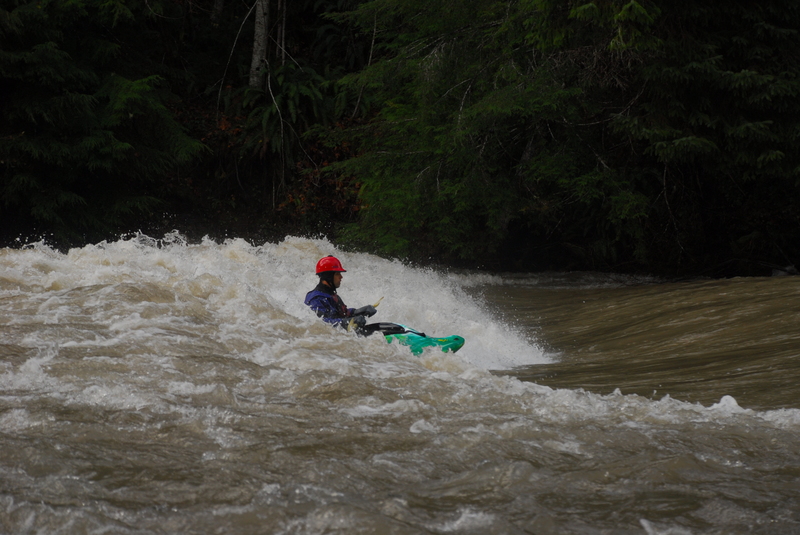
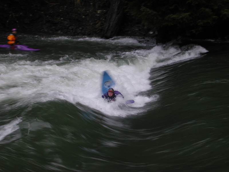
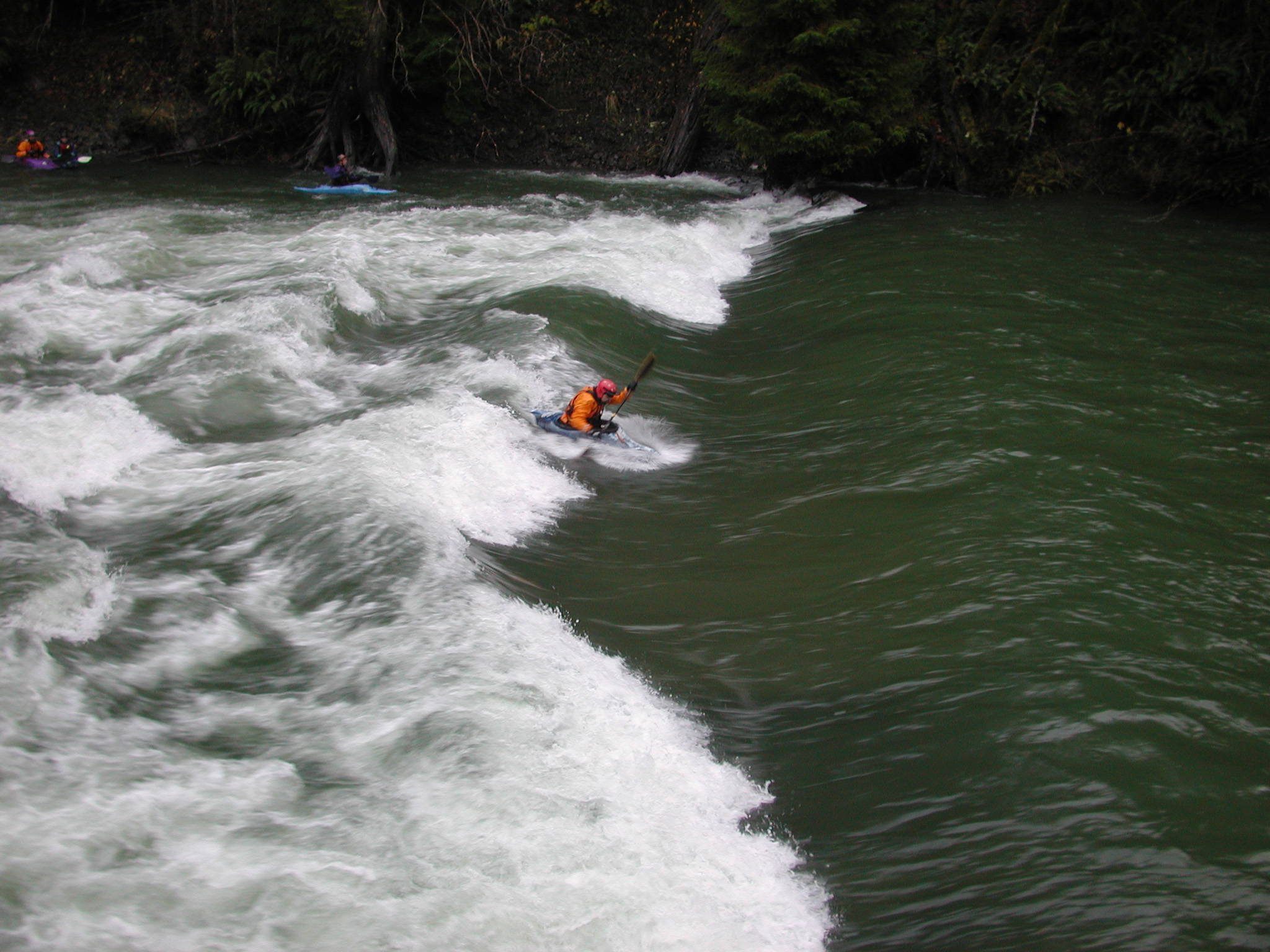
The run ends at the Sol Duc hatchery, where a river-wide weir diverted water into the hatchery, forming a spectacular park-and-play feature at high flows (~10,000 cfs), known as the Mosh Pit. The weir was destroyed during a flood, and its remnants were removed in the summer of 2022. A new weir is planned for construction by 2027, featuring a longer ramp to ensure smoother river hydraulics while reducing scour and adverse currents. It remains unclear whether the new structure will create optimal conditions for surfing at high flows.
Access Logistics:
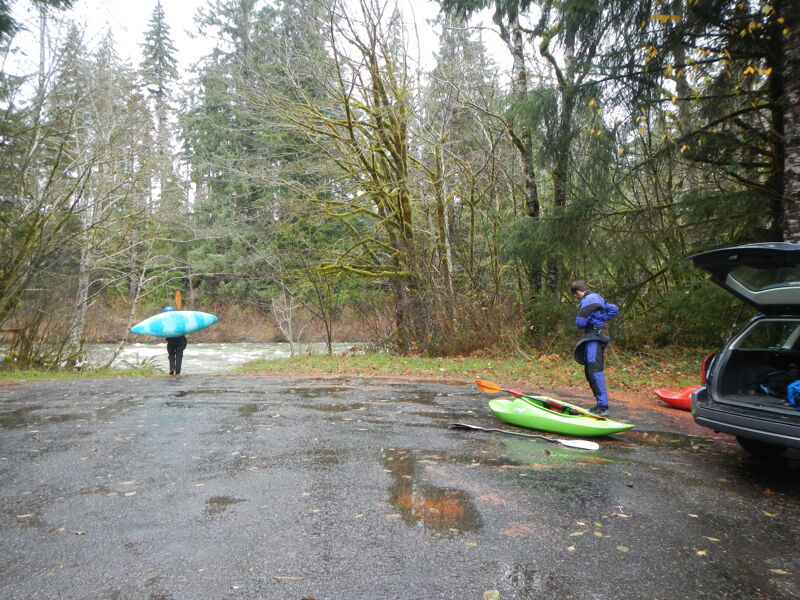
For those wanting to do the full run, turn off onto Hillstrom Road at Highway 101 mile 206.3 (this is just east of Bear Creek). Follow this road half a mile down to the put-in at the boat ramp. To reach the takeout from the put-in continue west on Highway 101 to mile 203.5 and turn south on Mary Clark Road and then turn immediately west on Pavel Road towards the State Salmon Hatchery. Follow Pavel Road 1.3 miles to the Sol Duc hatchery and pull into the first parking lot on your right and take the boat ramp down to the river.
for additional information see
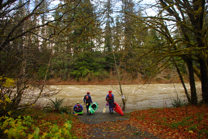
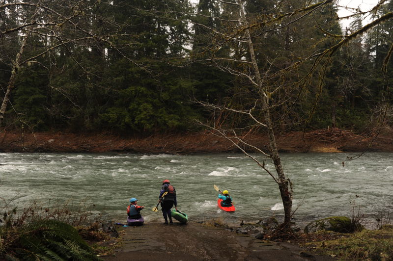
To reach the put-in, travel to Highway 101 mile 206.4 and turn south on Hillstrom Rd. and follow it to the boat launch access. The site features a short paved ramp to the river's edge that is suitable for rafts. Parking is available adjacent to this access point. The site is managed by Washington Department of Fish and Wildlife and requires a Discover Pass. This access is located at approximately river mile 36.8.

Located at river mile 30.9 on the Sol Duc River where the hatchery weir creates a large standing wave providing great surfing when rivers are high and nearing or exceeding flood stage. Use caution at the higest flows when trees and other debris are floating down the river. Unfortunately, a flood destroyed this feature and the remaining portion of the weir has been removed but it is planned for reconstruction by 2027. It's unclear if the new design will form the features paddlers knew as the Mosh Pit.
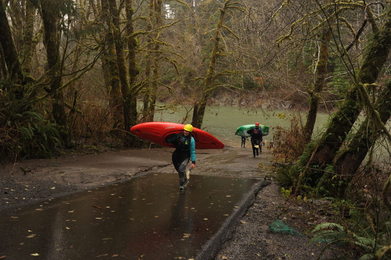
This access point is adjacent to the fish hatchery and managed as a formal river access by WDFW. A WDFW Access Pass or Discover Pass is required to park at this site which has a paved parking area with pull-through parking for trailers and a paved ramp that accesses the river. There is also a toilet at this site. This access is at approximately USGS river mile 30.8.
Apr 19, 2026
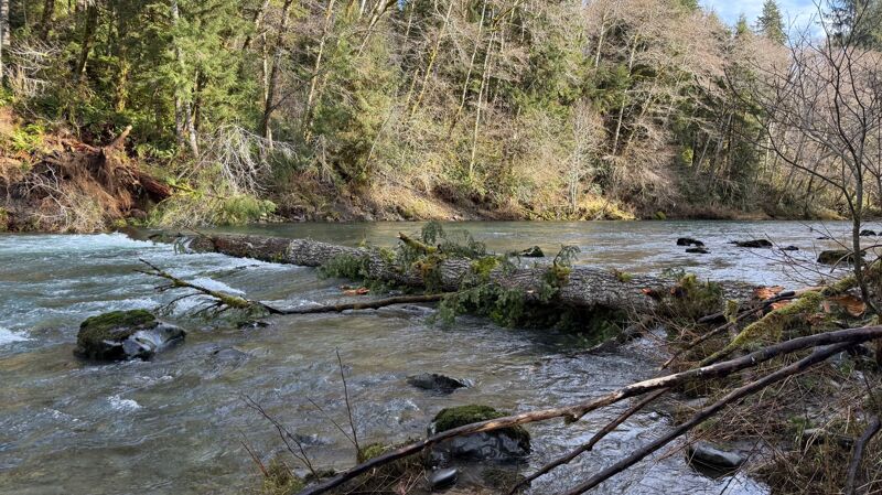
Three packrafters out for the day, put in at the Klahowya campground around 11:25am and took out at the Fish hatchery at 5:15pm (6ish hours) including a lunch break (14.5 Miles). Sol Duc R. nr Quillayute Gauge was at 17.36 feet ‘low runnable’. A fun day in the spring sun, although at this flow level, the river is a bit bony in places. The main river spanning wood noted in a prior report, could be floated over on river right and can be scouted from the gravel bar on the left. the rapid at (48.06500, -124.26575) however, was too low and bony, for passage on the upper section, but a short portage, on river right, allows you to enjoy the lower section of the rapid.
What remains of the hatchery weir is easily floated over on river left. Lots of eagles, and some kind of insect hatch with enough flying insects to mimic a hail storm at times.
Jan 21, 2026
Spanning log down river from Bear Ck quite a bit. It’s a little below the drop that has the hard right slot that bypasses where the drift boat was abandoned a couple of years ago. Above the long drop just above the 1st 101 bridge on this river section. At this flow there’s enough water to float over on river right. Another ft lower and the river is going to be blocked. SolDuc Gauge ~18.5'
Nov 25, 2021
We enjoyed Thanksgiving morning on the Sol Duc with a fun paddle from Hillstrom Road down to the hatchery under misty skies. The Mosh Pit was not in but we enjoyed fun class II and III whitewater before Thanksgiving evening with friends. Boaters on the trip included Tom O'Keefe, Omar Jepperson, James Girton, Leanna Girton, and Cassia Tackett.
Feb 1, 2020
When we arrived the Sol Duc had not yet crested to 31 feet and large logs were coming down river, so we ran Riverside down to Most Pit, 14 Miles in under 2 hours and when we got back to the Most Pit the logs had subsided and surfers right, river left was friendly. Surfers left river right was sticky.