Tieton
1. Rimrock Reservoir to Windy Point Campground (Upper)
| Difficulty | III+ |
| Length | 11.6 mi |
| Avg Gradient | n/a |
| Gauge | Rimrock Reservoir, Tieton River |
| Flow Rate as of 7 hours | 409 cfsbelow recommended |
| Reach Info Last Updated | August 25, 2024 |
The Okanogan and Wenatchee National Forests encompass more than four million acres and are jointly managed with headquarters in Wenatchee, Washington. The rivers flowing through these forests are essential to the whitewater paddling community—both as close-to-home runs for Washington residents and as classic objectives for paddlers traveling from across [...]Read More
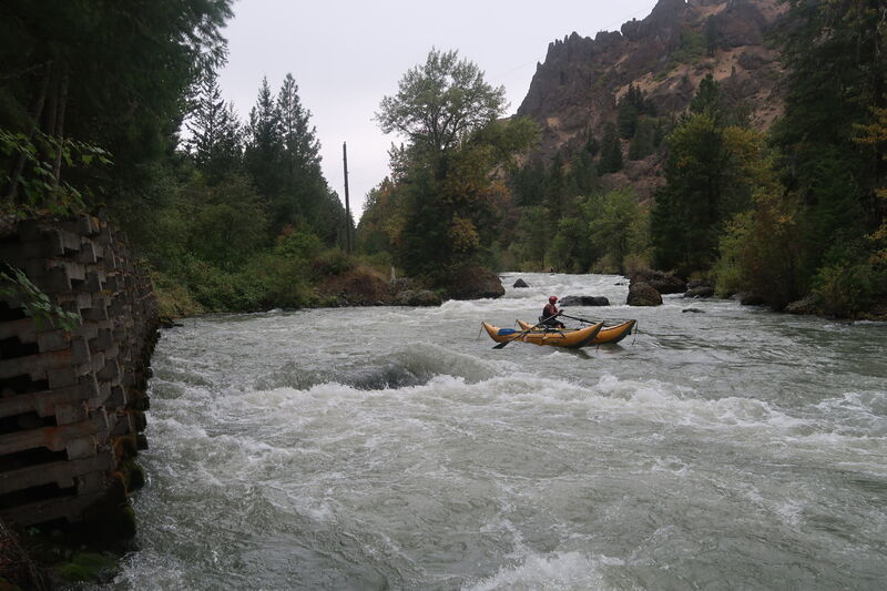
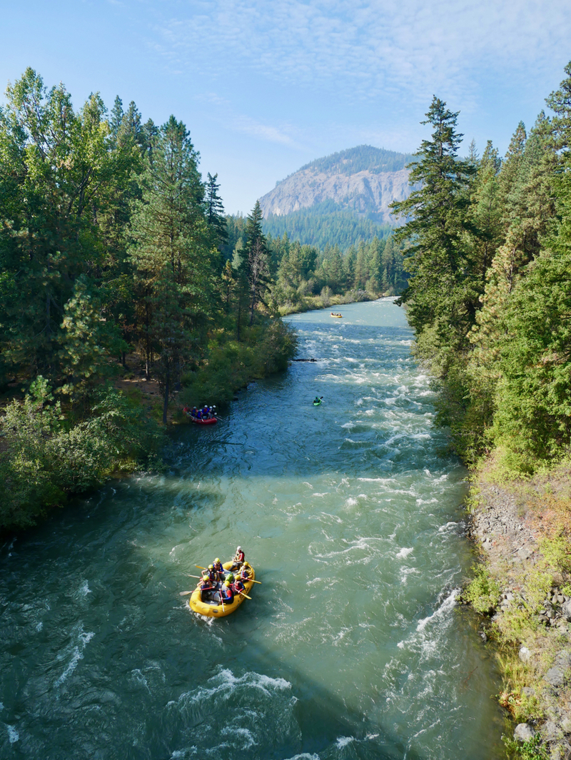
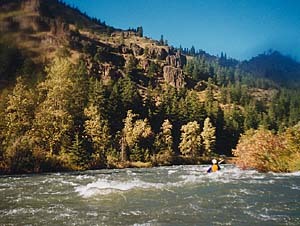
Busy raft traffic, a highway paralleling the river, and the flush of a dam release with few eddies make this a run many might pass up. As one of the few places with dependable whitewater in the waning days of summer, however, boaters from across the state converge on this popular late summer run. The river comes to life with the annual flip-flop typically occurring on our around the weekend after Labor Day. At that time, flows from the upper Yakima reservoirs are reduced for the benefit of spawning salmon and flows on the Tieton are increased to serve irrigation interests downstream providing good boating through much of September. The Tieton is also often boatable from mid-May into mid-July when the dam fills up and spills inflow. The canyon is beautiful and the water comes at a time of year when decent whitewater can be hard to find making it the last summer run for many.
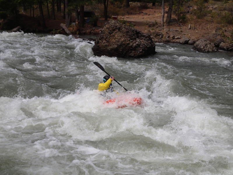
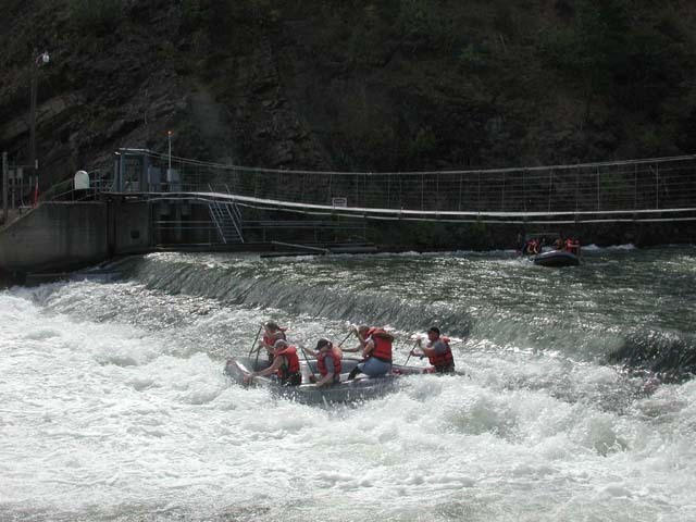
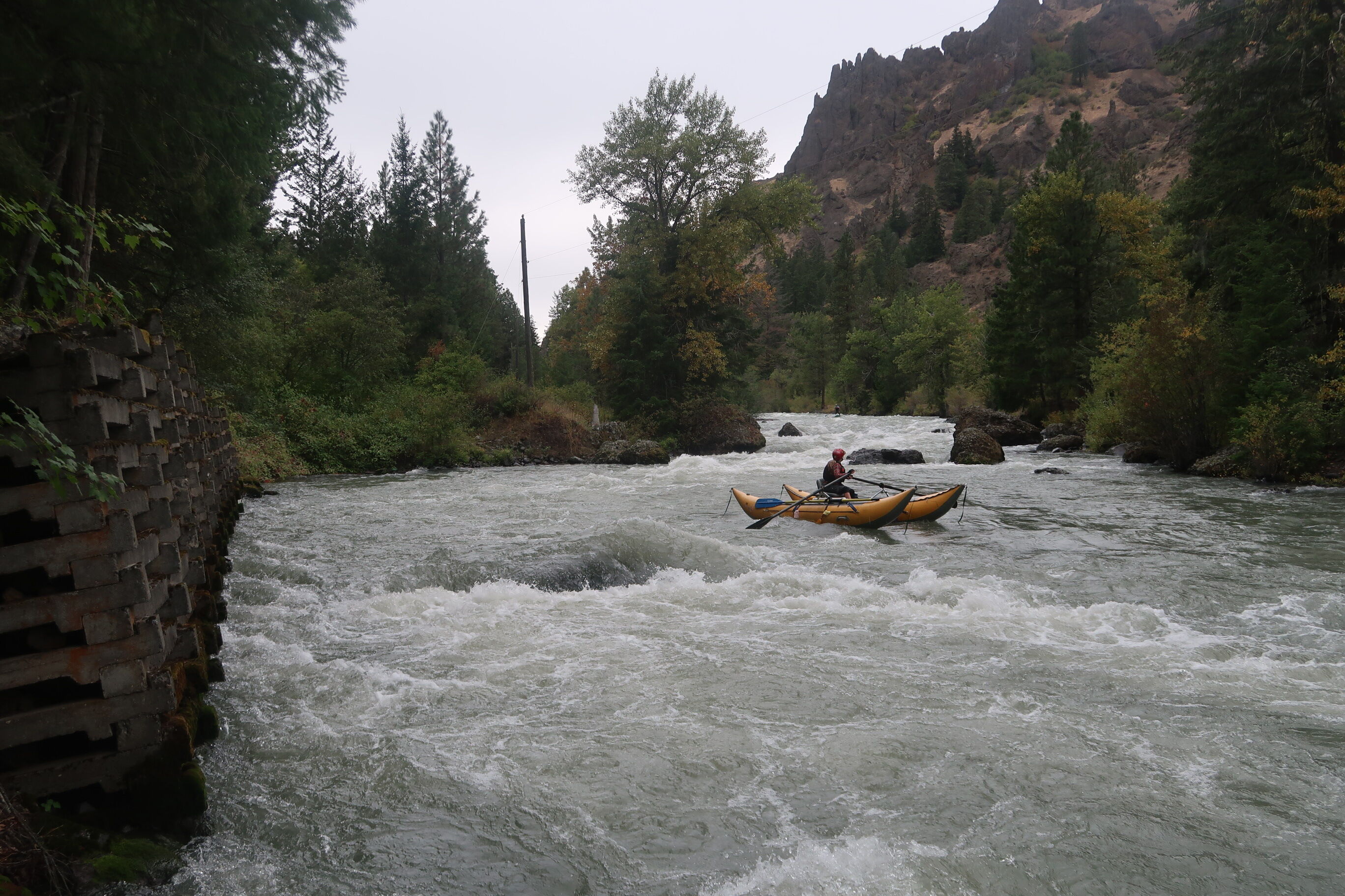
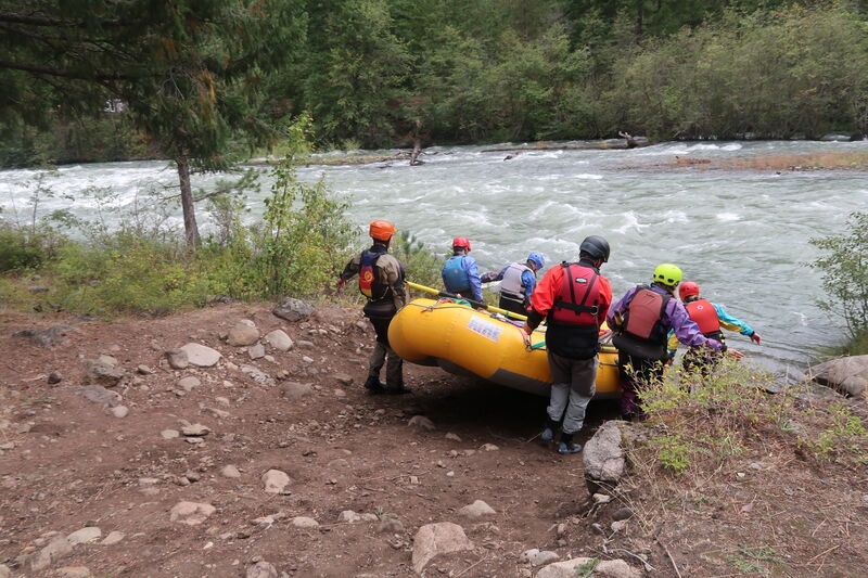
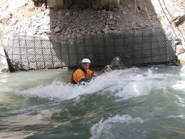
Most of the run is continuous class II and III rapids. This is not, however, a great beginner run. Lots of brush along the banks and the continuous nature of the run present a real challenge for those with less than solid boating skills. Rescues can be difficult so be sure to go with a strong crew. The first half of the run is characterized by fast water through shallow boulder gardens. The pace begins to change slightly with the approach of a low-head dam about halfway through the run. The dam is well marked by signs on river left at 1000' feet that can be seen from the road (most easily when driving in the downstream direction) near mile marker 172. A couple smaller side channels appear here, but the best option is to continue with the channel containing most of the flow as it heads towards river right. Those with solid boating skills should have no problem pulling out on river left once the dam is in sight. The dam can be run, but there are a couple of spots that wouldn't be much fun so if you have any doubts take the conservative route along the portage trail on river left. This is a
...
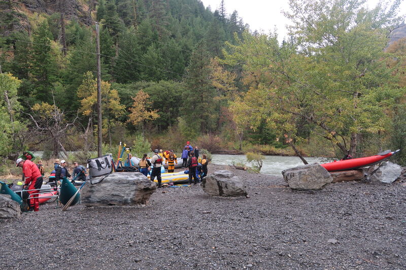
The most convenient put-in is at mile 166.6 along Highway 12.
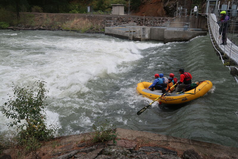
The dam is often run but it is also regularly portaged. Get out and take a look at it if you are not familiar with the line.
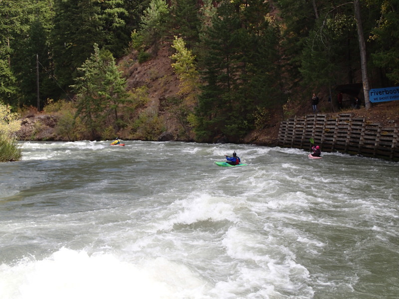
A fun surf wave under the bridge behind Trout Lodge.
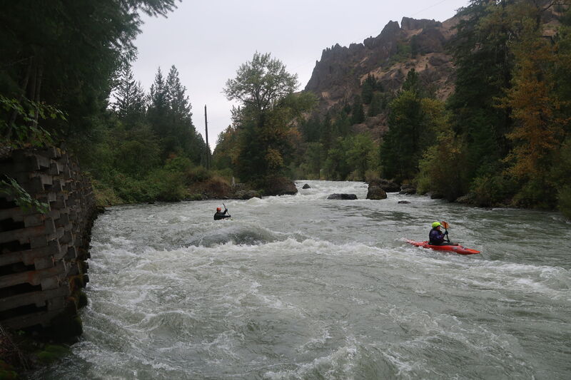
Fun rapid recognized by a retaining wall on river right.
Take out at the downstream of two bridges on river left at Highway 12 mile 177.1.
Aug 20, 2024
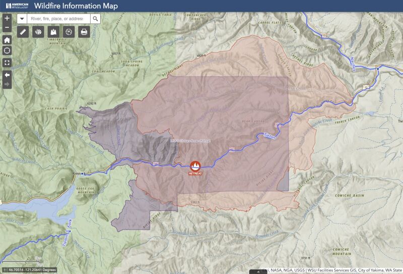
As a result of the Retreat Fire the Forest Service has instituted Closure Number 06-17-08-24-22 that encompasses 81,391 acres along the Tieton River from Tieton Road that includes the put-in for this run. This closure effectively prevents access to the Tieton River and will likely extend through the 2024 Tieton whitewater season during draw down of Rimrock Reservoir. This Order is effective August 20, 2024, through October 31, 2024, unless rescinded sooner.
In May 2022 the Regional Forester issued a Leader's Intent letter directing the Regional Leadership Team to 'reduce extended wildfire closures.' American Whitewater is engaged in policy discussions at the regional and national level to ensure that risk mitigation measures other than closures are fully evaluated.
The map can be accessed at this link: < https://arcg.is/1OKDmS0 >.
Sep 15, 2019
A family weekend trip to the Tieton River.