Tye
2. Alpine Falls to Beckler River (Lower)
| Difficulty | IV+ |
| Length | 7.5 mi |
| Avg Gradient | 60 fpm |
| Gauge | South Fork Skykomish River at Skykomish, Wa |
| Flow Rate as of 18 minutes | 375 cfsbelow recommended |
| Reach Info Last Updated | December 27, 2025 |
The highlight of this run is a short but excellent stretch—less than a mile—of high-quality class IV that holds water longer than many other runs in the Skykomish drainage. While brief, it packs in several memorable rapids and lends itself well to hot laps, with roughly 15-minute laps possible using a river-left shuttle. Other runs in the Skykomish watershed offer longer or more continuous whitewater, but this section is well worth a visit if you’re looking for something new or want to add another lap after running one of the area’s classic routes.
The full 7.5-mile run can be broken into the following sections:
Alpine Falls to BPA Powerline Crossing, 3.3 miles, class II braided channel
Unless you enjoy running significant drops with severe consequences for mistakes, most boaters will put in at the base of Alpine Falls. Although this V+ falls has been run, it features a very difficult entrance and multiple hazards that demand precise execution. Follow the trail down to the base of the falls and avoid putting in at the Highway 2 bridge.
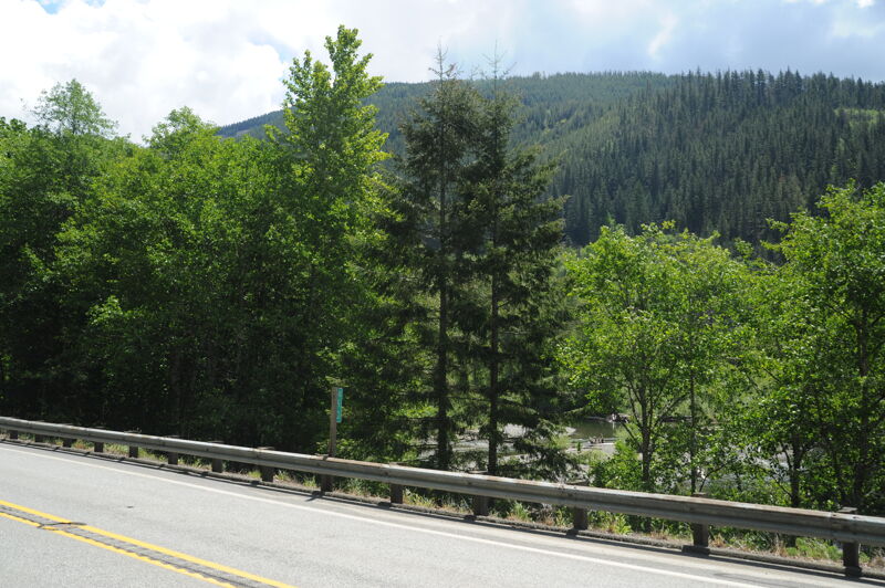
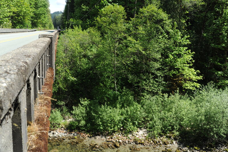
Below the falls, the river is scenic but offers a couple miles of mostly class II+ water before reaching the main whitewater. Despite the modest rating, this section is not suitable for beginners. Wood hazards are common and can easily push the difficulty up a grade. Portions of the river are visible from the road, and the unseen stretches are similar in character to what you can observe from Highway 2.
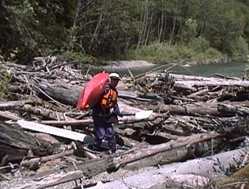
Just downstream of Highway 2 at mile 53, the character of the river changes noticeably. Boaters who want to skip the float from Alpine Falls can access the river here for a shorter run. A short distance below this access, a large logjam blocks part of the channel at an island. As of June 2001, the jam appeared stable and conveniently prevents wood from reaching the rapids downstream, but if it were to break loose it could create serious hazards in the boulder gardens below. Expect a sho
...
This access is at Highway 2 mile 55.3 at a large pullout on the downstream river left side of the bridge across the Tye River. This site is a day-use area for Alpine Falls although it is not signed or marked as such. A trail provides access to the base of the falls where you can put-in. Most opt to skip the three mile class II section and just put-in immediately upstream of the start of the class IV rapids.
Access on river right from Highway 2 located downstream of the class II section and a segment that has consistently collected signficant wood.
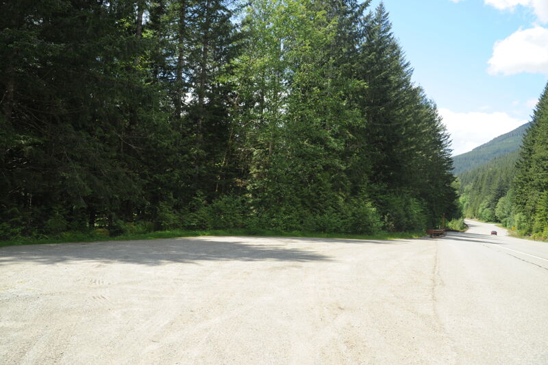
An access on river left, on Forest Service land along the Old Cascade Highway, can be used for quick laps on the prime whitewater segment. To reach this access, turn onto Foss River Road from Highway 2 at mile 50.6. Follow the road for 1.2 miles, crossing the Foss River bridge. Immediately after the bridge, stay left onto the Old Cascade Highway where Foss River Road makes a hard right turn. Follow the Old Cascade Highway 0.9 mile upstream to a “Private Road — No Turn Around” sign, where the river bends away from the road.
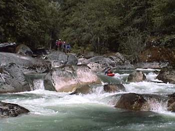
The first of the class IV rapids that can be boat scouted at moderate flows.
A slightly longer rapid that can be boat scouted at moderate flows.
Mind Bender is a challenging class IV+ rapid with congested sections among large boulders and several nice ledges split into roughly three sections extending for a couple of hundred yards. At moderate flows skilled paddlers can boat scout this rapid.
This access on river left is located at the junction of the Old Cascade Highway with the Foss River Road, Forest Road 68, where the road is close to the river on Forest Service land. This can be used as a take-out for short laps on the primary whitewater segment of the Tye River. To reach this access turn on to Foss River Road at Highway 2 mile 50.6. Follow this road 1.2 mile, just after crossing the Foss River Bridge, and stay left on the Old Cascade Highway where the Foss River Road makes a hard turn to the right. This junction is the access point.
Paddlers who start out on the Foss River can join the Tye River here. Note that all the land at the confluence is privately owned.
Use this access to avoid the two miles of class II down to the Beckler confluence. Access is available by scrambling up the bank at the Highway 2 bridge at mile 51.0. A small parking spot for a vehicle or two is available a short distance east on Highway 2 from the bridge.
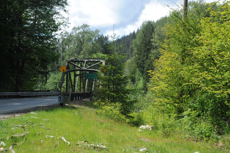
The Tye River joins the Beckler River to form the South Fork Skykomish River immediately upstream of the Highway 2 Bridge. This access is on the upstream river left side of the bridge at Highway 2 mile mile 49.8 which has space to park a car off the highway.
May 13, 2020
This run is getting more attention as of late. Put in is about a mile up a single lane potholed road along the Tye river.
There is a sign that says 'private road no turn around' and the river bends away from road. Put in here. The take out is at the road junction with the FR68 Foss road. The run is barely a mile long, pool droppish, and has some great boofs. There is a lot of wood hanging in from the banks and a couple class V penalty boxes, though the overall difficulty remains class IV. For first timers it's wise to scout carefully, or go with someone who knows the lines. Levels can greatly effect the difficulty. The Tye typically holds water late into the season, so this can be a great option when other local creeks have dropped out. Laps are easy, no hike in or off and hot laps can take less than 15 minutes. And of course there is always the option of extending runs downstream.
Apr 7, 2006
DO NOT put in at the base of Alpine Falls unless you really like flatwater paddling. You're looking at a small amount of class II followed by 2 miles of slow moving, braided channels. In addition you get one large nasty log portage.
The class IV+ stuff is a lot of fun, but access this section from the Foss River Rd. or from Highway 2 when you first see the river after passing Foss River Rd.
Take out at the confluence with the Foss, or at Highway 2 to avoid more flat water/ class II.
Jun 16, 2001
We put-in at Alpine Falls. The first part was a little slow (you wouldn't miss much by putting in further downstream where the river nears the road). After portaging a big log jam we came to a section with some great IV/V boulder gardens. We paddled down to the Beckler confluence but not much action beyond the first Hwy 2 bridge that comes shortly after the confluence with the Foss. The Skykomish at Goldbar was at 4000 cfs.