Wenatchee
2. Tumwater Campground to Leavenworth (Tumwater Canyon)
| Difficulty | V |
| Length | 9.1 mi |
| Avg Gradient | 64 fpm |
| Gauge | Wenatchee River at Peshastin, Wa |
| Flow Rate as of 22 minutes | 1260 cfsrunnable |
| Reach Info Last Updated | May 24, 2025 |
The Okanogan and Wenatchee National Forests encompass more than four million acres and are jointly managed with headquarters in Wenatchee, Washington. The rivers flowing through these forests are essential to the whitewater paddling community—both as close-to-home runs for Washington residents and as classic objectives for paddlers traveling from across [...]Read More
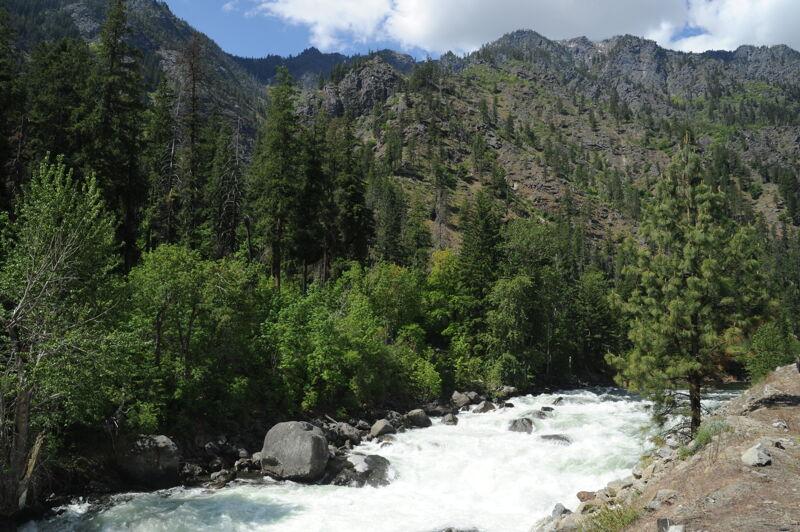
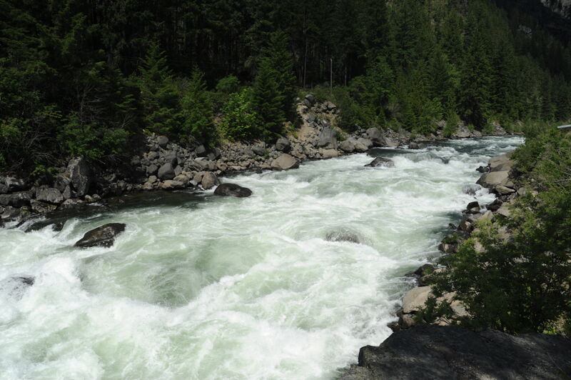
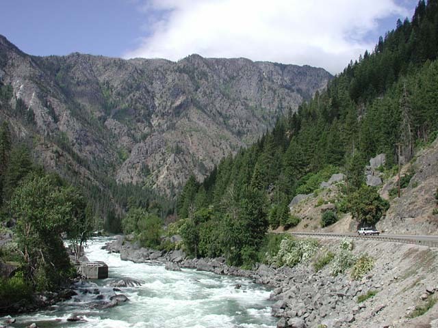
Tumwater Canyon is a unique resource for Washington paddlers providing big water class V in early summer and fun class IV late in the summer after other nearby runs are too low. The run has easy roadside access as it runs along Highway 2 and many paddlers get their first glimpse of this run during the peak of spring snow melt on trips over to the Wenatchee. At these flows the river is a chaotic maze of exploding holes and although it is run at these levels, many wait for later in the summer once other options are starting to dry up. It's a great place to be in the middle of the summer and you'll be sharing the river with sunbathers and those enjoying the swimming holes in the big pools between the rapids. With the river adjacent to the highway, it's easy to scout all the big drops. Don't forget that they are much bigger down at water level than they look from the road. If you find yourself in over your head it's always easy to shoulder your boat and hike up the road.
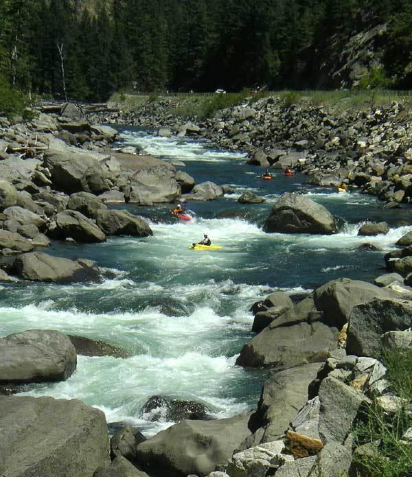
You can start a run through Tumwater Canyon from Tumwater Campground but Swiftwater Picnic Area is a good alternative access that still provides some class III warmup rapids. The action slowly builds with intermittent sections of flatwater and easy rapids as you reach The Wall which can be viewed from the road at mile 94. There are a few different lines through this drop and for the most part you just follow the main flow and treat it as read and run. It's a technical class IV+ boulder garden at lower flows and class V at higher flows. The class III runout continues down to the small reservoir formed by the old hydroelectric dam. You can see it from the road at mile 95.1. This dam was built to provide hydropower required to run the electric engines the railroad used through the tunnel at Steven's Pass. The generators have since been removed although the dam itself remains. There are a couple cabins on this reservoir and it's about a 5 minute flatwater paddle to the portage route on river left a
...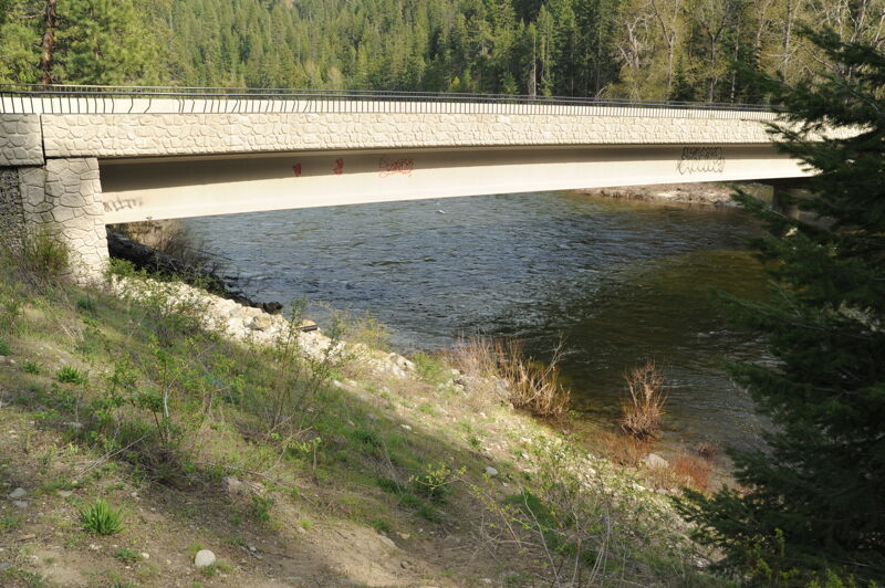
This is the most upstream put-in for those running the full length of Tumwater Canyon althought most select an access point downstream. The access is on the downstream river right side of the Highway 2 Bridge across the Wenatchee and just downstream of Tumwater Canyon. It is located at Highway 2 mile 90.3 where you turn onto Hatchery Creek Road and a short drive that provides access adjacent to the bridge.
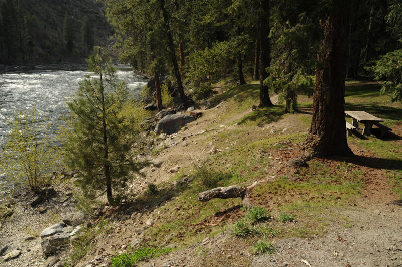
This is a standard put-in for those doing the long run through Tumwater Canyon. It is a Forest Service picnic site with a toilet and small parking area located at Highway 2 mile 92.3.
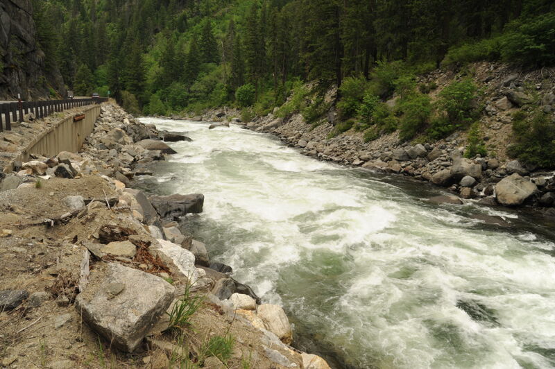
A long rapid that tapers off as you reach the reservoir held back by Tumwater Dam. Visible from Highway 2 mile 94.
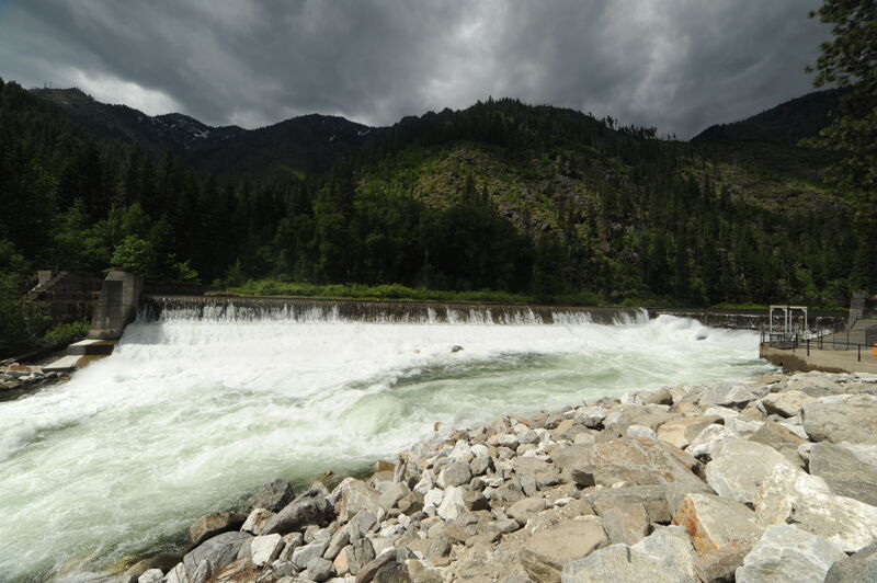
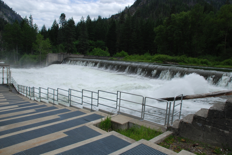
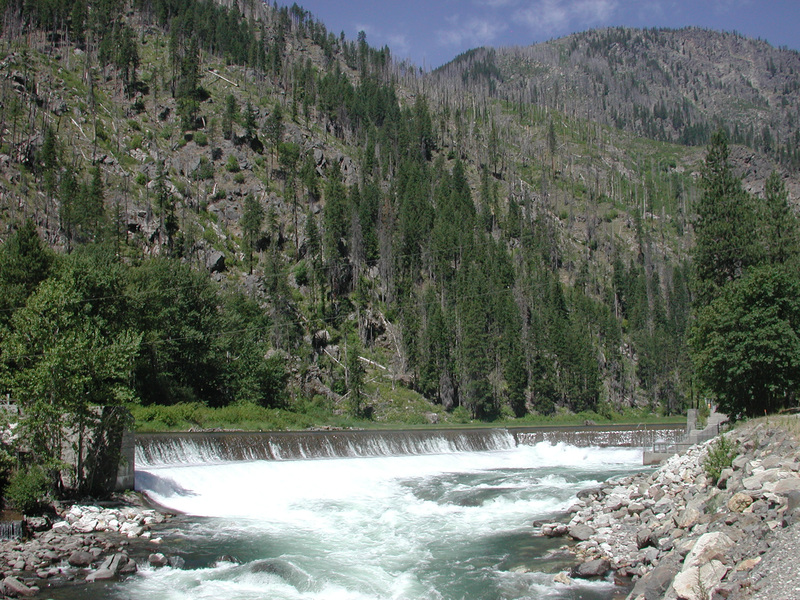
The Tumwater Dam was constructed from 1907 to 1909 was the largest hydroelectric project in the American West when it was built. It provided power for electric locomotives running on the Great Northern Railway through the tunnel at Steven's Pass. The project was closed in 1956 but the dam remains. In the past the dam was occassionally run but a project to repair and reinforce the dam's apron 2024 resulted in placement of large rocks at the base of the dam creating a hazard. The dam is located at Highway 2 mile 95.1. A small pull out and access below the dam is used as a put-in for those desiring a short run.
One of the longests rapids on the run that you can scout from Highway 2 mile 97.
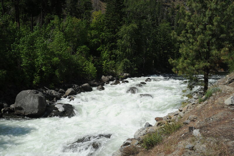
This rapid can be viewed from Highway 2 mile 97.8.
The last big drop on the run. Many portage it or take out just upstream at the pull out located at Highway 2 mile 98.5. You can also put-in below Last Exit for a short 1 mile run with fun class IV down to Icicle Creek Road Bridge.
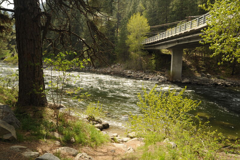
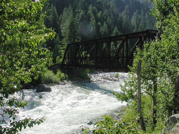
Take out on river left on the downstream side of the bridge. To reach this bridge, turn on to Icicle Creek Road at Highway 2 mile 99.1 (the west end of Leavenworth). It's about a mile up this road to the bridge. The take-out is on the downstream river left side of the bridge.
Jun 6, 2021
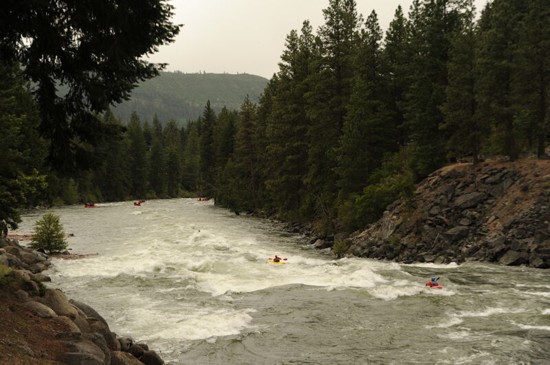
Rafts sometimes run the last mile of class IV in Tumwater Canyon and continue on through Leavenworth.
Aug 16, 2012
Nice video of running POW at 9K cfs: http://www.youtube.com/watch?v=8XIiWOKK-Pg&feature=share .
Pretty beefy, pretty tight line.
Jun 8, 2007
The Tumwater Dam was constructed from 1907 to 1909 was the largest hydroelectric project in the American West when it was built. It provided power for electric locomotives running on the Great Northern Railway through the tunnel at Steven's Pass. The project was closed in 1956 but the dam remains. The fish ladder visible in the foreground was constructed in 1987.
Jul 17, 2005
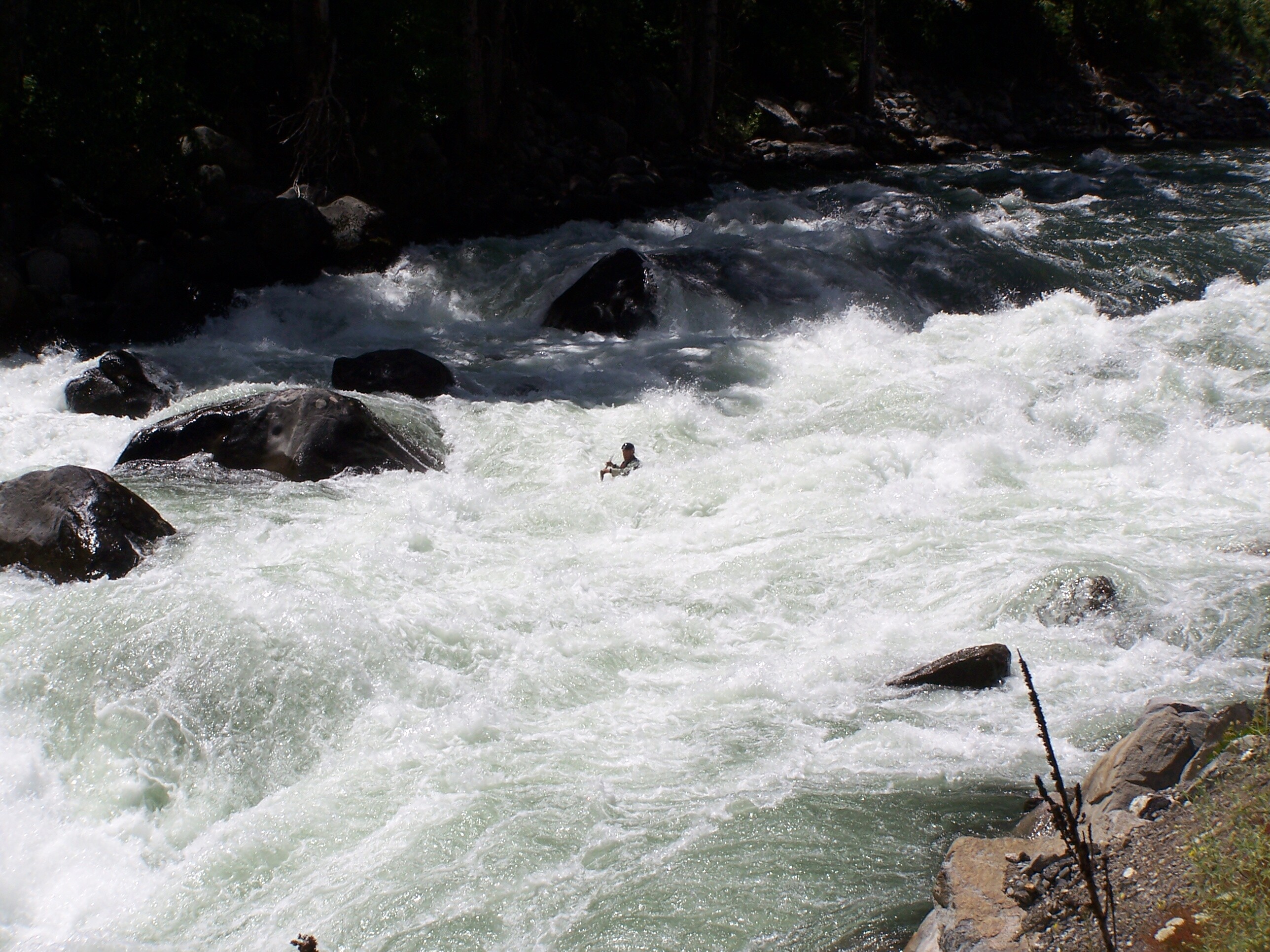
Chris B stylin' the many moves required to do a good line through The Wall.
Chris F flying through one of the drops in The Wall.
Jim Trhreading his way down The Wall.
Ron T., running the Wall twice as he waited for others. He also ran it the day before. Me thinks he likes this one!
This is the view looking from downstean at the entry coming into the Wall. Front to back: Ron, Jim, Lanson, Chris B, Chris F
Jul 16, 2005
Having never run this before, but two in our group have done it many times, I got out to shoopt piocs and this video. So when I got up to the lip, it was pretty lonesome. It's a long waaayyyy down from the lip! What a trip!
One of many of the drops in 'The Wall' requiring some nice precision paddling.
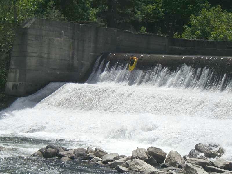
Here goes Chris's run off the dam. Not sure if it is legal, BUT there are no signs as yet, so if you got what it takes, go for some fun!
Jul 4, 2003
The Tumwater Dam was constructed from 1907 to 1909 and was the largest hydroelectric project in the American West when it was built. It provided power for electric locomotives running on the Great Northern Railway through the tunnel at Steven's Pass. The project was closed in 1956 but the dam remains.