Kings, N. Fork
Dinkey Creek to Main Kings Confluence
| Difficulty | V |
| Length | 3 mi |
| Avg Gradient | 90 fpm |
| Gauge | Nf Kings River Blw Dinkey Creek |
| Flow Rate as of 19 days | 97 cfsstale data |
| Reach Info Last Updated | December 1, 2009 |
This is a pretty run with many bedrock drops, especially in the upper half. It has a long and dependable season from mid winter to memorial weekend or even mid June. Kayakers will sometimes run the NF at very low flows early in the winter before other runs in the area get going. Large winter rain storms will often bring the NF up to medium or even high runnable levels.
Normally all the water in this reach is supplied by Dinkey Creek, so most years flows may not go above 600 to 1,000 cfs.. In big years, Dinkey gets bigger and upstream dams on the N. Fork spill, so flows can climb to 2,000 or 3,000 cfs. Above 2,000 cfs the run is huge, with monstrous ledge holes. It is still mostly runnable but some of the lines are pretty sneaky over shallows, or worse, insanely narrow in the midst of the killer holes.
Most of the rapids are visible from the road, but a few are hidden by trees. Everything is scoutable or portagable at river level.
Last few hundred yards above the confluence with the main Kings was the site of the 1972 west coast Olympic slalom trials. This channel is an excellent technical slalom course even without gates and is worth a look by intermediate boaters not interested in the upstream class 5 rapids.
Every group seems to come up with their own names for rapids, but a few seem worth passing on. Driving upstream from the main Kings, the NF runs straight then bends sharply east. The rapids in this straight section are easy, but 'Rock Pile' (4+) hides in the corner. A nice class 4ish rapid ends at the gauge in the middle of the straight section going east (driving upstream). 'Red Rocks' is the obvious reddish ledge rapid where the river bends north again. 'Three ledges' is an obvious name for the next big drop upstream. 'Dewell's Demise' and 'Furrow's Filet' are local names for the big drops continuing upstream. Chuck Stanley wrote about getting stuck in 'Chuck's Leap' but I have never figured out for sure which rapid that might be s
...
Put-in: Elevation 1260 feet. Either park on the road next to the NF Bridge and walk down on river left to the pool at the confluence. Alternatively drive across the bridge, turn left towards the Dinkey Creek bridge and immediately left down into a clearing between Dinkey and the NF. There is a nice sized pool, but class 4 bedrock drops begin immediately downstream. (Class 5 at high flows)

A large oddly textured boulder on river right signals the approach to this 8' waterfall. The main fall is generally runnable on the left edge. The reversal is backed up by a rib of rock extending from the right side. As flows rise, a sneak route opens up even further to the left. Scout to make sure you miss a boulder hiding just under the surface, below this sneak. The video above shows two boaters stuck and cartwheeling at the base of this falls. Easiest portage is on river right.
This rapid is not visible from the road though you could hike down to it.
The bridge is wrapped around a huge boulder in the middle of the river. The left side drops into a big pothole. Center routes pass close to the undercut boulder and the jagged metal of the bridge. The conservative route is to drop down a chute on river right over a ledge or two. Eddy hop down below and right of the wrapped bridge then work your way to far river left, before cutting back to the center and ski jumping off of junky boulders. (The GoalPost). If you miss the last cut, then you crash down the shallows on the left which is no big deal. At higher flows there is a fine center chute on the bottom, but it has severe pin potential at lower flows.
If you scout you might see lots of interesting lines to run.
A bouldery lead in, steepens before opening onto bedrock ledges. At moderate flows the river left route down the bedrock is fun, though Dick Furrow once sliced his hand with his paddle after flipping here. The right side of the bedrock is more conservative and is the only route at very high flows through a river wide reversal.
The second of 3 long distinctive rapids visible from the road. A long bouldery lead in abruptly opens onto bedrock ledges then funnels into a short but steep sluice against the left wall into a long pretty pool. Charge down the tongue on the left and hope you flush or boof as far right as you can. A strong eddy feeds in from river right and tends to keep swimmers and boats in the pour over. Ben D. had a nasty swim here after I inadvertantly signaled him down the middle. I just stuck my paddle up straight to indicate 'Come ahead', when I should have signalled either left or right! I have swam there twice, myself. The first time, I had to claw my way past my boat into the main current before I flushed. The second time, I ended up far enough out to the right that I was able to feel a rock under the surface and drag my way out against the current.
The scout is easy from the road, but more awkward at river level. Scout and or portage on river right.
The bottom ledge is typically run on the right edge, or sometimes by ski jumping off the rock on the left. At lower flows the reversal in the bottom ledge is not super sticky for which off line boaters can be thankful. Naturally as flows rise the consequences get more severe. At very high flows this drop becomes a river wide reversal and is often portaged.
An interesting class 4 rapid ends at a pool with a cable crossing and a gauging station. This gauging station is against the cliff on river right. A scale on the outside of the station shows the river level in tenths of feet. Convert to cfs with this Gauge Rating Table.
A big rapid formed by boulders, hides where the river bends from west to south. Scout, river right. The main flow and steepest lines tend to be on the right, while shallower and more congested lines are to the left. Boof the main openings through the boulders or bounce down further to the left. Being a boulder pile, things move around and the routes change over the years.
This is the last class 5 on this run, so intermediate boaters can launch below this drop to boat the last interesting 3/4 of a mile.
A long interesting, technical rapid leads from a nice pool (with cliff) down almost to the confluence with the main Kings. This was the location of the 1972 west coast Olympic slalom trials.
Feb 19, 2010
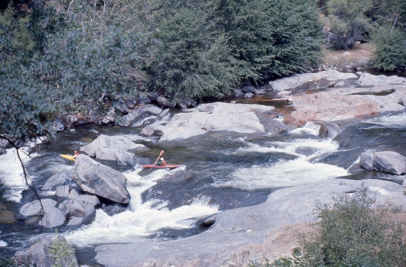
Three of us paddled from Balch Camp on the NF Kings down to Kirch Flat on the main Kings. It was a beautiful warm February day. The flow was from Balch Afterbay, due to the annual winter maintenance on the Kings River Powerhouse. Flow was around 670 cfs, which is a pretty nice flow, mostly clean, pushy but not really big yet. We did portage Chuck's Leap and Dewell's Demise. Eric swam out of the bottom ledge of 3 Ledges when his playboat did not punch through the center and it sucked him back in. Jeff went in the same spot but his bulbous SuperHero punched right through.
Jun 8, 2006
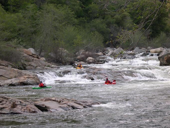
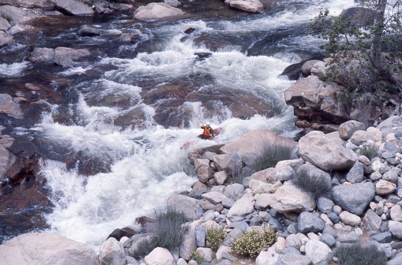
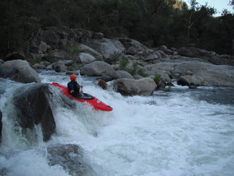
This rapid is at about the halfway
point in the run and is easily visible
from the road. Paddlers usually run
the river left channel (right side of
pictuer), boofing off a diagonal fan.
The middle and river right channels are often run at higher flows such as in this picture.
A small but nice 360 spin wave is
just out of this picture, downstream at low to moderate flows.
May 31, 2003
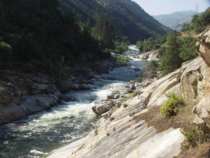
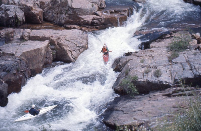
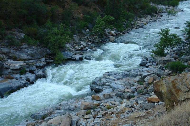
From top to bottom the visible rapids are Furrow's Filet, Dewell's Demise, and 3 Ledges.
Boaters can either boof far river right and try to clear the recirculation or charge down the tongue far river left and hope to punch the reversal. Riding the tongue is probably more exciting. This recirculation is strong and difficult to swim out of, hence the moniker based on one hapless victum. If you can swim into the main current on the left it will flush you out. I say this from experience.