Flambeau, S.Fk.
E) CTH.W to Skinner Creek Landing (11.2 miles)
Dec 17, 2020
Dec 17, 2020
May 12, 2011
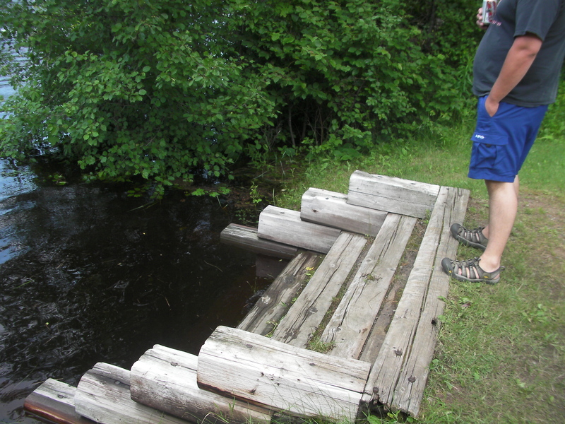
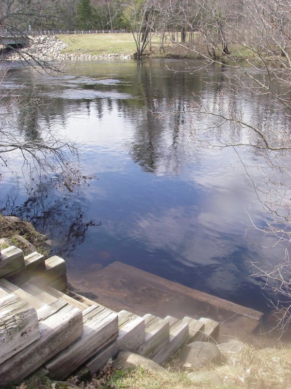
Stair gauge at put-in, June 24, 2010. 3.5 steps showing
May 12, 2011
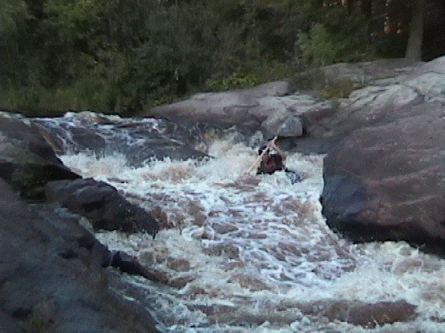
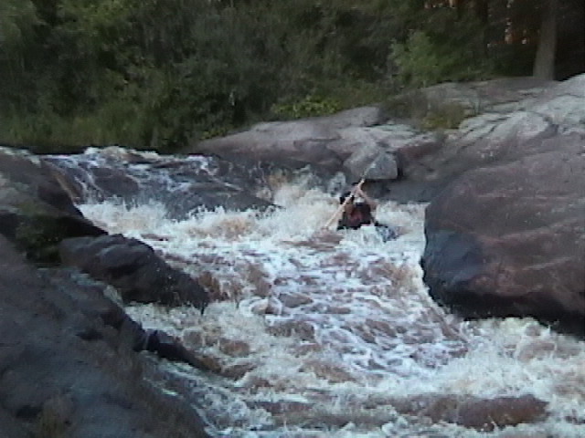
Ran at a level when the 4'x4' landing step was just barely covered. Posted a youtube video of the run
http://www.youtube.com/watch?v=2En5VF1WqCU
Hopefully I can get better at making those and uploading them, it is a 1st attempt.
May 12, 2011
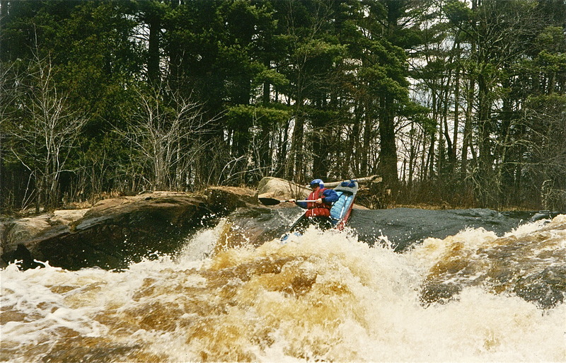
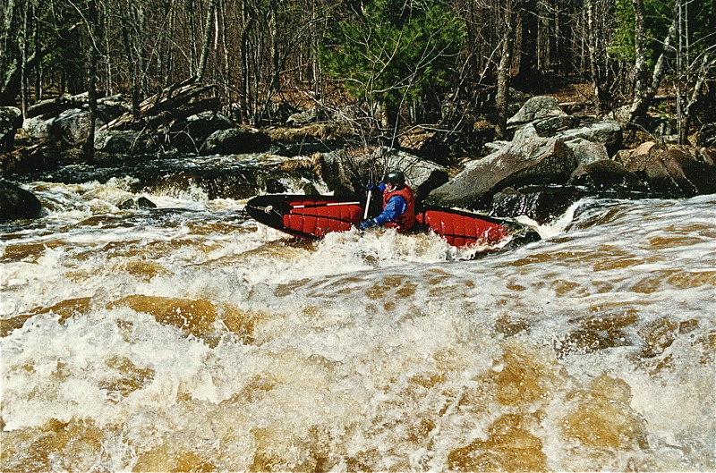
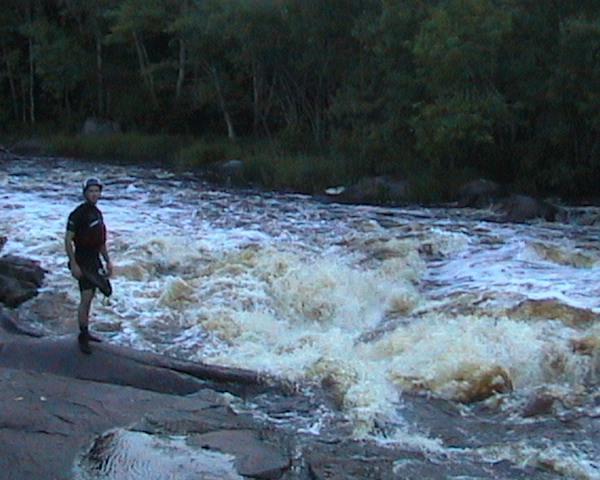
This is our local run, most put-in at Co M. We use the stairs at the put-in for an idea of flow. Highest I've run is with 3.5 steps showing in June of '10 and Sept of '10, this is a very high flow. Slough Gundy is a solid III with huge wave trains, 6' and higher nonstop from the first pitch above the cliff to the fifth and last pitch above the big pool. The only play would be for advanced boaters. The left side of the falls was runnable, but looked very pushy, the right side was unscoutable with the island mostly flooded and a far river right channel in the woods. Scratch (below Little Falls) was mostly washed out with less features than at lower levels. The Flambeau gauge was reading 13000+ cfs in during the June event. Based on where the greatest amount of rain fell, 6' in Phillips area and the N. Fork's very large reservoir (Turtle Flambeau) being over 5 feet below normal pool and not releasing any water, the So Fork at M likely had higher flows at the confluence, likely 6000+ cfs.
I believe there are 9-10 steps including the 4'x4' landing step at the bottom. As levels drop Slough Gundy changes dramatically, at some levels there are playspots everywhere and others they seem to disappear. The Falls also changes, the left side becomes more difficult and dangerous, with the right line (pourover slot next to island) looking very keepy and the left line near trail access pushing into the big rock on left that has sieve and often wood trapped underneath. The river right falls remains unscoutable, however the left line (slide) is probably runnable IV. As level drops further both lines of the river left falls open up and as do both on the river right side. The right line of the right (5' drop) is very sticky. As the river drops even further the left side becomes bony and the right side far more tame. Below the falls, Scratch, (named further downstream on the topo) at most levels is the most fun rapids to run, with a nice hole on far river left.
At high levels we use the skinner creek rd takeout, at moderate levels or only a bike or legs for a shuttle, we takeout below scratch and walk up using a decent trail along the river up to little falls. At low levels we may just run down to little falls and take-out or carry into the falls and run laps.
For flows watch for rain in Price County, watch the Jump gauge and the Flambeau gauge.
May 7, 2011
Left side of little falls was ok, a little boney, but good....right side was fine. Has a youtube video
http://www.youtube.com/watch?v=2En5VF1WqCU
Dec 5, 2010
South Fork Flambeau
Dec 4, 2010
Running 'Little Falls' at Spring Flow
Dec 4, 2010
Below Little Falls
Dec 4, 2010
South Fork Flambeau
Dec 4, 2010
South Fork Flambeau
Aug 2, 2008
Ed O'Meara Runs River Left At Falls
Jun 1, 2008
Ed O'Meara runs the left side of Little Falls
Aug 15, 2002
This is the river left side of Little Falls, which splits around a small island.
Aug 4, 2002
A short entertaining stretch on the Flambeau. Little Falls is definitely misnamed as this drop approaches a class IV. The river left side is also a stiff III.