Jump, S.Fk.
B) Little Falls to Big Falls (PnP or 2.7 miles)

| Difficulty | II-III(IV) |
| Length | 2.7 mi |
| Avg Gradient | 26 fpm |
| Gauge | Jump River at Sheldon, Wi |
| Flow Rate as of 38 minutes | 45 cfsbelow recommended |
| Reach Info Last Updated | September 7, 2020 |
Where CTH.N crosses the South Fork of the Jump River, you would have no idea what lies just upstream and downstream. At N, the river is flat and flowing, recovering from Little Falls, and readying for Big Falls.
Little Falls is roadside off Big Falls Rd less than a mile east of Cty N, and Big Falls is about 1.3 miles to the west.
Each 'falls' can easily be done as a PnP (carry-up, carry-out), as there is a lot of action in a brief area at each.
In fact, when many experienced boaters talk
about paddling 'the Jump', they are referring to just a PnP on Big Falls (as though
there were no other parts of the Jump to consider paddling) ... and for them, that might indeed be the case, but those looking for somewhat less challenging rapids or a longer trip will find some of our other listed sections quite worthwhile!
By the way . . . any time you are on shore (at either Little Falls or Big Falls), be aware there is plenty of poison ivy around. (KNOW WHAT IT LOOKS LIKE!!!)

USGS lists a sampling site with drainage area of 327 square miles.
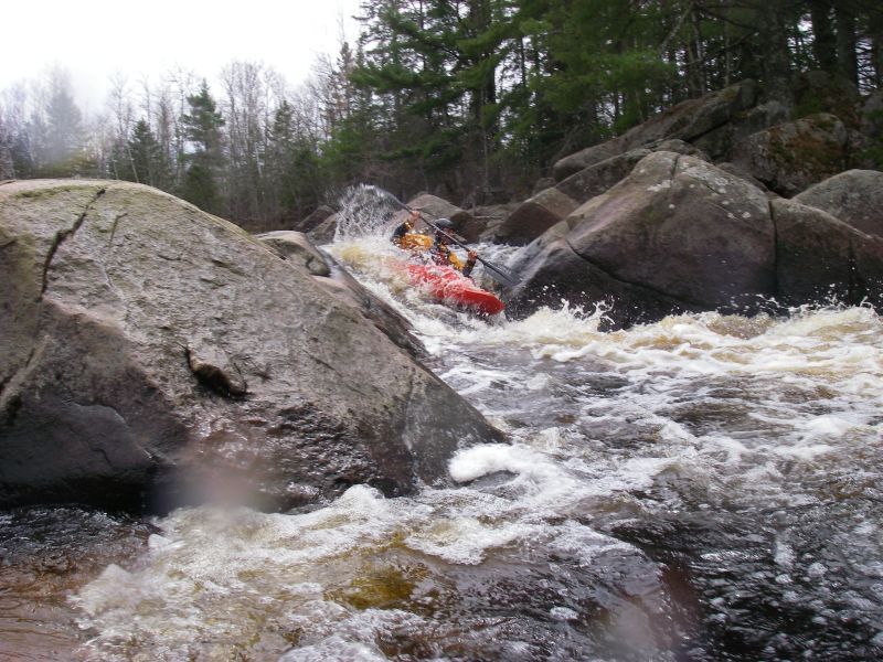
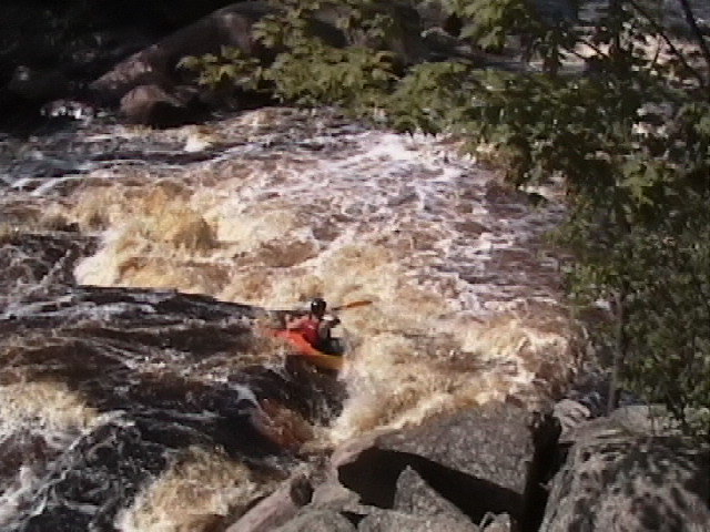
Immediately at the listed put-in, with roadside access, this is a 300-yard/0.2mi (+/-) stretch of (likely somewhat technical) class II(III) rapids. There are a few (generally catch-on-the-fly) possible playspots, and a few places which will become rather 'keepy' at flows near 1000-2000 cfs.
Since there is mostly just flat/flowing water between here and Big Falls, folks may wish to just do a PnP (park-and-play) here, carrying up to do laps on this rapids, then drive down to Big Falls for the same down there.
Check out the following video of parts of this rapids: https://youtu.be/FuM2sEMajm8
(Mostly included merely as a reference point, to help users understand where the features are located.)
Great video of this rapids is available at: https://youtu.be/pYNOJceszic
Many paddlers may skip doing any shuttle, opting instead to just do Big Falls as a park-and-play, carrying up in the park. Either: (A) Park in the first pull-off, then carry up to the picnic area to put-in and boat down to your vehicle, ** or ** (B) Drive past the first small parking pulloff to park by the picnic area, carry in, boat down to the end of the major rapids, then carry back up to your vehicle(s). Either way, you catch all the major action in this 0.25 mile stretch of pretty solid class III-IV technical action.
After scouting Big Falls, if you decide you aren't really interested in running it (for whatever reason), you do have some options to salvage your day.
If you put in at the tail-end of the
serious action at Big Falls (downslope from the aforementioned small parking
area), the next 0.4 mile downstream to where an island
(right-of-center in the flow) marks the end of this fine Class II
'run-out rapids'. Walk (or pre-set shuttle) back to your put-in.
Another option would be to drive up to Little Falls and run that
stretch, as already described above.