Menominee
A) Piers Gorge: Niagara to Hwy.8 (0.5-2.9 miles) *Fee Area*
| Difficulty | II-IV |
| Length | 2.7 mi |
| Avg Gradient | 15 fpm |
| Gauge | Menominee River at Niagara, Wi |
| Flow Rate as of 36 minutes | 1590 cfsII-IIIlow runnable |
| Reach Info Last Updated | January 6, 2021 |
In summer, 2012, the areas surrounding Piers Gorge, Quiver Falls, and Pemene Falls were incorporated into a State Recreation Area cooperatively operated by Michigan DNR and Wisconsin DNR. As a result, parking and access for each of these areas now requires either a daily or annual State Park sticker.
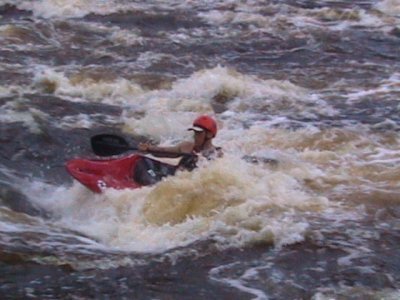
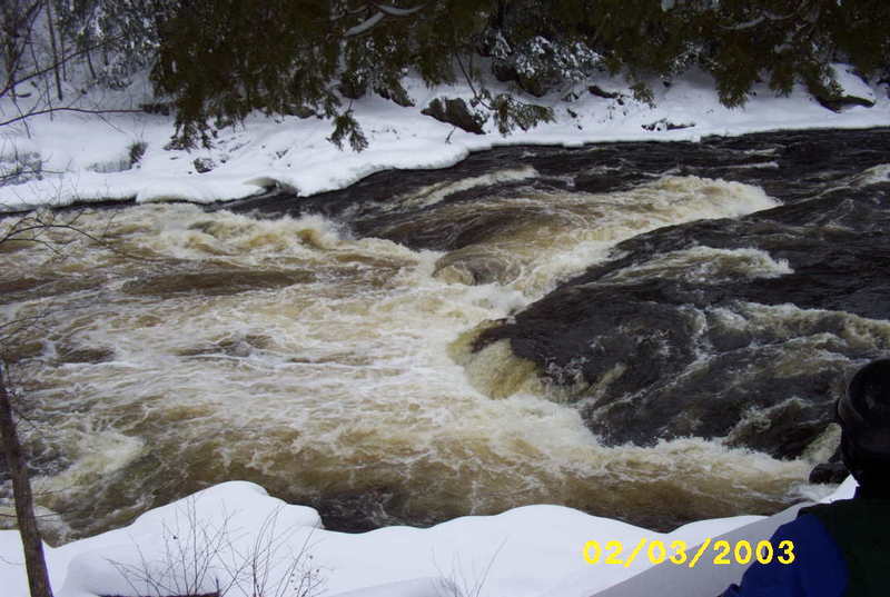
Piers Gorge (final 0.5mi., skipping the shuttle and foregoing Sand Portage) is often done as a big-water, carry-up park-and-play. The gorge often stays open well into winter. (Please scout for any ice-shelves which may overhang critical eddies or areas of shoreline where current may be likely to push you! Some years back, a local paddler who pushed the season had a near-death experience being stuffed into an ice-shelf, struggling to abandon boat and paddle, and did manage to free himself before having to attempt to breathe like a fish.)
Click the following link to watch a video (with a mix of rear-of-the-kayak mounted camera and aerial photography via helicopter-drone) for a good feel for Piers Gorge proper: https://youtu.be/WbSfbn-dCpY

The falls at the dam (just upstream of our listed put-in) has been run: Click to view a vimeo video of that run: https://vimeo.com/104679226
There is not many rapids in the States that hasn't been paddled yet, so I'm proud to present you the first ''First Descent' in the US. Little Quinnesec Falls is located in the Menominee, river that makes the natural border in between WI and MI. levels were 1440 CFS at that day. music: Left Alone ft. Chet Faker (ta-ku rmx)
The 'full run' tends not to be done by most serious whitewater boaters. Rather, they forego all the flatwater (and 'Sand Portage', aka Fourth Pier), and instead carry-up from the take-out to do only 'the gorge'.
The first rapid is known as Sand Portage or 4th Pier. The legend is this was known as Sand Portage because the Indians wore the rocks into sand with the countless times they used the trail on river left to portage the gorge. As the river enters 4th Pier, it is divided by an island (which many locals enjoy camping on). Most of the flow goes river-right of the island, and most boaters do too, since it is generally possible to attain to the features in the left channel after running the right (main) channel.
There is a glassy wave at the lead-in, and a micro eddy on river-left. It is pretty fun to dart into the eddy and catch as long of a surf as you can on this wave. Below this wave. there is another wave on river-right that is fun to surf, followed by a large eddy on river-left. Hit this eddy for access to the play features in the run-out from the left channel.
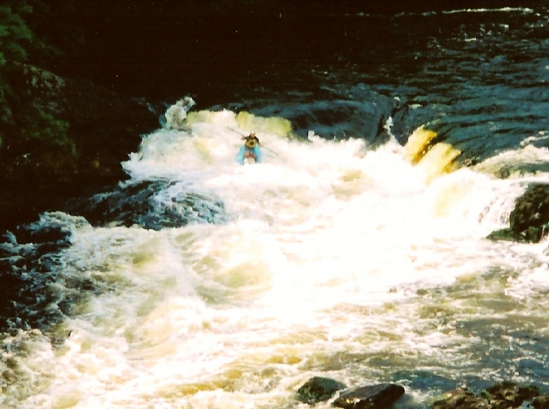
The first is a wave known as the Lone Ranger. It is located just furthest upstream where the flow from river-left of the island rejoins the flow from the channel to the river-right of the island. You have to work a little to get up to the wave, but its a nice surf when you do. At levels above 3000 cfs a second wave, Kemosabe forms just below the Lone Ranger. This one is much easier to get to, and very fun. Just below Kemosabe is a small hole known as Shallow Hal. Its fairly shallow, but nice for flat spins and blasting. Low angle cartwheels are possible here too. When the river is flowing around 4700 cfs, Shallow Hal becomes Wave 47, which provides much awesome fun.
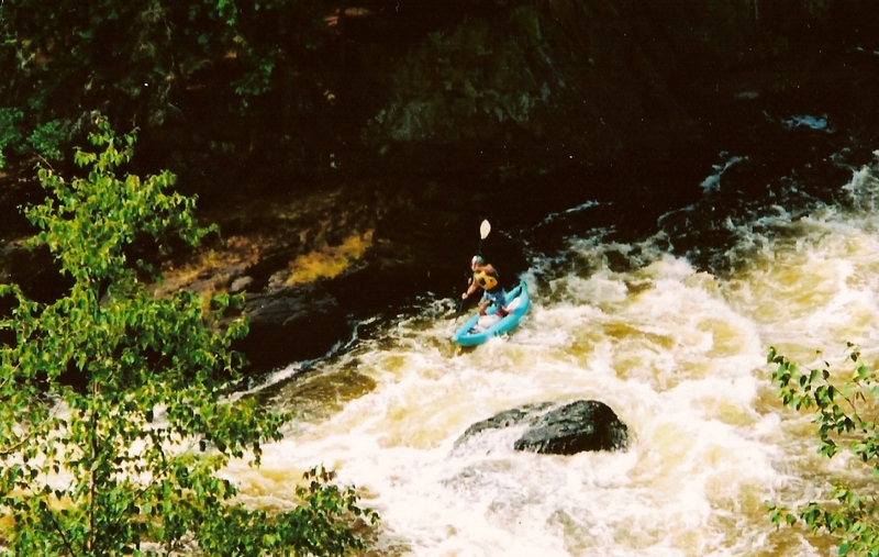
Just downstream (in the combined channel) is another hole known as Bloody Knuckles. This is a very bouncy/dynamic hole. I've seen some good boaters do some pretty cool things here, but it can be a difficult time staying in control of the hydraulic. Its sticky enough that if you flip in the hole, there's a good chance you'll still be in it when you roll up. At levels around 3,000 cfs it becomes very sticky and difficult to get out of. Also the surfers left of this hole is pretty shallow and is where Bloody Knuckles tends to dish out bloody knuckles.
Below Bloody Knuckles is a small ledge with a few play possibilities. There is a hole towards the river-left side of the river known as EZ-Loving. If you're trying to learn how to flat-spin this is a great spot, as it naturally tries to throw you into a spin. It is also nice for blasting.
Overall 4th Pier is not worth the visit unless the gorge is flowing at or above 1800 cfs. If the gorge is below 1800 cfs, I'd recommend doing a park and play in the 3rd-1st Piers.
Misicot Falls ('Third Pier') is the entrance to Piers Gorge. A rocky ledge (to the left) and the more usual line on the right, where a fine 'V' shaped tongue leads through waves and holes. (There are actually quite a few different lines which are run.) The main flow (on the right) runs headlong toward Volkswagen Rock, which can create a significant pourover/hole at higher flows.
3rd Pier (also known as Misicot Falls) can be recognized from upstream by the appearance of rock walls on each side of the river and a distinct horizon line. Also if coming down from 4th Pier you will see a sand beach on the river left side of the river before you get to the falls. This is where the rafters generally get out to scout the falls. There is an eddy on the river right just above the falls. This is a nice place for kayakers to get out and scout the drop, as the recommended line is from river right.
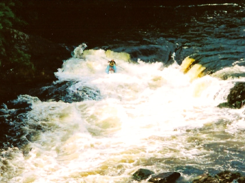
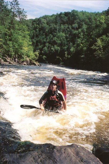
The drop itself is a 10' slide into the gorge proper. Extending about 6' from the river right shore at the base of the falls is a somewhat sticky hole that some boaters enjoy playing in. However, I have also seen this hole stop many a boater in their tracks as they come over the falls and proceed to freak them out, resulting in a swim through the next 1/2 mile of rapids. The falls are somewhat V-shaped on river right. The idea is to hit the falls in the center of that V moving towards river left. This line will put you in the large eddy on river left quickest. There is a hole on river left as you go over the falls, but I have penciled into this hole before and came out fine. The further to the river right that you hit the V, the more exciting the drop becomes. There are some very nice waves immediately below the drop. At levels around 2500 cfs the first wave you hit will send you air borne, which provides an awesome opportunity for a wave-wheel. However, Volkswagen Rock, just downstream of 3rd Pier discourages too many heroics.
Before the waves and current from Misicot Falls ('3rd Pier') die out, they pile into Volkswagen Rock, named for the VW-bug-sized 'hump' it causes at normal flows.
You generally have a lot of time to get to the left or right of it, but I have seen a boater get pinned on it and have heard of another loosing his front 2 teeth on it. At levels above 2500 it can be quite thrilling to try and jump over Volkswagen and the hole immediately below it. The hole immediately below Volkswagen is actually where the boater lost his teeth. He was apparently playing in the hole when it happened. The hole below Volkswagen is very shallow and for that reason is capable of causing painful injuries easily.
Also be aware that Volkswagen Rock is not one rock, but two; one on top of the other. The lower rock is undercut with a crack between the two. This sieve has potential to be particularly hazardous at lower flows and was the sight of a fatality when an individual was pinned at flows of 1200 cfs.
Just to the river right of Volkswagen is a nice surfing wave.
Just downstream and River Left of Volkswagen is Whirlpool Rapids. This is a stretch of squirrelly water that is pretty fun and sometimes unpredictable to run. Sometimes if you lean back you will go vertical while running these, and stay vertical for quite a while.
River right of Whirlpool Rapids is Cudaghi Island. On river right of Cudaghi Island is a nice eddy to catch. You can catch this eddy either by ferrying across Whirlpool Rapids and taking the river right channel around the island, or by hitting the hole known as Chicken-Ender and cutting river right just below the hole and just below the island. This will give you a chance to strut your stuff in Chicken-Ender. This is an awesome hole that is deep and easy to cartwheel in. There is also some very squirrelly water here which will do strange things with your body while upside down.
Just downstream of Chicken-Ender is 2nd Pier and the 2 Sisters. A river-left rock-ridge pushes most of the flow to river-right. There is a diagonal hole just above 2nd Pier that funnels into a hole known as Justin's Bane which can be a very difficult hole to work out of. The recommended approach to 2nd Pier, therefore, is to enter it river right of that diagonal hole to take the drop straight-thru. About a 5' drop into a wave/hole known as 1st Sister is followed fairly quickly by another hole, the 2nd Sister. At levels from 1300-2500 this hole is extremely flushy, but can be entertaining to put your boat in and see not only what you can do, but how long you can stay in there. At lower flows, it tends to be more friendly and appropriately retentive for better play.
Below 2nd Pier are some small boulder garden rapids, before the river wraps to the left, where there's a huge eddy on river left. This eddy is a great spot to practice stern squirts, and a convenient place to get out for the shortest carry back up if you want to hit the main gorge again.
Continuing downstream you reach the final feature, 1st Pier, AKA Terminal Surfer. At high flows, this is a massive recirc which will stop and surf a 12-man raft! The hole is basically in the center of the river, so you can sneak around it either to river-right or tight river-left. If you decide to play this hole it is recommended that you surf this hole on surfers right (river-left). The center of the hole is flushy (at playable levels) and thus can be the best place to exit. The surfers-left (river-right) side of the hole is generally quite trashy and has stripped many boaters of their pride and scared the crap out of them. That said, some guys do play this side as well.
Just below 1st pier is a large somewhat swampy backwater on river left. Paddle across this to shore where you'll find a trail leading up to the parking lot.
Fairly immediately after 'Terminal Surfer' you'll want to paddle to the river-left shore to either carry back to your vehicle(s) or to carry up for another run!
Dec 9, 2020
Watch this before going at lower flows. At 00:40 the paddle gets stuck in Volkswagon Rock at the same location a rafter died.
Apr 14, 2013
Now requires a daily fee (8$ in Nov. 2012) or a Michigan Recreation Passport, which can be used at all state parks in the state.
May 12, 2012
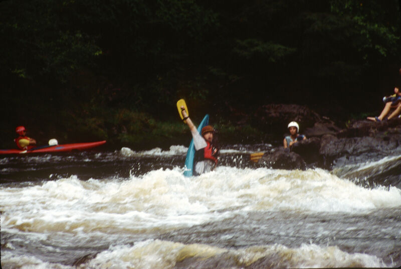
Just another angle on 3rd pier, 2500cfs. Was a clean line at this level. Level was a little high for play. We watched the rafts just go right over the top of VW rock.