Pine
A) Hwy.55 to Stevens Lake Rd. (13.4 miles)

| Difficulty | I-II |
| Length | 12.8 mi |
| Avg Gradient | 7 fpm |
| Gauge | Pine River Below Pine R Powerplant Nr Florence, Wi |
| Flow Rate as of 40 minutes | 1.91 ftbelow recommended |
| Reach Info Last Updated | January 27, 2025 |
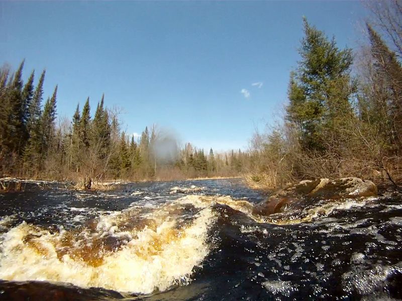
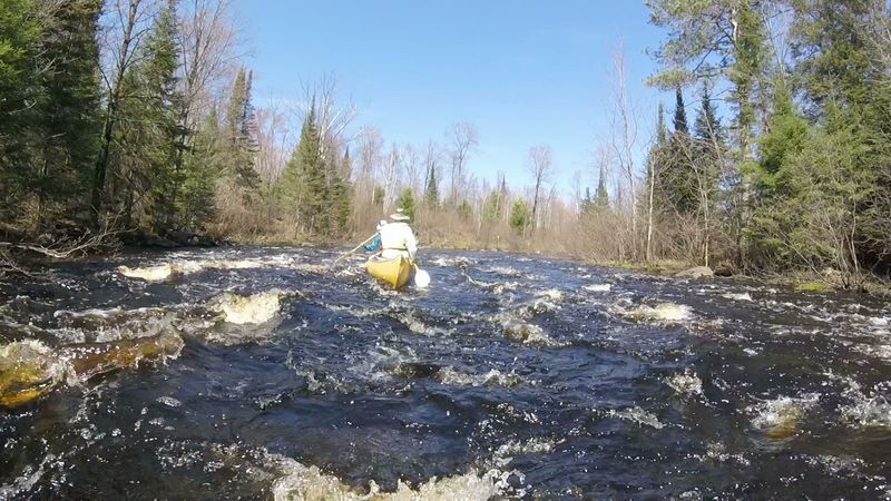
With adequate water levels this beautiful, intimate stretch of the upper Pine River offers long (1/3 to 1 mile each) runs through 6 different, back-to-back series of class 2 (with class 1) rapids, plus one additional shorter dash through a class 2+ (more technical) rapids. The total of over 4 miles (30% by distance) of rocky rapids provide enjoyable breaks to the 9 miles (70% by distance) of flowing flatwater through dense forest and marshlands.
Unique and critical to this section of the Pine River, is how to determine if water levels are adequate. The USGS flows (250cfs) that are adequate for the sections above and below this stretch are not adequate for passage through the rocky reaches of this stretch. When the rock, just downriver from the Hwy 55 bridge has more than 2” SHOWING above water, flow IS NOT ADEQUATE. If any of the rock is showing then the trip will require more maneuvering and may have some scraping on 3 of the upper rapids. On the other end of the scale, high flows are not significantly limiting for this section (just more waves and less rocks). Generally, the trip takes around 6 hours at low flow can be done in 5 or less hours at high flow rates.
The Pine River is a state of Wisconsin designated Wild River however, all of the public-owned riparian land along this section of the Pine is USFS land that is managed similar to but not the same as WI DNR managed land further downriver. Tent camping is common, river-right at the end of CCC rapids (also anywhere else on USFS land).
Upriver from Hwy 55, the Pine has a north and south branch, each with over 10 miles of meandering flatwater, beaver dams, and extensive marshlands. The only significant rapids is Wildcat Rapids, a tight, 170-foot-long class-1 at 45.882448, -88.852031 on the south branch (portage option on left).
Larry Zibell provided considerable assistance with the details on this page.
Parking is only available along the road. The put-in is on river-left just downriver from the bridge. There is a large staging area near river but a narrow slot to launch from. When the mid-river rock visible downriver from the bridge (and just downriver launch spot) has more than 2” SHOWING above water, flow IS NOT ADEQUATE. If any of the rock is showing then the trip will require more maneuvering and may have some scraping on 3 of the upper rapids. On the other end of the scale, high flows are not significantly limiting for this section (just more waves and less rocks).
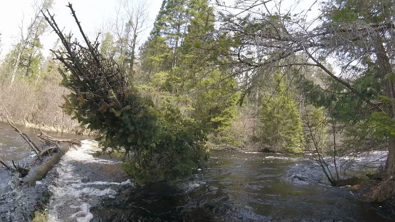
Starting at remnants of an old dam are a series of 4 separate class 1 rapids or swifts that are spaced out over a half mile. These are noted because the river here is intimate, swift, and prone to being blocked by fallen trees.

This 0.4 mile long class 2 (with class 1 parts) rapids ends in a pool, just above a dense, river-wide tangle of alder. Passage through has always been possible but requires attention, tight maneuvering, and some grabbing or deflecting of branches. Usually the far river-left route has been the most (often only) available route but its existence is not evident until you are close.
0.5 miles long class 2 (with class 1) rapids
Start of 6, class 1 rapids (with swifts) extending ¾ miles to just past an old, A-frame building (and tree farm) on river-right.
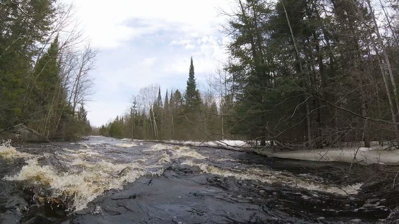
A 0.8-mile-long series of 5 separate rapids that start as a class 1 and build to a solid class 2. Watch out for field of just submerged boulders through the turn immediately after the end of the last rapids.
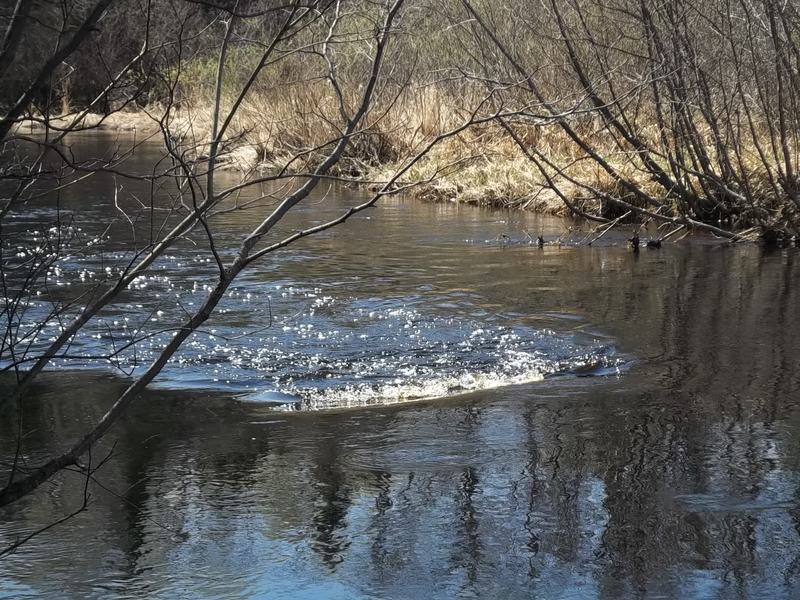
River-left as marker of progress through marshland
River-right. If water is high enough, this is a potential 400-foot shortcut leading back out of the 2nd outlet of Keystone Creek. The second outlet of Keystone Creek is 0.8 miles upriver from Old Dam Rapids.
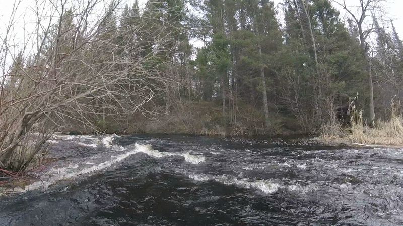
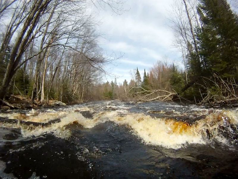
This rapids deserves scouting. The main, left channel is seldom, if ever, run. It can look deceptively inviting from above but has hazardous, submerged metal spikes projecting upwards from underwater remnants of the dam. Also, the left channel is often blocked or restricted by lodged trees that may not be visible from above the rapids. The regular route is to run the right-channel. It The right channel is very tight, starts with as a deceptive swift that turns left, out-of-sight, then builds to a stronger current towards a thread-the-needle line of boulders near the end of the channel (See “Thread-the-Needle photo at top of this page). Scouting (by bush-whacking through the river-right marsh) is to confirm that no strainer exists and to visualize the set-up for your one-shot run around the bend and through the boulders. After the drop around the Old Dam rapids a couple of class 2 rapids are back-to-back, just around the corner.
These series of 3 short class 1 (to 2) rapids occur through 900 feet. CCC rapids start about a half mile downriver from the end of this series of 3 rapids.
Expect the start of this rapids when you see the large, near-shore boulder on river-left. The top, bigger wave section is often complicated by a down tree. Substantial eddies are available at the end of the run where 2 man-made islands are spaced across the river. The islands are remnant of a bridge that use to lead across the river from the CCC camp that was on river-right.
The first of a series of 3 class-1 rapids start right below the terminal pool of CCC rapids. These are noted here because near the end is a right turn that has a large, river-wide sweeper. Unless water is very high, passage is only available through a tight angled slot with deceptively pushy current on far river-left.
Parking is only available along the road. The take-out is on river-left just upriver from the bridge (local advocacy for enlarging the shoulder exists). The trip can be extended 2.7 miles (45-60 minutes longer) to Hwy 139. Extending to Hwy 139 may be desirable when early spring road conditions make travel across Long Lake Rd too difficult. The downriver details are described in the downriver sections.
Jan 22, 2019
(Photo by John taken 4/30/2018)