Pine
C) Chipmunk Rapids to Bull Falls (10.5 miles)
| Difficulty | II-III |
| Length | 10.4 mi |
| Avg Gradient | 9 fpm |
| Permit | |
| Gauge | Pine River Below Pine R Powerplant Nr Florence, Wi |
| Flow Rate as of 40 minutes | 1.91 ftbelow recommended |
| Reach Info Last Updated | January 27, 2025 |
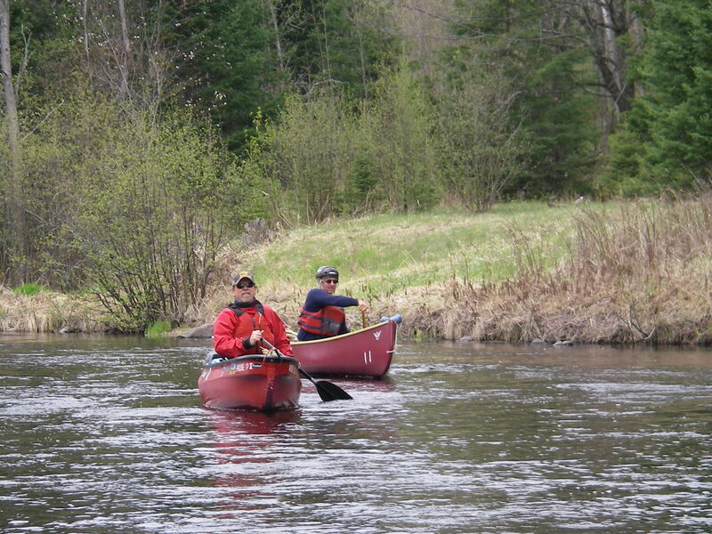
This is a very beautiful and fun section of the Pine River where the water zips along between 3 major class 2-3 rapids or falls. 60% of the entire section is swifts of class 1 rapids. Even after Bull Falls, swifts and class 1 rapids are continuous for another 7 miles. Well established and signed portage trails along upper Snaketail Rapids (class 2-3), Myers Falls (class 3), and Bull Falls (class 2-3) provide for good scouting, available spotter locations, and potential for multiple rerunning of rapids.
The short distance (1.8 miles) between Myers and Bull Falls and roads directly connecting parking-lot access to Myers, Goodman Grade, and Bull Falls offers a variety of whitewater paddling options:
A) a 10.5-mile thru-trip Including Snaketail Rapids, Myers Falls, and Bull Falls
B) a 1-stop, all-day, multiple rerunning of just Myers Falls
C) a short-paddle, short-shuttle day (2.1 mile shuttle doable as car-trip or bike-back) with multiple runs through both Myers and Bull Falls
D) a shortened thru-trip only including Snaketail and Myers with take-out at Goodman Grade
E) longer thru-trips including Snaketail, Myers, and Bull with takeout at Rochon’s Landing (total of 15.8 miles) or Hwy 101 (total of 19.1 miles). Gravel roads provide access to parking areas on the north or south sides of Myers and Bull Falls. In both cases, early spring access may not be available until snow and ground-frost are gone making these no-winter-maintenance gravel roads stable.
After the 7 miles of swifts and class-1 rapids below Bull Falls there is only a short class-1 rapids just past the confluence or the Pine with the Popple River. There are no other rapids until LaSalle Falls (see Pine reach D). LaSalle Falls is 4.1 miles downriver from the Hwy 101 bridge. The portage is on river-right and is signed.
In 1965 the Pine River became a state-of-Wisconsin designated Wild River. This designation is different from a federal Wild and Scen
...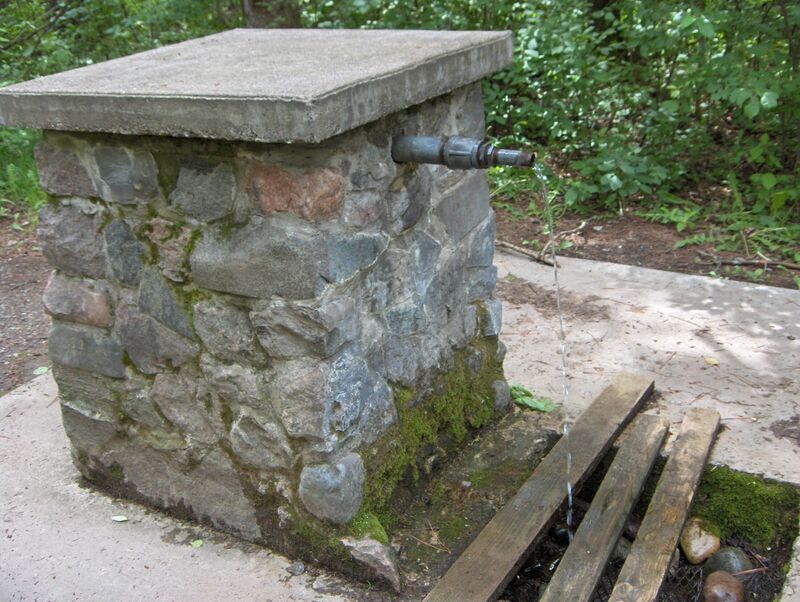
The landing is 100-feet down the path from the parking lot past the continuously running artesian spring. There is a staff gauge mounted on the downriver, river-right side of the center bridge support (interpretation in tab on flow). The USFS campground is around the loop road out of the far end of the parking lot. A pit-toilet building is available
As an indicator that Upper Snaketail Rapids start 0.6 miles downriver, a river-left clearing, with remains of burnt cabin, is on a sharp right turn. Portage signs for Snaketail are ahead on the right.
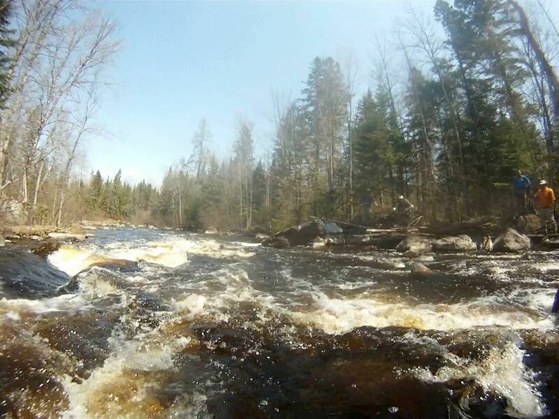
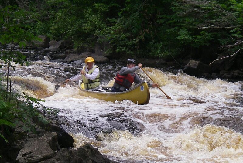
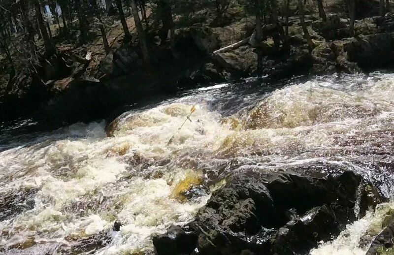
This 850-foot, 1st of 3, class-2, complex rapids is the most challenging of the set of 3 separate Snaketail rapids. It can elevate to a class 3 run with higher flows. Large trees have lodged across the top of the run in many years. Scouting from the portage trail is recommended. The 1,300-foot long portage (with picnic tables nearer the end) is a well-established path on river-right. The takeout is signed. It is on private land but was provided by the owner for public use to prevent people from trying to portage on river-left, which went right through the owner’s camp then down over some nasty terrain. Please use the river-right portage trail with respect.
This 660-foot long, 2nd of 3 class 2 rapids has no portage but is mostly straight with some big waves and a pool at the end. At lower flows wave height decreases and this rapids can drop to a class-1.

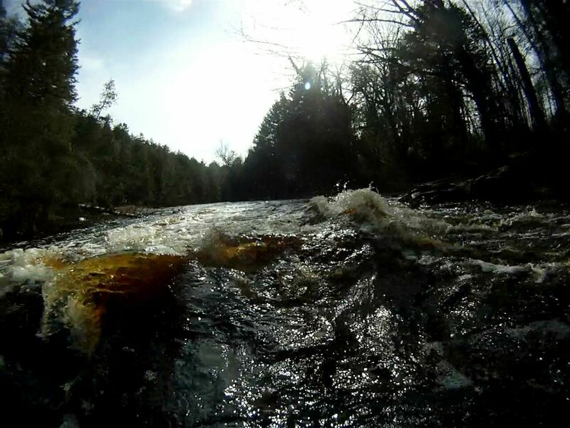
At 240 feet, this is the shortest of the 3 class-2 Snaketail Rapids. It has no portage. It is a pushy, S-shaped run with rock bumpers to avoid. At lower flows pushiness decreases and this rapids can drop to a class-1. Over half of the 4 miles between the end of Lower Snaketail Rapids and Myers Falls is of swifts with some class 1 rapids. There are long stretches that dance along nicely.
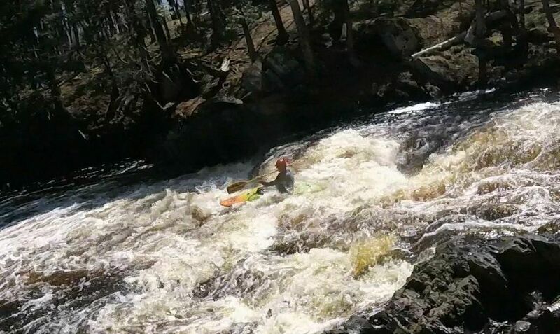
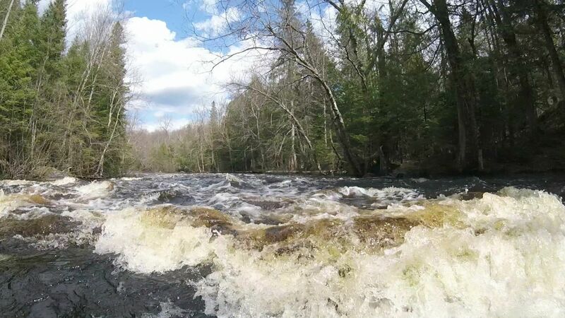
Myers Falls is a class-3, fast, 60-foot run, descending 13 feet across 3 drops. At lower runnable water levels the challenge is in hitting a tight S-shaped all fluid path. At higher runnable water levels the falls present multiple paths through intense hydraulic action. Signs mark both a high-water and a low-water takeout, on river-right. There is a well-established river-right (southside) portage or scouting trail that makes rerunning of the falls quite doable. The south side access Road (Price Lake Rd.) from Hwy 101 can be taken to a parking lot (45.898791, -88.433479) at Myers Falls that works well for either a day of just rerunning Myers Falls, running Myers to Bull Falls, or doing a trip from Myers to Rochon or 101 takeouts. For downriver trips from Chipmunk rapids use the northside access road (Goodman Grade) from Hwy 70 to bring you to parking lots near Myers (45.900171, -88.437198), Goodman Grade, or Bull Falls. The river-left (northside) takeout for Myers Falls is right at the end of the falls. Caution: Downriver from the terminal pool of Myers Falls, the river divides into multiple channels where blockage from down trees is common. Proceed with caution and be prepared to backtrack if a chosen channel is blocked.
The takeout is on the north side (river-left) with an easy access parking lot at 45.903021, -88.420655. Current can be swift here and the landing is tucked-in. Unless you anticipate a quick left-turn into the landing slot it can be overshot or missed. Some older maps will show a bridge here but the bridge is long gone.
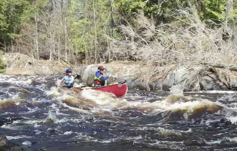
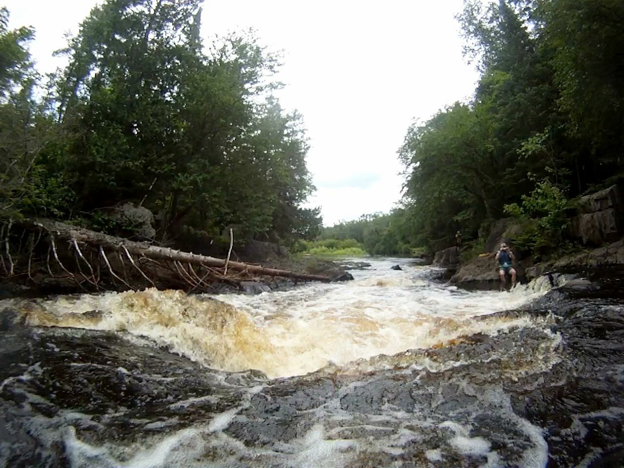
Bull Falls is a 200-foot, class-2 rapids (class-3 potential with bigger waves at high water). The main, right channel presents as a small initial drop then a building run to a final drop through a narrows with bigger waves. There is also a lesser-rapids optional left-channel route around the backside of an island. With higher water levels, the left channel, when not obstructed by logs, can be reached by working tightly along the left bank or carrying around on river-left and putting into the start of the left channel at the top of the island. The left channel goes behind the island and exits below the main-channel rapids. Upriver signs mark both a high-water and a low-water takeout, on river-right, for the well-established portage or scouting trail. Immediately downriver from Bull Falls the river proceeds as 7 continuous miles of fast swifts and class 1 rapids. A boat-exit spill on Bull Falls can be hard to recover from without support in place beforehand.
Bull Falls: The river-right (southside) parking lot (45.897870, -88.412243) is up a 200-foot, moderate slope path from the start of the portage trail. The river-left (northside) parking lot (45.898448, -88.408999) from the end of Bull Falls is not easy to get to. From the end of the rapids there is no easy landing spot, the hike is 500 feet, and the initial climb is very steep. and takeout on the northside before the falls is a longer hike to the parking lot with uphill terrain. Takeout before the falls can be less steep but is longer.
Rochon’s Landing: (45.880036, -88.343207): This takeout is a public landing on a slim piece of DNR land. It is 5.3 miles downriver from the end of Bull Falls and is an easy takeout on river-right but in a wide section of the river so be on right side of the river to avoid missing it. In the early spring, the last 500 feet of Thompsons Rd, after the right turn parallel to the river, heading towards Rochon’s landing remains difficult to impossible to drive on until the frost and moisture comes out of the roadbed. Getting stuck is most common on the way out from the landing as it is uphill. Don’t get stuck.
Hwy 101: (45.853510, -88.350581) This is an excellent, any season landing, with parking lot, on river-left before the Hwy 101 Bridge. It is 8.6 miles downriver from the end of Bull Falls.
Jan 1, 1900
The middle Snaketail Rapids can get big wave action at high flows