Popple
B) Newald Tower Rd to Morgan Lake Rd (4.7 miles)
| Difficulty | I-II |
| Length | 4.6 mi |
| Avg Gradient | 4 fpm |
| Gauge | Popple River Near Fence, Wi |
| Flow Rate as of 55 minutes | 37 cfsbelow recommended |
| Reach Info Last Updated | September 7, 2020 |
With two rocky rapids (II) and one bedrock ledge (II)) making up just 8% of its length, this section is run far less often than Morgan Lake Rd to Hwy 101. However, it is most useful as an easy-shuttle extension to the downriver section. It adds 4.7 miles of river (2-3 hrs, or avg 2.5) and a mere 3.5 more miles of shuttle distance. To add even a little more length (0.2 mile) and one fun rapids, NT Rapids (II) can be run by carrying upriver from the Newald Tower Bridge.
Just 1000 feet from the put-in, behind a small island on river-right, the South Branch of the Popple joins the North Branch. There are no significant rapids on the South Branch but for anyone interested in reading about growing up in the remote lands of this area of the Popple (1950-1960) will enjoy reading “Fences in the Woods,” by Ken Hedmark.
Masons Rapids (I-II) and Camp 1 Rapids (II) are relatively easy, rocky runs separated by a short pool and a signed portage (river-right) that is most useful to scout or avoid the often impenetrable, terminal bolder wall of Camp 1 Rapids (Notice tip of a swamped and mostly submerged, aluminum canoe below terminal boulder wall in the photo)
Anunson Trace Rapids: The bridge and bedrock ledge concentrate flow through this short drop. The rapids can be easily scouted from Morgan Lake Rd bridge. Earthen embankments are all that remain of the Anunson Dam built here in 1880.

Long (1/4 mile) curving rapids start as a tight, series of separate, small drops then widens around 2 bends. River-wide deadfalls will happen across this rapids so scout it (river left) as you carry upriver (900-foot fisherman’s trail) from the back of a large, well-established roadside campsite next to the bridge.
Landing is tucked in near right foot of bridge immediately at the end of NT Rapids. A rarely used staff gauge is on the downriver, left bridge abutment.
Drainage area at this point is 88.4 square miles (as calculated by USGS StreamStats v4.1.8 software). Drainage area at the USGS gauge is 139 square miles, so actual flow at this put-in might be ~0.6*gauge-reading (or, more closely, 5/8ths gauge reading).
Boren Rapids (I-II) and Camp 1 Rapids (II) are two, relatively easy, rocky runs separated by a short pool before the river splits around an island (main flow is left).
This is a signed portage on river-right just above the island, that allows easy access to scouting of the terminal bolder wall of Camp 1 Rapids.
Boren Rapids (I-II) and Mason Rapids (II) are two, relatively easy, rocky runs separated by a short pool before the river splits around an island (main flow is left). There is a signed portage on river-right just above the island that allows easy access to scouting of the terminal bolder wall of Camp 1 Rapids. At flows under 350 cfs the terminal bolder wall becomes practically impenetrable. At higher flows the clean path through is very tight – a regular canoe-eater with a long bushwhacking walk out. In either case, scouting is helpful because the terminal boulder wall presents as a hard to see, horizontal line (ledge like) in fast flow, with very little warning. Just beyond the terminal boulder wall is a large, very deep, stillwater pool (probably littered with submerged canoeing/fishing equipment).
River-right, provides easiest upriver paddle to Camp-1 Rapids.
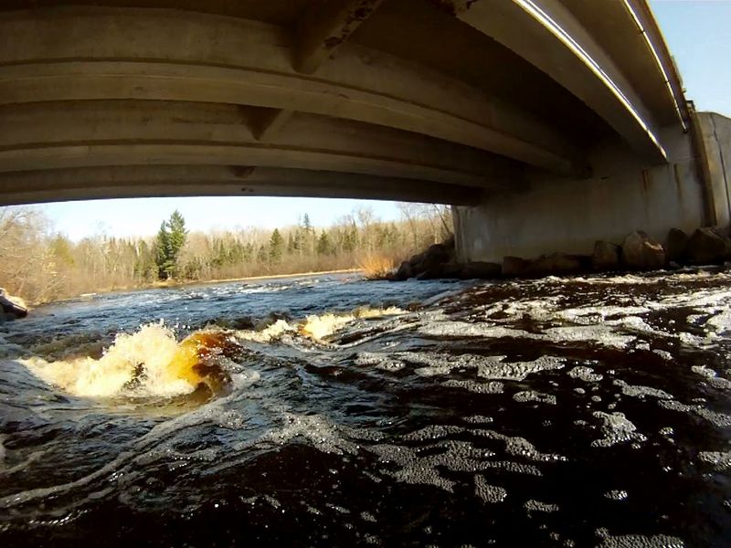
The bridge and bedrock ledge concentrate flow through this short drop. At high flow (>650 CFS) the center path leads to a large sucking hole directly under the bridge. At lesser flows the hole is a sweet s-shaped path past the brink of the hole. At low flow, the rapids ends in a confusing river-wide stone-field. Be prepared to stop or back-ferry immediately after s-shape drop. The best landing is on the right after the stone field. The landing on the left is often harder to get out of your boat and on to land.
The best landing is on the right after the stone field. The landing on the left is often harder to get out of your boat and on to land.
Apr 30, 2018
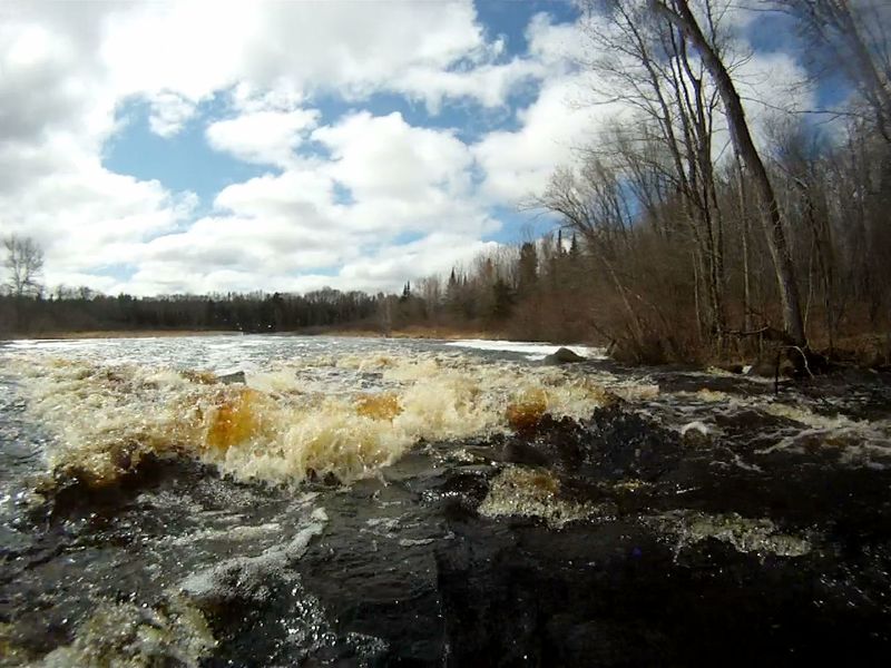
First run of this very late season: 4/29/2018 at 624CFS. Lots of bounce and velocity but no obstruction or ice shelves.
Mar 2, 2018
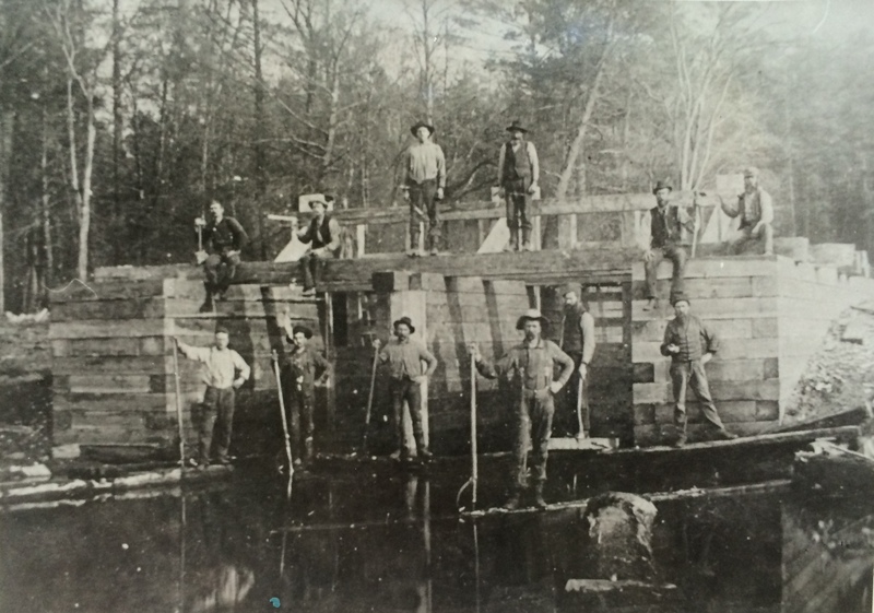
Anunson Trace Rapids start on the site where this dam was built. Built in 1880 by John and Halvor Anunson, it remained in place for the last log drive in 1908 ad was removed in 1910. The earth embankments and some in-river rocky debris are all that remain of the dam. When the Girard Lumber Company put in its railroad nearby it spelled the end of log drives.
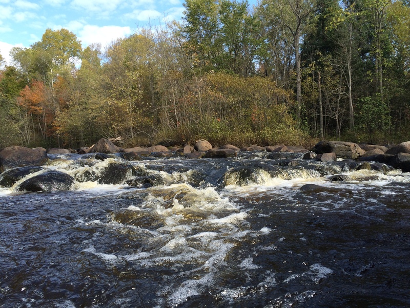
Oct 6, 2015
At low Water