| Difficulty | II-IV |
| Length | 6 mi |
| Avg Gradient | 70 fpm |
| Gauge | Meadow River Near Mt. Lookout, Wv |
| Reach Info Last Updated | February 23, 2004 |
River Description
The steepest mile starts within 1/2 mile of the CR 17/2 bridge put-in.
River Features
Put In
Access PointDistance: 0 mi
Take Out
Access PointDistance: 9.5 mi
Trip Reports
Log in to add a reportAD
Anthony Daniel
Sep 13, 2016
scout heavily for wood. A couple of years ago much of this run was impassable. It was more of a hike than a paddle. We only finished 1/2 of the run and spent as much time out of our boats as we were in them. If you have more recent info- please update since new information is hard to come by.
SM
Shawn McClung
Feb 6, 2004
Couldn't ask for a better line~~~~
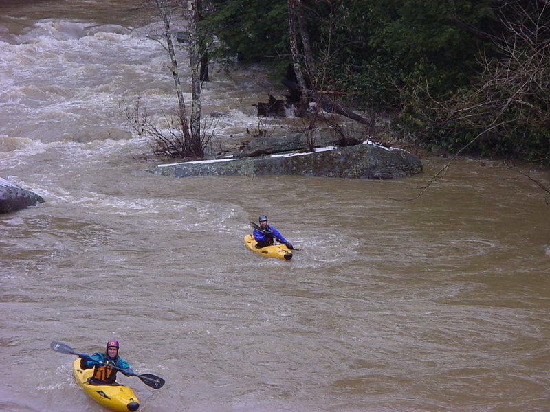
Stay off the Rocks
This picture was taken only a few minutes after the deer floated by..